The best cycling routes around Lauf
4.7
(69)
549
riders
41
rides
Touring cycling around Lauf offers a diverse landscape for cyclists, characterized by river valleys, reservoirs, and rolling hills. The region features a mix of paved paths along waterways and routes that ascend into forested areas. Cyclists can expect varied terrain, from gentle gradients suitable for leisurely rides to more challenging climbs. This area provides access to both open countryside and routes connecting to nearby towns and natural landmarks.
Best touring cycling routes around Lauf
- The most popular touring cycling route…
Last updated: October 26, 2026
4.8
(10)
49
riders
56.0km
03:32
580m
580m
Hard bike ride. Very good fitness required. Mostly paved surfaces.
4.7
(6)
47
riders
24.3km
02:17
750m
750m
Hard bike ride. Very good fitness required. Mostly paved surfaces.

5.0
(5)
50
riders
14.6km
00:54
100m
100m
Easy bike ride. Mostly paved surfaces.
4.6
(10)
27
riders
27.9km
01:40
100m
100m
Easy bike ride. Mostly paved surfaces.
5.0
(1)
33
riders
25.1km
02:28
990m
990m
Hard bike ride. Very good fitness required. You may need to push your bike for some segments of this route.
Get access to more routes and recommendations from other explorers.
Already have an account?
Our route recommendations are based on thousands of hikes, rides, and runs completed by other people on komoot.
Start today with a free account
Your next adventure awaits.


Tips from the Community

The Acherner Mühlbach is a river just under 22 kilometers long in Baden-Württemberg's Ortenaukreis and Rastatt districts. Key Facts & Course Course: It initially flows northwest through the center of Achern. It then runs through the Upper Rhine Plain. Mouth: Coming from the east, it flows into the Rheinniederungskanal near Rheinmünster-Greffern under the name Schwarzbach. Ecology & Recreation: In the Acherner Stadtgarten, the stream feeds a popular public water-treading facility (Kneipp facility). In addition, modern fish ladders for aquatic animals have been built along the river. Energy Use: The stream is actively used for sustainable energy projects. In the Oberachern district (Lott-Areal), a hydroelectric power plant feeds a private local heating network to supply over 60 apartments with CO₂-free electricity and heat.
0
0
The Rench is 57 km long. It originates near Zuflucht at an altitude of 915m. At Helmlingen, the Rench flows into the Rhine.
0
0

Unfortunately open only Tuesday, Friday and Saturday. But always worth a detour.
0
0

Free lido with playground, volleyball, showers etc. as well as a nice beach bar.
1
0
The historic fire station in Sasbach (Ortenau district) is a cultural monument from 1896, built according to the plans of the Achern architect Schnurr in the clinker style. It is designed as a single-story building with a central projection and an open belfry.
0
0

The Rench is 57 km long. It rises near Zuflucht at an altitude of 915 m. The Rench flows into the Rhine near Helmlingen.
3
0

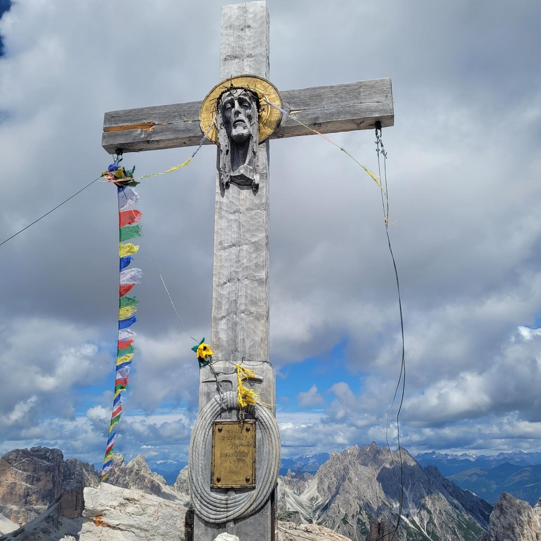
A field cross on the side of the road, unusually also a shrine in remembrance and gratitude.
1
0
Frequently Asked Questions
How many touring cycling routes are available around Lauf?
You can find nearly 40 touring cycling routes around Lauf, offering a diverse range of experiences. These include 8 easy routes, 11 moderate routes, and 19 more challenging options.
Are there easy touring cycling routes suitable for beginners or families in Lauf?
Yes, Lauf offers several easy touring cycling routes perfect for beginners or families. For instance, the Querfeldein Farm Shop & Café – Cross and wayside shrine loop from Lauf is an easy 14.5 km trail with minimal elevation, often completed in under an hour. Another great option is the Lake Achern – Schöllenhof Farm Shop loop from Lauf, which is 27.9 km and also rated easy.
What kind of terrain can I expect on touring cycling routes in Lauf?
The terrain around Lauf is quite varied. You'll find paved paths along river valleys, routes offering views of reservoirs, and trails that ascend into forested, rolling hills. This mix provides options from gentle gradients for leisurely rides to more demanding climbs.
Are there any circular touring cycling routes in Lauf?
Many of the touring cycling routes around Lauf are designed as loops. Examples include the challenging Renchdamm Pathway – Oberkirch Old Town loop from Lauf, which is 55.2 km, and the scenic Laufbach Reservoir – To the Great Fir, Untersmatt loop from Lauf, a difficult 25.2 km ride with significant elevation gain.
What are some scenic highlights or natural attractions I can see along the cycling routes?
The region around Lauf is rich in natural beauty. You can encounter stunning Vineyards of Sasbachwalden, or explore impressive waterfalls such as the Gaishöll Waterfalls and the Edelfrauengrab Waterfalls. The Wilder Sasbach Gorge also offers dramatic scenery.
What do other touring cyclists say about the routes in Lauf?
The touring cycling routes in Lauf are highly regarded by the komoot community, with an average score of 4.7 stars from over 60 reviews. Cyclists often praise the varied terrain, from river paths to forested hills, and the well-maintained network that caters to different ability levels.
Are there any long-distance touring cycling routes starting from Lauf?
While many routes are local loops, some routes offer significant distances. For example, the Renchdamm Pathway – Oberkirch Old Town loop from Lauf covers 55.2 km, providing a substantial ride through diverse landscapes.
Can I find routes with cafes or pubs along the way in Lauf?
Yes, many routes pass through or near villages and towns where you can find cafes and pubs. The Querfeldein Farm Shop & Café – Cross and wayside shrine loop from Lauf specifically mentions a farm shop and café, indicating opportunities for refreshments.
What is the best time of year for touring cycling in Lauf?
The region is generally pleasant for cycling from spring through autumn. Spring brings blooming landscapes, while autumn offers vibrant foliage. Summer is also popular, but it's always advisable to check local weather forecasts, especially for routes with significant elevation.
Are there routes that lead to prominent landmarks or viewpoints?
Absolutely. The Lake Mummelsee – Hornisgrinde Tower loop from Lauf is a challenging route that takes you towards the Hornisgrinde Tower, offering potential panoramic views from the highest mountain in the northern Black Forest. The Laufbach Reservoir – To the Great Fir, Untersmatt loop from Lauf also leads to a notable natural feature, the Great Fir.
What are the typical elevation gains on touring cycling routes in Lauf?
Elevation gains vary significantly. Easy routes like the Querfeldein Farm Shop & Café – Cross and wayside shrine loop from Lauf have minimal climbs, around 95 meters. More difficult routes, such as the Lake Mummelsee – Hornisgrinde Tower loop from Lauf, can involve over 1000 meters of ascent, providing a significant challenge.
Most popular routes around Lauf
Most popular attractions around Lauf

Get inspired with the komoot mobile app


Explore more
Browse the best Cycling routes in other regions.
