The best traffic-free bike rides around Le Douhet
4.5
(307)
2,087
riders
129
rides
No traffic touring cycling routes around Le Douhet traverse a landscape characterized by wooded and rolling countryside, featuring valleys, marshes, and plains. The region is shaped by the river Charente and its tributaries, contributing to a diverse natural environment. Cyclists can explore areas with vineyards and oak forests, as well as the significant Marais du Douhet coastal wetlands. Historical elements such as remnants of a Gallo-Roman aqueduct and the 17th-century Château du Douhet are integrated into the terrain.
Best no…
Last updated: November 3, 2026
4.4
(9)
71
riders
Hard bike ride. Very good fitness required. Mostly paved surfaces.
30
riders
Hard bike ride. Good fitness required. You may need to push your bike for some segments of this route.

4.3
(3)
7
riders
20.8km
01:13
130m
130m
Easy bike ride. Mostly paved surfaces.
13
riders
41.5km
03:31
340m
340m
Hard bike ride. Good fitness required. You may need to push your bike for some segments of this route.
9
riders
24.8km
01:59
250m
250m
Moderate bike ride. Good fitness required. Mostly paved surfaces.
Get access to more routes and recommendations from other explorers.
Already have an account?
Our route recommendations are based on thousands of hikes, rides, and runs completed by other people on komoot.

Tips from the Community

The Chaniers ferry (Charente-Maritime) is one of the last traditional river ferries still in operation in France. It allows crossing the Charente River between Chaniers and Courcoury, a few kilometers downstream from Saintes. A crossing used for centuries History of the Chaniers ferry The ferry crossing at Chaniers is very old: it dates back to the Middle Ages. In the mid-17th century, it was already an important crossing point on the Charente. It was not only used to cross the river: it also allowed residents to access the meadows on the other side, particularly for agricultural activities. In the early 20th century, the Chaniers ferry was part of a much larger network of crossings on the Charente. In 1909, thirteen ferries were still recorded in Charente-Inférieure, including the one in Chaniers. Ferries were essential at the time before the proliferation of bridges. Why "chain ferry"? The principle consists of holding the ferry on a chain connecting the two banks. The ferryman uses this chain to move the boat forward and keep it on its course despite the current. In Chaniers, the current ferry is motorized, unlike the ferry in Dompierre-sur-Charente, which is operated manually. The Tourist Office, however, still describes it as a "chain ferry," and the municipality as the traditional crossing method connecting Chaniers to Courcoury. The ferry today The crossing takes place between Le Communal in Chaniers and the Courcoury bank. It is free and can transport pedestrians, cyclists, and motorized vehicles. Its operation depends in particular on the flow of the Charente River. The municipality of Chaniers officially presents "the port of Chaniers and its chain ferry" as an element of its local heritage. Important point: I am correcting my previous message: the Chaniers ferry is not simply a "19th-century ferry." The crossing has been attested since the Middle Ages; it is its mode of operation and its equipment that have evolved over the centuries.
0
0
🏛️ Construction: 18-19 AD The arch was built around 18-19 AD, during the reign of Emperor Tiberius. It stood at the entrance to the Roman bridge crossing the Charente, at the outlet of the Via Agrippa, which connected Lyon to Saintes. It is therefore not truly a "triumphal arch": it was both a road monument and a monumental gate marking the entrance to Mediolanum Santonum, the capital of Roman Aquitaine. 👤 Who had it built? The arch was financed by Caius Julius Rufus, a Romanized notable from Saintonge. He dedicated it to Tiberius as well as his nephew Germanicus. The inscriptions engraved on the entablature still allow us today to know the figures to whom it was dedicated. The name "Arch of Germanicus" therefore comes from this dedication, and not from the fact that Germanicus personally had the arch built or crossed it. 🏗️ A rather exceptional monument The arch has two bays, likely allowing for the differentiation of traffic flows. It measures approximately 15 m high by 16 m wide. Its Corinthian and composite capitals bear witness to particularly meticulous Roman architecture. It constituted a true demonstration of the power and Romanization of Saintes. ⚠️ The moment the arch almost disappeared This is probably the most interesting episode in its history. For centuries, the arch was always located at the level of the Roman bridge and then the medieval bridge, on the right bank of the Charente. In the 19th century, the old bridge had become dilapidated. When it was decided to demolish it, around 1843, the arch was also threatened with destruction. It was then that Prosper Mérimée, Inspector General of Historical Monuments, intervened. He advocated for its preservation and arranged for its dismantling, relocation, and reassembly on the new bank. Another figure is also associated with this preservation: Victor Hugo, who stayed in Saintes in September 1843 and intervened in favor of the monument's conservation with Mérimée. 📍 Why is the arch no longer exactly in its ancient location? The arch we see today, on Place Bassompierre, is therefore no longer in its original location. It was moved a few dozen meters during the transformation of the quays and the disappearance of the old bridge. It was dismantled stone by stone and then reassembled in order to preserve it. It is now located in the immediate vicinity of the ancient Roman bridge crossing. 🏛️ Protection The Arch of Germanicus was finally classified as a historical monument in July 1905. An interesting detail The Crazannes quarries, located near Saintes, supplied a limestone widely used in the region's ancient constructions. Crazannes stone was notably used for monuments such as the Arch of Germanicus. In summary: 18-19 → construction of the arch at the entrance to the Roman bridge ↓ Antiquity → Middle Ages → the arch remains associated with the crossing of the Charente ↓ 1843 → demolition of the old bridge and threat to the arch ↓ 1843-1844 → Mérimée's intervention and relocation of the arch ↓ 1905 → classified as a Historical Monument
0
0

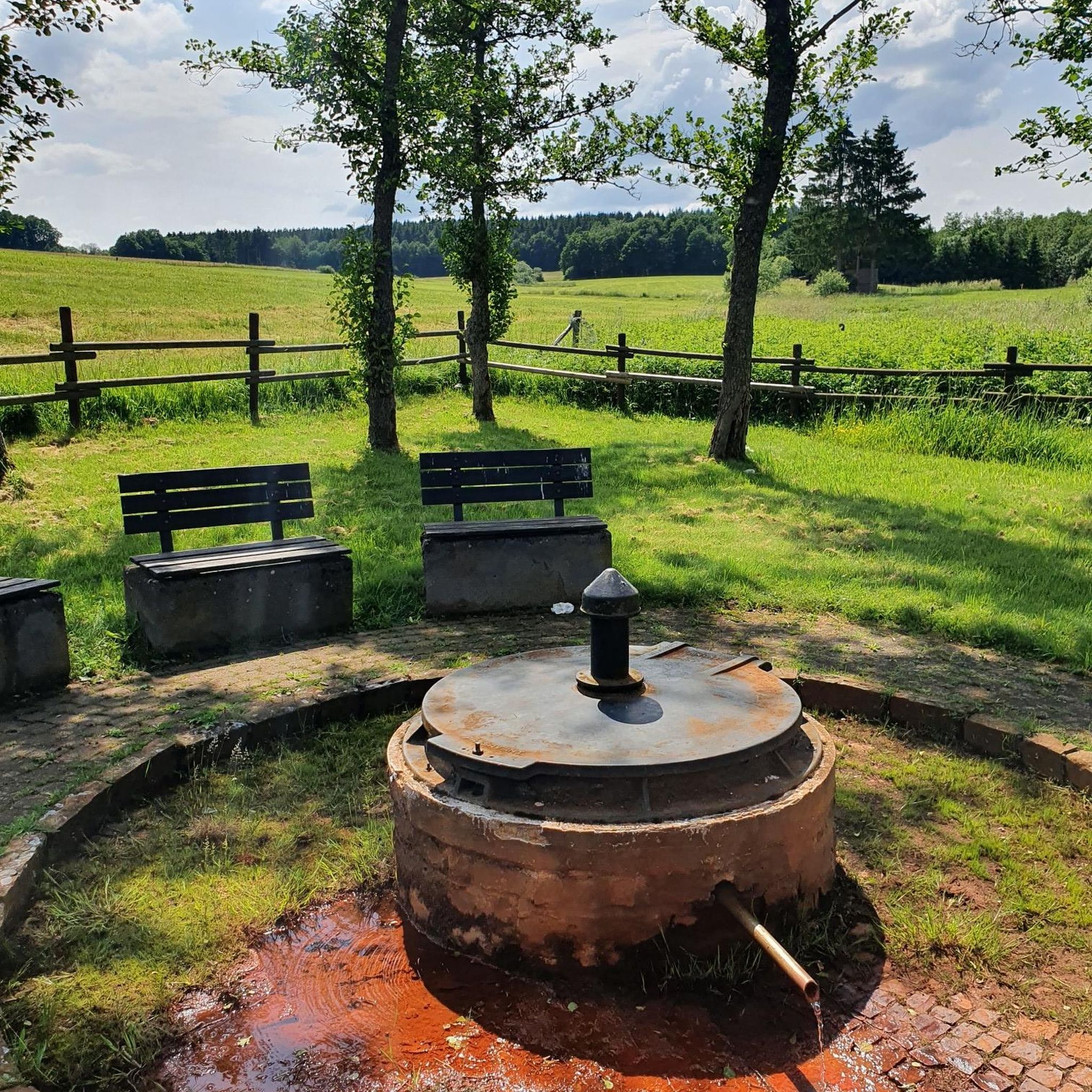
Guided tours possible from April 2026! These two fountains were developed by the inhabitants in the 18th and 19th centuries, using the water source of the aqueduct built by the Romans in the 1st century BC. A washhouse and a mill were built there. At the bottom of the mill, restored in 1993 by the village inhabitants, you can discover the "Roman slab" pipeline. The water no longer flows through this aqueduct but disappears into a fault to join the natural underground conduit. Until around 1935, this fountain was owned by a miller who, at his will, prohibited access to the inhabitants, which forced the municipality at the time to build another washhouse upstream in an old quarry.
0
0


Built around the 1930s, this kiln was used by the inhabitants of the village of Chez Jaguenaud until around 1945. Its operation was used to "fire" clay, transformed into hollow tiles, as well as stone. Quicklime was thus collected from it, a material used by the region's farmers. Purchased by the municipality in 1999, it was restored and rebuilt identically to preserve this small piece of heritage. Its landscaped surroundings make it a remarkable attraction. A nearby parking lot allows visitors to linger.
0
0

I really enjoyed this ride. I’m 46, I did it on a 40 year old road bike, it’s more suited to a cyclocross bike!
1
0

Several ruins of ancient Gallo-Roman viaducts
0
0
Frequently Asked Questions
How many no-traffic touring cycling routes are available around Le Douhet?
There are over 100 dedicated no-traffic touring cycling routes around Le Douhet, offering a wide range of options for exploring the region. You'll find routes suitable for various skill levels, from easy rides to more challenging long-distance tours.
What kind of landscapes will I experience on these no-traffic cycling routes?
The no-traffic routes around Le Douhet traverse a diverse and picturesque landscape. You can expect to cycle through wooded and undulating countryside, past vineyards, and alongside the Ruisseau du Rochefollet and other waterways. The region also features the unique biodiversity of the Marais du Douhet, offering stunning natural scenery, especially in spring or at sunset.
Are there any easy, family-friendly no-traffic routes suitable for beginners?
Yes, Le Douhet offers nearly 50 easy no-traffic touring cycling routes, perfect for families or beginners. These routes typically feature gentle gradients and shorter distances, allowing for a relaxed exploration of the local scenery. A great example is the Douhet Castle – Gallo-Roman Aqueduct loop from Le Douhet, which is just over 20 km long and has minimal elevation gain.
Can I find circular no-traffic cycling routes in the area?
Many of the no-traffic touring cycling routes around Le Douhet are designed as circular loops, allowing you to start and finish at the same point without retracing your steps. This is ideal for exploring different facets of the landscape, from historical sites to natural wetlands, on a single ride. For instance, the Taillebourg loop from Juicq is a pleasant circular option.
What historical attractions can I see along the no-traffic touring cycling routes?
The region is rich in history. Many routes pass by or near significant historical sites. You can discover vestiges of a Gallo-Roman aqueduct, including the sources of La Grand Font. The 17th-century Crazannes Castle and the 12th-century Église Saint-Martial are also notable landmarks. The Douhet Castle – Gallo-Roman Aqueduct loop from Le Douhet specifically highlights these historical elements.
What do other touring cyclists enjoy most about the no-traffic routes in Le Douhet?
The no-traffic touring cycling routes around Le Douhet are highly rated by the komoot community, with an average score of 4.5 stars. Reviewers often praise the tranquility of the routes, the beautiful blend of wooded areas and open countryside, and the opportunity to discover historical sites like the Gallo-Roman aqueduct in a peaceful setting.
Are there any longer or more challenging no-traffic touring routes for experienced cyclists?
Yes, for experienced cyclists seeking a greater challenge, there are nearly 30 difficult no-traffic touring routes available. These routes cover longer distances and may include more varied terrain. An example is the extensive Crazannes Castle – Chemin de la Charente loop from Saint-Hilaire-Brizambourg, which spans over 168 km and features significant elevation changes.
Where can I park my car to access these no-traffic cycling routes?
Many of the no-traffic cycling routes around Le Douhet have convenient starting points in or near villages, where public parking is often available. For routes starting directly from Le Douhet, you can typically find parking within the village. For routes originating from nearby towns like Saint-Hilaire-Brizambourg or Juicq, look for designated parking areas near the route's beginning.
What is the best time of year to go no-traffic touring cycling in Le Douhet?
The spring and early autumn months are generally considered the best time for no-traffic touring cycling in Le Douhet. During spring, the Marais du Douhet is particularly vibrant, and the weather is pleasantly mild. Autumn offers beautiful foliage and comfortable temperatures. Summer can also be enjoyable, but it's advisable to start earlier in the day to avoid the midday heat.
Are there opportunities to stop for refreshments or cafes along these routes?
While many of the no-traffic routes take you through serene countryside, they often connect or pass near charming villages and towns. These locations typically offer opportunities to stop for refreshments, whether it's a local bakery, a small cafe, or a restaurant. Planning your route with these potential stops in mind can enhance your cycling experience.
Can I access the no-traffic cycling routes using public transport?
Accessing the starting points of these routes via public transport might be limited, as many begin in smaller villages like Le Douhet. However, the larger town of Saintes, just 10 km away, is more accessible by public transport and offers connections to the wider region. From Saintes, you could cycle to nearby route starting points or explore routes that begin closer to the town.
Most popular attractions around Le Douhet

Get inspired with the komoot mobile app


Explore more
Browse the best Cycling routes in other regions.
