The best gravel rides around Le Douhet
4.5
(46)
403
riders
47
rides
Gravel biking around Le Douhet offers routes through the Charente-Maritime department, characterized by its river valleys, historic sites, and agricultural landscapes. The terrain generally features gentle elevation changes, making it suitable for various skill levels. Paths often follow riverbanks or traverse open countryside, providing a mix of surfaces for gravel cyclists.
Best gravel bike trails around Le Douhet
- The most popular gravel bike trail is View of the Arch of Germanicus – Port of the Lys loop from Saintes,…
Last updated: November 2, 2026
4.3
(3)
55
riders
61.0km
04:02
150m
150m
Moderate gravel ride. Good fitness required. Mostly paved surfaces.
5.0
(5)
33
riders
40.2km
02:23
180m
180m
Moderate gravel ride. Good fitness required. Mostly paved surfaces.

4.3
(7)
48
riders
Moderate gravel ride. Good fitness required. Mostly paved surfaces.
4.4
(5)
36
riders
34.3km
02:08
130m
130m
Hard gravel ride. Good fitness required. You may need to push your bike for some segments of this route.
4.5
(2)
22
riders
42.3km
02:25
220m
220m
Moderate gravel ride. Good fitness required. Mostly paved surfaces.
Get access to more routes and recommendations from other explorers.
Already have an account?
Our route recommendations are based on thousands of hikes, rides, and runs completed by other people on komoot.
Start today with a free account
Your next adventure awaits.

Tips from the Community

The site of La Baine, in Chaniers, predates the current mill. 14th century: the first attested mills A document dated 1310 mentions cloth mills at La Baine. They were built on piles driven into the riverbed and were used, among other things, for fulling fabrics. These mills then belonged to the dean and chapter of the cathedral of Saintes. They had been destroyed a few years earlier by the Count of la Marche. In 1313, the chapter obtained authorization to rebuild two mills, a weir, and a fishery. 17th century: Colbert's royal mill It was in the 17th century that La Baine gained considerable importance. A complex of five wheat mills was rebuilt on a secondary branch of the Charente, which was not used for navigation. Around 1630, the mills belonged to the brothers Charles and Jacques Duval, who held the beneficial ownership, while the lordship of Chaniers was under the chapter of the Saint-Pierre de Saintes cathedral. Then came Jean-Baptiste Colbert, minister to Louis XIV and Secretary of State for the Navy. Around 1670, Colbert had the mill redeveloped and enlarged to considerably increase its production capacity. The new complex had seven water passages and thus became one of the most powerful mills in the region. Why was Colbert interested in La Baine? The reason was directly linked to the creation and development of the Rochefort arsenal. The mill primarily produced wheat and barley flour intended for the sustenance of the Royal Navy sailors. The grains arrived via the Charente aboard gabares (flat-bottomed barges). After delivering their cargo to the mill, the gabares departed with the flour destined, among other places, for Rochefort. The mill of La Baine was therefore part of a true royal industrial and logistical system organized around the Charente and Rochefort. 19th century: gradual transformation In the 19th century, milling activity continued. The old mills gradually became a true industrial establishment. In 1845, the site was operated by five different millers. From 1897, the complex was gradually brought together by Mr. Lardy, who modernized the facilities and introduced machinery. His son Rémy Lardy succeeded him. 20th century: the flour mill In the 1930s, the mill had become a true industrial flour mill. Its capacity reached about 50 quintals of wheat per day. In 1936, the hydraulic power was supplied by several wheels about 5 meters in diameter. The total water intake was about 4 meters, with a head of 1.50 meters. The facilities included, among other things: two double grinders; a double converter; a pair of millstones; a plansichter; five purifiers. Milling activity finally ceased in the mid-20th century, with sources placing the end of industrial activity around the years 1940-1960, depending on whether one refers to the flour mill or the complete disappearance of milling activity. Today The building has been preserved and transformed into a restaurant, while retaining remarkable elements of its industrial past, notably the wheel and part of the old machinery. The Moulin de la Baine is now located at 14 rue Colbert, 17610 Chaniers, directly above the Charente. A particularly interesting point The mill, the dam, and the locks form an inseparable historical ensemble. The current dam has, however, undergone modern transformations: a prefectural decree from 2012 classifies the hydraulic structure of the Moulin de La Baine as a Class D dam, among other things.
0
0
The Chaniers ferry (Charente-Maritime) is one of the last traditional river ferries still in operation in France. It allows crossing the Charente River between Chaniers and Courcoury, a few kilometers downstream from Saintes. A crossing used for centuries History of the Chaniers ferry The ferry crossing at Chaniers is very old: it dates back to the Middle Ages. In the mid-17th century, it was already an important crossing point on the Charente. It was not only used to cross the river: it also allowed residents to access the meadows on the other side, particularly for agricultural activities. In the early 20th century, the Chaniers ferry was part of a much larger network of crossings on the Charente. In 1909, thirteen ferries were still recorded in Charente-Inférieure, including the one in Chaniers. Ferries were essential at the time before the proliferation of bridges. Why "chain ferry"? The principle consists of holding the ferry on a chain connecting the two banks. The ferryman uses this chain to move the boat forward and keep it on its course despite the current. In Chaniers, the current ferry is motorized, unlike the ferry in Dompierre-sur-Charente, which is operated manually. The Tourist Office, however, still describes it as a "chain ferry," and the municipality as the traditional crossing method connecting Chaniers to Courcoury. The ferry today The crossing takes place between Le Communal in Chaniers and the Courcoury bank. It is free and can transport pedestrians, cyclists, and motorized vehicles. Its operation depends in particular on the flow of the Charente River. The municipality of Chaniers officially presents "the port of Chaniers and its chain ferry" as an element of its local heritage. Important point: I am correcting my previous message: the Chaniers ferry is not simply a "19th-century ferry." The crossing has been attested since the Middle Ages; it is its mode of operation and its equipment that have evolved over the centuries.
0
0
🏛️ Construction: 18-19 AD The arch was built around 18-19 AD, during the reign of Emperor Tiberius. It stood at the entrance to the Roman bridge crossing the Charente, at the outlet of the Via Agrippa, which connected Lyon to Saintes. It is therefore not truly a "triumphal arch": it was both a road monument and a monumental gate marking the entrance to Mediolanum Santonum, the capital of Roman Aquitaine. 👤 Who had it built? The arch was financed by Caius Julius Rufus, a Romanized notable from Saintonge. He dedicated it to Tiberius as well as his nephew Germanicus. The inscriptions engraved on the entablature still allow us today to know the figures to whom it was dedicated. The name "Arch of Germanicus" therefore comes from this dedication, and not from the fact that Germanicus personally had the arch built or crossed it. 🏗️ A rather exceptional monument The arch has two bays, likely allowing for the differentiation of traffic flows. It measures approximately 15 m high by 16 m wide. Its Corinthian and composite capitals bear witness to particularly meticulous Roman architecture. It constituted a true demonstration of the power and Romanization of Saintes. ⚠️ The moment the arch almost disappeared This is probably the most interesting episode in its history. For centuries, the arch was always located at the level of the Roman bridge and then the medieval bridge, on the right bank of the Charente. In the 19th century, the old bridge had become dilapidated. When it was decided to demolish it, around 1843, the arch was also threatened with destruction. It was then that Prosper Mérimée, Inspector General of Historical Monuments, intervened. He advocated for its preservation and arranged for its dismantling, relocation, and reassembly on the new bank. Another figure is also associated with this preservation: Victor Hugo, who stayed in Saintes in September 1843 and intervened in favor of the monument's conservation with Mérimée. 📍 Why is the arch no longer exactly in its ancient location? The arch we see today, on Place Bassompierre, is therefore no longer in its original location. It was moved a few dozen meters during the transformation of the quays and the disappearance of the old bridge. It was dismantled stone by stone and then reassembled in order to preserve it. It is now located in the immediate vicinity of the ancient Roman bridge crossing. 🏛️ Protection The Arch of Germanicus was finally classified as a historical monument in July 1905. An interesting detail The Crazannes quarries, located near Saintes, supplied a limestone widely used in the region's ancient constructions. Crazannes stone was notably used for monuments such as the Arch of Germanicus. In summary: 18-19 → construction of the arch at the entrance to the Roman bridge ↓ Antiquity → Middle Ages → the arch remains associated with the crossing of the Charente ↓ 1843 → demolition of the old bridge and threat to the arch ↓ 1843-1844 → Mérimée's intervention and relocation of the arch ↓ 1905 → classified as a Historical Monument
0
0

Courcoury is a natural island surrounded by the Charente and Seugne rivers, giving it a unique landscape setting between marshes and waterways, conducive to biodiversity and outdoor activities. It is also the only village in Charente-Maritime to have been awarded 4 stars by the "Villes et villages étoilés" label, recognizing its efforts to reduce light pollution through intelligent and environmentally friendly public lighting.
1
0

I really enjoyed this ride. I’m 46, I did it on a 40 year old road bike, it’s more suited to a cyclocross bike!
1
0

It is an absolutely beautiful village.
0
0

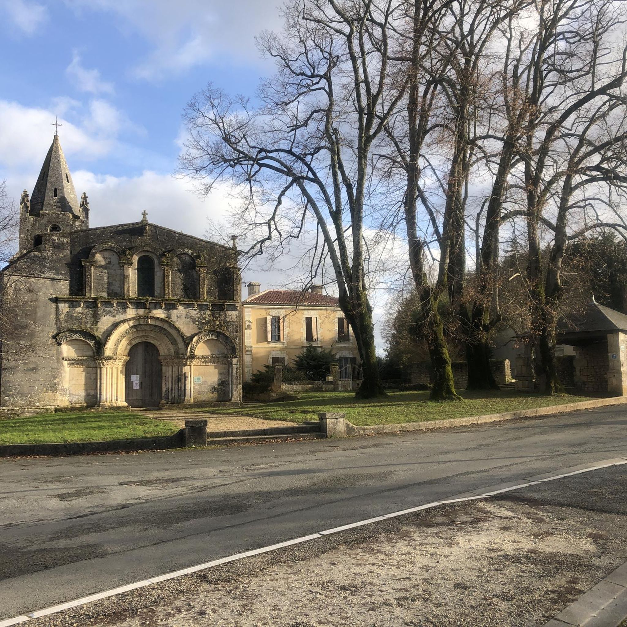
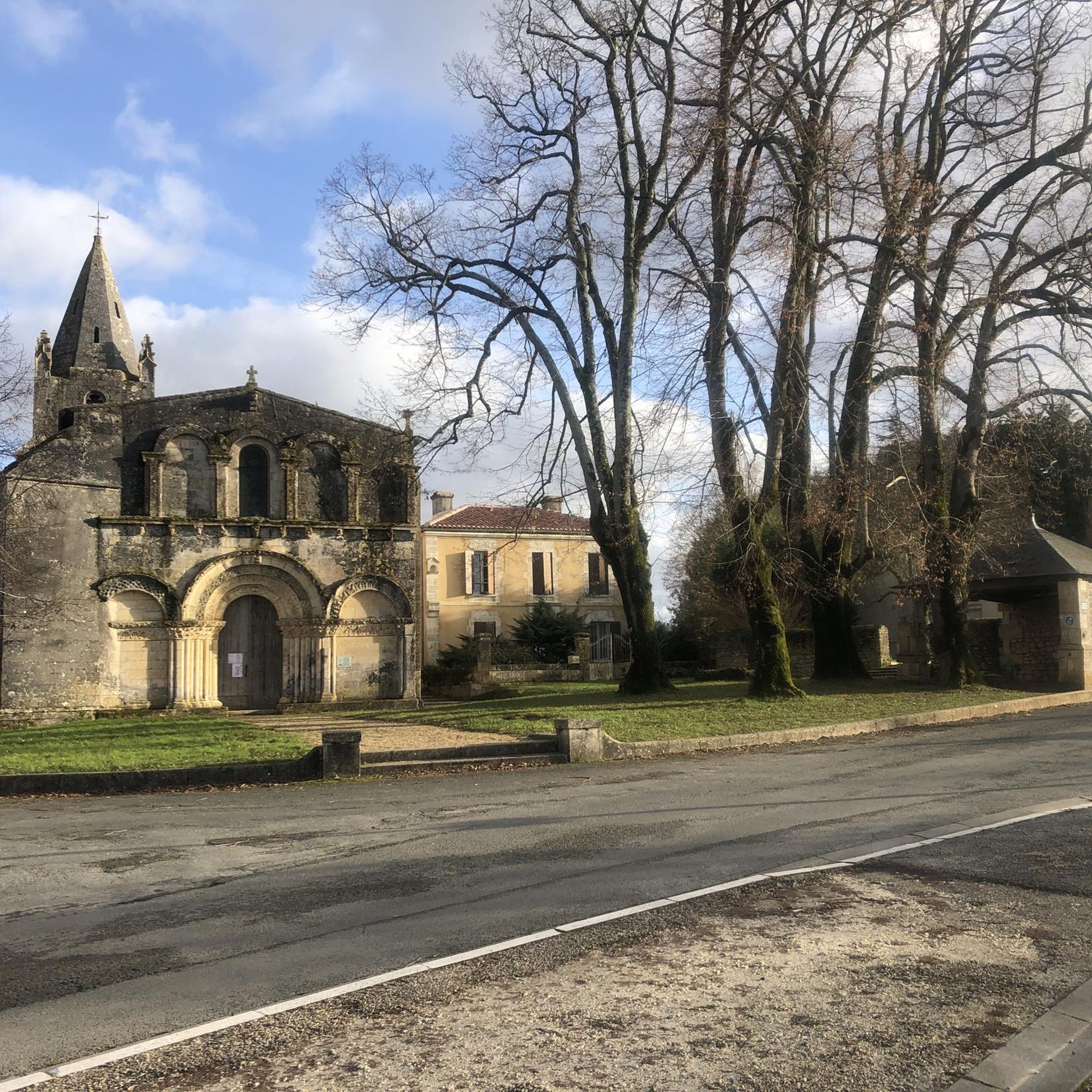
The Abbaye-aux-Dames is built around the church of Sainte-Marie, built in the twelfth century. Famous for its facade and its characteristic "pinecone" bell tower, it is one of the emblematic monuments of Saintonge's Romanesque art. After several wars and fires, the place was restored in the 1970s and 1980s and is now a hotel. When you walk through the long corridors you feel like you have been transported back to the time when the abbey was still alive.
4
0

Frequently Asked Questions
How many gravel bike trails are there in Le Douhet?
Le Douhet offers a wide selection of gravel bike trails, with over 60 routes available for exploration. These routes cater to various skill levels, from easy to difficult.
Are there easy gravel bike trails suitable for beginners in Le Douhet?
Yes, Le Douhet has several easy gravel bike trails perfect for beginners. There are 8 routes specifically categorized as easy, providing gentle terrain and manageable distances to get started.
Are there any family-friendly gravel bike routes around Le Douhet?
While specific 'family-friendly' designations aren't always available, many of the easy and moderate routes in Le Douhet, characterized by their gentle elevation changes and scenic river valleys, are suitable for families. Consider routes that avoid major roads and focus on dedicated paths.
Can I find circular gravel bike routes in Le Douhet?
Absolutely. Many of the gravel bike routes in Le Douhet are designed as loops, allowing you to start and finish at the same point. For example, the View of the Arch of Germanicus – Port of the Lys loop from Saintes is a popular circular option.
What are some scenic viewpoints or attractions I can see along the gravel bike trails?
The gravel bike trails around Le Douhet often pass by historic sites and natural beauty. You can explore landmarks such as Crazannes Castle, the ancient Abbaye de Fontdouce, and various charming churches like Saint-Martin Church. Many routes also offer picturesque views of the Charente River.
Are there options for more advanced gravel bikers?
Yes, Le Douhet caters to more experienced gravel bikers with 20 routes classified as difficult. These trails typically feature longer distances and more varied terrain, such as the challenging Saint-Savinien-sur-Charente – Saint-Vivien Church in Geay loop from Annepont.
What is the typical length of gravel bike trails in Le Douhet?
Gravel bike trails in Le Douhet vary significantly in length. You'll find routes ranging from shorter rides of around 20-30 km to longer excursions exceeding 80 km. For instance, the Chaniers chain bin – View of the Charente River loop from Saintes is about 34 km, while others can be much longer.
Where can I find parking for gravel biking routes in Le Douhet?
Many gravel bike routes in the Le Douhet area start from towns like Saintes or Bussac-sur-Charente, where public parking is generally available. It's advisable to check local parking options in the specific starting town for your chosen route.
What do other gravel bikers say about the trails in Le Douhet?
The gravel biking experience in Le Douhet is highly regarded by the komoot community, with an average rating of 4.5 stars from over 40 reviews. Riders often praise the diverse landscapes, historic sites, and the well-maintained paths that offer a mix of surfaces.
Are there less crowded gravel bike routes available?
To find less crowded routes, consider exploring some of the less-trafficked trails or riding during off-peak hours, such as weekdays or early mornings. While popular routes like those starting from Saintes can see more activity, the extensive network around Le Douhet offers plenty of opportunities for a quieter ride through the agricultural landscapes and river valleys.
What is the best time of year for gravel biking in Le Douhet?
The spring and autumn months generally offer the most pleasant conditions for gravel biking in Le Douhet, with mild temperatures and beautiful scenery. Summer can also be enjoyable, but it's best to ride early in the morning or late afternoon to avoid the midday heat. Winters are typically mild but can be damp.
Are there any cafes or places to stop for refreshments along the routes?
Many routes pass through or near charming villages and towns in the Charente-Maritime department, where you can often find local cafes, bakeries, or small shops to refuel. Planning your route with komoot allows you to identify potential stops along the way.
Can I bring my dog on the gravel bike trails?
Generally, dogs are welcome on many public paths and trails in the region, especially if kept on a leash. However, it's always best to check local regulations or specific trail rules, particularly if passing through nature reserves or private land, to ensure a pleasant experience for everyone.
Most popular attractions around Le Douhet

Get inspired with the komoot mobile app


Explore more
Browse the best Gravel rides in other regions.
