The best traffic-free bike rides around Plancherine
4.6
(181)
5,543
riders
43
rides
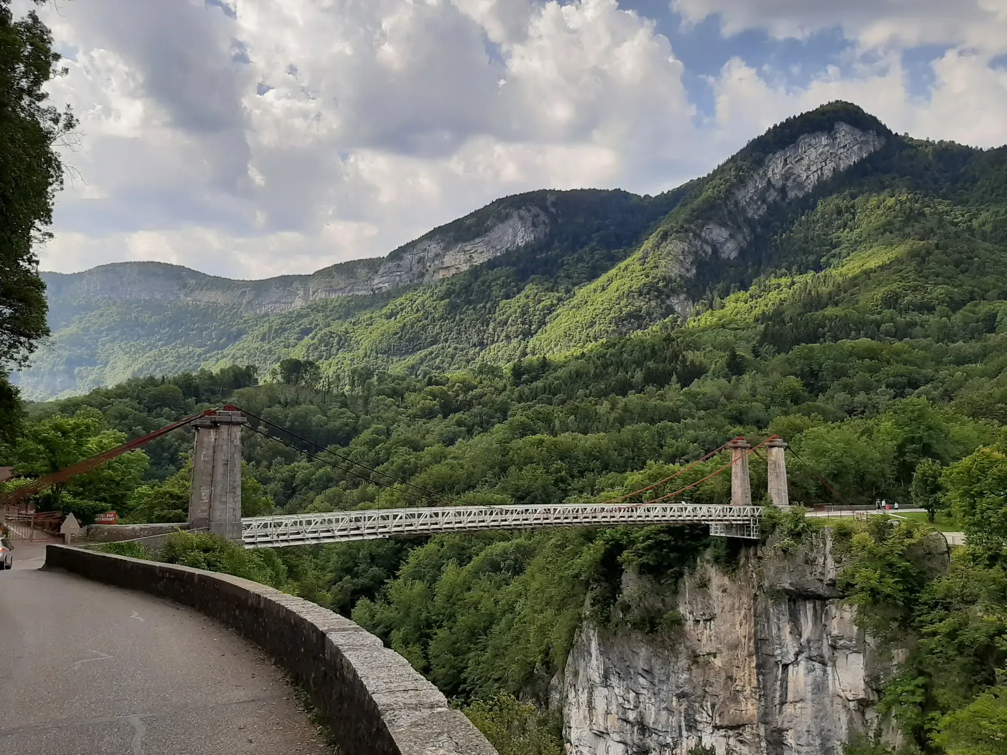
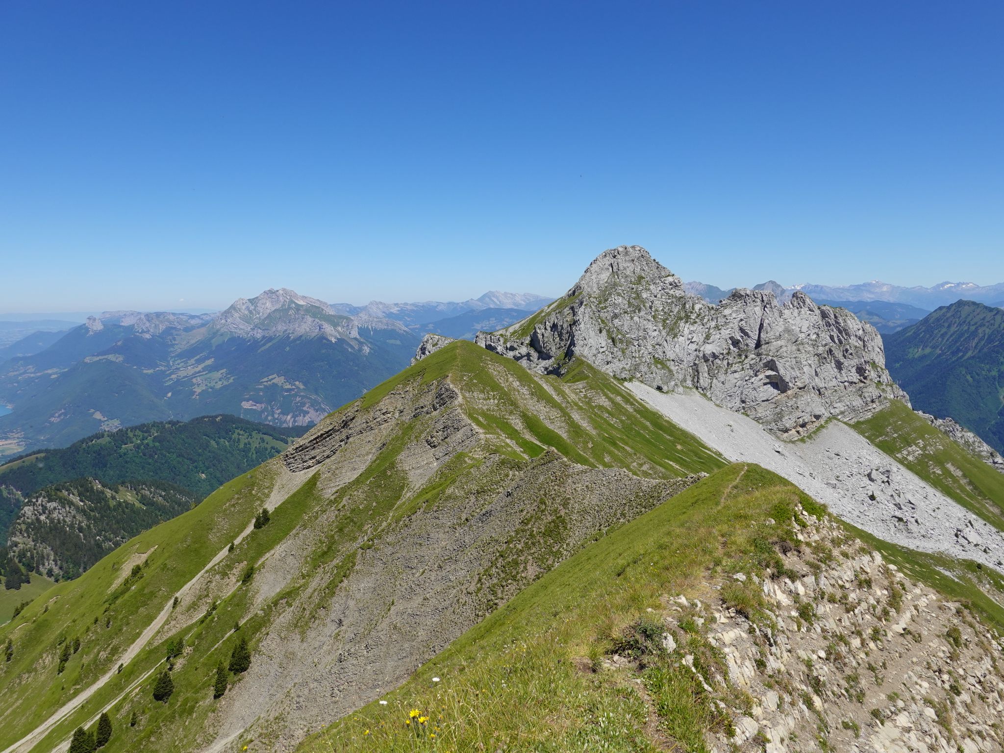
No traffic touring cycling routes around Plancherine traverse a landscape characterized by orchards, ancient dwellings, and the towering limestone peaks of the Massif des Bauges. This region, part of the Parc Naturel Régional du Massif des Bauges, offers varied elevations ranging from 440m to 2173m. The terrain includes picturesque valleys, such as the Tamié valley, and leads towards challenging alpine passes. This diverse environment provides a range of options for touring cyclists.
Best no traffic touring cycling routes around Plancherine
…Last updated: July 30, 2026
4.8
(5)
190
riders
53.5km
03:48
1,010m
1,010m
Hard bike ride. Very good fitness required. Mostly paved surfaces. Suitable for all skill levels.
5.0
(1)
76
riders
33.6km
02:58
1,180m
1,180m
Hard bike ride. Very good fitness required. Mostly paved surfaces. Suitable for all skill levels.

Sign up for free
5.0
(1)
22
riders
17.4km
01:30
610m
620m
Hard bike ride. Very good fitness required. Mostly paved surfaces. Suitable for all skill levels.
5.0
(1)
14
riders
25.6km
01:58
680m
680m
Hard bike ride. Very good fitness required. Mostly paved surfaces. Suitable for all skill levels.
12
riders
24.4km
02:05
420m
420m
Hard bike ride. Good fitness required. You may need to push your bike for some segments of this route.
Get access to more routes and recommendations from other explorers.
Sign up for free
Already have an account?
Our route recommendations are based on thousands of hikes, rides, and runs completed by other people on komoot.
Start today with a free account
Your next adventure awaits.
Login or Signup



Tips from the Community

Beautiful lake, beautiful bike path, packed on Sundays.
1
0
Beautiful lake, beautiful bike path, packed full on Sundays.
2
0
I was there in 2014, but it was annoying because all the paragliders were being flown up.
2
0
beautiful railway line cycle path to Annecy, along the east side initially nice cycle paths
3
0
Beautiful old town of Albertville.
2
0
beautiful church on the edge of the old town of Albertville
2
0

To the cycle tourist who invented his own pass.
0
0

Frequently Asked Questions
How many no traffic touring cycling routes are available around Plancherine?
There are over 45 dedicated no traffic touring cycling routes around Plancherine. These routes offer a variety of experiences, with 8 easy, 12 moderate, and 25 difficult options to suit different fitness levels and preferences.
What kind of terrain can I expect on no traffic touring cycling routes in Plancherine?
The terrain around Plancherine is quite varied, ranging from gentle valley paths to more challenging climbs into the Massif des Bauges. You'll find routes with significant elevation gain, such as the Conflans – Fort du Mont loop from Gilly-sur-Isère which features over 1000m of ascent, as well as flatter options like the L'Art Lie – Grignon Lake loop from Gilly-sur-Isère with only 100m of elevation gain.
Are there any family-friendly no traffic cycling routes in the Plancherine area?
Yes, there are several easy routes suitable for families. The region offers paths that are less demanding, often following riverbanks or flatter sections of the valleys. For example, the L'Art Lie – Grignon Lake loop from Gilly-sur-Isère is an easy option with minimal elevation, perfect for a relaxed family outing.
What interesting landmarks or attractions can I see along these routes?
Plancherine and its surroundings are rich in natural beauty and historical sites. You might encounter the picturesque Tamié valley, the historic Tamié Abbey, or the impressive Fort de Tamié. Natural features like the Grotte et Cascade de Seythenex (Seythenex Cave and Waterfall) are also accessible, as seen on the La Sambuy Base Station – Seythenex Cave and Waterfall loop from Seythenex. You can also explore nearby highlights such as the medieval city of Conflans in Albertville, or discover various mountain peaks like La Belle-Étoile and Petite Sambuy.
What is the best time of year to go touring cycling in Plancherine?
The best time for touring cycling in Plancherine is generally from spring through autumn. During these seasons, the weather is milder, and the mountain passes are typically clear of snow. Summer offers warm temperatures, while spring and autumn provide beautiful scenery with fewer crowds. Always check local weather conditions, especially for higher elevation routes, as conditions can change rapidly in the mountains.
Are there any circular no traffic touring cycling routes available?
Yes, many of the no traffic touring cycling routes around Plancherine are designed as loops, allowing you to start and finish at the same point. Examples include the Col du Vorger loop from Mercury and the Bike loop from Gilly-sur-Isère, providing convenient options for day trips.
What do other touring cyclists enjoy most about the no traffic routes in Plancherine?
The area is highly rated by the komoot community, with an average score of 4.67 out of 5 stars from over 300 reviews. Reviewers often praise the stunning alpine scenery, the tranquility of the traffic-free paths, and the diverse range of routes catering to different skill levels, from gentle valley rides to challenging mountain ascents.
Are there options for advanced touring cyclists seeking challenging no traffic routes?
Absolutely. Plancherine is situated near the Massif des Bauges, offering numerous difficult routes with significant elevation gains. For instance, the Conflans – Fort du Mont loop from Gilly-sur-Isère is a challenging option with over 1000m of climbing, providing a rewarding experience for experienced touring cyclists.
Can I find places to rest or eat along the no traffic cycling routes?
While specific cafes or restaurants directly on every traffic-free path may vary, the region is dotted with villages and towns where you can find amenities. Many routes pass through or near communities like Gilly-sur-Isère or Mercury, offering opportunities for refreshments. Additionally, the area has several mountain huts, such as Drison Refuge or Refuge de la Combe, which can serve as rest stops on longer, more remote tours.
Are there any routes that feature waterfalls or other natural water features?
Yes, the natural landscape around Plancherine includes beautiful water features. The La Sambuy Base Station – Seythenex Cave and Waterfall loop from Seythenex specifically highlights the Grotte et Cascade de Seythenex, offering a chance to experience a stunning waterfall during your ride.
What are the typical elevations on the no traffic touring cycling routes?
The elevation profiles vary significantly. Easy routes might have as little as 100m of ascent, while difficult routes can feature over 1000m of climbing. The region's position at the foot of the Massif des Bauges means that even seemingly moderate routes can include noticeable ascents and descents, providing a good workout and panoramic views.
Most popular routes around Plancherine
Most popular attractions around Plancherine

Get inspired with the komoot mobile app


Explore more
Browse the best Cycling routes in other regions.
