The best traffic-free bike rides around Castanet-Le-Haut
4.5
(7)
56
riders
3
rides
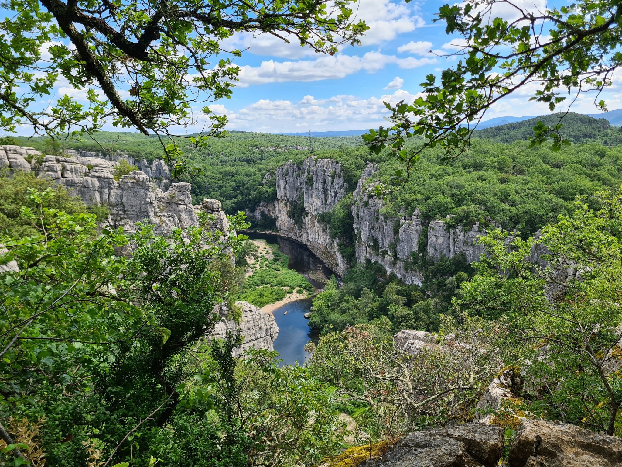
Gravel biking around Castanet-Le-Haut offers diverse landscapes within the Haut-Languedoc Regional Natural Park, featuring a mix of granitic massifs and limestone plateaus. The terrain includes forest tracks, small roads, and hilly single tracks that traverse valleys and dense forests, providing varied surfaces for no traffic gravel bike trails. The region is characterized by significant elevation changes, gorges like the Héric, and rivers such as the Dourdou de Camarès and Mare. These natural features contribute to a network of challenging gravel cycling routes without cars.
Best no traffic gravel bike trails around Castanet-Le-Haut
- The most popular no traffic gravel bike trail is Mountain views – Drinking water and toilets loop from Les Thérondels, a difficult 17.7 miles (28.4 km) trail that takes 2 hours 21 minutes to complete, offering expansive mountain views.
- Another top favourite among local gravel bikers is Col du Coustel (883 m) – Along the Mare loop from Fagairolles, a difficult 21.5 miles (34.6 km) path. This route features climbs to mountain passes and follows scenic river sections.
- Local gravel bikers also love the Along the Mare – Col du Coustel (883 m) loop from Saint-Gervais-sur-Mare, a difficult 23.2 miles (37.4 km) trail leading through varied terrain including river valleys and mountain ascents, often completed in about 3 hours 7 minutes.
- Gravel biking around Castanet-Le-Haut is defined by mountainous terrain, deep gorges, and dense forests, with routes often incorporating challenging climbs to viewpoints. The network primarily offers difficult options for experienced gravel bikers.
- The routes in Castanet-Le-Haut are highly rated by the komoot community with an average score of 4.6 stars from over 5 reviews. More than 50 gravel bikers have used komoot to explore Castanet-Le-Haut's varied terrain.
Last updated: November 2, 2026
5.0
(2)
11
riders
36.7km
02:02
370m
370m
Moderate gravel ride. Good fitness required. Mostly paved surfaces.
5
riders
33.4km
02:44
920m
930m
Hard gravel ride. Very good fitness required. Mostly paved surfaces.

1
riders
28.4km
02:22
520m
520m
Hard gravel ride. Very good fitness required. Mostly paved surfaces.
4.0
(1)
2
riders
36.2km
03:01
860m
860m
Hard gravel ride. Very good fitness required. Mostly paved surfaces.
4.0
(1)
2
riders
37.4km
03:07
870m
870m
Hard gravel ride. Very good fitness required. Mostly paved surfaces.
Our route recommendations are based on thousands of hikes, rides, and runs completed by other people on komoot.
Start today with a free account
Your next adventure awaits.




Tips from the Community

Clinging to a rocky outcrop almost encircled by the Jaur, Olargues is a remarkable fortified village whose medieval organization is still perfectly legible. At the summit, the former keep of the castle, transformed into a bell tower in the 17th century after the fortress was destroyed on Cardinal Richelieu's orders, still dominates the valley. Below, the Devil's Bridge, built in the 12th century, has spanned the Jaur for nearly nine centuries. Between the two, "calades" (cobbled alleyways) and old houses invite you to step back in time. It is easy to understand why Olargues is among the Most Beautiful Villages in France!
3
0
Located in the Jaur valley, in the heart of the Hauts cantons of the Hérault, Riols is a vast rural village typical of the Haut-Languedoc. The village is intimately linked to the history of the abbey of Saint-Pons-de-Thomières, founded in the 10th century, on which it long depended. From the Middle Ages onwards, Riols was part of a network of monastic possessions. Even today, the old center retains its valley setting, crossed by the Jaur, around which the main routes and activities developed. The Pont-Vieux and several structures on the river bear witness to this close relationship between the village and its watercourse.
3
0
A small, discreet bridge that crosses the Mare in the middle of the section between Bouissounades and Andabre.
3
0
At Aux Bouissounades, the sports course follows this stream, in a landscape entirely structured by the Mare. On foot or by bike, this section mainly offers a moment of respite, in the shade of the banks and wooded slopes.
3
0

One of the many tunnels that punctuate the PassaPaïs greenway, allowing easy crossing of the territory by bicycle.
0
0

Great enduro-style ride with plenty of swimming spots. Beginners should refrain.
0
0

Here there is a steep ascent and a steep descent, because the path no longer follows the railway line, up to 10%
0
0
Frequently Asked Questions
How many no-traffic gravel bike trails are available in Castanet-Le-Haut?
This guide features 3 challenging no-traffic gravel bike routes around Castanet-Le-Haut. These trails are designed to immerse you in the region's natural beauty, away from vehicular traffic.
What kind of terrain can I expect on the no-traffic gravel bike trails in Castanet-Le-Haut?
The trails in Castanet-Le-Haut offer a diverse mix of terrain, reflecting the region's unique geography within the Haut-Languedoc Regional Natural Park. You'll encounter forest tracks, small roads, and hilly, rugged sections that traverse valleys and plateaus. The area includes parts of the granitic Espinouse massif and limestone plateaus, providing varied surfaces ideal for gravel biking.
Are there any circular no-traffic gravel routes around Castanet-Le-Haut?
Yes, several routes are designed as loops, bringing you back to your starting point. For instance, consider the challenging Mountain views – Drinking water and toilets loop from Les Thérondels, the Col du Coustel (883 m) – Along the Mare loop from Fagairolles, or the Along the Mare – Col du Coustel (883 m) loop from Saint-Gervais-sur-Mare for a full circular experience.
Are there any waterfalls or natural pools along these gravel routes?
Yes, the region is known for its beautiful natural water features. You can discover the stunning Gouffre du Cerisier Natural Pool and Waterfall, which offers a refreshing stop. The Mare and Dourdou de Camarès rivers also carve out scenic routes, often with opportunities for dips.
What are the best viewpoints to discover on these no-traffic gravel trails?
The area boasts spectacular viewpoints due to its significant elevation changes. Don't miss the Orientation table at Mont Caroux, offering expansive views of the Haut Languedoc Natural Park. Another notable spot is the Col de la Croix de Mounis, providing a 360-degree vista of the surrounding mountains and forests.
How difficult are the no-traffic gravel bike trails around Castanet-Le-Haut?
The routes featured in this guide are generally considered difficult, with significant elevation gains. For example, the Along the Mare – Col du Coustel (883 m) loop from Saint-Gervais-sur-Mare involves over 860 meters of ascent. These trails are best suited for experienced gravel bikers looking for a challenge.
What do other gravel bikers say about the trails in Castanet-Le-Haut?
The komoot community highly rates the gravel biking experience in Castanet-Le-Haut, with an average score of 4.6 stars. Reviewers often praise the challenging terrain, the stunning natural beauty of the Haut-Languedoc Regional Natural Park, and the peaceful, traffic-free environment that allows for an immersive outdoor adventure.
Are there any historical sites to see along the no-traffic gravel routes?
While the routes focus on natural landscapes, the broader region of Castanet-Le-Haut is rich in history. You might encounter remnants of ancient Roman camps, Visigothic tombs, 14th-century chapels like Sainte Eutrope, and 18th-century mills such as Nougayrol, adding a cultural dimension to your ride.
What is the best time of year to go gravel biking in Castanet-Le-Haut?
The Haut-Languedoc Regional Natural Park, where Castanet-Le-Haut is located, offers varied climates. Spring and autumn generally provide the most pleasant temperatures for gravel biking, with vibrant flora and comfortable conditions. Summer can be warm, especially at lower elevations, while higher passes might experience cooler weather.
Can I access these no-traffic gravel trails using public transport?
Access to Castanet-Le-Haut and its surrounding trails primarily relies on personal transport. While some regional bus services might exist, direct public transport links to trailheads are limited. Planning for car access or local taxi services is generally recommended for reaching the starting points of these routes.
Where can I find parking for these no-traffic gravel trails?
Parking availability varies by trailhead. For routes like the Mountain views – Drinking water and toilets loop from Les Thérondels, you would typically find parking options in or near the village of Les Thérondels. Similarly, routes starting from Fagairolles or Saint-Gervais-sur-Mare would have parking available in those respective areas. Always check local signage for specific parking regulations.
Are these no-traffic gravel trails suitable for families with children?
The routes highlighted in this guide are rated as difficult due to significant elevation and varied terrain. They are generally more suited for experienced adult gravel bikers. For families with children, it's advisable to seek out easier, flatter sections or dedicated greenways in the broader region, which might offer a less challenging experience.
Most popular routes around Castanet-Le-Haut
Most popular attractions around Castanet-Le-Haut

Get inspired with the komoot mobile app


Explore more
Browse the best Gravel rides in other regions.
