The best walks and hikes around Marklohe
4.5
(187)
912
hikers
38
hikes
Hiking around Marklohe offers a diverse landscape characterized by the Weser River and its picturesque riverbanks, alongside rolling hills and green meadows. The region is situated near significant natural areas, including the Steinhuder Meer Nature Park and Dümmersee Lake, providing varied terrain for outdoor activities. These features contribute to a landscape that blends riverine environments with more open, undulating countryside.
Best hiking trails around Marklohe
- The most popular hiking route is Nienburg Town Hall – Nienburg Harbour loop from Marklohe…
Last updated: November 1, 2026
4.6
(14)
27
hikers
14.5km
03:40
20m
20m
Moderate hike. Good fitness required. Easily walkable paths.
4.8
(4)
21
hikers
Easy hike. Easily walkable paths.

5.0
(3)
14
hikers
4.05km
01:04
30m
30m
Easy hike. Easily walkable paths.
4.7
(7)
19
hikers
21.5km
05:27
40m
40m
Hard hike. Very good fitness required. Easily walkable paths.
5.0
(1)
9
hikers
5.63km
01:29
50m
50m
Easy hike. Easily walkable paths.
Get access to more routes and recommendations from other explorers.
Already have an account?
Our route recommendations are based on thousands of hikes, rides, and runs completed by other people on komoot.
Start today with a free account
Your next adventure awaits.

Tips from the Community

The glacial erratics from Småland in Nienburg/Weser are impressive relics of a natural history dating back tens of thousands of years. These large, often smoothly polished boulders originally came from the southern Swedish region of Småland and were transported to northern Germany by mighty glaciers during the last Ice Age. As the ice sheet slowly moved south, it tore rocks from the Scandinavian bedrock and carried them over long distances. When the ice melted, these so-called erratics were left behind in the landscape – far from their place of origin. Such glacial erratics, which can be geologically clearly attributed to Sweden, can also be found in Nienburg. Their composition, such as granite or gneiss, as well as characteristic structures, allow conclusions to be drawn about their Småland origin. They thus vividly illustrate the immense forces of the Ice Age and demonstrate how profoundly glaciers shaped the landscape we see today. The glacial erratics are silent witnesses to history, forging a connection between the Nienburg region and Scandinavia. Beyond their geological significance, these erratics also play a cultural and design role. In Nienburg, they are deliberately used as striking elements in the cityscape and green spaces, serving simultaneously as a starting point for environmental education and the preservation of historical memory.
1
0

The small inland harbor is located on the Weser River, with moorings for smaller ships and boats and adjacent green spaces. The area is easily accessible via the Weser Cycle Path and offers a short, worthwhile detour to the waterfront—with views of the quiet harbor activity and the scenic riverside area.
0
0

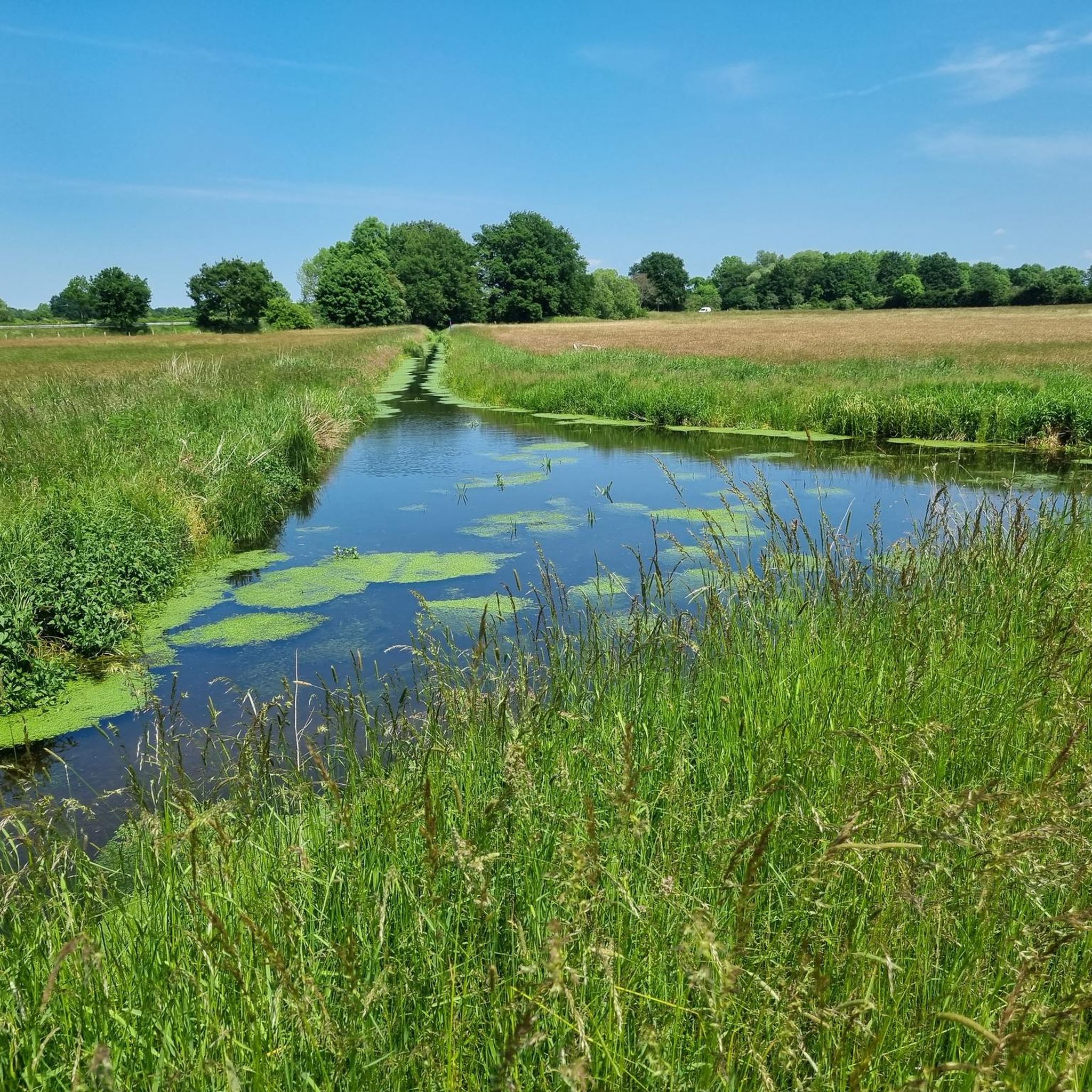
The Werderteich is part of the Hakenwerder ponds, a lake district near Nienburg.
3
0
From here you have a beautiful view of the Weser.
0
0
The Werderteich is part of the Hakenwerder ponds, a lake district near Nienburg.
0
0
The blue painted bridge leads over the Weser.
0
0

The street noise of the federal highway and the less than idyllic Weser Bridge are countered by various more or less attractive graffiti.
2
0
Listed bridge over the Weser in the west of Nienburg (Weser) as an arched bridge made of steel, concrete and natural stone, built in 1950. More precisely, a Langer beam with the special feature that the arch presents itself as a steel lattice sickle. 108m long, 9.2m wide. Successor to a bridge from 1908, blown up by the Wehrmacht towards the end of the war in April 1945. https://www.kreiszeitung.de/lokales/nienburg/damals-heute-einige-jahre-weserbruecke-nicht-3065526.html https://denkmalatlas.niedersachsen.de/viewer/fullscreen/31020353/3/
3
0
Frequently Asked Questions
How many hiking trails are available around Marklohe?
Marklohe offers a diverse network of nearly 40 hiking trails. These routes cater to various fitness levels, including easy, moderate, and difficult options, ensuring there's a suitable path for everyone.
What kind of landscapes can I expect to see while hiking in Marklohe?
Hiking in Marklohe provides a rich variety of landscapes. You'll encounter picturesque riverbanks along the Weser River, rolling hills, and green meadows. The region is also close to significant natural areas like the Steinhuder Meer Nature Park and Dümmersee Lake, offering diverse environments from riverine paths to open countryside.
Are there any easy hiking trails suitable for beginners or a relaxed walk?
Yes, Marklohe has over 20 easy hiking trails. A great option is the Stream with a small gorge – Hubertus Spring loop from Oyle, which is an easy 3.8-mile (6.2 km) path exploring natural features like a stream and the Hubertus Spring.
What are some interesting natural features or landmarks to look out for on the trails?
Marklohe's trails feature several points of interest. You can explore the Die Rolle or Estorfer Lake, and the Hakenwerder Ponds. The Weser River itself is a central feature, with the historic Weser Ferry Schweringen offering a unique river crossing experience. The nearby Crane Moor also features an adventure trail for families.
Are there any circular hiking routes in Marklohe?
Many of Marklohe's trails are designed as circular routes, allowing you to start and end at the same point. An example is the Werder Pond – Nienburg Harbour loop from Marklohe, a moderate 7.9-mile (12.8 km) trail.
When is the best time of year to go hiking in Marklohe?
The best seasons for hiking in Marklohe are spring and autumn. In spring, nature is in full bloom, offering vibrant scenery. Autumn transforms the forests with colorful foliage, creating a magical atmosphere for your walks.
What do other hikers say about the trails in Marklohe?
The trails in Marklohe are highly regarded by the komoot community, with an average rating of 4.5 stars from over 160 reviews. Hikers often praise the varied terrain, the scenic views along the Weser River, and the well-maintained paths that cater to different skill levels.
Are there any family-friendly hiking options in the Marklohe area?
Yes, the region offers family-friendly options. The 'Adventure Trail in the Crane Moor' is an exciting circular route through moor and heathland, featuring interactive stations designed for children to learn about nature in a playful way.
Can I find places to rest or have a picnic along the hiking routes?
Yes, you can find various facilities along the routes. For example, the Cyclists' Barn Estorf and the Grill Hut Binner Schlucht offer places to rest. There's also the Nienburger Bruch Shelter With E-Bike Charging Station, which provides a convenient stop.
Are there any trails that offer views of the Weser River?
Absolutely. The Weser River is a defining feature of the Marklohe landscape. Routes like the Nienburg Harbour – View of the Weser loop from Marklohe specifically lead through the Weser River landscape, offering extensive views of the river and its surroundings.
How long do hikes around Marklohe typically take?
Hiking durations vary depending on the trail's length and your pace. For instance, the Nienburg Town Hall – Nienburg Harbour loop from Marklohe, a 10.2-mile (16.4 km) trail, typically takes about 4 hours and 8 minutes to complete. Shorter, easy trails can be completed in under 2 hours.
Most popular attractions around Marklohe

Get inspired with the komoot mobile app


Explore more
Browse the best Hikes in other regions.
