The best traffic-free bike rides around Santa Cecília De Voltregà
4.4
(142)
13,678
riders
107
rides
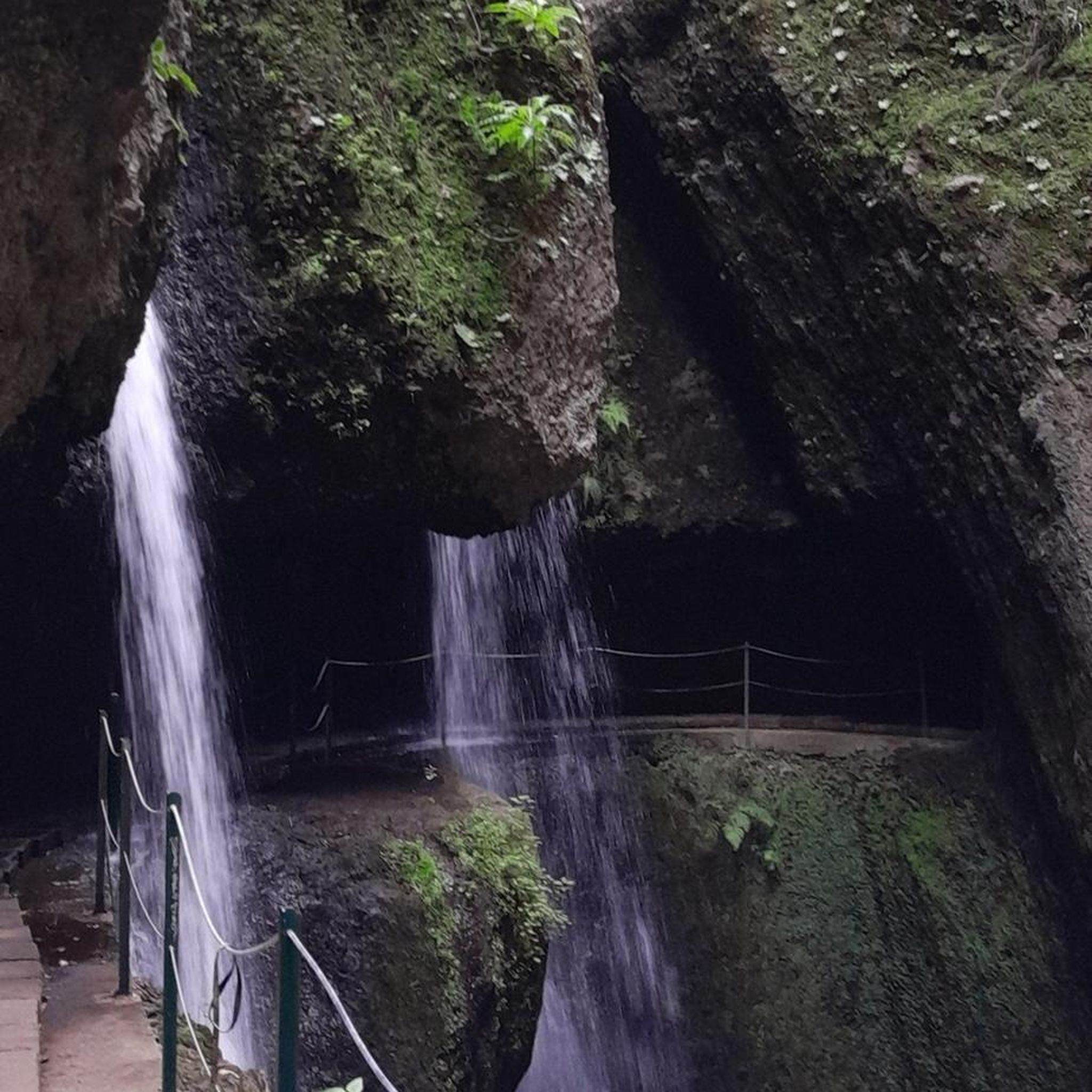
No traffic road cycling routes around Santa Cecília De Voltregà traverse a landscape characterized by diverse terrain, including tranquil stream valleys, expansive woodlands, and cultivated fields. The region's average altitude of 520 meters contributes to varied elevations, offering both flat sections and challenging climbs. Notable natural features like the Riera de Sorreigs and the Gorg Negre waterfall enhance the scenic road bike routes. This area provides a blend of natural beauty and quiet secondary roads suitable for road cycling.
Best…
Last updated: May 21, 2026
4.0
(2)
137
riders
61.6km
03:11
1,020m
1,010m
Hard road ride. Very good fitness required. Some segments of this route may be unpaved and difficult to ride.
4.0
(5)
280
riders
Moderate road ride. Good fitness required. Some segments of this route may be unpaved and difficult to ride.

Sign up for free
5.0
(9)
246
riders
50.6km
02:31
770m
770m
Moderate road ride. Good fitness required. Some segments of this route may be unpaved and difficult to ride.
156
riders
94.3km
05:29
2,030m
2,030m
Hard road ride. Very good fitness required. Some segments of this route may be unpaved and difficult to ride.
3.0
(2)
177
riders
68.0km
03:34
1,090m
1,090m
Hard road ride. Very good fitness required. Some segments of this route may be unpaved and difficult to ride.
Get access to more routes and recommendations from other explorers.
Sign up for free
Already have an account?
Our route recommendations are based on thousands of hikes, rides, and runs completed by other people on komoot.
Start today with a free account
Your next adventure awaits.
Login or Signup
Popular around Santa Cecília De Voltregà

Tips from the Community


The entire Vall d'en Bas, a valley located in the region of La Garrotxa, is a spectacular place, a very open valley surrounded by small mountains with lush vegetation. The views of the village of El Mallol, which rises above the valley, are particularly beautiful. Here you can take a great souvenir photo of the Vall d'en Bas.
1
0


It is a nice climb because of the tradition of the port, because of the views there are, I recommend that if you go down, be careful because of the sharp curves and the narrow road.
0
0
It is a small town that is in a privileged environment. It is a haven of peace.
0
0
This is the road that leaves Sant Pere de Torelló and ascends the southern slope to Coll de Bracons. It is a winding road, which generally gains altitude, although with continuous breaks. Ideal on hot days as it has many shadows.
0
0
Together with the Collada de Collfred they are the great ports in the area in terms of hardness. The port of Bracons has 2 completely different aspects. The best is the eastern slope, but I recommend facing both at some point in your life. - The eastern slope, which starts from the Vall d'en Bas, is 8 km long, the last 7 km at an average of 9%. The final kms are the hardest and most constant at 10%. The panoramic views of the Vall d'en Bas are continuous. It's a door! - The west slope, which starts from Torelló, is very irregular with the first 14km with a continuous up and down, where you gain height little by little. From this point, starting from Sant Andreu de la Volta, the slope rises radically, leaving 5km ahead on average at 7%, with a full km at 10%. I leave you the link with the altimetry of the port by @cyclingcols --> http://www.cyclingcols.com/col/Bracons
1
0
It is a very pleasant port on both sides since it is very bearable, always with ramps of around 5%. I like it better on the southern slope, the one that starts from The 2 slopes are very different, not only in length, but also in the type of landscape. The southern slope is 31.9km from Roda de Ter. It is used in the Terra de Remences march. It has 2 rest areas. It is an open climb, with mostly panoramic views. At first, a lot of views on the Plan de Vic. The northern slope, which starts from the Vall d'en Bas, is 11 km long and has hardly any views, almost always in the shadow of the vegetation and the gorge through which the road climbs. It has several horseshoe curves that give it the appearance of more of a mountain pass. I leave you the link of the altimetry published by @cyclingcols, the best on these topics --> http://www.cyclingcols.com/col/Condreu
0
0
Frequently Asked Questions
How many no-traffic road cycling routes are available around Santa Cecília De Voltregà?
There are over 100 dedicated no-traffic road cycling routes around Santa Cecília De Voltregà, offering a wide range of options for cyclists looking for quiet roads. These routes vary in difficulty, with a good selection of moderate and challenging rides.
What kind of terrain and elevation can I expect on these routes?
The region around Santa Cecília De Voltregà offers diverse terrain, from tranquil stream valleys and cultivated fields to significant climbs. You'll find routes combining flat sections with ascents, such as the challenging 6.7 km climb to the Sanctuary of Bellmunt, which features spectacular ramps and winding roads. Routes like the Sant Hipòlit de Voltegrà and Sant Bartomeu del Grau circular via the La Trona road involve over 1000 meters of elevation gain, providing a good test of endurance.
Are there any family-friendly no-traffic road cycling routes?
While many road cycling routes in the area involve varied terrain and some climbs, there are easier options available. Look for routes with lower elevation gain and shorter distances if cycling with family. The region's quiet secondary roads are generally suitable for a more relaxed pace, but always check the route details for specific difficulty and elevation before heading out.
What are the best times of year for road cycling in Santa Cecília De Voltregà?
The diverse landscapes of Santa Cecília De Voltregà are enjoyable throughout much of the year. Spring and autumn generally offer the most comfortable temperatures for road cycling, avoiding the peak heat of summer and the colder, potentially wetter conditions of winter. These seasons provide pleasant weather for tackling both the flat sections and the more demanding climbs.
What natural features or landmarks can I see along the routes?
Many routes offer scenic views and pass by notable natural and historical sites. You might encounter reservoir views, expansive woodlands, and the Riera de Sorreigs, which features the remarkable Gorg Negre waterfall. Cultural highlights include the Romanesque church of Santa Cecília and the hermitage of Santa Perpètua. For panoramic views, consider routes that ascend to the Sanctuary of Bellmunt, offering vistas of Montseny, the Vic plain, and the Pyrenees. You can also explore highlights like the Sant Feliuet de Savassona Hermitage or the Lady's Oak.
Are there any circular no-traffic road cycling routes?
Yes, many of the no-traffic road cycling routes in the area are designed as circular loops, allowing you to start and finish at the same point. An example is the Sant Hipòlit de Voltegrà and Sant Bartomeu del Grau circular via the La Trona road, which offers a substantial loop through varied landscapes. Another option is the La Trona Road – La Trona Viewpoint loop from Manlleu.
What is the quality of the road surface like on these quiet routes?
The region's quiet secondary routes are generally well-maintained, providing a good surface for road cycling. While specific conditions can vary, the focus on 'no traffic' routes often means less wear and tear from heavy vehicles, contributing to a smoother ride. However, it's always advisable to check recent route comments or local conditions if you have concerns about specific sections.
What do other cyclists say about road cycling in Santa Cecília De Voltregà?
The komoot community highly rates the road cycling experience in Santa Cecília De Voltregà, with an average score of 4.5 out of 5 stars from over 130 ratings. Cyclists frequently praise the quiet, scenic roads, the diverse terrain, and the rewarding climbs that offer spectacular panoramic views.
Are there routes that connect Santa Cecília De Voltregà to nearby towns like Vic or Manlleu?
Yes, the road network in the Osona region allows for routes that connect Santa Cecília De Voltregà to surrounding towns. While specific routes starting directly from Santa Cecília De Voltregà to these towns might vary, you can find routes like the Coll Formic Pass (1,145 m) – El Brull loop from Manlleu or the Coll de Bracons – Collada de Collfred loop from Manlleu, which are accessible from nearby points and offer extensive exploration of the wider area.
Where can I find parking for my car when starting a road cycling route?
Parking availability can vary depending on your chosen starting point. In Santa Cecília De Voltregà and surrounding villages, you can typically find public parking areas. For routes starting from specific trailheads or attractions, look for designated parking facilities. It's always a good idea to check the route details or local maps for specific parking recommendations near your intended start location.
Are there any particularly challenging no-traffic road cycling routes in the area?
For experienced cyclists seeking a challenge, routes like the Sant Hipòlit de Voltegrà and Sant Bartomeu del Grau circular via the La Trona road offer over 1000 meters of elevation gain over more than 60 km. Other difficult routes, such as the Coll de Bracons – Collada de Collfred loop from Manlleu, can feature over 2000 meters of climbing, providing a significant test of endurance and skill on quiet, scenic roads.
Most popular routes around Santa Cecília De Voltregà
Most popular attractions around Santa Cecília De Voltregà

Get inspired with the komoot mobile app


Explore more
Browse the best Road cycling routes in other regions.
