The best traffic-free bike rides around El Pont De Vilomara I Rocafort
4.4
(21)
571
riders
106
rides
Gravel biking around El Pont De Vilomara I Rocafort offers diverse terrain within the Bages region of Catalonia. The area features forested hills, narrow valleys, and proximity to the Llobregat River, providing varied landscapes for no traffic gravel bike trails. Riders can expect a mix of rural roads, comfortable tracks, and unpaved paths, with significant elevation changes in some sections. The region's natural features include the Sant Llorenç del Munt i l'Obac Natural Park and historical vineyard landscapes with unique dry stone vats.
Best no traffic gravel bike trails around El Pont De Vilomara I Rocafort
- The most popular no traffic gravel bike trail is Corbatera Pond – La Séquia Canal Trail loop from Manresa Alta, a 39.6 miles (63.8 km) trail that takes 5 hours 7 minutes to complete. This route navigates varied terrain, including sections along the La Séquia Canal.
- Another top favourite among local gravel bikers is Corbatera Pond – Parque de l'Agulla loop from Manresa Alta, a difficult 33.5 miles (54.0 km) path. This route offers views of the Parque de l'Agulla and surrounding natural areas.
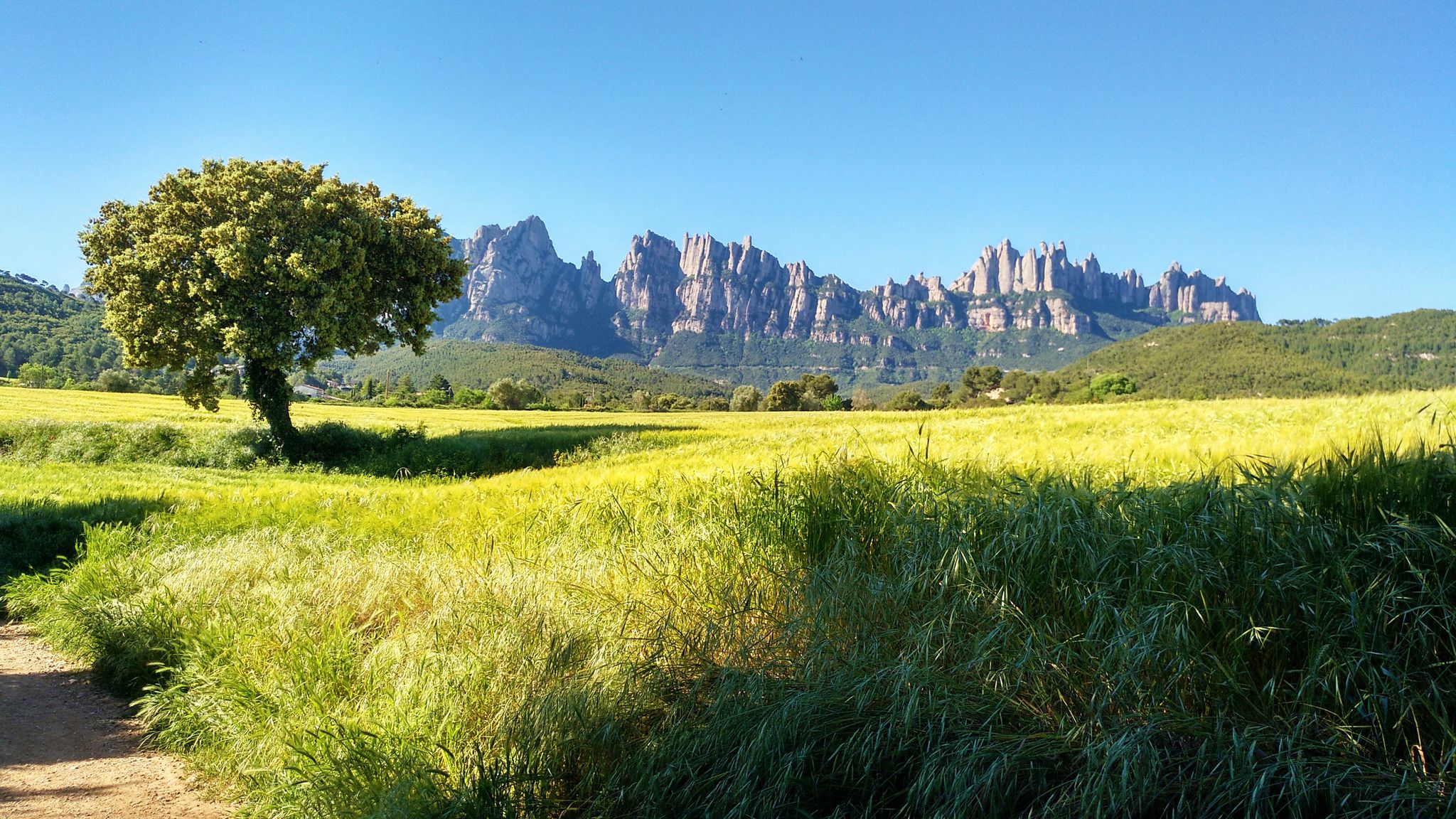
- Local gravel bikers also love the View of Montserrat – Manresans' Weir loop from Manresa Alta, a 63.4 miles (102.0 km) trail leading through the region with views of Montserrat, often completed in about 7 hours 40 minutes.
- Gravel biking around El Pont De Vilomara I Rocafort is defined by forested hills, river valleys, and historical vineyard areas. The network offers options for different ability levels, with many challenging routes available.
- The routes in El Pont De Vilomara I Rocafort are highly rated by the komoot community with an average score of 4.2 stars from 20 reviews. More than 600 gravel bikers have used komoot to explore El Pont De Vilomara I Rocafort's varied terrain.
Last updated: May 21, 2026
4.3
(4)
28
riders
51.3km
03:44
570m
570m
Hard gravel ride. Very good fitness required. Mostly paved surfaces. Suitable for all skill levels.
5.0
(1)
23
riders
35.3km
02:34
310m
310m
Hard gravel ride. Good fitness required. You may need to push your bike for some segments of this route.

Sign up for free
19
riders
102km
07:42
1,420m
1,430m
Hard gravel ride. Very good fitness required. Mostly paved surfaces. Suitable for all skill levels.
15
riders
43.2km
03:33
810m
810m
Hard gravel ride. Very good fitness required. Mostly paved surfaces. Suitable for all skill levels.
5.0
(1)
23
riders
61.3km
04:22
750m
750m
Hard gravel ride. Very good fitness required. You may need to push your bike for some segments of this route.
Get access to more routes and recommendations from other explorers.
Sign up for free
Already have an account?
Our route recommendations are based on thousands of hikes, rides, and runs completed by other people on komoot.
Start today with a free account
Your next adventure awaits.
Login or Signup

Other adventures around El Pont De Vilomara I Rocafort


Tips from the Community

Castell de Sallent, val la pena desviar-se i parar
0
0

A town with a great history that is worth visiting 🤩
1
0

The Transéquia As a tribute to the people who built the irrigation canal between 1339 and 1383, which still provides a large flow of water to the city of Manresa today, the Young Chamber of Manresa began organizing the Transéquia in 1985. Starting from Balsareny, it passes through the municipalities of Sallent, Santpedor and Sant Fruitós de Bages and reaches the Parc de l'Agulla de Manresa. In 2014, the Fundació Aigües de Manresa - Junta de la Séquia took over from the Young Chamber and has been organizing it ever since.
0
0

Pleasant walk through Talamanca and its surroundings with a moderate slope. The route runs along well-marked tracks and is marked with milestones with white and green labels. With this itinerary we will discover the medieval origins of Talamanca based on its cultural and natural heritage. The route follows a section of the stream between small gorges and waterfalls that have emerged between the rocks. The itinerary discovers constructions such as the dry stone huts, the water lilies or the unique area of the balma salt of the Gobians and a part following the stream bed, scene of one of the most important battles of the war of succession. Part of the excursion goes through Sant Llorenç del Munt i l'Obac Natural Park.
0
0
The original building, built in the 11th century, was the embryo of the town and the political center of the district. It was part of the network of castles aimed at the defense of the colonists who repopulated the lands conquered by the Saracens. In the twelfth century, the Saracen threat faded but the process of feudalization caused disputes between Castilians for control of the castle, with several sagas taking place: the Cardona, the Talamanca, the Castellbell. In 1717, Bourbon troops demolished the castle, a fate shared by many of the castles of Old Catalonia. In the 18th century, the Castellbells built the manor house with a tower.
0
0
the Inici de la Sèqui, a space of great beauty, landscape and a space of tranquility
0
0
A good place to stop and make a vignette
0
0
The sections of the Sèquia combine beauty, nature and transport you to the medieval past of the Canal, especially the Section of Roure Gros and the sections of Mas de les Coves.
0
0
Frequently Asked Questions
How many no-traffic gravel bike trails are available in El Pont De Vilomara I Rocafort?
There are over 80 dedicated no-traffic gravel bike trails around El Pont De Vilomara I Rocafort. These routes offer a diverse range of experiences, from moderate to difficult, ensuring a quiet and immersive ride through the region's natural beauty.
What kind of terrain can I expect on these gravel bike trails?
The terrain around El Pont De Vilomara I Rocafort is quite varied, featuring forested hills, narrow valleys, and sections along the Llobregat River. You'll encounter a mix of rural roads, comfortable tracks, and unpaved paths. The area is adjacent to the Sant Llorenç del Munt i l'Obac Natural Park, which means you can expect significant elevation changes and rugged, yet non-technical, gravel surfaces.
Are there any family-friendly no-traffic gravel routes?
While many routes in this guide are rated as moderate to difficult due to elevation and distance, the region does offer sections that can be adapted for families. Look for flatter paths along the Llobregat River or consider shorter loops. Always check the route details for elevation profiles and distance to ensure it matches your family's capabilities.
Can I bring my dog on these gravel bike trails?
Many of the natural trails and rural roads are suitable for cycling with dogs, provided they are well-behaved and kept under control, especially in areas with wildlife or livestock. Always ensure your dog is accustomed to longer rides and consider the weather conditions. Remember to carry enough water for both yourself and your pet.
What are some notable landmarks or viewpoints I can discover along the trails?
The region is rich in historical and natural sights. You might encounter the remains of Rocafort Castle, offering incredible views, or the unique 'tines de pedra seca' (dry stone vats) in areas like the Vall del Flequer, which are recognized as Intangible Cultural Heritage. For stunning panoramic views, consider routes that pass near La Mola and the Monastery of Sant Llorenç del Munt or Collbaix Summit, where you can often see Montserrat in the distance.
Are there any circular no-traffic gravel routes?
Yes, many of the gravel routes in the area are designed as loops, allowing you to start and finish at the same point. For example, the Corbatera Pond – La Séquia Canal Trail loop from Manresa Alta offers a substantial circular ride. These loops are ideal for exploring the diverse landscapes without needing to retrace your steps.
What is the best time of year to go gravel biking in El Pont De Vilomara I Rocafort?
Spring and autumn are generally the most pleasant seasons for gravel biking in this region, offering mild temperatures and vibrant natural scenery. Spring brings lush greenery, while autumn provides beautiful fall colors. Summer can be hot, so early morning or late afternoon rides are recommended, especially along the cooler river sections. Winter rides are also possible, though some higher elevation paths might be cooler.
What do other gravel bikers enjoy most about the trails here?
The komoot community rates the gravel biking experience in El Pont De Vilomara I Rocafort highly, with an average score of 4.2 out of 5 stars from 20 ratings. Reviewers often praise the quiet, traffic-free nature of the routes, the diverse landscapes ranging from riverbanks to forested hills, and the stunning views, particularly towards Montserrat. The historical elements like the dry stone vats also add a unique cultural dimension to the rides.
Are there any routes that offer views of Montserrat?
Absolutely! Given the region's proximity, many trails provide spectacular views of the iconic Montserrat mountain range. For instance, the View of Montserrat – Manresans' Weir loop from Manresa Alta is specifically highlighted for its vistas. Look for routes that climb to higher elevations or pass through open areas to catch these impressive panoramas.
Where can I find parking for these no-traffic gravel trails?
Many routes start from towns or villages like Manresa Alta or Manresa Baixador, where public parking is generally available. For trails venturing deeper into natural areas, look for designated parking spots near trailheads or rural access points. Always check local signage for any restrictions or fees.
Are there any easy gravel bike trails for beginners?
While this guide features routes primarily rated as moderate to difficult, beginners can still enjoy the area by selecting shorter segments of longer trails or focusing on flatter sections, such as those found along the Llobregat River. It's advisable to check the elevation profile and distance of any chosen route to ensure it aligns with your comfort level and fitness.
Most popular routes around El Pont De Vilomara I Rocafort
Most popular attractions around El Pont De Vilomara I Rocafort

Get inspired with the komoot mobile app


Explore more
Browse the best Gravel rides in other regions.
