The best traffic-free bike rides around Duruelo De La Sierra
4.5
(2)
261
riders
18
rides
No traffic touring cycling routes around Duruelo De La Sierra traverse a landscape defined by the Sierra de Urbión mountains, dense pine forests, and the nascent Duero River. The region features glacial landforms, such as Laguna Negra, and unique rock formations like Castroviejo. Cyclists can explore well-maintained tracks and quiet roads that wind through this varied terrain, offering a tranquil escape into nature.
Best no traffic touring cycling routes around Duruelo De La Sierra
- The most popular no traffic touring cycling route is San Francisco Viewpoint – Neila Lagoons loop from Quintanar de la Sierra, a 18.4 miles (29.7 km) difficult trail that takes 2 hours 19 minutes to complete. This route offers significant elevation gain through mountainous terrain.
- Another top favourite among local touring cyclists is Puente de los Arrieros – Duero Trail loop from Covaleda, a moderate 12.9 miles (20.7 km) path. This trail follows the initial journey of the Duero River, providing scenic views along its banks.
- Local touring cyclists also love the Quintanar de la Sierra – San Leonardo de Yagüe loop from Quintanar de la Sierra, a 35.7 miles (57.4 km) trail leading through extensive pine forests, often completed in about 3 hours 49 minutes.
- Touring cycling around Duruelo De La Sierra is defined by the Sierra de Urbión peaks, dense pine forests, and glacial landscapes, with many routes utilizing quiet roads and dedicated cycling networks. The network offers options for various ability levels, from moderate to difficult.
- The routes in Duruelo De La Sierra are highly rated by the komoot community with an average score of 4.5 stars from over 2 reviews. More than 260 touring cyclists have used komoot to explore Duruelo De La Sierra's varied terrain.
Last updated: May 20, 2026
41
riders
29.7km
02:19
810m
810m
Hard bike ride. Very good fitness required. Mostly paved surfaces. Suitable for all skill levels.
20
riders
20.7km
01:49
170m
170m
Moderate bike ride. Good fitness required. Mostly paved surfaces. Suitable for all skill levels.

Sign up for free
5.0
(1)
11
riders
Hard bike ride. Very good fitness required. Mostly paved surfaces. Suitable for all skill levels.
15
riders
19.4km
01:48
360m
360m
Moderate bike ride. Good fitness required. Mostly paved surfaces. Suitable for all skill levels.
11
riders
42.8km
04:19
880m
880m
Hard bike ride. Very good fitness required. Mostly paved surfaces. Suitable for all skill levels.
Get access to more routes and recommendations from other explorers.
Sign up for free
Already have an account?
Our route recommendations are based on thousands of hikes, rides, and runs completed by other people on komoot.
Start today with a free account
Your next adventure awaits.
Login or Signup


Tips from the Community

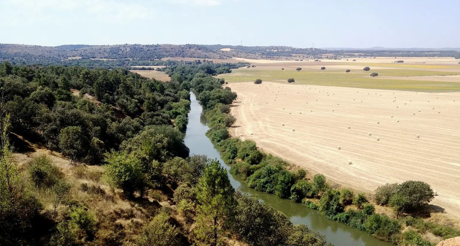
Stage 2. Duruelo de la Sierra/Soria 69 kilometers. 510 meters of elevation gain. Duruelo has hotels, restaurants, and grocery stores. It is the town where the Duero River originates at the foot of the Urbión Peaks. The Senda del Duero Nature Trail begins at Fuentes del Duero, where the river officially originates, at an altitude of 2,100 meters, a landscape of crushed granite shaped by the fierceness of the high mountains. The route leaves the town along the Senda del Duero. The posts are located at a cattle gate, and there are hiking and mountain bike trail signs in several directions. The path is also marked with the red and white stripes of the GR-14 trail. It crosses a small, inconspicuous slope on a grassy slope and descends some steps to the fantastic path that runs along the riverbank—the perfect way to start this cycle tour. The river path is about seven kilometers long, with the tricky sections at the end, where rain and flooding have stripped the road bare, requiring careful adjustment to squeeze gravel tires between the stones. There's also a short stretch of stairs that isn't suitable for cycling. The path passes over the Soria Bridge (17th century) and climbs the slopes of Mount Peña Rubia, far from the river. It's the longest and steepest climb of the cycling day. The end is impossible; the path is ridden with roots and rills from runoff, but it only takes a few minutes. Soon, the forest track appears, descending at full speed to Molinos de Duero, another iconic village of pine-forest architecture with its May pine tree in the square and a landmark for road cycling. The red markers of the Duero Path pass under the road and continue toward Vinuesa along the route of an ancient Roman road, which is quite difficult for gravel bikes due to the poor condition of the surface. The comfortable option for bicycles with panniers is the road. Vinuesa is a good place to grab a snack, a section of a branch of the Cañada Real Segoviana (Royal Segovian Trail) that reaches from the Cameros region of Rioja via the Puerto de Santa Inés. The pines of the Revinuesa Valley are magnificent; they have always been renowned for their high-quality wood and their proud, solemn bearing. For centuries, they have shaped the economic pulse of forest resources in the Pinares region.
0
0
San Leonardo de Yagüe Km 61. Altitude 1,060. The Greenways and Nature Trails networks restore old railway lines from the late 19th and early 20th centuries, when engineers marked the placement of rails following the terrain and elevations, avoiding steep slopes, something unthinkable in today's railway designs. The railway weaves through the mountain pine forests and passes far from Navaleno; even the old station is off the route, although it appears to be undergoing restoration. In San Leonardo de Yagüe, however, a cinematic curiosity of the railway remains visible. Before reaching the town, the rails that were the setting for a sequence in the film Doctor Zhivago appear, where Zhivago meets Strelnikov. This scene is set with photos from the film and the famous Mikado locomotive, an interesting location for classic film lovers. The town is a fine example of the region's pine architecture. It has stately homes, remains of a 16th-century castle, and the town square features a pine tree raised during the "pingada de mayo" (May Pingada), a popular festival held by local youths who select a large pine tree from the forest and hoist it (pingan) using wooden forks and ropes until the trunk is positioned vertically in the town square. The descent to Hontoria del Pinar is fast; the bike can reach 30 kilometers per hour without applying pressure on the pedals. It's a delightful stretch in the kingdom of the pine forest. The current development of the Nature Trail ends at the entrance to the town, near the Lobos River. It looks like the end of the road, but it's actually a break in the signage work to Cascajares del Campo. These will soon be completed, and the trail will continue to the Engaña Tunnel, in the Cantabrian Mountains. In Hontoria, I have prepared a connecting section to Duruelo de la Sierra to return to Soria along the Senda del Duero. The trail is fairly simple and obvious, following the forest trails of the pine forests. It climbs up the Palacios de la Sierra road and crosses the mountain range to pass by the Presón Refuge and the Castroverde Refuge, in case anyone prefers to spend the night in the pine forest. The climb to the Balcón de Pilatos has some rather steep slopes at the end of the stage through the Umbría mountain range. It's the last warm-up before a comforting descent along the Duruelo de la Sierra road.
0
0

A curious large stone, it moves but cannot be dragged.
0
0
Nice area for outdoor activities.
0
0
In one of the many visits to Covaleda, which I usually go to, I have visited this beautiful place and I contribute photos
0
0
Frequently Asked Questions
What kind of terrain can I expect on the no-traffic touring cycling routes around Duruelo de la Sierra?
The routes in Duruelo de la Sierra offer a diverse range of terrain, from well-maintained tracks and old roads to bridle paths and small trails, many of which are ideal for gravel and road cycling due to very low traffic. You'll encounter the dense pine forests of the Pinares region, glacial landscapes, and routes tracing the initial journey of the Duero River.
Are there routes suitable for families or beginners looking for easy, no-traffic touring cycling?
While this guide focuses on moderate to difficult routes, the broader Pinares Soria-Burgos BTT network, which Duruelo de la Sierra is part of, includes 'Green Routes' specifically designed for families or beginners. These routes are generally circular and offer a gentle introduction to the region's beautiful landscapes.
What are some notable natural features or landmarks I can see along these no-traffic cycling routes?
Many routes will lead you through stunning natural features. You can explore the majestic Laguna Negra, a glacial lake steeped in legend, or cycle near the source of the Duero River. The area also boasts unique rock formations at Castroviejo and picturesque waterfalls like Cueva Serena. For panoramic views, consider routes that pass by viewpoints such as the Lost Love Viewpoint.
What is the best season for touring cycling in Duruelo de la Sierra to avoid traffic and enjoy the scenery?
The best seasons for touring cycling in Duruelo de la Sierra are typically spring and autumn. During these times, the weather is pleasant, the natural landscapes are vibrant, and you can enjoy the quiet roads and trails without the peak summer crowds. Winter can be challenging due to snow, especially at higher elevations.
Are there any circular no-traffic touring cycling routes available?
Yes, many of the routes in the region are designed as circular paths, allowing you to start and end in the same location. For instance, the San Francisco Viewpoint – Neila Lagoons loop from Quintanar de la Sierra offers a challenging circular experience, while the Puente de los Arrieros – Duero Trail loop from Covaleda provides a moderate option.
What is the general difficulty level of the no-traffic touring cycling routes in this guide?
This guide features routes ranging from moderate to difficult. There are 8 moderate routes, which are suitable for occasional cyclists, and 10 difficult routes, designed for regular cyclists seeking a higher physical demand. Routes like Quintanar de la Sierra – San Leonardo de Yagüe loop from Quintanar de la Sierra are considered difficult, while Puente de los Arrieros – Medieval Bridge of Soria loop from Covaleda is a moderate option.
Can I find places to eat or stay near the no-traffic cycling routes in Duruelo de la Sierra?
Duruelo de la Sierra and its surrounding villages offer charming options for cyclists. The village itself features traditional stone houses and local craftsmanship. You'll find places to refuel with hearty, locally sourced cuisine. For accommodation, there are various options, including shelters like El Búnker Shelter or Fuente del Berro Shelter, which can be found along some routes.
What do other touring cyclists say about the no-traffic routes in Duruelo de la Sierra?
The komoot community highly rates the touring cycling experience in Duruelo de la Sierra, with an average score of 4.5 stars. Reviewers often praise the tranquility of the extensive pine forests, the stunning glacial landscapes, and the well-maintained, quiet tracks that allow for an immersive nature experience away from traffic.
Are there any routes that specifically explore the Picos de Urbión area?
Yes, the Sierra de Urbión, including the Picos de Urbión, forms a stunning backdrop for many routes. While not explicitly listed in this guide, the region's cycling network includes routes that allow you to experience the towering peaks and lush forests. You can find highlights like Pico de Urbión and Picacho del Camperón (2,101 m) within the broader area, accessible via various cycling paths.
How many no-traffic touring cycling routes are covered in this guide for Duruelo de la Sierra?
This guide features 18 carefully selected no-traffic touring cycling routes around Duruelo de la Sierra, offering a range of experiences from moderate to difficult, all designed to provide a peaceful ride through the region's natural beauty.
Are there any routes that pass by waterfalls or unique rock formations?
Yes, the region is known for its picturesque waterfalls and unique geological features. While specific routes are not detailed here, you can find serene spots like Cueva Serena with its beautiful waterfall and the labyrinthine rock formations of Castroviejo within the area. Many cycling-friendly paths lead to these natural wonders, offering magical corners to explore.
Most popular routes around Duruelo De La Sierra
Most popular attractions around Duruelo De La Sierra

Get inspired with the komoot mobile app


Explore more
Browse the best Cycling routes in other regions.
