The best traffic-free bike rides around Aprigliano
4.7
(60)
1,430
riders
25
rides
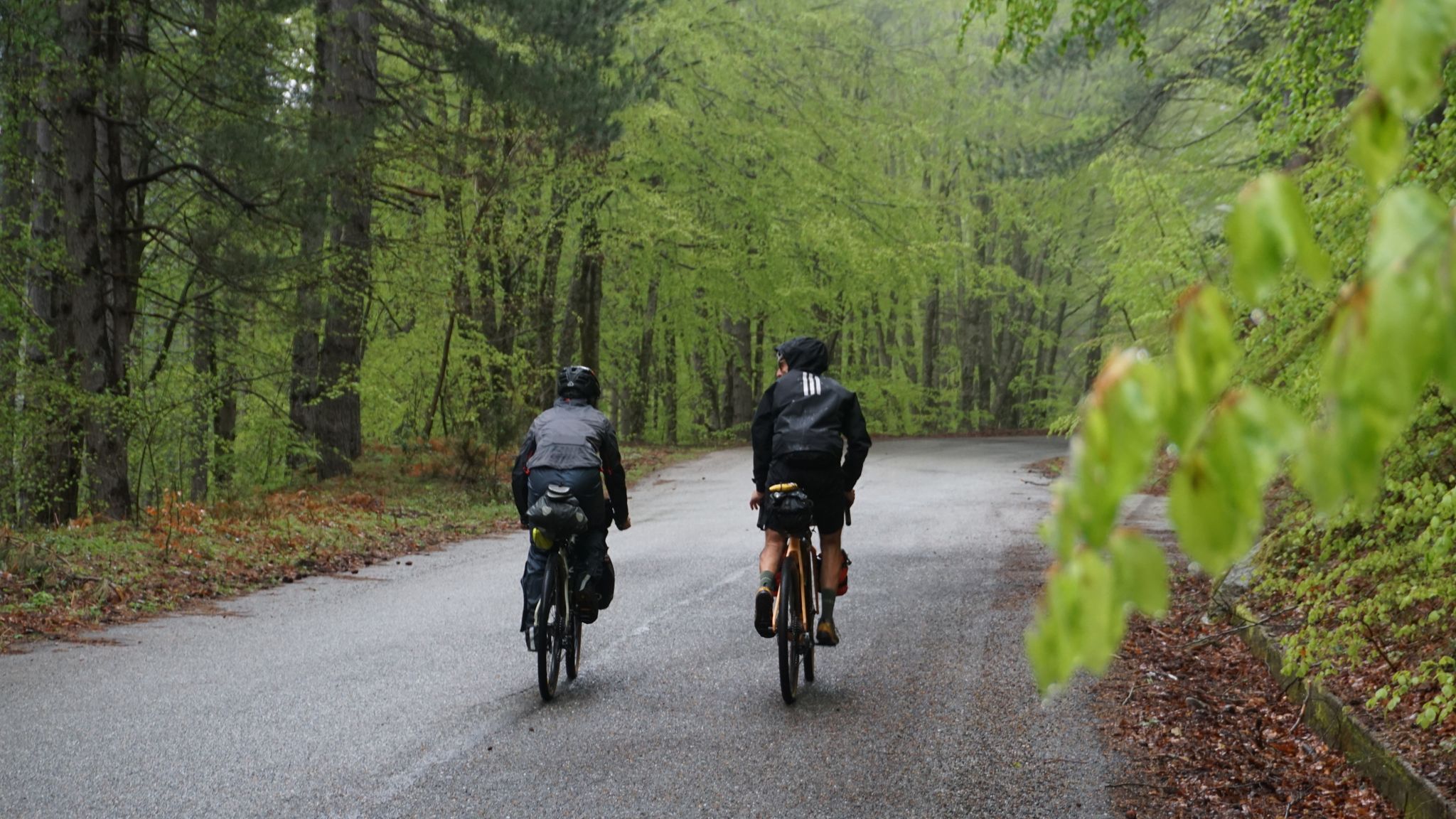
No Traffic road bike trails Aprigliano are situated in a mountainous region of Calabria, Italy, serving as a gateway to the Sila National Park. The area is characterized by high plateaus, dense forests of Calabrian pine and beech, and significant elevation gains, with much of the territory exceeding 1,000 meters in altitude. Artificial lakes like Lake Arvo and Lake Cecita are prominent features, providing scenic backdrops for road cycling. This landscape offers varied and challenging routes for road cyclists.
Best…
Last updated: May 19, 2026
20
riders
80.2km
04:47
2,010m
2,010m
Hard road ride. Very good fitness required. Mostly well-paved surfaces and easy to ride.
5.0
(1)
27
riders
38.3km
02:08
760m
760m
Moderate road ride. Good fitness required. Mostly well-paved surfaces and easy to ride.

Sign up for free
3.0
(1)
27
riders
44.4km
02:43
1,190m
1,190m
Hard road ride. Very good fitness required. Mostly well-paved surfaces and easy to ride.
4.4
(9)
31
riders
61.6km
03:51
1,720m
1,720m
Hard road ride. Very good fitness required. Mostly well-paved surfaces and easy to ride.
26
riders
61.3km
03:28
1,350m
1,350m
Hard road ride. Very good fitness required. Mostly well-paved surfaces and easy to ride.
Get access to more routes and recommendations from other explorers.
Sign up for free
Already have an account?
Our route recommendations are based on thousands of hikes, rides, and runs completed by other people on komoot.
Start today with a free account
Your next adventure awaits.
Login or Signup



Tips from the Community

A functioning and very fresh water fountain is located on the road to Montescuro.
0
0
working water fountain between Spezzano Piccolo and Spezzano della Sila
0
0


Every first Friday/Saturday of the month
0
0

a few kilometers from the summit for Montescuro
0
0
Camigliatello is at the center of many hiking and cycling routes
2
0

Very nice and crowded town….
4
0
Frequently Asked Questions
How many no-traffic road cycling routes are available around Aprigliano?
There are over 20 dedicated no-traffic road cycling routes around Aprigliano, offering a variety of experiences for different skill levels. You'll find routes ranging from moderate to difficult, with significant elevation gains as you explore the Sila National Park.
What kind of landscapes can I expect on these routes?
The routes around Aprigliano primarily traverse the mountainous terrain of the Sila National Park, featuring dense forests of Calabrian pine, beech, and silver fir. You'll encounter high plateaus, mountain peaks, and picturesque artificial lakes like Lake Arvo and Lake Cecita, offering stunning panoramic views.
Are there any easy no-traffic road cycling routes for beginners?
While many routes in the Aprigliano area are moderate to difficult due to the mountainous terrain, there is at least one easy route available. These routes are generally well-paved and offer a gentler introduction to cycling in the Sila region.
What are the typical elevation gains on these routes?
Given the mountainous nature of the Sila National Park, you can expect significant elevation gains. For example, routes like the Strada delle Vette and Lake Arvo Loop feature over 1,200 meters of ascent, providing a challenging experience for road cyclists.
What are some notable landmarks or scenic viewpoints along the routes?
Many routes offer breathtaking views. You can enjoy extensive vistas of Lake Arvo from high points like Panoramic view from Colle Perilli over Lake Arvo. Other notable features include the ancient black pines at the I Giganti della Sila Nature Reserve and the scenic Lorica and Lake Arvo area.
Are there any loop routes available?
Yes, several routes are designed as loops, allowing you to start and end in the same location. An example is the challenging ring tour from Camigliatello Silano to Monte Scuro and Monte Botte Donato, which offers continuous views along the Strada delle Vette.
What is the best time of year for no-traffic road cycling around Aprigliano?
The best time for road cycling around Aprigliano is typically from spring through autumn. During these seasons, the weather is generally mild, and the natural beauty of the Sila National Park is at its peak. Winter can bring snow, especially at higher elevations, making some routes inaccessible.
What do other road cyclists enjoy most about cycling in Aprigliano?
The area is highly rated by the komoot community, with an average score of 4.56 stars. Reviewers often praise the quiet, well-paved roads, the challenging climbs, and the stunning natural scenery, particularly the dense forests and panoramic views over the Sila lakes and mountains.
Are there any routes that pass by significant mountain peaks?
Absolutely. Many routes take you through or near prominent peaks. For instance, the Monte Scuro e Monte Botte Donato loop from Lorica offers an intense ride with over 2,000 meters of elevation gain, bringing you close to the highest points of Sila Grande like Monte Botte Donato and Monte Scuro.
Can I find accommodation or cafes near the cycling routes?
Yes, towns like Aprigliano and nearby Camigliatello Silano (a popular starting point for many routes) offer various amenities including cafes, restaurants, and accommodation options suitable for cyclists. It's advisable to check specific route details for facilities directly on the path.
Is public transport available to reach the starting points of these routes?
While Aprigliano itself is a good base, public transport options to specific remote starting points within the Sila National Park might be limited. It's often recommended to use a car to reach the main access points or larger towns like Camigliatello Silano, which are well-connected and offer parking.
Are there any family-friendly no-traffic road cycling options?
While the region is known for its challenging terrain, some sections of the broader Calabria Parks Cycle Path, which Aprigliano is part of, might offer flatter, more family-friendly segments. For specific no-traffic road routes directly around Aprigliano, look for the 'easy' graded tours, which will have less demanding climbs.
Most popular attractions around Aprigliano

Get inspired with the komoot mobile app


Explore more
Browse the best Road cycling routes in other regions.
