The best traffic-free bike rides around Etroubles
4.6
(94)
2,827
riders
29
rides
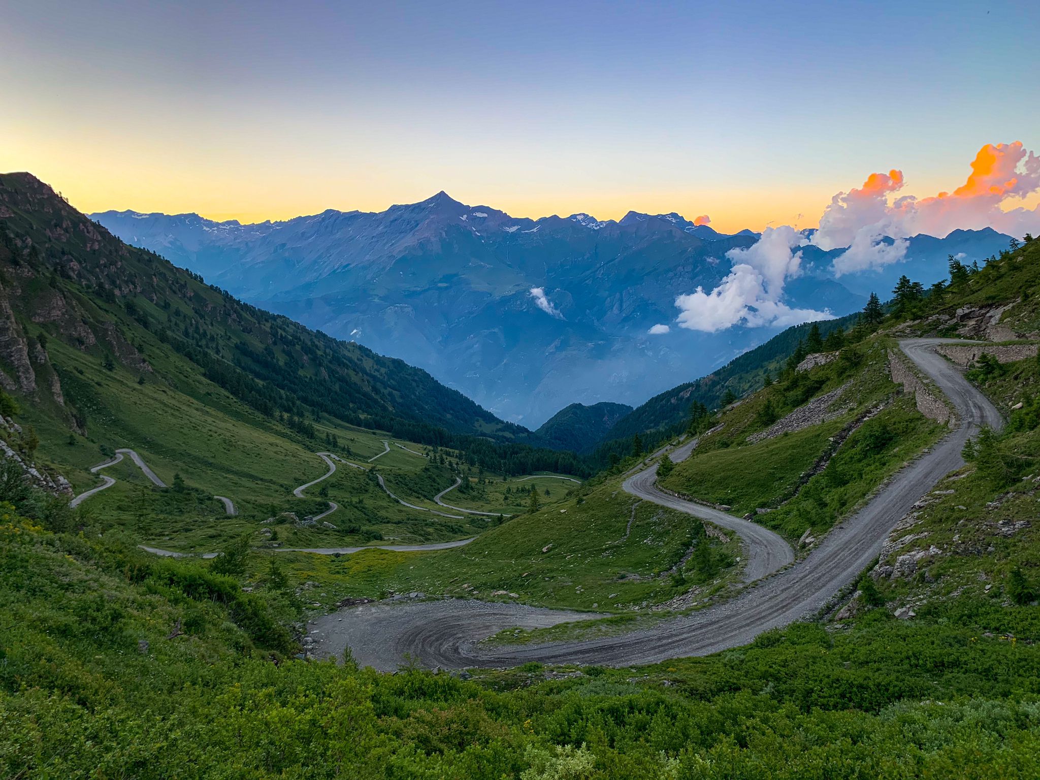
No traffic touring cycling routes around Etroubles are set within the Great St. Bernard Valley of the Aosta Valley, at an altitude of 1270 meters. The region is characterized by an amphitheater of mountains, including Mont Vélan and Mont Fallère, alongside lush forests and green pastures. The Artanavaz river flows nearby, offering flatter paths. This Alpine environment provides diverse terrain for cycling.
Best no traffic touring cycling routes around Etroubles
- The most popular no traffic touring cycling route is Ru…
Last updated: May 19, 2026
4.8
(6)
27
riders
33.5km
03:20
960m
970m
Hard bike ride. Very good fitness required. Mostly paved surfaces. Suitable for all skill levels.
5.0
(2)
21
riders
21.0km
02:02
630m
630m
Hard bike ride. Very good fitness required. Mostly paved surfaces. Suitable for all skill levels.

Sign up for free
5.0
(1)
19
riders
31.1km
03:22
1,090m
1,090m
Hard bike ride. Very good fitness required. Mostly paved surfaces. Suitable for all skill levels.
14
riders
13.7km
01:13
340m
340m
Moderate bike ride. Good fitness required. Mostly paved surfaces. Suitable for all skill levels.
9
riders
51.9km
04:34
1,490m
1,490m
Hard bike ride. Very good fitness required. You may need to push your bike for some segments of this route.
Get access to more routes and recommendations from other explorers.
Sign up for free
Already have an account?
Our route recommendations are based on thousands of hikes, rides, and runs completed by other people on komoot.
Start today with a free account
Your next adventure awaits.
Login or Signup


Other adventures around Etroubles

Tips from the Community

Carved out of the eco-sustainable renovation of a typical stone and wood hut at an altitude of 1,943 meters, Rifugio Chaligne in Gignod offers 32 beds and a cuisine based on dairy products from local pastures. Reachable on foot in just over an hour from Buthier or by mountain bike along the rural road, the structure is part of the famous Tour du Mont Fallère hiking circuit.
1
0

The Municipality of Gignod embodies the true essence of the Aosta Valley mountains, strategically located along the ancient routes of the Via Francigena. Surrounded by lush forests and imposing peaks towards the Gran San Bernardo, this picturesque territory combines nature, culture, and ancient traditions in a suggestive alpine setting, proving to be the perfect destination for a regenerating stop during an outdoor itinerary or for a day exploring the high-altitude beauties. Beyond the breathtaking panoramas, Gignod is a crossroads of stories to be experienced at a slow pace, where the strong connection with the land is expressed through excursions to the historic medieval Tower, bike rides on pristine trails, and moments of absolute tranquility. A perfect balance between historical heritage, spectacular landscapes, and deep relaxation, ideal for immersing yourself completely in the charm of the Aosta Valley. The Municipality of Gignod is also the ideal place to recharge your e-Bike and earn DINAclub points. Find out how at: dinaclub.repower.com To discover the territory, here is an itinerary ready to be cycled: komoot.com/tour/2955453853
0
0


Beautiful how the stream flows down in steps.
8
0
The Château Verdun is a medieval fortress located at an altitude of 1,350 metres above sea level in the commune of Saint-Oyen, in the Valle d’Aosta region. The castle is owned by the canons of the Grand Saint Bernard and has served as a guest house for nine centuries. The architecture of the Château Verdun is square and massive. It was originally built in the 10th and 11th centuries and is located on the road to the village of Flassin. Although it is lower than the main road of the village, it still occupies a prominent position at 1,350 metres above sea level. The castle was originally given to the monks of the Hospice du Grand-Saint-Bernard by Amédée III in 1137. It served as an agricultural annex to the hospice and as a resting place for travellers and pilgrims.
5
0
Camping Pineta, located in Saint-Rhémy-en-Bosses in the Valle d’Aosta, Italy, is a beautiful campsite that has been in existence since 1967. Here are some of the features of this campsite: Location: The campsite is located at the foot of the Flassin Valley, in the heart of the Great Saint Bernard Valley. It is situated at an altitude of 1370 metres above sea level and offers a relaxing holiday in the heart of nature. Environment: The campsite is surrounded by a forest of pines, firs and larches. The terraces on which the pitches are located are shaded by these trees. Panoramic View: Guests can enjoy a unique view surrounded by mountains and forests. Convenient Location: The campsite is located 18 km from the city of Aosta and 20 km from the village of Bourg Saint Pierre in Switzerland, making it an ideal base from which to explore the entire region in comfort.
5
0

Opening hours 12:15 - 14:30 19:00 - 21:00 Open from mid-June to mid-September No day off +39 348 3366924 info@chaligne.com
2
1
The Chaligne hut was officially opened on June 21, 2006, on the Alpe Chaligne (1943 m) in the municipality of Gigod, on the path from Buthier to Pointe Chaligne. From the hamlet of Buthier, you reach the Alpe Mendey and then take path "3A" (travel time 1.15 h). The hut can also be reached by mountain bike (5 km route along the main road). Source: https://www.chaligne.com/
2
1
Frequently Asked Questions
How many no traffic touring cycling routes are available around Etroubles?
There are over 20 no traffic touring cycling routes around Etroubles. The majority of these, about 15, are rated as difficult, offering a significant challenge. There are also 6 moderate routes and at least 1 easy route for those seeking a less strenuous ride.
What is the general difficulty level of no traffic touring cycling routes in Etroubles?
The no traffic touring cycling routes around Etroubles are predominantly challenging, with 15 out of 22 routes rated as difficult. These often involve substantial elevation gains, typical of the Alpine terrain. There are also 6 moderate routes and at least 1 easy option for a more relaxed experience.
What kind of terrain can I expect on these no traffic touring cycling routes?
You can expect diverse Alpine terrain, ranging from paved roads on historic passes to dirt roads and paths through lush forests and green pastures. Routes like the Ru du Menouve – Ru Menouve dirt road loop indicate sections with unpaved surfaces, while others will follow more established paths through the valley.
What historical landmarks or attractions can I see along no traffic touring cycling routes in Etroubles?
Etroubles itself is an open-air museum with contemporary art and historical buildings. Many routes pass through charming villages and offer views of significant landmarks. The region is part of the ancient Via Francigena. You might encounter the medieval Vachéry Tower, or cycle towards the historic Great St. Bernard Pass. For more information on Etroubles as an open-air museum, you can visit Visit Italy.
Are there natural features or viewpoints to enjoy on these routes?
Absolutely. The routes are set against a backdrop of majestic mountains like Mont Vélan and Mont Fallère, offering breathtaking Alpine vistas. You'll find numerous viewpoints overlooking the Valais Alps. Some routes pass by beautiful natural features such as Lac de Grand Saint Bernard, Fenetre Lakes, or the Gaula Stream. The Bastillon Pass and Col de Champillon also offer stunning panoramic views.
What is the best time of year for no traffic touring cycling in Etroubles?
The best time for touring cycling in Etroubles is typically from late spring to early autumn (May to October). During these months, the weather is generally mild, and the Alpine passes are clear of snow, offering optimal conditions for exploring the region's diverse routes and enjoying the stunning landscapes.
Are the no traffic touring cycling routes around Etroubles suitable for families?
While many routes are challenging, there are options suitable for families, particularly the easier and moderate routes. Look for routes with lower elevation gain and shorter distances. The flat paths along the Artanavaz river, though not explicitly listed as komoot routes here, offer pleasant, leisurely rides for all ages.
Can I bring my dog on these no traffic touring cycling routes?
Many outdoor areas in the Aosta Valley are dog-friendly, but it's always best to keep dogs on a leash, especially in areas with livestock or wildlife. Check specific local regulations for nature reserves or protected areas you plan to cycle through. Ensure your dog is fit enough for the chosen route's distance and elevation.
Where can I find parking near the no traffic touring cycling routes in Etroubles?
Etroubles, being a popular tourist destination, offers various parking options within or just outside the village. For routes starting from specific points like Saint-Oyen or Ollomont, you will typically find designated parking areas. It's advisable to check local signage upon arrival for the most convenient spots.
Are there any loop routes for no traffic touring cycling around Etroubles?
Yes, several no traffic touring cycling routes around Etroubles are designed as loops, allowing you to start and finish in the same location. Examples include the Camping Pineta – Château Verdun loop from Saint-Oyen and the Locanda delle Minere loop from Vaud. These are convenient for day trips as they bring you back to your starting point.
What do other touring cyclists enjoy the most about touring cycling in Etroubles?
The area is highly rated by the komoot community, with an average score of 4.57 stars. Reviewers often praise the stunning Alpine landscapes, the sense of tranquility on the no traffic routes, and the rich historical context of the region, including the ancient Via Francigena and charming villages like Etroubles itself.
Most popular routes around Etroubles
Most popular attractions around Etroubles

Get inspired with the komoot mobile app


Explore more
Browse the best Cycling routes in other regions.
