The best walks and hikes around Lütschental
4.6
(10286)
76,383
hikers
785
hikes
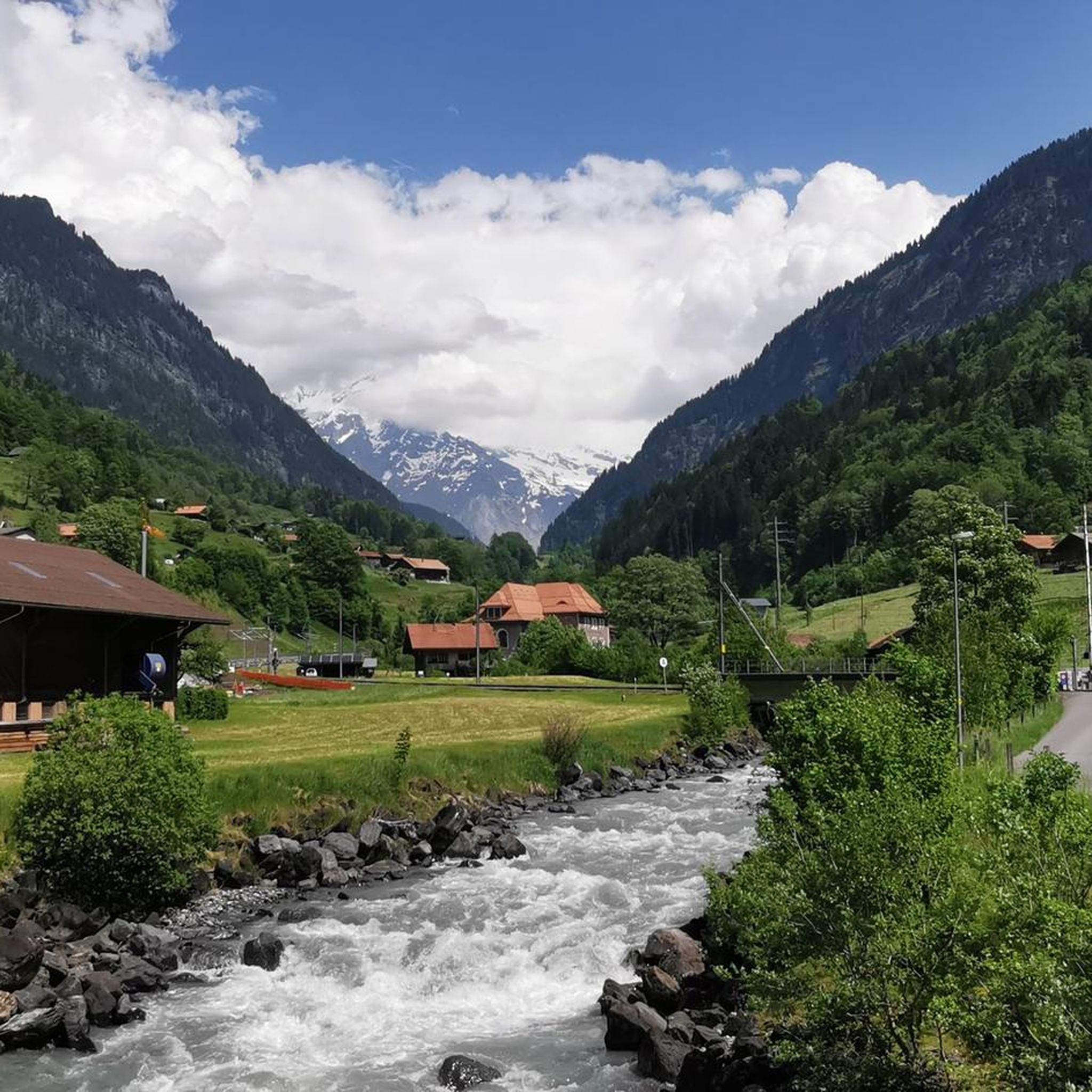
Hiking around Lütschental offers access to diverse alpine landscapes within the Bernese Oberland. The region is characterized by an imposing mountain backdrop, including peaks like the Eiger, Mönch, and Jungfrau, alongside glacial-alpine environments and lush green valleys. Rivers such as the Black and White Lütschine flow through the area, which also features alpine meadows, dense forests, and mountain lakes. This area is part of the UNESCO World Heritage Region Swiss Alps Jungfrau-Aletsch, highlighting its natural value.
Best hiking trails around…
Last updated: October 1, 2026
4.7
(74)
301
hikers
13.2km
04:59
660m
660m
Moderate hike. Good fitness required. Mostly accessible paths. Sure-footedness required.
4.8
(18)
112
hikers
11.4km
03:30
390m
390m
Moderate hike. Good fitness required. Mostly accessible paths. Sure-footedness required.

4.8
(188)
1,838
hikers
8.05km
02:13
140m
140m
Moderate hike. Good fitness required. Easily-accessible paths. Suitable for all skill levels.
4.9
(12)
230
hikers
8.46km
03:15
610m
600m
Moderate hike. Good fitness required. Easily-accessible paths. Suitable for all skill levels.
5.0
(2)
29
hikers
17.6km
08:53
1,410m
1,410m
Hard hike. Very good fitness required. Sure-footedness, sturdy shoes and alpine experience required.
Get access to more routes and recommendations from other explorers.
Already have an account?
Our route recommendations are based on thousands of hikes, rides, and runs completed by other people on komoot.
Start today with a free account
Your next adventure awaits.

Tips from the Community

The Eiger is almost 4000 m high, Mönch and Jungfrau significantly over 4000 m. Impressive to see from the Schynige Platte.
0
0
You have a complete overview of the lake up to Brienz, of course also the Rothorn. On the west side Interlaken. There the Aare flows out of Lake Brienz, to flow into Lake Thun quite soon.
0
0
No, you cannot camp in this region.
0
0

From the Schynige Platte, you have a great view of the Eiger, Mönch, and Jungfrau trio, and it's also not quite as touristically crowded as some other vantage points in the Jungfrau region. For me, the most beautiful thing about the Schynige Platte is the journey on the cogwheel railway.
0
0

Alphorn and water fountain! Recover your breath before the steep part.
0
0

The view of Grindelwald and the Wetterhorn could hardly be more beautiful. Children will enjoy the forest playground and the subsequent hike on the Öpfelchüechliweg trail.
0
0

Perfect view of the Eiger, Mönch and Jungfrau.
0
0

Attention on the cable car
0
0
Frequently Asked Questions
How many hiking trails are available around Lütschental?
Lütschental offers a vast network of hiking trails, with over 790 routes recorded on komoot. These range from easy strolls through valleys to challenging mountain expeditions, catering to various experience levels.
What is the best time of year to go hiking in Lütschental?
The best time for hiking in Lütschental is typically from late spring to early autumn (May to October). During these months, trails are generally clear of snow, and the alpine meadows are lush. The region's stunning mountain backdrop, including peaks like the Eiger, Mönch, and Jungfrau, is particularly impressive under clear skies.
Are there family-friendly hiking options in Lütschental?
Yes, Lütschental has many trails suitable for families. The region features diverse landscapes with alpine meadows and forests, offering easier paths for children. While specific family-friendly routes are not detailed here, you can find over 280 easy routes on komoot that are generally suitable for families.
Can I bring my dog on the hiking trails in Lütschental?
Many trails in Lütschental are dog-friendly, allowing you to explore the stunning alpine landscapes with your canine companion. It's always advisable to keep dogs on a leash, especially in areas with livestock or protected wildlife, and to check local regulations for specific routes.
What kind of natural attractions can I expect to see along the trails?
Hiking trails in Lütschental often lead through diverse natural settings. You can encounter glacial-alpine environments, lush green valleys, and rivers like the Black and White Lütschine. Notable natural features include pristine mountain lakes such as Bachalpsee and Hinterburgseeli, as well as dense forests and alpine meadows. The region is part of the UNESCO World Heritage Region Swiss Alps Jungfrau-Aletsch, highlighting its exceptional natural value.
Are there any circular hiking routes in Lütschental?
Yes, Lütschental offers several circular hiking routes. For instance, the Panorama Trail to Faulhorn – View of Lake Brienz loop from Lütschental is a moderate 8.1-mile (13.1 km) loop that provides expansive views towards Lake Brienz. Another option is the Männlichen Summit – View from Männlichen loop from Wengen, a 7.0-mile (11.3 km) moderate path leading to the Männlichen summit with panoramic vistas.
What are the difficulty levels of hikes in Lütschental?
Lütschental offers a wide range of difficulty levels. On komoot, you'll find over 280 easy routes, more than 360 moderate routes, and over 150 difficult routes. This variety ensures options for beginners, experienced hikers, and those seeking challenging alpine adventures.
How accessible are the hiking trails by public transport?
The Lütschental region benefits from good infrastructure, including public transport options that can help access various trailheads. Mountain trains and cable cars also allow access to higher altitudes, making sections of longer hikes more manageable. It's recommended to check local transport schedules for specific starting points.
Are there any mountain huts or places to stay overnight along the trails?
Yes, the region has mountain huts and accommodations. For example, the historic Faulhorn Summit & Mountain Hotel is one of the oldest mountain hotels in Europe and can be reached via routes like the Faulhorn Summit & Mountain Hotel – View of the Faulhorn loop from Lütschental. Other options include the Mönchsjoch Hut and Gleckstein Hut (SAC).
What do other hikers say about the trails in Lütschental?
The hiking trails in Lütschental are highly regarded by the komoot community, with an average rating of 4.7 stars from over 8,400 reviews. Hikers frequently praise the stunning alpine landscapes, the impressive mountain backdrop featuring peaks like the Eiger, Mönch, and Jungfrau, and the diverse range of trails available.
Are there any viewpoints offering panoramic vistas?
Lütschental is renowned for its panoramic views. The Männlichen Summit – View from Männlichen loop from Wengen leads to the Männlichen summit, offering expansive mountain vistas. Additionally, the Two lakes footbridge - Harder Kulm viewing platform provides impressive views of Lake Thun and Lake Brienz.
Most popular routes around Lütschental
Most popular attractions around Lütschental

Get inspired with the komoot mobile app


Explore more
Browse the best Hikes in other regions.
