The best mountain hikes around Lütschental
4.9
(100)
1,141
hikers
53
hikes
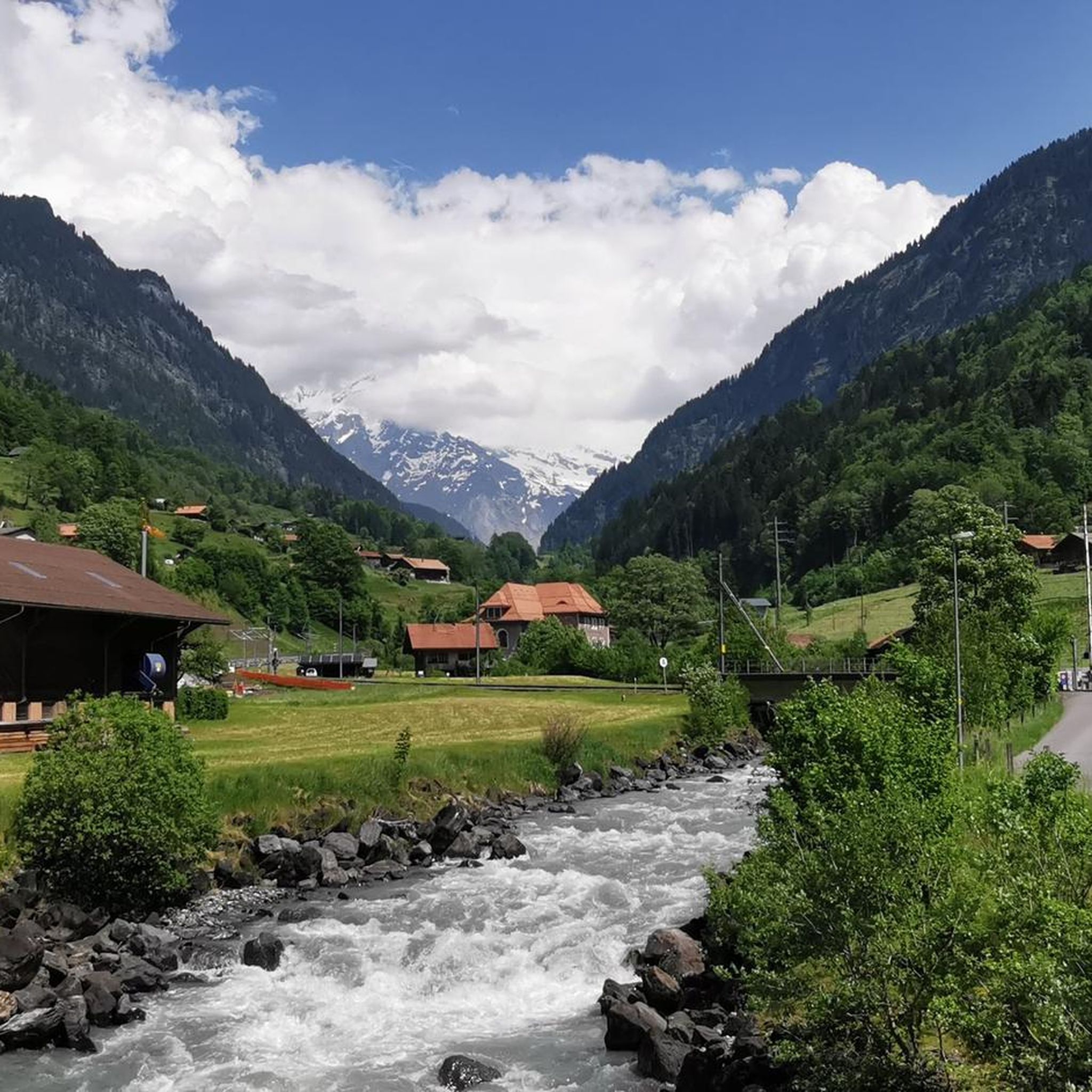
Mountaineering routes around Lütschental, situated in the Bernese Oberland of Switzerland, navigate a landscape characterized by towering Alpine peaks including the Eiger, Mönch, and Jungfrau. This region, part of the Jungfrau-Aletsch UNESCO World Heritage Site, features significant glacial formations and river valleys carved by the Lütschine River. The terrain offers a diverse mix of forested areas, rocky slopes, and high mountain passes, providing varied challenges for mountaineers.
Best mountaineering routes around Lütschental
- The most popular mountaineering route is Lobhornhütte –…
Last updated: November 6, 2026
4.5
(4)
33
hikers
12.7km
06:11
1,000m
1,000m
Hard mountaineering route. Very good fitness required. Mostly walkable paths. Sure-footedness required.
22
hikers
10.3km
04:59
860m
860m
Moderate mountaineering route. Good fitness required. Mostly walkable paths. Sure-footedness required.

34
hikers
9.91km
05:15
910m
910m
Hard mountaineering route. Very good fitness required. Mostly walkable paths. Sure-footedness required.
5.0
(1)
16
hikers
16.0km
05:26
830m
830m
Hard mountaineering route. Very good fitness required. Easily walkable paths.
4.7
(7)
18
hikers
6.21km
02:16
190m
190m
Moderate mountaineering route. Good fitness required. Mostly walkable paths. Sure-footedness required.
Get access to more routes and recommendations from other explorers.
Already have an account?
Our route recommendations are based on thousands of hikes, rides, and runs completed by other people on komoot.
Start today with a free account
Your next adventure awaits.

Tips from the Community

A beautifully located mountain restaurant at 2,116 m above sea level, above Kleine Scheidegg – perfect for a cozy break during a hiking or biking tour 🥾🚲. From the terrace, you can enjoy a fantastic view of the Eiger, Mönch, and Jungfrau 😍🏔️. Culinary-wise, there is down-to-earth Swiss cuisine 🇨🇭 – just the thing after gaining some altitude. Especially the location slightly off the beaten track on Kleine Scheidegg makes Grindelwaldblick a really nice stopover ☕🥘🌄. ⭐ Highlight: the large sun terrace and, of course, the unique mountain panorama – dining with an Eiger view included 🤩⛰️
0
0

You have a complete overview of the lake up to Brienz, of course also the Rothorn. On the west side Interlaken. There the Aare flows out of Lake Brienz, to flow into Lake Thun quite soon.
0
0
The ascent by historic train is already an experience. The view from the top is phenomenal: Eiger, Mönch and Jungfrau to the south, Interlaken with the two lakes to the north!
0
0
No, you cannot camp in this region.
0
0

Super view of the big Lobhörner
0
0

The Schynige Platte is a wonderful starting point for a hike in the middle of the Bernese Alps. An impressive panorama of the mountain world opens up right from here. The view of the distinctive peaks of the Jungfrau Region is particularly beautiful. Various hiking trails lead on from the Schynige Platte – including towards Faulhorn and First.
0
0


From the Schynige Platte, in good weather, you have a breathtaking view of the Eiger, Mönch, Jungfrau and the lakes of Brienz and Thun. Very close to the mountain station, there is a very beautifully designed and large alpine garden. The slow ride on the rustic cogwheel railway has an incredibly relaxing effect.
0
0
Frequently Asked Questions
How many mountaineering routes are available around Lütschental?
There are over 50 mountaineering routes around Lütschental, offering a wide range of challenges. The network includes 24 moderate and 33 difficult routes, ensuring options for various skill levels.
Are there any circular mountaineering routes in the area?
Yes, Lütschental offers several excellent circular routes. For a challenging experience, consider the Lobhornhütte – Lobhörner loop from Gündlischwand, which is 12.7 km long. A moderate option is the Mountaineering loop from Schynige Platte, which is shorter at 5.7 km.
What are some notable natural features or landmarks I might see on a mountaineering tour?
Lütschental is rich in natural beauty. You'll encounter majestic peaks like the Eiger, Mönch, and Jungfrau. The region is part of the Jungfrau-Aletsch UNESCO World Heritage Site, featuring significant glacial formations. You might also pass by beautiful mountain lakes such as Bachalpsee or Hinterburgseeli, and dramatic viewpoints like the Two lakes footbridge - Harder Kulm viewing platform.
What is the best time of year for mountaineering in Lütschental?
The best time for mountaineering in Lütschental is typically from late spring to early autumn (June to September) when the trails are generally free of snow and weather conditions are more stable. However, the region also offers winter hiking and snowshoeing options for those seeking snowy landscapes.
Are there any family-friendly mountaineering options?
While many mountaineering routes in Lütschental are challenging, some sections or shorter loops can be suitable for families with older children who have some hiking experience. For example, the Sulsbach Bridge – Lobhornhütte loop from Gündlischwand is rated moderate and offers varied mountain scenery, which might be a good starting point for active families.
Can I bring my dog on the mountaineering trails in Lütschental?
Many trails in the Bernese Oberland are dog-friendly, but regulations can vary. It's generally advisable to keep dogs on a leash, especially in areas with livestock or wildlife. Always check local signage and be prepared for varied terrain, which might include rocky sections or steep ascents that could be challenging for some dogs.
What kind of terrain can I expect on the mountaineering routes?
The terrain around Lütschental is diverse, ranging from forested areas and open alpine meadows to challenging rocky slopes and high mountain passes. You'll encounter significant elevation changes, with routes featuring ascents of over 1,000 meters, providing a true Alpine mountaineering experience.
How accessible are the trailheads by public transport?
Lütschental is well-connected by public transport, with a railway station served by trains connecting to Interlaken Ost and Grindelwald. Many trailheads are accessible via these train lines or local bus services, making it convenient to reach your starting point without a car. For instance, the Wengen Railway Station – Kleine Scheidegg loop from Wengen starts directly from a railway station.
Are there places to eat or stay near the mountaineering routes?
Yes, the region offers various options for food and accommodation. Mountain huts like the Faulhorn mountain hotel or the Mönchsjochhütte provide places to rest and eat during longer tours. The village of Lütschental itself, and nearby towns like Grindelwald and Interlaken, offer a range of cafes, pubs, and accommodation options.
What do other mountaineers enjoy most about the routes in Lütschental?
The mountaineering routes in Lütschental are highly rated by the komoot community, with an average score of 4.9 stars from over 90 reviews. Reviewers often praise the breathtaking panoramas of the high, glaciated peaks, the diverse terrain, and the well-maintained trail network that caters to various ability levels.
Are there any less strenuous mountaineering routes for beginners?
While many routes are difficult, there are moderate options suitable for those with some experience looking for less strenuous ascents. The Sulsbach Bridge – Lobhornhütte loop from Gündlischwand is a moderate 10.3 km path that leads through varied mountain scenery, offering a good introduction to the area's mountaineering.
Most popular routes around Lütschental
Most popular attractions around Lütschental

Get inspired with the komoot mobile app


Explore more
Browse the best Mountain Hikes & Routes in other regions.
