The best traffic-free bike rides around Muldestausee
4.5
(1703)
6,146
riders
100
rides
No traffic touring cycling routes around Muldestausee traverse a landscape transformed from former lignite mining areas into a region of lakes and forests. The area is characterized by the expansive Muldestausee reservoir, the third-largest body of water in Saxony-Anhalt, and borders the diverse heath and floodplain landscapes of the Dübener Heide Nature Park. Cyclists will find varied topography, including rolling hills, dense forests, and numerous lakeside paths, offering a blend of natural beauty and industrial heritage. This network provides a…
Last updated: October 1, 2026
4.7
(483)
1,595
riders
46.7km
02:53
160m
160m
Moderate bike ride. Good fitness required. Mostly paved surfaces. Suitable for all skill levels.
4.8
(178)
372
riders
20.9km
01:13
60m
60m
Easy bike ride. Great for any fitness level. Mostly paved surfaces. Suitable for all skill levels.

4.7
(54)
178
riders
Moderate bike ride. Good fitness required. Mostly paved surfaces. Suitable for all skill levels.
4.4
(22)
77
riders
44.9km
02:53
140m
140m
Hard bike ride. Good fitness required. You may need to push your bike for some segments of this route.
4.3
(10)
82
riders
Easy bike ride. Great for any fitness level. Mostly paved surfaces. Suitable for all skill levels.
Get access to more routes and recommendations from other explorers.
Already have an account?
Our route recommendations are based on thousands of hikes, rides, and runs completed by other people on komoot.
Start today with a free account
Your next adventure awaits.
Other adventures around Muldestausee


Tips from the Community

You have to pedal hard once to get up.
0
0
You can ride your MTB nicely around the Muldestausee. Via Pouch, Friedersdorf —alte Poststrasse —Schlaitz
1
0

Rides very well, BUT you miss the beautiful forest paths of the Dübener Heide. Tip: If you have a little more time and wider tires than a road bike, it's better to ride through the magnificent forest area.
0
0

The barrier structure near Friedersdorf is a 19 m high and 303 m long gravity dam with a construction volume of 40,000 m³. On February 17, 2023, a hydropower plant was commissioned, which is expected to generate 13.6 GWh of electrical energy per year. The construction cost 25 million euros and began in October 2016.[1] Source https://de.wikipedia.org/wiki/Muldestausee
2
0
The normal water level is around 79 m above sea level with a storage volume of approx. 115 million m³. The role of the Muldestausee as a flood retention basin is insignificant. However, the basin can temporarily retain 3 million m³ during floods (difference between total storage and usable storage). In fact, it is not a reservoir in the true sense, but rather a river dam. Since the flow velocity of the Mulde slows down considerably upon entering the lake, the Muldestausee acts as a sedimentation trap, into which approx. 400,000 t of solids (gravel, sand, silt) are deposited annually. These solids are missing from the river upon exiting the outlet structure, leading to a greater deepening of the riverbed of the lower Mulde and having ecological consequences. Source https://de.wikipedia.org/wiki/Muldestausee
2
0
After the excavation of coal from the Muldenstein open-cast mine (1954–1975), the relocation of the Mulde river over a distance of approximately eleven kilometers was necessary to expand the Goitzsche open-cast mine (today's Großer Goitzschesee). Part of the new river course was laid through the excavated Muldenstein open-cast mine. Flooding took place from April 30, 1975, to March 1, 1976. The Muldestausee lake has an inlet and an outlet structure. Source https://de.wikipedia.org/wiki/Muldestausee
2
0
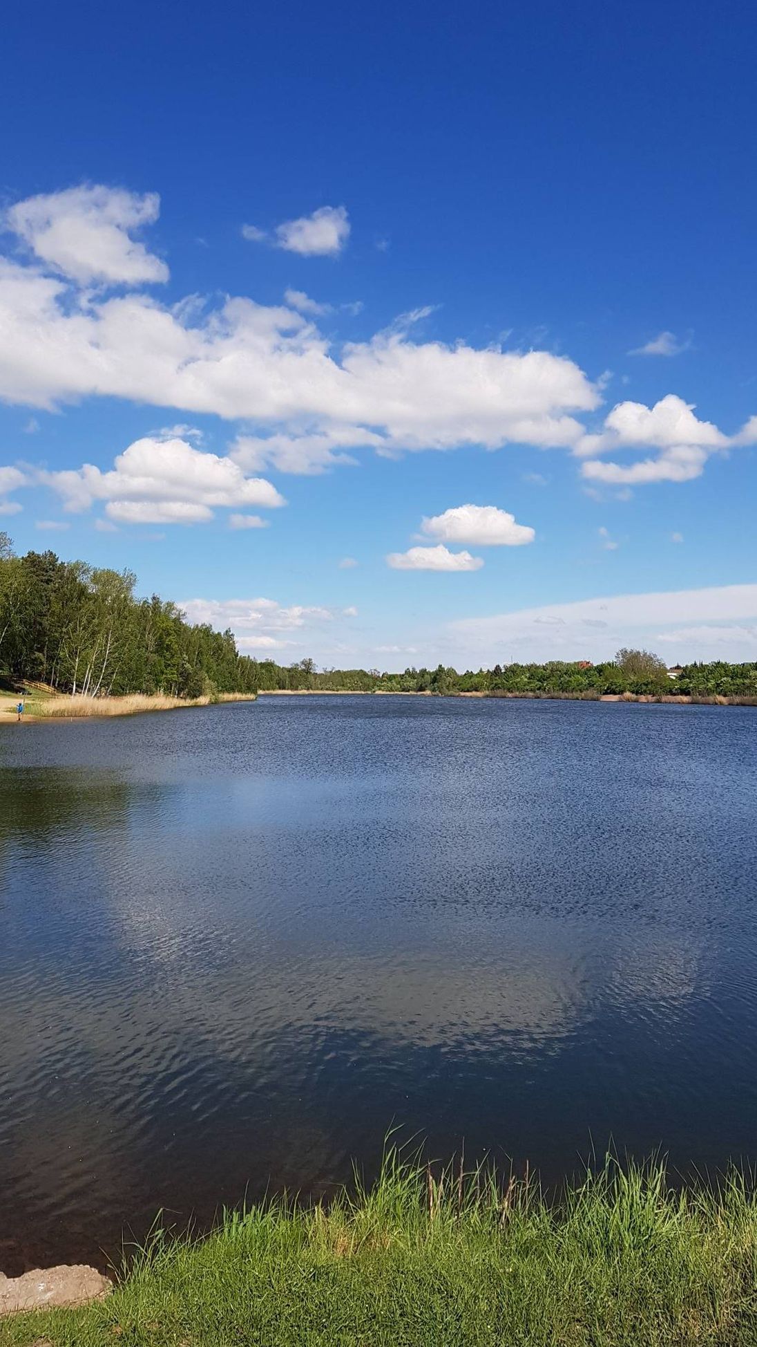
The Muldestausee is an flooded open-cast mine in the district of Anhalt-Bitterfeld/Sachsen-Anhalt. Its bordering towns are Friedersdorf, Schlaitz, Pouch and Mühlbeck. With a surface area of 6.3 km², it is the third largest body of water in the state of Saxony-Anhalt. Its length is approx. 9 km, its widest point is 2 km, and its greatest depth is 35 m Source https://de.wikipedia.org/wiki/Muldestausee
2
0
Frequently Asked Questions
How many no-traffic touring cycling routes are available around Muldestausee?
There are over 100 dedicated no-traffic touring cycling routes around Muldestausee, offering a wide range of options for exploring the region's unique landscapes. Many of these routes are designed to keep you away from vehicular traffic, providing a peaceful cycling experience.
What is the general difficulty level of the no-traffic touring cycling routes in Muldestausee?
The no-traffic routes around Muldestausee cater to various skill levels. You'll find a significant number of easy routes, with 75 classified as such, making them ideal for leisurely rides. There are also 24 moderate routes and 19 more challenging options for experienced cyclists seeking longer distances or more varied terrain.
What kind of terrain can I expect on the no-traffic cycling routes around Muldestausee?
The terrain around Muldestausee is diverse, transitioning from a former lignite mining area into a picturesque landscape. Cyclists can expect a mix of lakeside paths, rolling hills, and dense forests within the Dübener Heide Nature Park. The routes often feature well-maintained paths suitable for touring bikes, offering views of expansive waterscapes and heath and floodplain landscapes.
What are some interesting landmarks or viewpoints along the no-traffic cycling routes?
Many no-traffic routes offer access to fascinating landmarks. You can cycle past the impressive Muldestausee itself, visit the Europa Shelter on the Muldestausee Forest Cycle Path, or enjoy panoramic views from the Red Tower in Pouch. The Muldestausee Bridge also provides scenic vistas of the lake and the Mulde River. For a longer ride, consider the route "Mulde Bridge at Muldestausee – View of the Mulde River loop from Rösa" which highlights the river's flow.
Can I visit historical sites or castles while cycling in the Muldestausee region?
Yes, the region offers several historical sites and castles accessible from the cycling network. You can explore highlights such as Reinharz Moated Castle, Burgkemnitz Castle, or the Delitzsch Baroque Palace. The Delitzsch Historic Town Center is also a worthwhile stop for those interested in local history.
Are there circular no-traffic touring cycling routes available around Muldestausee?
Yes, many of the no-traffic touring cycling routes around Muldestausee are circular, allowing you to start and end at the same point without retracing your steps. An example is the "View of Gröberner Lake – Lake Gröbern loop from Burgkemnitz" which offers a scenic circular experience.
Are the no-traffic touring cycling routes around Muldestausee suitable for families with children?
Absolutely. Given the focus on no-traffic routes and the prevalence of easy trails, Muldestausee is an excellent destination for family-friendly cycling. The flat sections around the lakes and through the forests provide safe and enjoyable rides for children, allowing families to explore nature together.
Are dogs allowed on the no-traffic cycling routes around Muldestausee?
Generally, dogs are welcome on leashes on most cycling paths in the Muldestausee region, especially within the Dübener Heide Nature Park. However, it's always advisable to check local signage for specific rules in protected areas or around certain attractions to ensure a pleasant experience for everyone.
Where can I find places to eat or stay overnight along the no-traffic routes?
The Muldestausee region offers various options for refreshments and accommodation. You can find places like the Ochsenkopf Forest Inn or the Pannenkoek Shaft Lodge along or near some routes. There are also huts such as Forsthaus Thielenhaide, providing opportunities for a break or an overnight stay for cyclists.
Is public transport an option for reaching the no-traffic cycling routes, especially with a bike?
Public transport options are available in the Muldestausee region, connecting to various starting points for cycling routes. While regional trains and buses often accommodate bicycles, it's recommended to check the specific operator's policies and any potential peak hour restrictions for bike carriage before planning your journey.
What do other touring cyclists enjoy most about the no-traffic routes in Muldestausee?
The no-traffic touring cycling routes in Muldestausee are highly rated by the komoot community, with an average score of 4.56 stars. Reviewers often praise the peacefulness of the car-free paths, the beautiful transformation of the landscape from its mining past, and the diverse natural scenery, including the expansive lakes and the rich wildlife of the Dübener Heide Nature Park.
Most popular routes around Muldestausee
Most popular attractions around Muldestausee

Get inspired with the komoot mobile app


Explore more
Browse the best Cycling routes in other regions.
