The best traffic-free bike rides around Rothenbucher Forst
4.6
(1903)
11,355
riders
257
rides
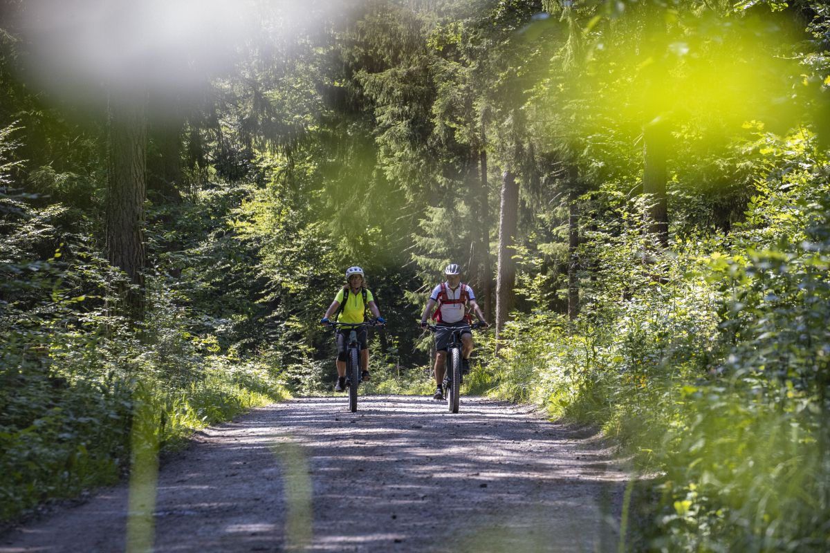
No traffic touring cycling routes around Rothenbucher Forst traverse an entirely forested municipal-free area within Bavaria's Spessart region. The landscape is characterized by extensive, serene forests, picturesque valleys, and several natural protection zones. Notable features include various lakes such as Kaltengrundsee and Breitsee, alongside varying elevations, with Hengstkopf reaching 506 meters above sea level. This environment provides a diverse backdrop for touring cyclists seeking routes away from traffic.
Best no traffic touring cycling routes around Rothenbucher Forst
- The most popular…
Last updated: May 15, 2026
4.8
(5)
85
riders
Hard bike ride. Very good fitness required. You may need to push your bike for some segments of this route.
4.9
(13)
46
riders
Hard bike ride. Very good fitness required. You may need to push your bike for some segments of this route.

Sign up for free
4.0
(3)
24
riders
Hard bike ride. Very good fitness required. Mostly paved surfaces. Suitable for all skill levels.
4.8
(8)
42
riders
Moderate bike ride. Good fitness required. Mostly paved surfaces. Suitable for all skill levels.
5.0
(7)
40
riders
21.2km
01:44
350m
350m
Moderate bike ride. Good fitness required. Mostly paved surfaces. Suitable for all skill levels.
Get access to more routes and recommendations from other explorers.
Sign up for free
Already have an account?
Our route recommendations are based on thousands of hikes, rides, and runs completed by other people on komoot.
Start today with a free account
Your next adventure awaits.
Login or Signup
Popular around Rothenbucher Forst

Other adventures around Rothenbucher Forst

Tips from the Community

There used to be a wayside shrine here. After it fell into disrepair, the cross was erected. Sit down for a moment and pause
0
0

One gets the impression that the stream's course has been so beautifully shaped by "beaver work"
0
0

An artistically designed old transformer station. It's now worth seeing.
0
0

Wood used to be floated here.
0
0
The lake was created to float timber.
0
0

The Hafenlohr is a 26.5 km long (27.7 km including the Tiergartenbach) right tributary of the Main River in the districts of Aschaffenburg and Main-Spessart in the Bavarian Spessart region. The Hafenlohr rises from two springs in the municipality of Rothenbuch. The longer and occasionally more water-rich branch is the Tiergartenbach, which often dries up on dry days. Officially, it is considered the upper course of the Hafenlohr main watercourse. The source, known as the Hafenlohr Spring, in the center of the village provides water almost year-round. The Hafenlohr Spring is located at Rothenbuch Castle. It was encased in sandstone during the road widening of the St 2317. Its water flows northwest through the castle moat and, after about 100 meters, flows from the left bank into the bed of the Tiergartenbach, which flows from the Tiergartengrund on the northern edge of the village and is already 1.3 km[7] long. It doesn't provide water year-round, but at times it provides more than the perennial spring at the castle. The spring at the castle was probably once a meeting place for hunters in the eastern Spessart, which is why construction of a hunting lodge began here in 1342. The spring water fed the castle moat and several surrounding trout lakes, which no longer exist. Source and further information: https://de.wikipedia.org/wiki/Hafenlohr_(Fluss)
1
0
The Hafenlohr is a 26.5 km long (27.7 km including the Tiergartenbach) right tributary of the Main River in the districts of Aschaffenburg and Main-Spessart in the Bavarian Spessart region. The Hafenlohr rises from two springs in the municipality of Rothenbuch. The longer and occasionally more water-rich branch is the Tiergartenbach, which often dries up on dry days. Officially, it is considered the upper course of the Hafenlohr main watercourse. The source, known as the Hafenlohr Spring, in the center of the village provides water almost year-round. The Hafenlohr Spring is located at Rothenbuch Castle. It was encased in sandstone during the road widening of the St 2317. Its water flows northwest through the castle moat and, after about 100 meters, flows from the left bank into the bed of the Tiergartenbach, which flows from the Tiergartengrund on the northern edge of the village and is already 1.3 km[7] long. It doesn't provide water year-round, but at times it provides more than the perennial spring at the castle. The spring at the castle was probably once a meeting place for hunters in the eastern Spessart, which is why construction of a hunting lodge began here in 1342. The spring water fed the castle moat and several surrounding trout lakes, which no longer exist. Source and further information: https://de.wikipedia.org/wiki/Hafenlohr_(Fluss)
1
0
Rothenbuch is one of the oldest and most important towns in the Inner Spessart region. The first documented mention of "zuo den Rodenboychen" dates back to 1318, when the Archbishop of Mainz, Peter von Aspelt, and the Bishop of Würzburg, Gottfried III von Hohenlohe, concluded a security cooperation agreement here. In 1342, construction began on a castle in Rothenbuch, at the source of the Hafenlohr River. The first inhabitants were likely settled there as hunting lodgers. During the Peasants' War of 1525, the castle was severely damaged or destroyed. In 1566, the castle was rebuilt and expanded on the orders of Daniel Brendel von Homburg, Elector of Mainz. The first depiction of Rothenbuch can be found on one of the oldest existing Spessart maps, the so-called Pfinzig map from 1594. Source: Wikipedia
2
0
Frequently Asked Questions
How many no-traffic touring cycling routes are available in Rothenbucher Forst?
Rothenbucher Forst offers a wide selection of no-traffic touring cycling routes, with over 270 options available. These routes cater to various fitness levels, ensuring there's a suitable ride for everyone.
What kind of terrain can I expect on the no-traffic touring cycling routes in Rothenbucher Forst?
The routes in Rothenbucher Forst feature diverse terrain, from serene forest paths to picturesque valleys. While many sections are paved, you'll also encounter unpaved stretches, offering a varied cycling experience. The region is characterized by extensive forests and varying elevations, including the Hengstkopf at 506 meters, providing both gentle and challenging climbs.
Are there any circular no-traffic touring cycling routes in Rothenbucher Forst?
Yes, many of the no-traffic touring cycling routes in Rothenbucher Forst are circular, allowing you to start and end your journey in the same location. An example is the Water buffalo in the Hafenlohr Valley – Einsiedel Hamlet loop from Naturpark Spessart, a moderate 47 km route.
What natural attractions can I see along the no-traffic touring cycling routes?
Rothenbucher Forst is rich in natural beauty. You can encounter several beautiful lakes like Kaltengrundsee, Bomigsee, and Breitsee. Keep an eye out for the Water buffalo in the Hafenlohr Valley, a unique natural monument. The Spessartwiesen Nature Reserve – Habichsthal also offers stunning natural landscapes.
Are there any historical sites or landmarks to visit while cycling?
Beyond natural features, the region offers interesting historical sites. You can find the Historic Beer Cellar Zum Spessart, or the Herrenbild Chapel. The Untere Mühle Rothenbuch and the Steinmühle on the Weiberbach are also historical mills that make for idyllic resting spots.
What is the best time of year for touring cycling in Rothenbucher Forst?
The extensive forests and diverse landscapes of Rothenbucher Forst make it enjoyable for touring cycling throughout much of the year. Spring and autumn offer pleasant temperatures and vibrant scenery, while summer provides longer daylight hours. Even in winter, some trails may be accessible, but it's always best to check local conditions.
Are there any family-friendly no-traffic touring cycling routes?
Yes, Rothenbucher Forst has routes suitable for families. While specific 'easy' routes are fewer (16 out of 271), many moderate routes can be enjoyed by families with some cycling experience. Look for routes with less elevation gain and shorter distances for a more relaxed family outing.
Can I bring my dog on the no-traffic touring cycling routes?
Many trails in Rothenbucher Forst are dog-friendly, especially those through the extensive forests. However, it's always recommended to keep your dog on a leash, particularly in nature protection zones and near wildlife. Be mindful of other cyclists and hikers, and ensure your dog is comfortable with longer rides.
What do other touring cyclists enjoy most about the routes in Rothenbucher Forst?
The komoot community highly rates the touring cycling experience in Rothenbucher Forst, with an average score of 4.6 out of 5 stars. Reviewers often praise the quiet, extensive forests, the diverse landscapes, and the well-maintained network of trails that offer a true escape from traffic.
Are there any challenging no-traffic touring cycling routes for experienced riders?
Absolutely. For experienced riders seeking a challenge, Rothenbucher Forst offers 138 difficult routes. These often feature significant elevation changes and longer distances. An example is the View of Naturpark Spessart – Hohewart-Haus (Hohe Warte) loop from Weibersbrunn, a demanding 39 km route with over 640 meters of elevation gain.
Where can I find parking for the no-traffic touring cycling routes?
While specific parking locations are not detailed here, Rothenbucher Forst, being a popular outdoor destination, typically offers designated parking areas at trailheads or near key access points to the forest. It's advisable to check specific route descriptions on komoot for recommended starting points and parking information.
Are there any routes that offer views or viewpoints?
Given the varying elevations, including the Hengstkopf at 506 meters, many routes offer rewarding views over the extensive forests and valleys of the Spessart region. Routes like the View of Naturpark Spessart – Hohewart-Haus (Hohe Warte) loop from Weibersbrunn are specifically named for their scenic vistas.
Most popular routes around Rothenbucher Forst
Most popular attractions around Rothenbucher Forst

Get inspired with the komoot mobile app


Explore more
Browse the best Cycling routes in other regions.
