The best city hikes and walks around Langenhagen
4.5
(845)
4,062
hikers
41
hikes
Urban hiking trails around Langenhagen offer diverse landscapes within the North German flatlands, characterized by the glacial valley of the Leine River and numerous lakes. The region is part of the larger Grüner Ring, an 80-kilometer circular path that provides access to various natural areas away from urban traffic. Hikers can explore river meadows, urban green spaces, and local parks. This environment provides a variety of scenic backdrops for outdoor activities.
Best urban hiking trails around Langenhagen
- The most popular…
Last updated: October 27, 2026
4.3
(4)
63
hikers
Easy hike. Easily walkable paths.
18
hikers
Moderate hike. Good fitness required. Easily walkable paths.

11
hikers
3.69km
00:56
10m
10m
Easy hike. Easily walkable paths.
17
hikers
Easy hike. Easily walkable paths.
4.8
(4)
34
hikers
Easy hike. Easily walkable paths.
Get access to more routes and recommendations from other explorers.
Already have an account?
Our route recommendations are based on thousands of hikes, rides, and runs completed by other people on komoot.
Other adventures around Langenhagen

Tips from the Community

This is what a transformer box can look like too..
2
0
I only got lost on the way to the bridge, but it will be firmly planned for future tours, as it is also very easy to ride with a road bike...
0
0
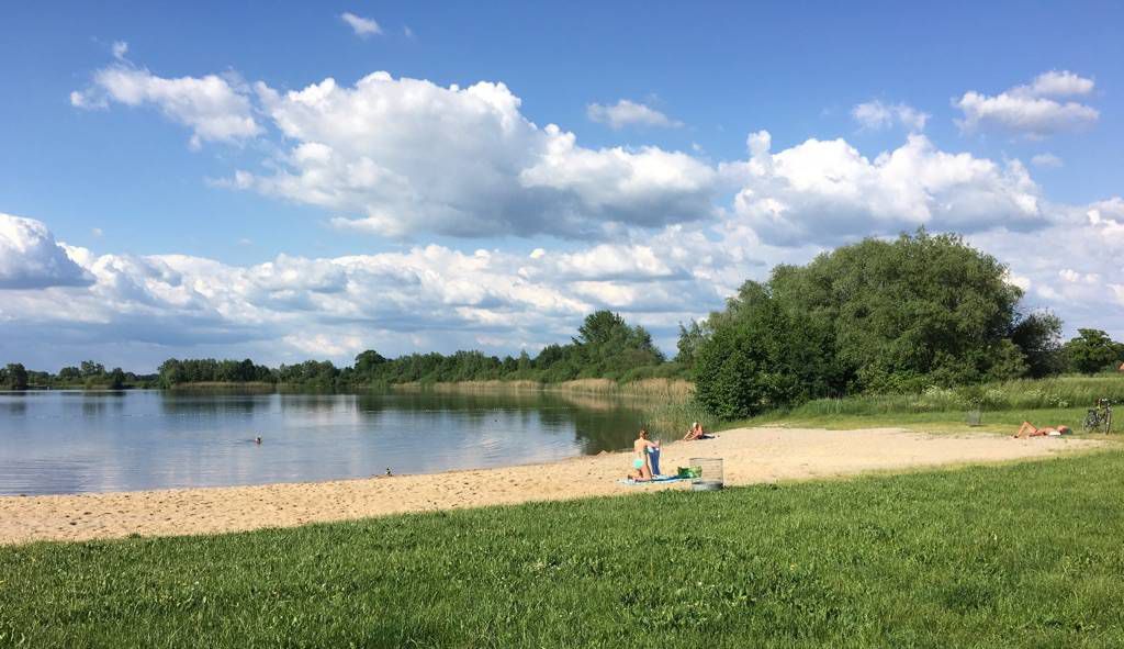
At 34°C, the crowd at the lake was extremely high the last time I passed by.
0
0
At 34°C, the crowd at the lake was extremely high when I last drove by.
0
0

Check https://strandalm.de to see if it's open. :)
0
0

The Hanover Water Tower is a 62-meter-high, listed former water tower in Hanover, located on Vahrenwalder Straße in the Brink-Hafen district. Upon its completion in 1911, it was considered the largest water tower in Europe.
0
0

The cycle path bridge over the A2 motorway at Peter-Strasser-Allee is an important component of Langenhagen's cycle path network. It creates a direct and safe connection between the eastern districts and the recreational area at Silbersee. The overpass provides barrier-free access to the motorway, allowing cyclists and pedestrians to easily reach the lake. The bridge thus promotes everyday mobility without a car and optimally integrates the recreational area into the city's cycle path network.
1
0

There are two beautiful avenues of old trees: Niederrader Allee consists of sycamore maples, while Stadtparkallee consists of oaks and linden trees.
0
0
Frequently Asked Questions
How many urban hiking trails are available in Langenhagen?
Langenhagen offers a wide variety of urban hiking trails, with over 40 routes available. The majority, around 37, are rated as easy, making them accessible for most hikers. There are also 8 moderate routes and 1 difficult route for those seeking more of a challenge.
What makes Langenhagen a good place for urban hiking?
Langenhagen, situated in the larger Hanover region, provides a unique blend of urban accessibility and natural landscapes. It benefits from the North German flatlands, the Leine River valley, and is part of the extensive Grüner Ring, an 80-kilometer circular path connecting diverse natural areas, lakes, and nature reserves right on the city's doorstep.
Are there any easy urban walks suitable for families or beginners?
Yes, Langenhagen has many easy routes perfect for families and beginners. For instance, the Eichenpark Water Tower – Flower Garden loop from Langenhagen is an easy option. Another gentle walk is the Fountain by the Town Hall – Eichenpark Water Tower loop from Langenhagen, offering a pleasant experience without significant elevation changes.
What kind of natural features can I expect to see on urban hikes in Langenhagen?
Urban hikes in Langenhagen often lead through diverse natural settings. You can explore areas around lakes like the Silbersee Langenhagen, river meadows along the Leine, and sections of the Grüner Ring that pass through moors and protected habitats. Keep an eye out for local wildlife such as white storks, red kites, and deer.
Are there any circular urban walks in Langenhagen?
Many of the urban trails in Langenhagen are designed as circular routes, offering convenient starting and ending points. A good example is the Nightingale Spot loop from Brink-Hafen, which allows you to return to your starting point without retracing your steps.
What do other hikers enjoy most about urban hiking in Langenhagen?
The komoot community highly rates the urban hiking experience in Langenhagen, with an average score of 4.6 stars from over 800 ratings. Reviewers often praise the accessibility of the trails, the peaceful natural surroundings close to the city, and the well-maintained paths that make for enjoyable walks.
Can I access urban trails in Langenhagen using public transport?
Yes, many sections of the Grüner Ring and local trails in Langenhagen are well-connected by public transport. This makes it easy to reach various starting points for your urban hikes without needing a car, allowing for flexible exploration of different segments.
Are there any longer, more challenging urban hikes available?
While most urban hikes in Langenhagen are easy, there are options for those looking for a longer, more moderate challenge. The St. Joseph Church – Fitness Trail in the Park loop from Langenhagen Mitte is a moderate route spanning over 12 kilometers, offering a more extended exploration of the area's urban green spaces.
What interesting landmarks or attractions can I see near the urban trails?
Beyond the natural beauty, urban trails in Langenhagen offer proximity to several interesting landmarks. You can find historical sites like Herrenhausen Palace or the Welfenschloss. The West Shore of the Maschsee and the Schwien Bridge over the River Leine are also notable points of interest that can be incorporated into your urban hiking adventures.
What is the best time of year for urban hiking in Langenhagen?
Langenhagen's urban trails are enjoyable year-round. Spring brings blooming flora, while summer offers lush greenery. Autumn provides beautiful foliage, and even in winter, the flat terrain and well-maintained paths make for pleasant walks, especially along the frozen lakes or through quiet, snow-dusted parks.
Most popular routes around Langenhagen
Most popular attractions around Langenhagen

Get inspired with the komoot mobile app


Explore more
Browse the best Hikes in other regions.
