The best hikes from bus stations around Neumarkt im Mühlkreis
4.6
(3164)
21,300
hikers
22
hikes
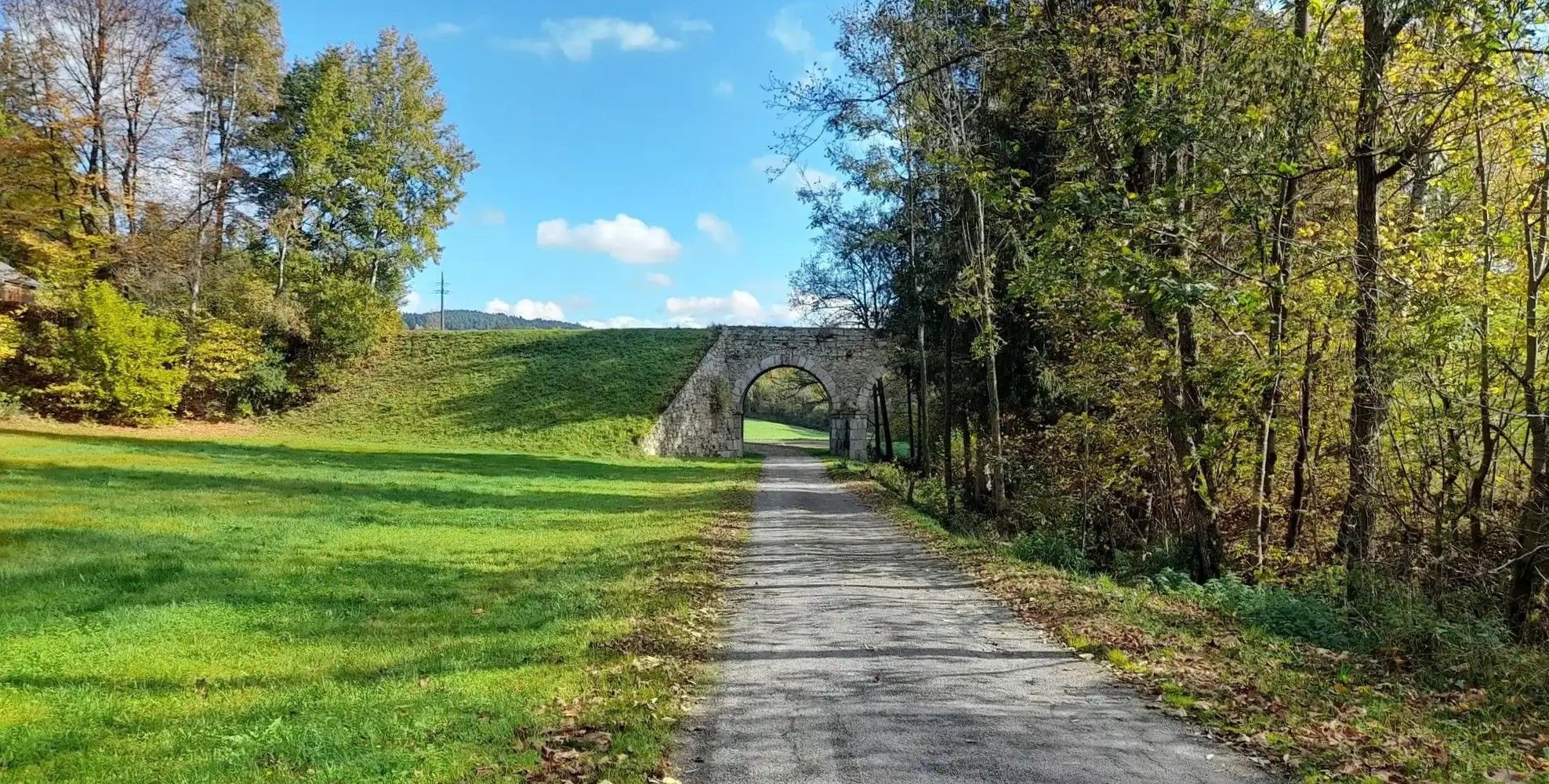
Bus station hiking trails around Neumarkt im Mühlkreis traverse a landscape characterized by rolling hills, dense forests, and scenic valleys such as the Kleine Gusen. The region's terrain features gentle elevations and cultural landscapes, offering diverse hiking opportunities. Prominent natural features include the Gipfel des Großen Zeißbergs and the Kirchberg, providing varied environments for exploration.
Best bus station hiking trails around Neumarkt im Mühlkreis
- The most popular bus station hiking route is Horse Railway Bridge Model – Schneiderwiese Barbecue Area loop from Neumarkt im Mühlkreis, a 6.4 miles (10.2 km) trail that takes 2 hours 57 minutes to complete. This moderate route explores both natural and historical points of interest.
- Another top favourite among local hikers is Parish Church of Saint James loop from Neumarkt im Mühlkreis, a moderate 5.9 miles (9.6 km) path. This route offers views of the local parish church and surrounding landscapes.
- Local hikers also love the Großer Zeißberg Summit – Parish Church of Saint James loop from Neumarkt im Mühlkreis, an 8.8 miles (14.2 km) trail leading through varied terrain including the Großer Zeißberg Summit, often completed in about 4 hours 10 minutes.
- Hiking around Neumarkt im Mühlkreis is defined by rolling hills, dense forests, and scenic valleys, with routes offering panoramic views extending towards the Czech border. The network provides options for easy, moderate, and difficult ability levels.
- The routes in Neumarkt im Mühlkreis are highly rated by the komoot community with an average score of 4.6 stars from more than 3,000 reviews. More than 21,000 hikers have used komoot to explore Neumarkt im Mühlkreis's varied terrain.
Last updated: May 14, 2026
5.0
(7)
36
hikers
Moderate hike. Good fitness required. Easily-accessible paths. Suitable for all skill levels.
5.0
(5)
29
hikers
9.55km
02:50
290m
290m
Moderate hike. Good fitness required. Easily-accessible paths. Suitable for all skill levels.

Sign up for free
4.7
(6)
24
hikers
Moderate hike. Good fitness required. Easily-accessible paths. Suitable for all skill levels.
4.6
(5)
23
hikers
Moderate hike. Good fitness required. Easily-accessible paths. Suitable for all skill levels.
5.0
(5)
14
hikers
5.15km
01:25
80m
80m
Easy hike. Great for any fitness level. Easily-accessible paths. Suitable for all skill levels.
Get access to more routes and recommendations from other explorers.
Sign up for free
Already have an account?
Our route recommendations are based on thousands of hikes, rides, and runs completed by other people on komoot.
Start today with a free account
Your next adventure awaits.
Login or Signup
Popular around Neumarkt im Mühlkreis
Other adventures around Neumarkt im Mühlkreis

Tips from the Community

In clear weather, the Alpine chain from the Ötscher to Traunstein would be visible above Loibersdorf.
0
0

Unfortunately, there is no summit cross on the highest elevation with granite rocks on the Zeissberg, but the view and the tranquility of this place of power are all the more beautiful.
1
0

There is a model of a horse-drawn railway carriage on a small bridge over a stream. Great for getting in and posing for a photo.
0
0
Very nice, small rest area with a fire pit and plenty of seating. There is also a rustic outhouse.
0
0

“Zeissberg-Rundweg” no longer exists in this form in Neumarkt im Mühlkreis.
0
0

Next to beer, Most is THE typical drink for the Mühlviertel. In Wirt z'Trosselsdorf you can learn a lot about must and of course taste it. More information is available at https://www.ooemuseen.at/museum/201-mostmuseum-im-wirt-ztrosselsdorf.
1
0

Photos from my tour: 2023.05.20. GUSENRUNDE - small Gusental to GUSEN URSPRUNG - large Gusental https://www.komoot.de/tour/1127792659
0
0
All sorts about the horse railway can be found here: https://www.pferdeeisenbahn.at/ https://de.wikipedia.org/wiki/Pferdeeisenbahn_Budweis%E2%80%93Linz%E2%80%93Gmunden Here WACHTHAUS No. 39 is described from page 36: https://steyr.dahoam.net/?paged=2&cat=537 Seen on my tour: 2023.05.20. GUSENRUNDE - small Gusental to GUSEN URSPRUNG - big Gusental https://www.komoot.de/tour/1127792659
0
0
Frequently Asked Questions
How many bus station hiking trails are available in Neumarkt im Mühlkreis?
There are over 20 bus station hiking trails around Neumarkt im Mühlkreis, offering a variety of options for different preferences and fitness levels. These routes are designed to be easily accessible via public transport.
What kind of terrain and difficulty can I expect on bus station hikes around Neumarkt im Mühlkreis?
The trails in Neumarkt im Mühlkreis traverse a diverse landscape of rolling hills, dense forests, and scenic valleys. You'll find a good mix of routes: 8 are easy, 13 are moderate, and 2 are more difficult, ensuring options for leisurely strolls or more demanding adventures. The region is characterized by its gentle hills and captivating cultural landscapes.
Are there family-friendly hiking routes accessible by bus in Neumarkt im Mühlkreis?
Yes, several easy routes are perfect for families. For example, the Hiking loop from Götschka Nord is an easy option, covering about 5 km with minimal elevation gain, making it suitable for a pleasant family outing.
Can I bring my dog on these bus station hiking trails?
Most hiking trails in the Neumarkt im Mühlkreis region are dog-friendly, allowing you to enjoy the natural beauty with your canine companion. Always keep your dog on a leash, especially near livestock or in populated areas, and remember to carry water for both of you.
What interesting landmarks or natural features can I see along these routes?
Many routes offer glimpses of the region's unique attractions. You might encounter historical sites like the Wachthaus 39 der Pferdeeisenbahn, or natural gems such as the Tal der Kleinen Gusen. Some trails also lead to impressive viewpoints like the Hoh-Haus at Buchberg Observation Tower, offering panoramic views.
Are there any circular routes starting from bus stations?
Yes, many of the bus-accessible trails are circular, allowing you to start and end your hike at the same point, often conveniently near a bus stop. An example is the Horse Railway Bridge Model – Schneiderwiese Barbecue Area loop from Neumarkt im Mühlkreis, which offers a moderate circular experience.
What are some notable viewpoints or summits accessible from bus stations?
The region is known for its panoramic views. You can hike to the Großer Zeißberg Summit, which is part of the Großer Zeißberg Summit – Parish Church of Saint James loop. This route provides spectacular vistas that can stretch as far as the Czech border.
Are there places to rest or get refreshments along the bus station trails?
Yes, the region has inviting guesthouses and huts like the Braunberghütte and Pelmbergstüberl, which offer opportunities for rest and to savor regional delicacies. Some routes, such as the Trosselsdorf Cider Museum – Horse Railway Bridge Model loop, pass by interesting local establishments.
What do other hikers enjoy most about hiking in Neumarkt im Mühlkreis?
The area is highly rated by the komoot community, with an average score of 4.56 stars. Reviewers often praise the picturesque landscapes, the diverse trails catering to all fitness levels, and the tranquility of the dense forests and scenic valleys.
What is the best time of year for bus station hikes in Neumarkt im Mühlkreis?
Neumarkt im Mühlkreis offers beautiful hiking experiences throughout much of the year. Spring and autumn provide pleasant temperatures and vibrant scenery, while summer is ideal for enjoying the lush greenery. Even in winter, some trails can be enjoyed, though conditions may require appropriate gear.
Are there any historical sites or cultural points of interest on these trails?
Yes, the region has a rich history reflected in its cultural landscapes. You might encounter sites like the Kumpfmühle Wassermühle, a historic watermill, or the aforementioned Wachthaus 39 der Pferdeeisenbahn, which hints at the region's past transport methods. The Parish Church of Saint James loop also takes you past a significant local landmark.
Most popular routes around Neumarkt im Mühlkreis
Most popular attractions around Neumarkt im Mühlkreis

Get inspired with the komoot mobile app


Explore more
Browse the best Hikes in other regions.
