The best hikes from bus stations around Parco Adda Sud
4.2
(1120)
8,336
hikers
16
hikes
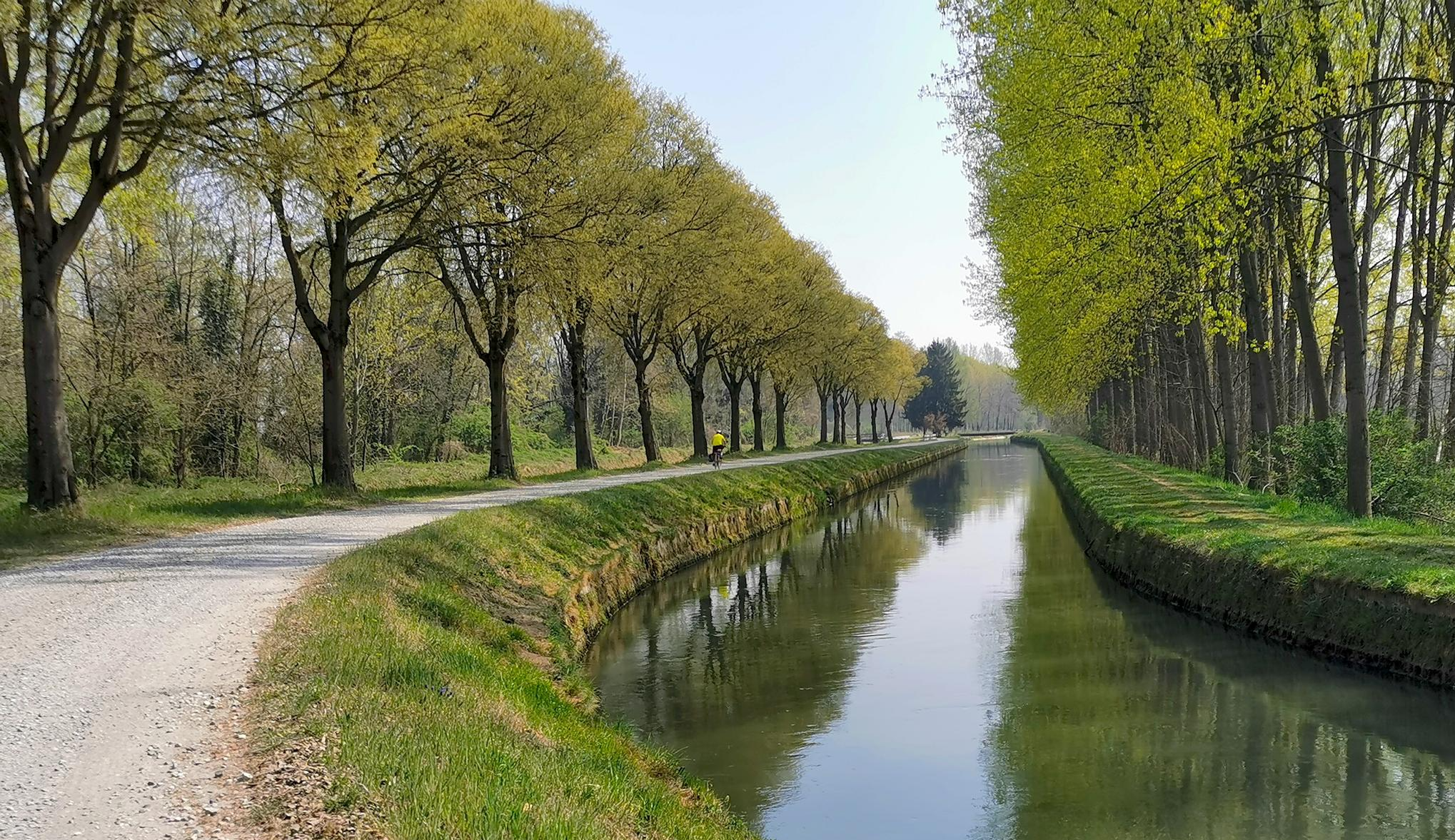
Bus station hiking trails around Parco Adda Sud traverse a landscape shaped by the Adda River, featuring diverse natural and agricultural environments. The region is characterized by its riverine setting, including wetlands, oxbow lakes, and extensive alluvial plains. Hikers encounter a mix of cultivated fields, particularly maize, and natural woodlands composed of species like alder, willow, and maple. The terrain generally consists of well-compacted dirt paths with minimal elevation changes, making it accessible for various activity levels.
Best bus station hiking trails around Parco Adda Sud
- The most popular bus station hiking route is Giro di Corneliano Bertario e Canale della Muzza, a 6.2 miles (10.0 km) trail that takes 2 hours 31 minutes to complete. This moderate route explores the canal and surrounding rural areas.
- Another top favourite among local hikers is From Gombito to Serio – loop tour, a moderate 7.3 miles (11.7 km) path. This route offers views of the river and agricultural plains, typically completed in 3 hours.
- Local hikers also love the Bridge over the Muzza – Bend on the Muzza Canal loop from Cavaione, a 5.7 miles (9.2 km) trail leading through riverine landscapes and past the Muzza Canal, often completed in about 2 hours 18 minutes.
- Hiking around Parco Adda Sud is defined by its riverine environment, agricultural plains, and natural woodlands. The network offers options for different ability levels, with 7 easy and 9 moderate routes available.
- The routes in Parco Adda Sud are highly rated by the komoot community with an average score of 4.3 stars from more than 800 reviews. More than 6000 hikers have used komoot to explore Parco Adda Sud's varied terrain.
Last updated: August 6, 2026
4.3
(7)
32
hikers
10.00km
02:31
20m
20m
Hike a moderate 6.2-mile loop along the historic Canale della Muzza, exploring agricultural landscapes and landmarks in Lombardy.
1
hikers
11.7km
03:00
50m
50m
Moderate hike. Good fitness required. Easily-accessible paths. Suitable for all skill levels.

Sign up for free
4.5
(4)
21
hikers
Moderate hike. Good fitness required. Easily-accessible paths. Suitable for all skill levels.
4.0
(5)
16
hikers
Moderate hike. Good fitness required. Easily-accessible paths. Suitable for all skill levels.
5.0
(2)
10
hikers
6.59km
01:41
20m
20m
Easy hike. Great for any fitness level. Easily-accessible paths. Suitable for all skill levels.
Get access to more routes and recommendations from other explorers.
Sign up for free
Already have an account?
Our route recommendations are based on thousands of hikes, rides, and runs completed by other people on komoot.
Start today with a free account
Your next adventure awaits.
Login or Signup
Popular around Parco Adda Sud
Other adventures around Parco Adda Sud

Tips from the Community

beautiful place, I highly recommend it
0
0

The bridge over the Muzza Canal, located in Lavagna (a hamlet of the municipality of Comazzo in the province of Lodi), is a historical landmark for crossing this ancient artificial waterway. The Muzza is a branch of the Adda river, known for being one of the oldest canals in Europe. Lavagna Lodigiana is a small rural village immersed in the countryside that develops right next to the canal. The bridge area is frequented by cyclists and hikers who travel along the Muzza cycle path or the Muzza-Ponte di Lavagna route, enjoying the river landscape.
0
0

The Adda River is the fourth longest watercourse in Italy with its 313 kilometers and is entirely within the Lombardy region. It represents one of the main left tributaries of the Po River and has a very large hydrographic basin that covers about a third of the regional territory.
0
0
The Adda River is the fourth longest watercourse in Italy with its 313 kilometers and is entirely contained within the Lombardy region. It represents one of the main left tributaries of the Po River and has a very large hydrographic basin that covers about a third of the regional territory.
0
0
Montanaso Lombardo is an Italian municipality of 2,243 inhabitants [2,244] located in Lombardy, in the province of Lodi. The village is situated a few kilometers from the provincial capital Lodi, immersed in the Po Valley and bordered by the waters of the Adda river and the Muzza canal.
0
0
The Muzza canal (61 km long in total) is a branch of the Adda River and has recently celebrated its 800th anniversary, making it one of the oldest in Europe. Its name, with slight variations over the centuries, still recalls the Roman family Mutia who moved here in 90 BC, starting the first land reclamation works. Smaller watercourses branch off from the wide canal, winding through the countryside for a total length of about 1000 kilometers, mainly intended for agricultural irrigation. The surrounding landscape of countryside and farmhouses is evocative, with a succession of tree-lined rows and open fields. It is also very interesting from a naturalistic point of view as it attracts many aquatic birds that can be observed along the route.
1
0
The Muzza canal (61 km long in total) is a branch of the Adda River and recently celebrated its 800th anniversary, making it one of the oldest in Europe. Its name, with slight variations over the centuries, still recalls the name of the Roman Mutia family who moved here in 90 BC, initiating the first land reclamation works. Minor watercourses branch off from the wide canal, winding through the countryside for a total length of about 1000 kilometers, and are mainly intended for agricultural irrigation. The surrounding landscape of countryside and farmhouses is evocative, with rows of trees and open fields. It is also very interesting from a naturalistic point of view as it attracts many waterfowl that can be observed along the route.
1
0

Be careful on the steps when the ground is wet! This passage allows you to cross the right bank of the Muzza.
2
0
Frequently Asked Questions
How many bus-accessible hiking trails can I find in Parco Adda Sud?
There are over a dozen hiking trails in Parco Adda Sud that are easily accessible by bus, offering a variety of experiences for different skill levels. You'll find a good mix of easy and moderate routes.
Are there any easy, family-friendly routes accessible by bus in Parco Adda Sud?
Yes, several easy routes are suitable for families. For instance, the Lodi Main Cemetery loop from Montanaso Lombardo is an easy 6.6 km hike that's great for a relaxed outing. The park also features accessible trails with well-compacted surfaces, perfect for all ages.
What kind of natural landscapes can I expect to see on these bus-accessible trails?
The trails accessible by bus in Parco Adda Sud showcase the region's diverse natural beauty. You'll encounter scenic riverbanks along the Adda River, tranquil woodlands, and unique wetland areas like oxbow lakes (lanche and morte). Many routes also pass through agricultural plains, characterized by maize fields and rows of poplars.
Can I spot any wildlife while hiking from a bus station in Parco Adda Sud?
Absolutely. Parco Adda Sud is a haven for wildlife, especially birds. The wetlands and oxbow lakes are ideal for observing numerous aquatic bird species. The park is known for its successful white stork reintroduction project and hosts several heronries. Keep an eye out for polecats, dormice, and even fallow deer in the northern woods.
Are there any historical or cultural points of interest along the bus-accessible routes?
Yes, many trails offer glimpses into the region's rich history. You might encounter traditional rural settlements known as 'cascine,' which preserve centuries of agricultural heritage. The park also features medieval and Renaissance castles, such as the Borromeo Castle of Camairago or Maccastorna and its castle. You can also see important hydraulic structures like the Muzza and Vacchelli irrigation canals.
What is the best time of year to hike these bus-accessible trails in Parco Adda Sud?
Spring and autumn are generally the most pleasant seasons for hiking in Parco Adda Sud. In spring, the landscape is vibrant with new growth and blooming flowers, while autumn offers beautiful foliage and comfortable temperatures. Summer can be warm, but riverside trails often provide shade. Winter hikes are also possible, offering a different, quieter perspective of the park.
Are there any circular routes that start and end near a bus stop?
Yes, many of the bus-accessible trails are designed as circular routes, allowing you to return to your starting point without needing additional transport. An example is the moderate Giro di Corneliano Bertario e Canale della Muzza, which offers a loop experience.
What do other hikers say about the bus-accessible trails in Parco Adda Sud?
The komoot community highly rates the hiking experiences in Parco Adda Sud, with an average score of 4.3 stars. Hikers often praise the peaceful river views, the well-maintained paths, and the opportunity to discover both natural beauty and historical sites easily accessible by public transport.
Are there any specific natural monuments or reserves I can reach via bus-accessible trails?
Yes, some trails lead to significant natural areas. For instance, you can explore the unique ecosystem of the Lanca Adda Morta, an old river branch that is now a crucial nature reserve. The Confluence of the Adda and Po rivers is another notable natural monument you might encounter.
Are there any moderate difficulty trails accessible by bus for a longer hike?
For those looking for a slightly longer and more challenging hike, the From Gombito to Serio – loop tour is a moderate 11.7 km route that can be reached by bus. It offers a rewarding experience with varied terrain and scenic views.
Where can I find more information or maps for these trails once I arrive?
The Parco Adda Sud features visitor centers, such as those in Castiglione d'Adda and Villa Pompeiana. These centers can provide maps, detailed information about the trails, and insights into the park's natural and cultural heritage, helping you make the most of your bus-accessible hiking adventure.
Most popular routes around Parco Adda Sud
Most popular attractions around Parco Adda Sud

Get inspired with the komoot mobile app


Explore more
Browse the best Hikes in other regions.
