The best hikes from bus stations around Vila Real De Santo António
4.4
(816)
3,793
hikers
8
hikes
Bus station hiking trails around Vila Real De Santo António offer access to the diverse landscapes of the eastern Algarve region of Portugal. The area is characterized by extensive pine forests, coastal dunes, and the banks of the Guadiana River, which forms a natural border with Spain. Hikers can explore protected natural areas, including the Mata Nacional das Dunas Litorais and the Castro Marim and Vila Real de Santo António Marshland Natural Reserve, which features marshland and salt pans. The terrain is generally flat, providing accessible options for various activity levels.
Best bus station hiking trails around Vila Real De Santo António
- The most popular bus station hiking route is Mata de VRSA + Saúde Trail, a 4.0 miles (6.5 km) trail that takes 1 hour 39 minutes to complete. This easy path leads through tranquil pine forests.
- Another top favourite among local hikers is Praia de Monte Gordo — circular route, a moderate 7.7 miles (12.4 km) path. This route takes approximately 3 hours 8 minutes and explores coastal dunes and sandy beaches.
- Local hikers also love the Guadiana Naval Association – House Martin Nesting Sites loop from Vila Real de Santo António, a 4.6 miles (7.4 km) trail leading along the banks of the Guadiana River, often completed in about 1 hour 52 minutes.
- Hiking around Vila Real De Santo António is defined by pine forests, coastal dunes, and the Guadiana River. The network offers options for different ability levels, from easy walks to moderate excursions.
- The routes in Vila Real De Santo António are highly rated by the komoot community with an average score of 4.3 stars from over 600 reviews. More than 3000 hikers have used komoot to explore Vila Real De Santo António's varied terrain.
Last updated: October 8, 2026
4.1
(22)
74
hikers
6.53km
01:39
10m
10m
Easy hike. Great for any fitness level. Easily-accessible paths. Suitable for all skill levels.
4.7
(3)
8
hikers
12.4km
03:08
20m
20m
Moderate hike. Good fitness required. Easily-accessible paths. Suitable for all skill levels.

4.2
(15)
49
hikers
Moderate hike. Good fitness required. Easily-accessible paths. Suitable for all skill levels.
4.6
(22)
63
hikers
11.0km
02:47
20m
20m
Moderate hike. Good fitness required. Easily-accessible paths. Suitable for all skill levels.
4.2
(12)
23
hikers
Easy hike. Great for any fitness level. Easily-accessible paths. Suitable for all skill levels.
Get access to more routes and recommendations from other explorers.
Already have an account?
Our route recommendations are based on thousands of hikes, rides, and runs completed by other people on komoot.
Start today with a free account
Your next adventure awaits.
Popular around Vila Real De Santo António
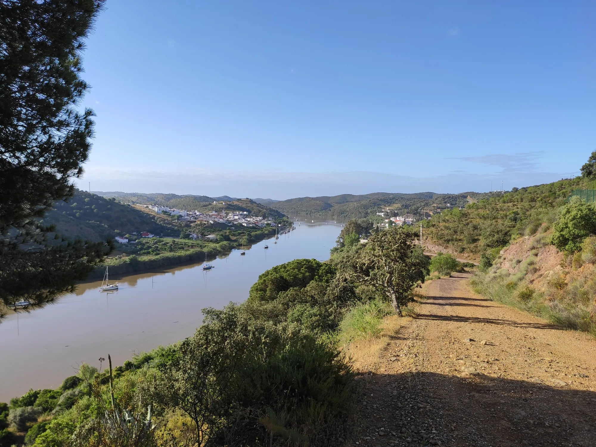
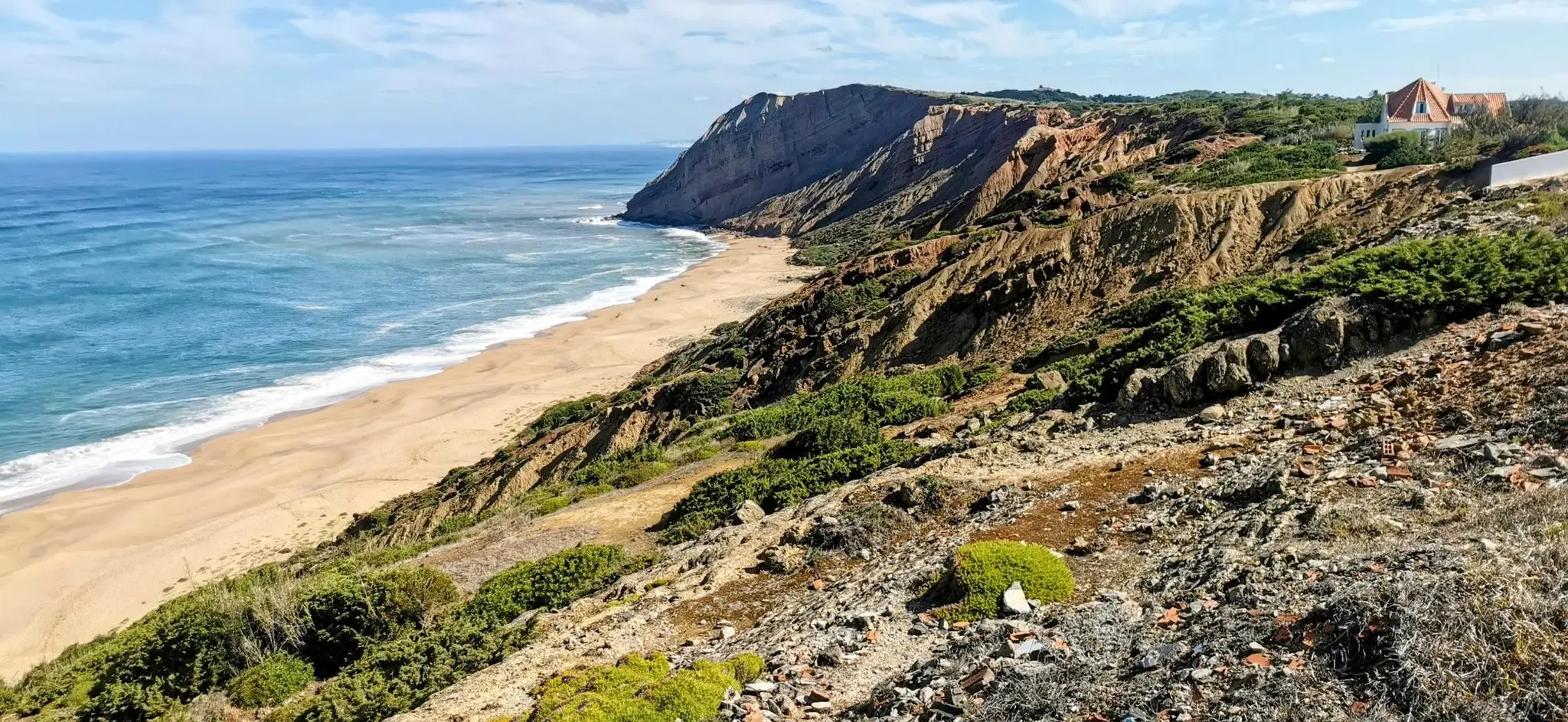
Other adventures around Vila Real De Santo António


Tips from the Community

Near the harbor you will find this beautiful building 👀
1
0

Very large picnic area.
2
1

The Vila Real de Santo António waterfront is a large avenue between the Guadiana River and the city. Very pleasant for walking or cycling. 👍🥾🚲
0
0
Vila Real de Santo António is a city in the Algarve region with a distinct historical center, characterized by its Pombaline design, and a privileged location near the mouth of the Guadiana River, opposite Ayamonte, Spain. The city was built from scratch in just two years in the 18th century, under the direction of the Marquis of Pombal. 👍🥾🚲
0
0
Vila Real de Santo António is located on the Gulf of Cádiz, which is part of the Atlantic Ocean, and on the right bank of the Guadiana River, whose lower reaches form the border between Portugal and Spain. The town boasts several attractions, charming restaurants, bars, and cafés! And of course, a lighthouse! 👀 A ferry ⛴️ runs hourly to the Spanish town of Ayamonte. ...
3
0
Vila Real de Santo António is a municipality and town in the Faro District of Portugal. It lies on the Gulf of Cádiz, which is part of the Atlantic Ocean, and on the right bank of the Guadiana River, whose lower reaches form the border between Portugal and Spain. Ayamonte, in Spain, lies on the opposite bank of the Guadiana River.
4
0
Vila Real de Santo António is a municipality and town in the Faro District of Portugal. It lies on the Gulf of Cádiz, which is part of the Atlantic Ocean, and on the right bank of the Guadiana River, whose lower reaches form the border between Portugal and Spain. Ayamonte, in Spain, lies on the opposite bank of the Guadiana River.
3
0
Vila Real de Santo António is a municipality and town in the Faro District of Portugal. It lies on the Gulf of Cádiz, which is part of the Atlantic Ocean, and on the right bank of the Guadiana River, whose lower reaches form the border between Portugal and Spain. Ayamonte, in Spain, lies on the opposite bank of the Guadiana River.
4
0
Frequently Asked Questions
How many bus station accessible hiking trails are there around Vila Real de Santo António?
There are 8 hiking routes around Vila Real de Santo António that are easily accessible from bus stations, offering a variety of experiences for different skill levels.
Are there any easy, family-friendly hikes accessible by bus?
Yes, several routes are suitable for families. An easy option is the Mata de VRSA + Saúde Trail, which is about 6.5 km long and leads through tranquil pine forests. Another great choice is the Guadiana Naval Association – House Martin Nesting Sites loop from Vila Real de Santo António, an easy 7.3 km route along the river.
Which trails offer circular routes from a bus stop?
Many of the bus-accessible trails are circular, allowing you to start and end at the same point. The Praia de Monte Gordo — circular route is a moderate 12.3 km option that explores the coastal area. Another is the View of Ayamonte and Spain – Talhão Path loop from Vila Real de Santo António, a moderate 11 km route offering scenic views.
Are there dog-friendly hiking trails accessible by public transport?
Yes, the region is generally welcoming to dogs. Praia de Santo António, which can be accessed via routes like the Talhão Path – Monte Gordo Dune Boardwalk loop from Vila Real de Santo António, is known for being dog-friendly, offering both a trail and a swimming area for pets. Always keep your dog on a leash and clean up after them.
What kind of natural landscapes can I expect to see on these bus-accessible hikes?
The trails offer diverse landscapes. You can explore the extensive pine forests of the Mata Nacional das Dunas Litorais, walk along coastal dunes and sandy beaches, or enjoy scenic paths along the Guadiana River. The region is also home to the Castro Marim and Vila Real de Santo António Marshland Natural Reserve, a biological hotspot with marshlands and salt pans.
What wildlife might I encounter on the trails?
The region is rich in wildlife. In the pine forests, you might spot chameleons and various bird species. The Castro Marim and Vila Real de Santo António Marshland Natural Reserve is particularly known for its aquatic birds, including flamingos, spoonbills, Caspian terns, white storks, and the black-winged stilt.
What are some interesting natural attractions or landmarks along these routes?
Many routes offer access to unique natural features. You can explore the Salt Pans of the Reserva Natural do Sapal de Castro Marim e Vila Real de Santo António, or enjoy the coastal beauty of Manta Rota Beach. Some trails also provide views of the Guadiana River, which forms the border with Spain.
What is the best time of year for hiking near Vila Real de Santo António?
The eastern Algarve, including Vila Real de Santo António, is excellent for hiking during spring and autumn when temperatures are mild and the landscapes are vibrant. Even in winter, the climate is generally pleasant for outdoor activities. Summers can be hot, so early morning or late afternoon hikes are recommended if visiting during this season.
Are there any viewpoints or scenic spots on the bus-accessible trails?
Yes, several routes offer beautiful views. The View of Ayamonte and Spain – Talhão Path loop from Vila Real de Santo António provides panoramic vistas across the Guadiana River towards Spain. Coastal trails also offer stunning ocean views and access to long sandy beaches.
What do other hikers enjoy most about hiking in Vila Real de Santo António?
The area is highly rated by the komoot community, with an average score of 4.26 stars. Reviewers often praise the diverse landscapes, from tranquil pine forests to scenic coastal paths and the unique marshlands, as well as the accessibility of these trails via public transport.
Are there cafes or amenities near the bus-accessible hiking trails?
Many trails are close to towns like Monte Gordo or Vila Real de Santo António itself, where you can find cafes, restaurants, and other amenities. For example, routes around Monte Gordo Beach will have facilities nearby. The Mata Nacional das Dunas Litorais is also easily accessible from populated areas.
Most popular routes around Vila Real De Santo António
Most popular attractions around Vila Real De Santo António

Get inspired with the komoot mobile app


Explore more
Browse the best Hikes in other regions.
