Saint-Andéol-De-Fourchades
Saint-Andéol-De-Fourchades
Top 13 Natural Monuments around Saint-Andéol-De-Fourchades
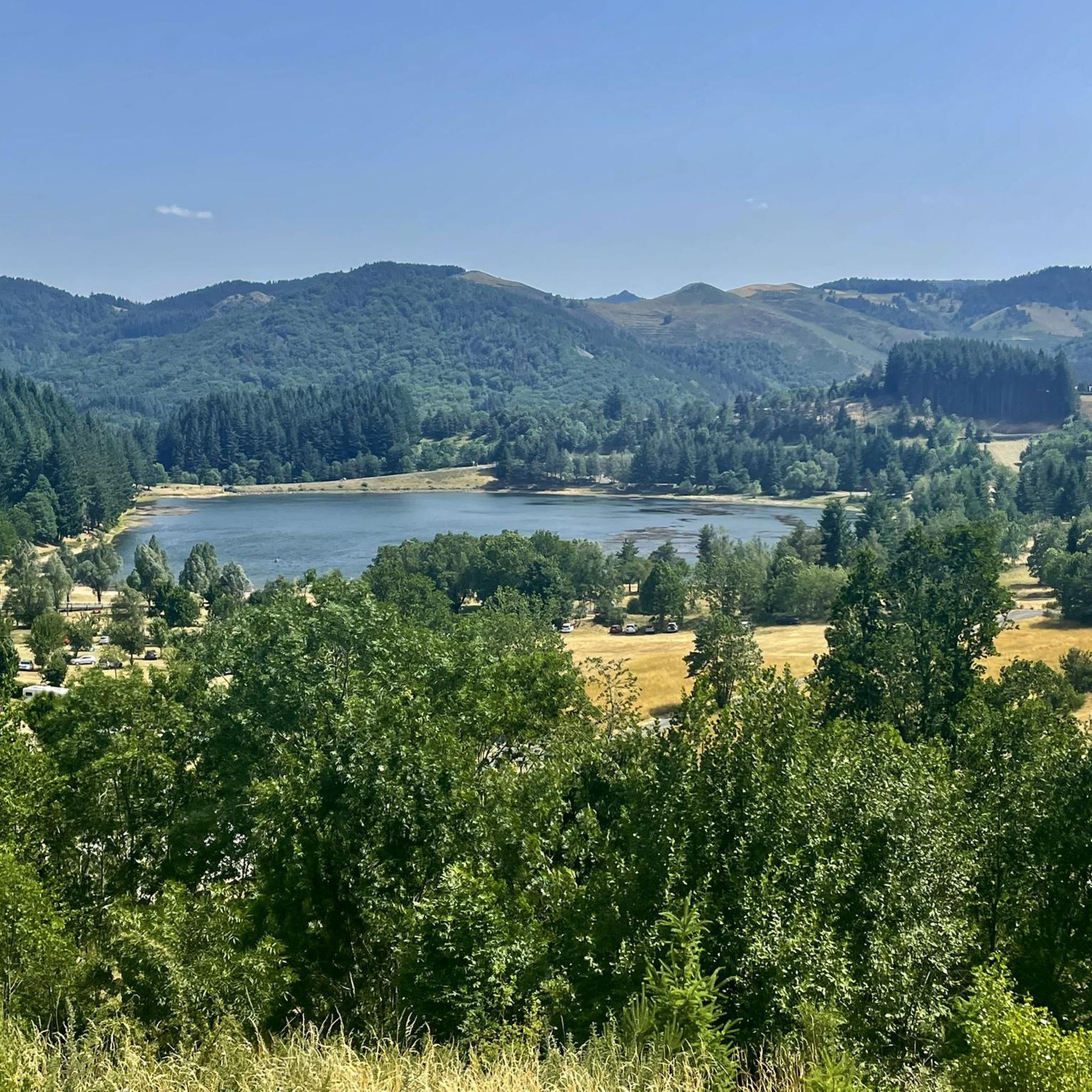
Best natural monuments around Saint-Andéol-De-Fourchades are found within the Ardèche mountains, part of the Monts d'Ardèche Regional Nature Park, a UNESCO Global Geopark. This region features diverse landscapes, ancient volcanoes, and pristine rivers. It offers various natural sites known for their unique geological characteristics and scenic beauty. The area provides opportunities to explore volcanic formations and significant natural landmarks.
Best natural monuments around Saint-Andéol-De-Fourchades
- The most popular natural monuments is South summit of Mont Mézenc, a summit that offers…
Last updated: May 8, 2026
South summit of Mont Mézenc
Highlight • Summit
You are also precisely on the watershed line.
Translated by Google •
Tip by

Mount Gerbier de Jonc
Highlight • Summit
Translated by Google •
Tip by

Sign up now to discover places like this
Get recommendations on the best single tracks, peaks, & plenty of other exciting outdoor places.
Sign up for free
North summit of Mont Mézenc
Highlight • Summit
At 1744m, it is the highest point in the Haute-Loire department. The southern peak already belongs to …
Translated by Google •
Tip by
Boutières Cross Pass
Highlight • Mountain Pass
Translated by Google •
Tip by

Ray-Pic Waterfall
Highlight • Waterfall
Translated by Google •
Tip by

Sign up for free to discover even more natural monuments around Saint-Andéol-De-Fourchades.
Sign up for free
Already have an account?
Start today with a free account
Your next adventure awaits.
Login or Signup
Popular around Saint-Andéol-De-Fourchades
Tips from the Community

Lots of hikers. Be polite and share the trail. The descent with the small steps is a treat.
0
0

A pass at an altitude of over 1500 m. It is the highest in Ardèche.
0
0

The paths on Mont Mezenc have recently been renovated. Not all of the paths shown are still there. The remaining paths are relatively wide for a mountain peak and easy to walk.
0
0

Mont Gerbier-de-Jonc is one of the highest peaks of the Monts d'Ardèche in the south-eastern Massif Central. The mountain itself is a striking, extinct volcanic cone with a good view over the Massif Central. The ascent and descent require some fitness and good footwear. There are a few short climbing rocks that cannot be avoided. But the view is worth it.
0
0

Unfortunately, swimming is forbidden
2
0

The Ray-Pic waterfall is a natural waterfall and a natural volcanic site. The amazing rock formations of this 60-meter waterfall follow a lava flow that forms a cascade of basalt columns.
3
0

The Col de la Croix de Boutières from Saint-Martin-de-Valamas is 27.1km long with a total drop of 1024m. The average gradient is 3.5% with maximum gradients of 9%.
1
0

The Col de la Croix Boutières, at 1,502m, is the highest pass in the Ardèche. It separates the Velay to the west from the Cirque de Boutières to the east.
0
0
Frequently Asked Questions
What are the most popular natural monuments around Saint-Andéol-De-Fourchades?
Visitors frequently enjoy the South summit of Mont Mézenc, which offers incredible views of the Ardèche and Haute-Loire departments. Another highly rated spot is Mount Gerbier de Jonc, famous as the source of the Loire River. The dramatic Ray-Pic Waterfall, with its basalt columns, is also a favorite.
What unique geological features can I see in the natural monuments near Saint-Andéol-De-Fourchades?
The region is rich in volcanic geology. You can observe the distinctive basalt columns at the Ray-Pic Waterfall, formed from ancient lava flows. Mount Gerbier de Jonc is a striking volcanic peak, and the nearby Lac d'Issarlès is a deep lake nestled within an ancient volcanic crater. The entire area is part of the Monts d'Ardèche Regional Nature Park, a UNESCO Global Geopark, highlighting its significant geological heritage.
Are there family-friendly natural monuments to visit around Saint-Andéol-De-Fourchades?
Yes, several natural monuments are suitable for families. The climb to the summit of Mount Gerbier de Jonc is often recommended for families with children, offering a fun, slightly challenging ascent with rewarding panoramic views. The Tchier de Borée, a site with carved stones and cultural history, also offers a beautiful viewpoint and is considered family-friendly.
What outdoor activities can I do near these natural monuments?
The area around Saint-Andéol-De-Fourchades offers diverse outdoor activities. You can explore numerous hiking trails, including routes around Mount Gerbier de Jonc. For more options, check out the Hiking around Saint-Andéol-De-Fourchades guide. Road cycling is also popular, with challenging routes like those found in the Road Cycling Routes around Saint-Andéol-De-Fourchades guide. Additionally, there are various Running Trails around Saint-Andéol-De-Fourchades.
What is the best time of year to visit the natural monuments?
The Ardèche mountains offer beauty throughout the year. Spring and autumn provide pleasant temperatures for hiking and exploring, with vibrant foliage or blooming wildflowers. Summer is ideal for enjoying the outdoors, though it can be busier. Winter offers a different, often snowy, landscape, especially at higher elevations like Mont Mézenc and Mount Gerbier de Jonc, but some access might be limited by snow.
Are there any natural monuments with historical or cultural significance?
Yes, the Tchier de Borée is a notable site. While a man-made monument, it is deeply integrated into the natural landscape and tells the cultural history of the Boutières region through 70 carved stones depicting symbols and myths. The entire Monts d'Ardèche Regional Nature Park also holds historical significance as a UNESCO Global Geopark, recognizing its long geological history.
Can I find viewpoints with panoramic scenery?
Absolutely. The South summit of Mont Mézenc offers an extraordinary 360-degree view over the Ardèche, Loire, and Haute-Loire. Similarly, climbing Mount Gerbier de Jonc rewards you with terrific panoramic vistas. The Boutières Cross Pass is another spectacular viewing spot, providing beautiful landscapes.
Are dogs allowed on trails near the natural monuments?
While specific regulations can vary by site, many outdoor trails in the Monts d'Ardèche Regional Nature Park are generally dog-friendly, especially if kept on a leash. It's always best to check local signage at each specific natural monument or trail entrance for any restrictions.
Are there any places to eat or drink near the natural monuments?
Yes, you can find refreshments near some natural monuments. For instance, the Boutières Cross Pass has a cafe available. The area around Mount Gerbier de Jonc is also known for places where you can taste local specialties.
What should I wear when visiting the natural monuments, especially for hiking?
Given the varied terrain and potential for elevation changes, it's advisable to wear comfortable shoes with a sturdy profile, especially if you plan to hike to summits like Mount Gerbier de Jonc or Mont Mézenc. Layered clothing is also recommended, as weather conditions can change quickly in the mountains.
Is swimming allowed at the Ray-Pic Waterfall?
No, swimming is explicitly forbidden at the Ray-Pic Waterfall due to safety reasons and to preserve the natural site.
What is the significance of Mont Mézenc regarding water flow?
The South summit of Mont Mézenc is precisely located on a watershed line. This means it plays a role in the equitable sharing of water between the Mediterranean Sea and the Atlantic Ocean, making it a significant geographical point.
How long does it typically take to visit the natural monuments?
The duration of your visit depends on the monument and your activity. A hike to the summit of Mount Gerbier de Jonc can take a couple of hours. Visiting the Ray-Pic Waterfall viewpoint might be shorter, while exploring the trails around Mont Mézenc could be a half-day or full-day excursion. Plan according to your interests and fitness level.
Most popular routes around Saint-Andéol-De-Fourchades
Most popular attractions around Saint-Andéol-De-Fourchades

Get inspired with the komoot mobile app


Explore more
Extend your search for the best caves by checking out these guides of the top ones around Saint-Andéol-De-Fourchades:
