Top 11 Mountain Passes around Plan
Best mountain passes around Plan are located within the Pyrenees, a mountain range forming a natural border between France and Spain. This region features numerous challenging and scenic mountain passes, many of which are known for their inclusion in professional cycling races. The area offers diverse landscapes, from valleys to rocky peaks, providing routes for various outdoor activities. These passes have historically served as crucial links for travel and trade.
Best mountain passes around Plan
- The most popular mountain passes…
Last updated: November 1, 2026
Collado de Sahún
Highlight • Mountain Pass
Translated by Google •
Tip by

Puerto de Arro – Monastery of San Victorián
Highlight (Segment) • Mountain Pass
Legend has it that Saint Victorián arrived in the Pyrenees …
Translated by Google •
Tip by

Sign up now to discover places like this
Get recommendations on the best single tracks, peaks, & plenty of other exciting outdoor places.
Cullivert Pass
Highlight • Mountain Pass
Translated by Google •
Tip by

La Collada
Highlight • Mountain Pass
Showing Translation
Tip by

Liri
Highlight • Settlement
Translated by Google •
Tip by

Sign up for free to discover even more mountain passes around Plan.
Already have an account?
Start today with a free account
Your next adventure awaits.


Other adventures around Plan

Tips from the Community

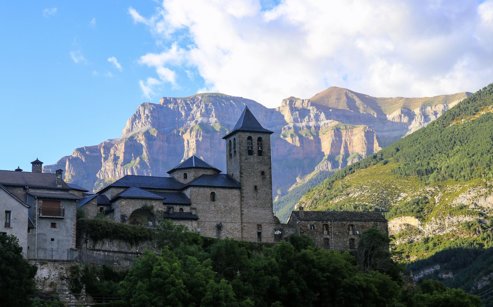
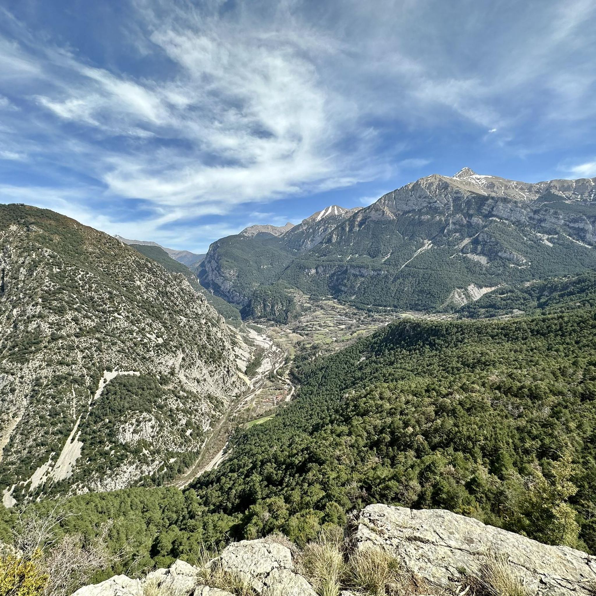
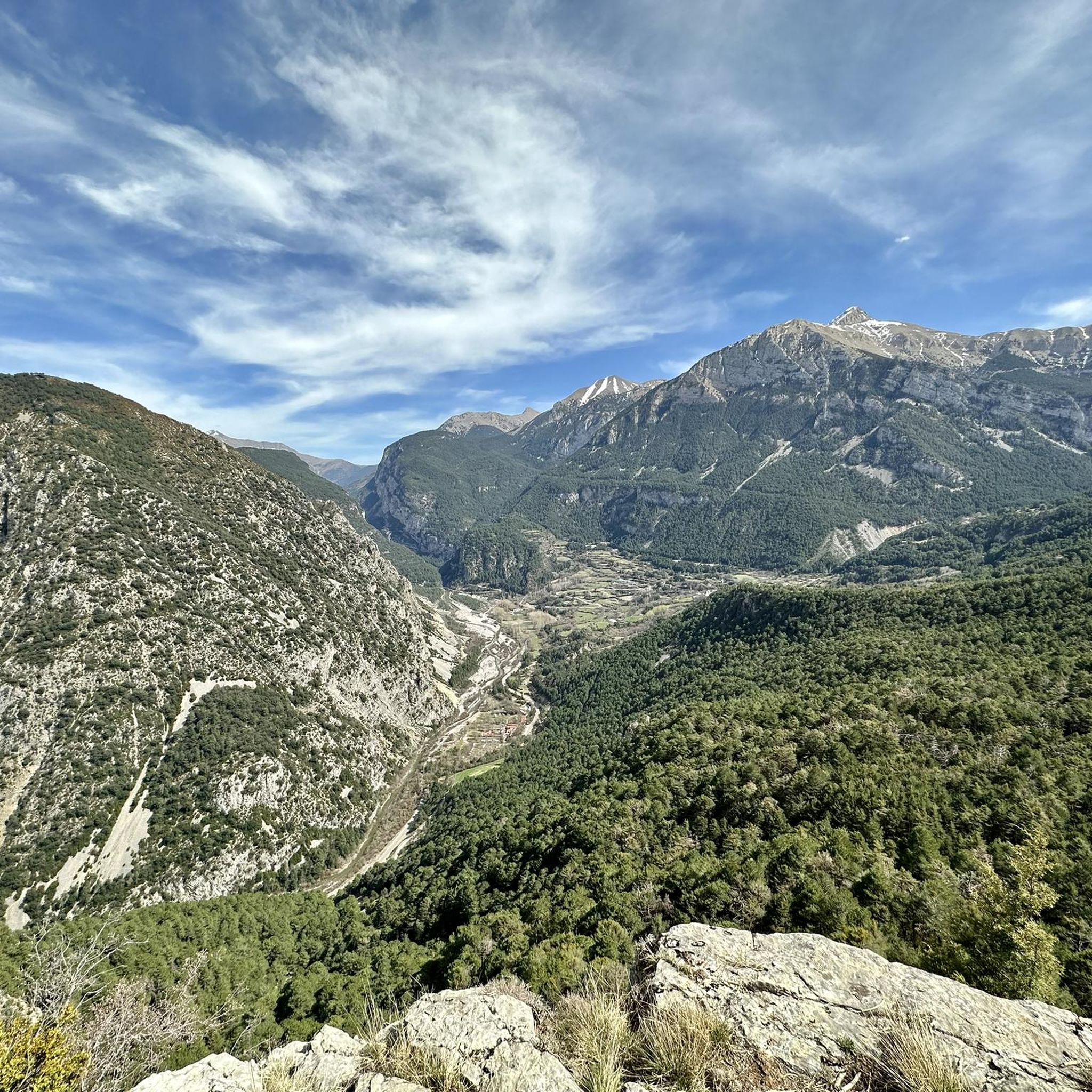
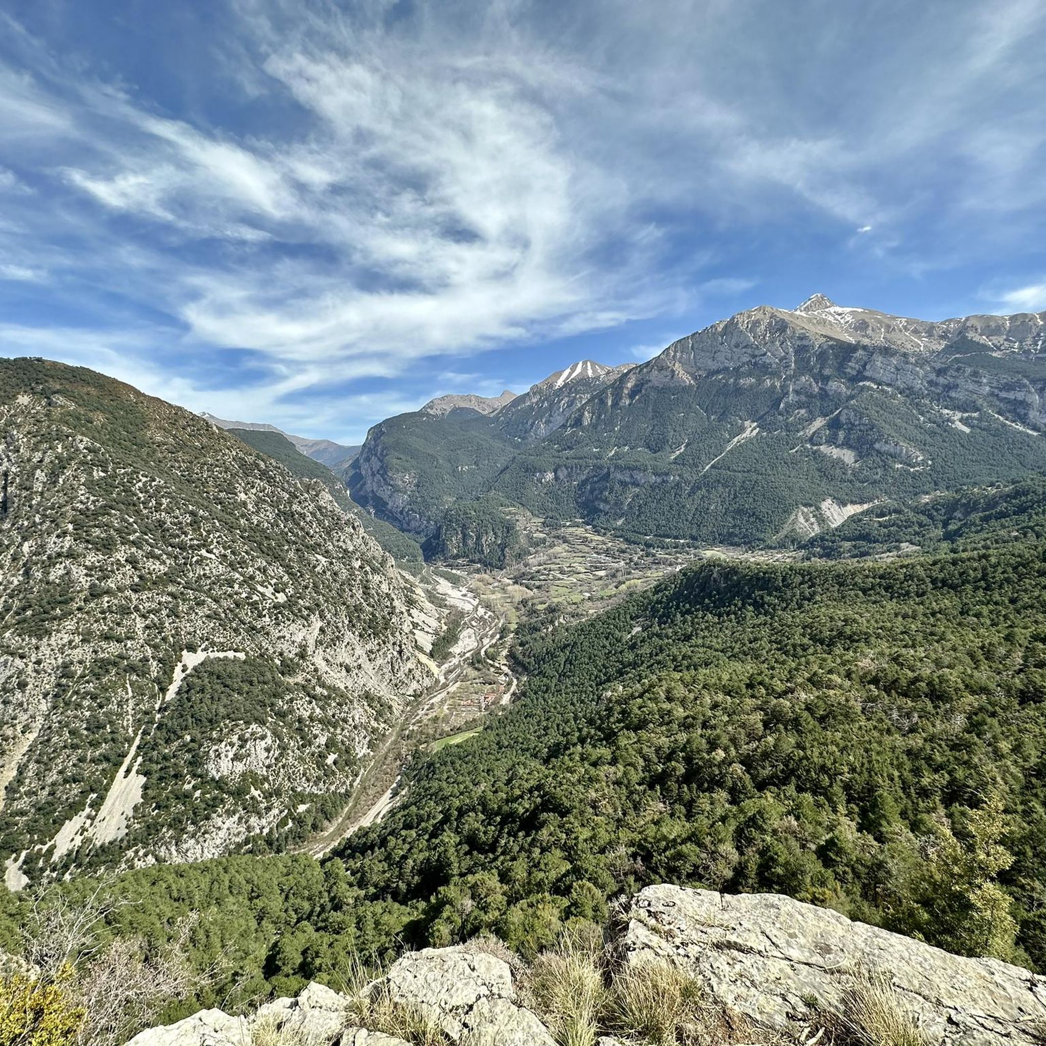
La Collada, at an altitude of 1548m, is the pass between the Cinca valley and the Ésera valley on the North face of Peña Montañesa. Impressive views to the West of the entire Cinca valley: Ainsa, Labuerda, Escalona... While to the East, we find the Cotiella massif.
0
0
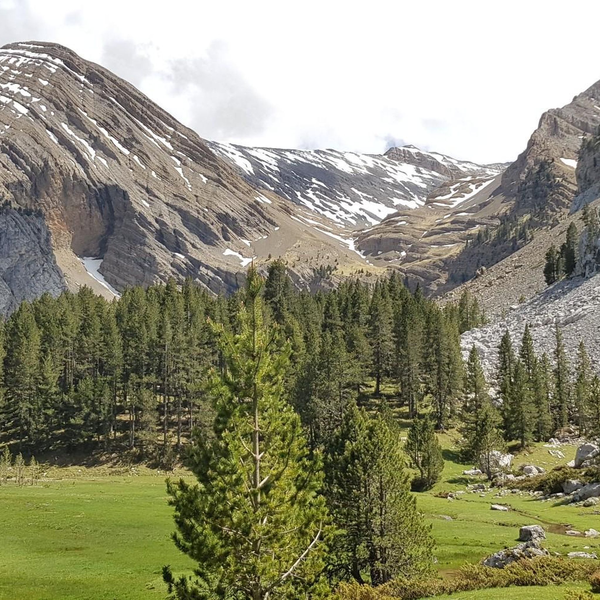
An idyllic meadow in the middle of the forest, located on the North face of Peña Montañesa
0
0
A legendary mountain pass in the Pyrenees. A crossing point between the Chistau and Benasque valleys, linking Sobrarbe and Ribagorza at an altitude of 2000m.
0
0
A very enjoyable climb. No steep inclines, a narrow but well-maintained road. The finish at the foot of Peña Montañesa has its charm.
0
0

Collado de Cullivert is the link between the Cotiella massif (2912 m), Sierra Ferrera and the Peña Montañesa (2291 m). Natural passage between the regions of Ribagorza and Sobrarbe, separation line of the slopes of the Ésera and Cinca rivers. Access to the Cullivert pass (1,471 m) is via a demanding but beautiful track of almost 6 km that goes up the Ravine of Viu.
0
0

Access is via forest tracks in good condition. Obviously, to reach 2000m it takes a little time but the reward is worth it: the views are magnificent over the valleys and peaks at 360 degrees. A delight !
1
0

The road that goes up from Sahún goes up through the port of Liri until reaching the town itself, with few houses but which maintains a spectacular view of the Castejón de Sos valley. The port has a length of almost 5 km and a maximum slope of 22%.
0
0

This is the natural pass between the valleys of Chistau and Benasque. As such, it has been used for millennia and proof of this is the megalithic circle next to the track, which even then served to delimit border limits called "mugas".
0
0
Frequently Asked Questions
What kind of terrain and difficulty can I expect on mountain passes around Plan?
The mountain passes around Plan, located in the Pyrenees, often feature challenging terrain. For instance, the route to Collado de Sahún is primarily a gravel track, rough in sections, with an elevation gain of over 1100 meters to its height of 2020 meters. Similarly, Grist Pass or Forqueta Pass involves a fairly hard climb, especially under direct sun. Many routes are demanding, making them suitable for experienced hikers and cyclists.
Are there any historical sites accessible via mountain passes near Plan?
Yes, the Puerto de Arro – Monastery of San Victorián pass leads directly to the Monastery of San Victorián, which dates back to the 6th century and is considered one of the oldest monasteries in Spain. This route offers a blend of natural beauty and significant cultural heritage.
What are some of the most scenic viewpoints from mountain passes in the Plan region?
Many passes offer spectacular views. From Collado de Sahún, you can enjoy panoramic vistas of prominent peaks such as l'Aneto, Posets, Robiñera, Monte Perdido, and Eristes. Other passes like Cullivert Pass also provide beautiful mountain panoramas as they link different massifs and river slopes.
What outdoor activities can I do near these mountain passes?
The region around Plan offers a variety of outdoor activities. You can find numerous road cycling routes, such as the challenging 'Ordesa and Monteperdido through the Pineta Valley' or 'Tella y Revilla from Escalona'. For gravel biking, options include the 'Collado de Sahún – Collado de Sahún loop from Chía'. Mountain biking enthusiasts can explore trails like 'Vuelta a la Sierra de Chía desde el Collado de Sahún'. You can find more details on these activities in the Road Cycling Routes around Plan, Gravel biking around Plan, and MTB Trails around Plan guides.
Are there hiking trails that incorporate these mountain passes?
Yes, several mountain passes are integral to hiking routes. For example, Grist Pass or Forqueta Pass is a passing point for a variant of the trans-Pyrenean path (GR-11.2), connecting the Chistau and Benasque valleys. Many passes serve as natural passages between valleys and massifs, offering challenging and scenic trails for hikers.
What do visitors enjoy most about the mountain passes around Plan?
Visitors frequently highlight the stunning natural beauty and the challenging yet rewarding experiences. The panoramic views of major Pyrenean peaks, the sense of accomplishment after a demanding climb, and the opportunity to explore historical sites like the Monastery of San Victorián are often mentioned. The diverse landscapes, from lush valleys to rocky peaks, also contribute to a memorable visit.
What is the best time of year to visit the mountain passes in the Pyrenees near Plan?
The best time to visit mountain passes in the Pyrenees, including those near Plan, is typically from late spring to early autumn (May to October). During these months, the weather is generally more stable, snow has melted from higher elevations, and trails are more accessible. Summer offers the warmest temperatures, while spring and autumn provide cooler weather and vibrant foliage, though some higher passes might still have snow early in the season or experience early snowfall in late autumn.
Are there any amenities or facilities available near the mountain passes?
While many passes are in remote mountain environments, some routes may offer basic amenities. For instance, a tip for the Puerto de Arro – Monastery of San Victorián route mentions a fountain at a crossroads, which can be useful for refilling water bottles. It's always advisable to carry sufficient supplies as facilities can be sparse.
How challenging are the climbs to these mountain passes?
The climbs to mountain passes around Plan are generally considered challenging. For example, the ascent to Collado de Sahún involves over 1100 meters of elevation gain on a rough gravel track. The route to Puerto de Arro – Monastery of San Victorián has an average gradient of 4.6% and a maximum of 13.5% over 11 km. These passes are often featured in professional cycling races due to their demanding nature.
Can I find long-distance trails that pass through this region?
Yes, the region is part of significant long-distance routes. The Grist Pass or Forqueta Pass, for example, is a key point on a variant of the GR-11.2, which is part of the trans-Pyrenean path. These trails offer extensive opportunities for multi-day treks and connect various valleys and natural areas.
What is the significance of these mountain passes in the Pyrenees?
Mountain passes in the Pyrenees, including those around Plan, have historically served as crucial links for trade, travel, and migration between France and Spain. They are naturally formed navigable routes through the mountain range, often created by erosion or tectonic activity. Their strategic importance has made them significant throughout history, and many are now famous for their inclusion in prestigious cycling events like the Tour de France.
Most popular routes around Plan
Most popular attractions around Plan

Get inspired with the komoot mobile app


Explore more
See even more epic mountain passes by checking out these guides around Plan:
