Top 5 Mountain Passes around Full-Reuenthal
Mountain passes around Full-Reuenthal, a municipality in the Zurzach district of Aargau, Switzerland, are situated in an area characterized by agricultural land, forests, and its location on the Rhine River. The region's average elevation of approximately 315 meters above sea level means it does not feature high alpine passes. Instead, the area offers routes that traverse local hills and provide scenic views within its natural landscape.
Best mountain passes around Full-Reuenthal
- The most popular mountain pass is Serpentine Pass Near Hottwil, a mountain pass that features a smooth asphalt surface and a consistent climb. This route is noted for its low traffic, making it suitable for cycling.
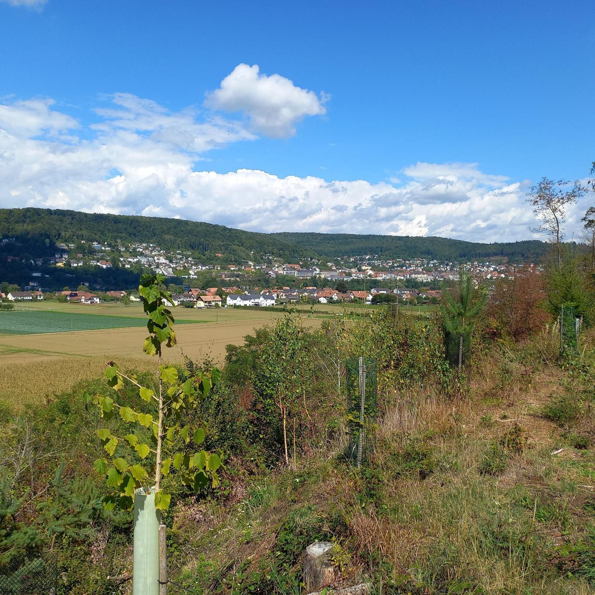
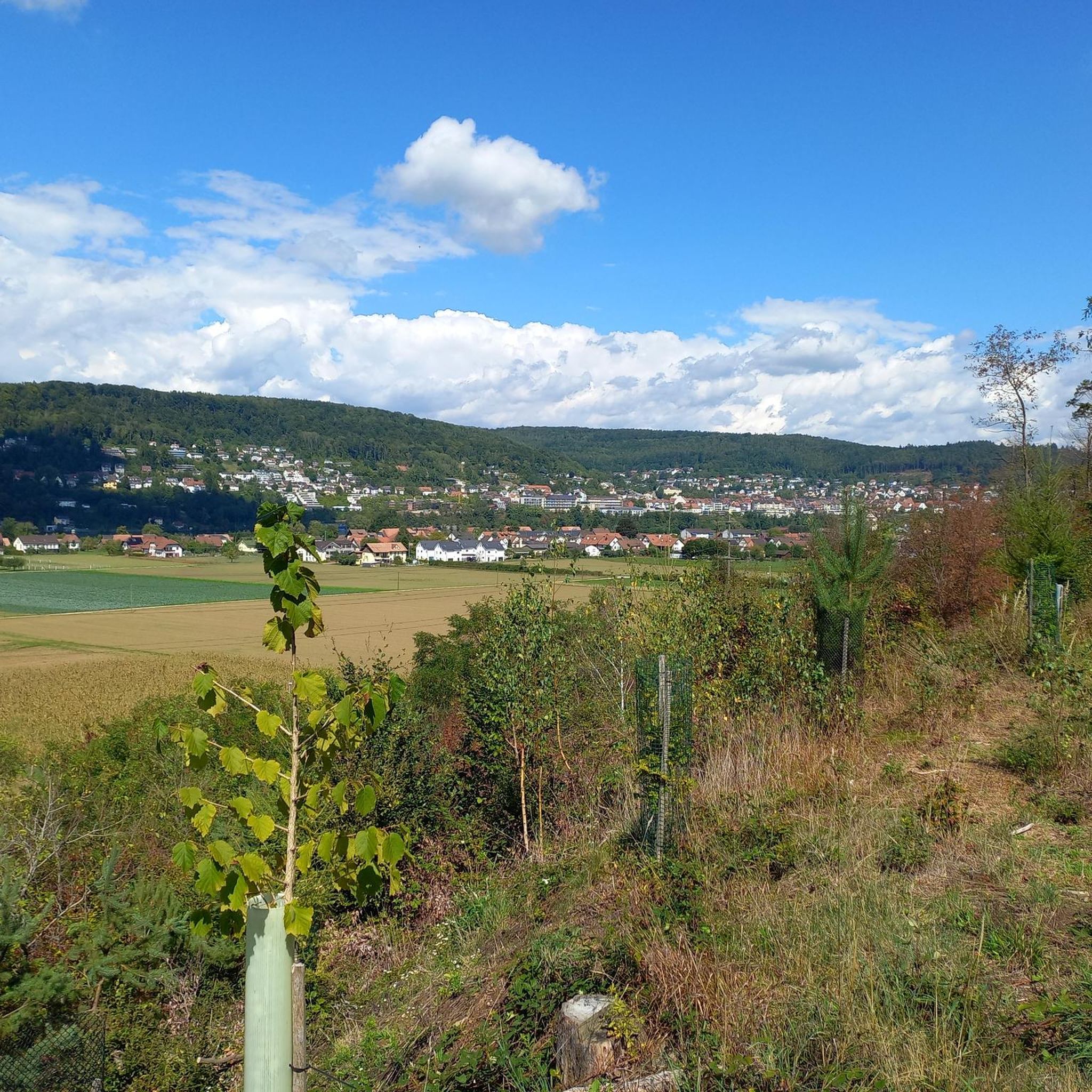
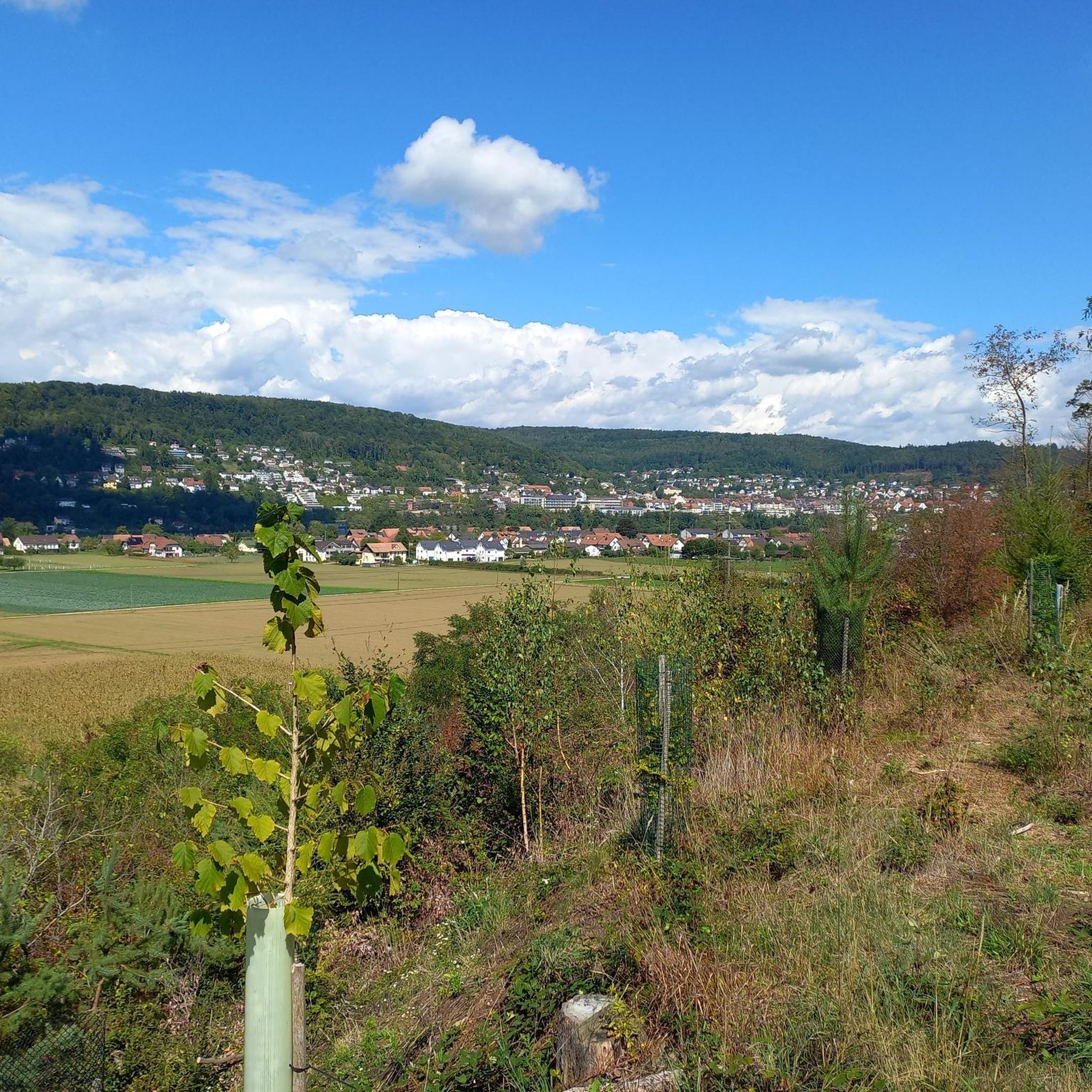
- Another must-see spot is Erli rest area, a parking area located at a pass height. Visitors can relax under treetops and enjoy views of Mandach and the Black Forest.
- Visitors also love Bührersteiger Pass Summit Bunker, a man-made monument and historical site. This location features strategically placed bunkers from World War II, offering an insight into historical fortifications.
- Full-Reuenthal is known for mountain passes that offer cycling routes, viewpoints, and historical sites. The area provides a variety of routes to explore, from paved climbs to locations with historical significance.
- The mountain passes around Full-Reuenthal are appreciated by the komoot community, with 24 upvotes and 3 photos shared by users.
Last updated: September 30, 2026
Bürersteig Pass
Highlight • Mountain Pass
Translated by Google •
Tip by

Serpentine Pass Near Hottwil
Highlight • Mountain Pass
Tip by

Sign up now to discover places like this
Get recommendations on the best single tracks, peaks, & plenty of other exciting outdoor places.
Erli rest area
Highlight • Parking
Translated by Google •
Tip by

Bührersteiger Pass Summit Bunker
Highlight • Monument
Translated by Google •
Tip by
Scenic hairpin bends in Southern Black Forest Nature Park
Highlight • Mountain Pass
Translated by Google •
Tip by

Sign up for free to discover even more mountain passes around Full-Reuenthal.
Already have an account?
Start today with a free account
Your next adventure awaits.
Tips from the Community

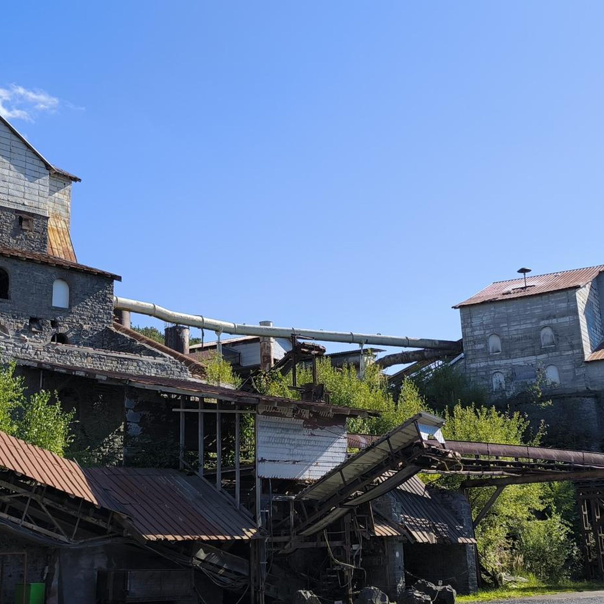
Arrived at the summit of the Bürersteig (550 m above sea level), a versatile hub for cyclists and mountain bikers in the Jurapark Aargau opens up. Those who have mastered the ascent from Mönthal or Gansingen do not have to go directly down the fast descent to Remigen – there is plenty to discover at the top: Discover military history: The Bürersteig fortified position Directly in the area of the pass and in the adjacent forest areas, you will encounter historical concrete structures from the Second World War and the Cold War. Purpose of the facility: The pass was part of the Swiss Army's Bürersteig fortified position. Its mission was to block a potential enemy advance from the Rhine Valley across the Jura towards the Mittelland and the Aare Valley.
1
0

Pleasant gradient, easy to manage. Beware, we are not alone on the road. Especially when going downhill. The route is also popular with motorcyclists and cars, especially on weekends and holidays when the weather is nice.
1
0

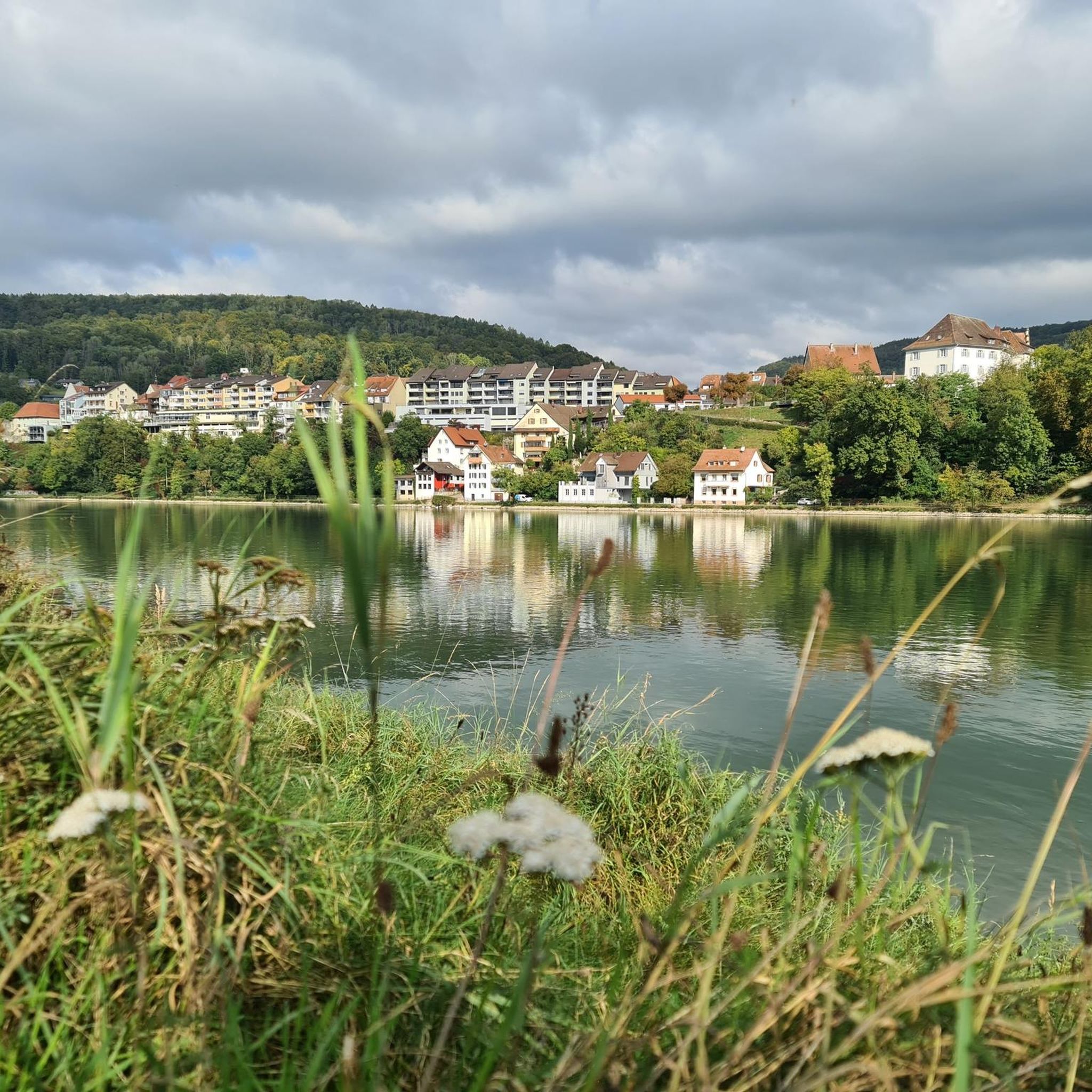
Beautiful view of Mandach and the Black Forest
0
0

I only see so many strategically well-placed bunkers from World War II thanks to the fact that I travel by bike. Interesting how they are small and yet so different.
1
0

Grünegg pass height, small parking lot
1
0
At this intersection, under the treetops, you can relax from your journey and watch the passing cars. Personally, I stop there every time. It's truly special...
2
0

This small beautiful pass is best approached from the village of Hottwil. Excellent smooth asphalt surface with a climb from Hottwil to the base of 3% then increasing to 6-7% for the remainder of the climb. There is not a lot of traffic on this route so it is a real pleasure to ride this route in all seasons and weather.
0
0
Frequently Asked Questions
What kind of terrain can I expect on mountain passes around Full-Reuenthal?
The mountain passes around Full-Reuenthal are not high alpine. Instead, you'll find routes that traverse local hills, agricultural land, and forests, often situated near the Rhine River. The average elevation is around 315 meters above sea level, offering scenic views without the steep, rugged climbs of higher mountain ranges.
Are there any scenic viewpoints along the mountain passes near Full-Reuenthal?
Yes, several spots offer great views. For instance, the Erli rest area provides views of Mandach and the Black Forest. You can also find great views along the Scenic hairpin bends in Southern Black Forest Nature Park and from Schachen Pass, which overlooks a former quarry towards Baldingen.
Are the mountain passes around Full-Reuenthal suitable for cycling?
Absolutely. Many routes are well-suited for cycling. The Serpentine Pass Near Hottwil, for example, features a smooth asphalt surface and a consistent climb with low traffic, making it a pleasure to ride in all seasons.
What is the difficulty level of the mountain passes near Full-Reuenthal?
The passes in this region generally offer intermediate difficulty. While they feature climbs, such as the 3-7% grade on the Serpentine Pass Near Hottwil, they are not as demanding as high alpine routes. Many, like the Scenic hairpin bends in Southern Black Forest Nature Park, are described as having a 'humane slope' and are beautifully landscaped.
Are there family-friendly spots along the mountain passes near Full-Reuenthal?
Yes, the Erli rest area is a family-friendly spot located at a pass height. It offers a small parking lot where you can relax under treetops and enjoy the views, making it a good place for a short break with family.
Where can I find parking when visiting the mountain passes around Full-Reuenthal?
The Erli rest area at Grünegg pass height offers a small parking lot, providing a convenient place to stop and enjoy the surroundings.
What is the best time of year to visit the mountain passes around Full-Reuenthal?
Given the region's lower elevation and the nature of its passes, they can generally be enjoyed in all seasons. Spring and autumn offer pleasant temperatures for cycling and exploring, while summer provides lush green landscapes. Even in winter, some routes remain accessible, especially those with smooth asphalt surfaces like the Serpentine Pass Near Hottwil.
Are there any historical sites along the mountain passes near Full-Reuenthal?
Yes, the Bührersteiger Pass Summit Bunker is a notable historical site. It features strategically placed bunkers from World War II, offering an interesting insight into past fortifications in the area.
What other outdoor activities can I do in the Full-Reuenthal region?
Beyond exploring the passes, the Full-Reuenthal region offers a variety of outdoor activities. You can find numerous MTB Trails, Running Trails, and Road Cycling Routes that traverse the local landscape of agricultural land, forests, and the Rhine River.
Can I find mountain biking trails near Full-Reuenthal's passes?
Yes, the area around Full-Reuenthal is suitable for mountain biking. You can explore various MTB Trails, with options ranging from moderate to difficult, taking you through scenic routes like the 'View from Waldkircher Höhe' or along the Rhine Canal.
Are there running routes available in the Full-Reuenthal area?
The Full-Reuenthal region provides several options for runners. You can find various Running Trails, including routes along the Rhine riverbank, around the Klingnau Reservoir, or shorter loops like the 'Trimm-Dich Path'.
Are there any gravel routes among the mountain passes near Full-Reuenthal?
Yes, Schachen Pass offers a nice gravel route. It features old asphalt in the south and marl in the north, providing a pleasant experience without motor vehicles.
Most popular routes around Full-Reuenthal
Most popular attractions around Full-Reuenthal

Get inspired with the komoot mobile app


Explore more
See even more epic mountain passes by checking out these guides around Full-Reuenthal:
