The best gravel rides around Casabermeja
29
riders
3
rides
Gravel biking around Casabermeja offers access to a diverse and mountainous natural environment within the hills north of Málaga. The region is characterized by its hilly relief, with elevations ranging from 500 to 900 meters, providing panoramic views of the surrounding landscape. It is situated within the Montes de Málaga Natural Park, featuring extensive pine forests, olive groves, and deep valleys carved by the Guadalmedina and Cauche rivers. This varied terrain includes a mix of paved roads, vehicle-width gravel tracks,…
Last updated: May 24, 2026
6
riders
Hard gravel ride. Very good fitness required. Mostly paved surfaces. Suitable for all skill levels.
6
riders
Hard gravel ride. Very good fitness required. Mostly paved surfaces. Suitable for all skill levels.

Sign up for free
2
riders
Hard gravel ride. Very good fitness required. Mostly paved surfaces. Suitable for all skill levels.
Our route recommendations are based on thousands of hikes, rides, and runs completed by other people on komoot.
Start today with a free account
Your next adventure awaits.
Login or Signup
Tips from the Community

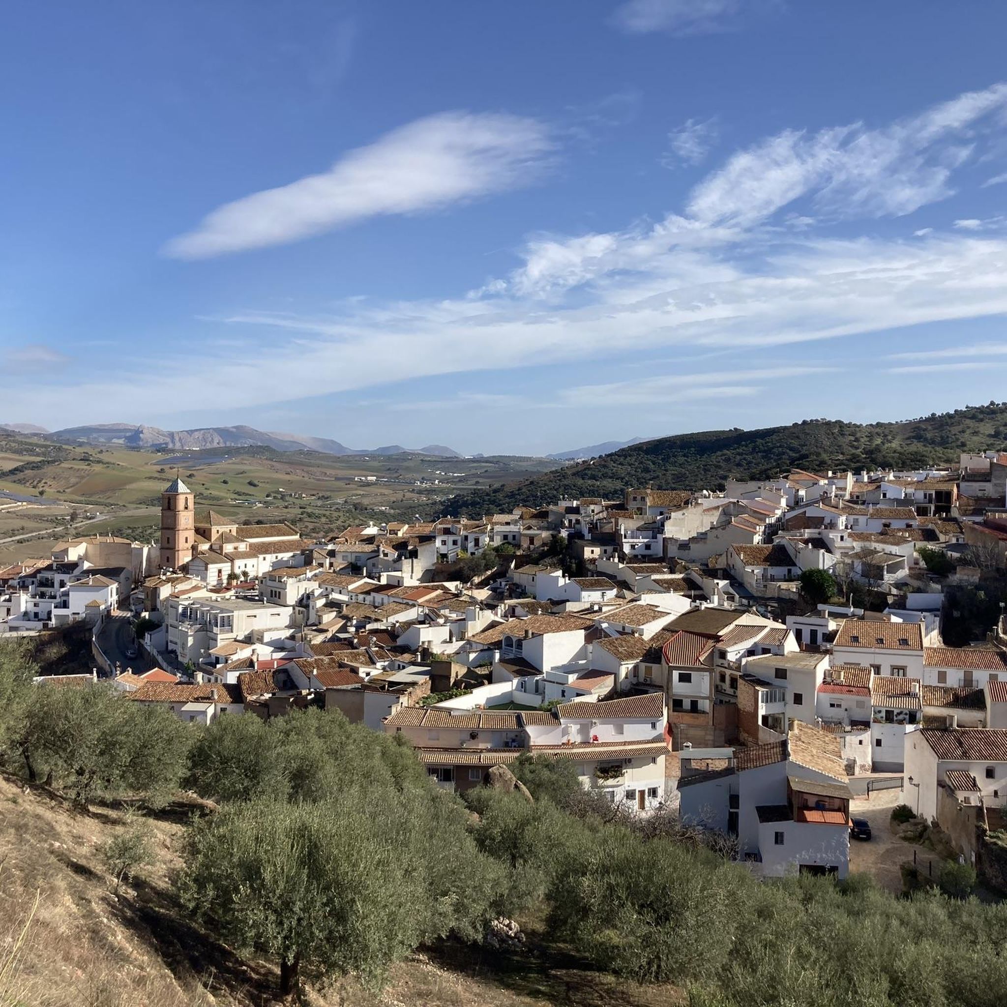
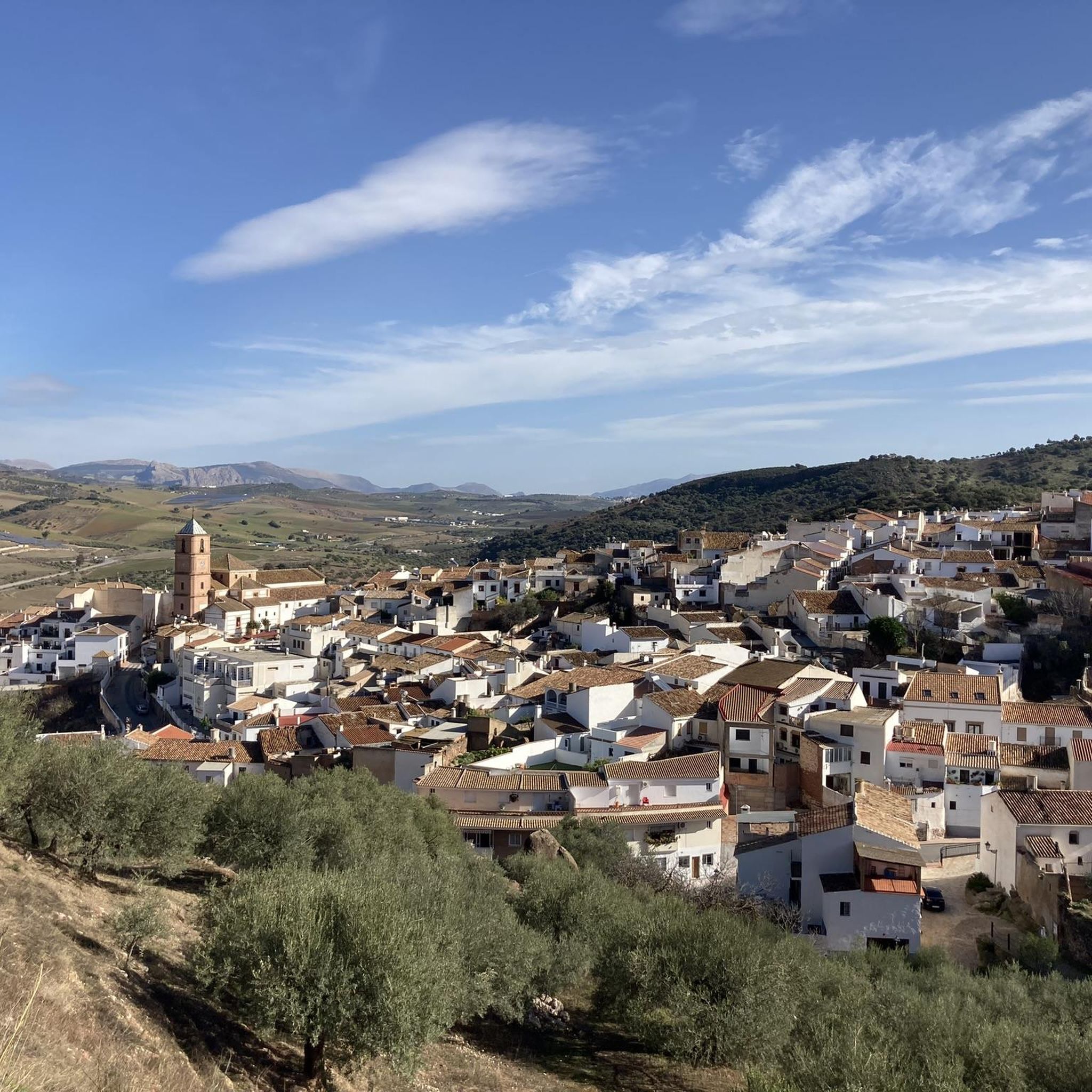
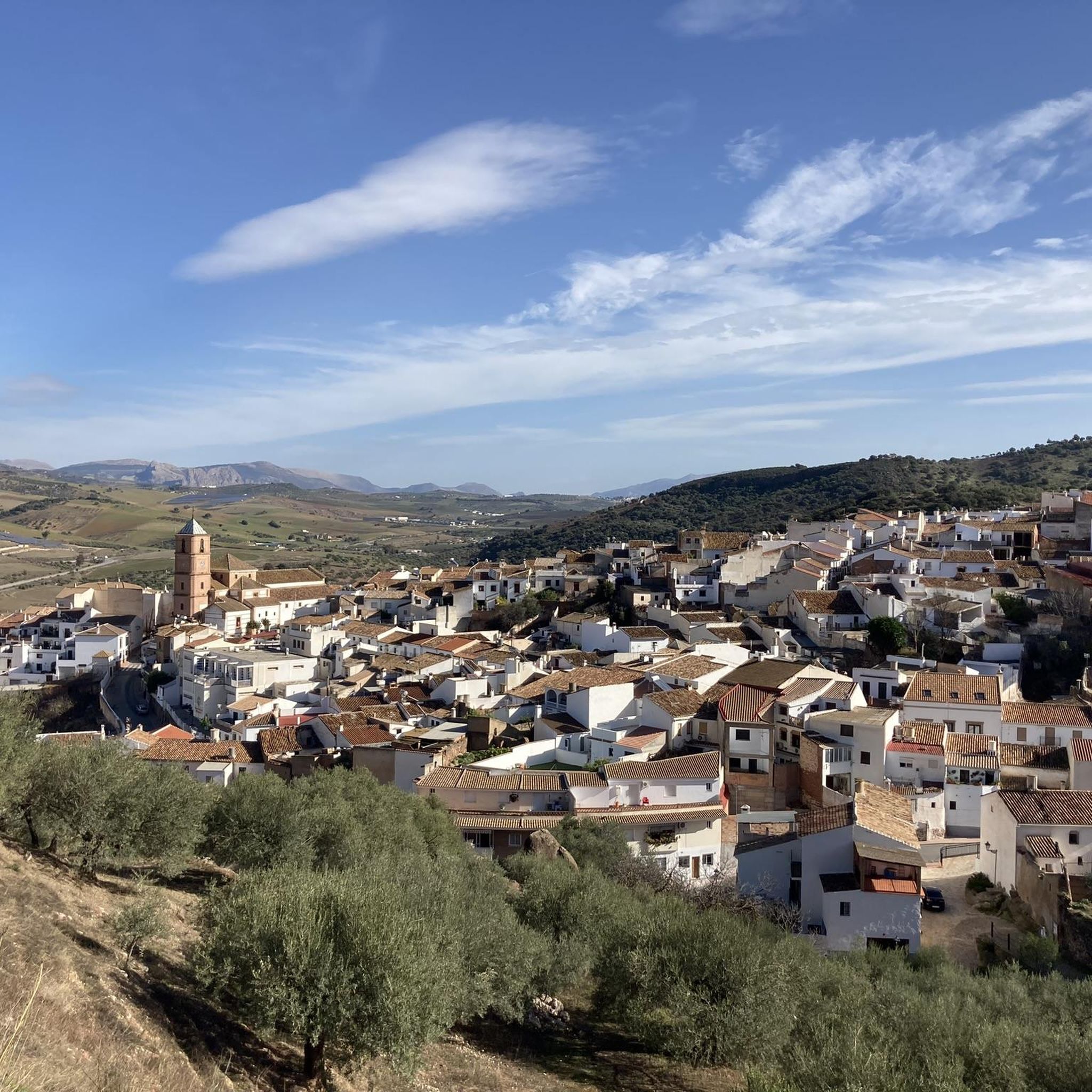
The Mirador offers a sweeping panoramic view of the surrounding hills at the foot of the El Torcal Natural Park. From here, one can see across rolling hills, olive and almond groves, and the expansive valley stretching below the village. In the background, striking rock formations rise, while the village itself is picturesquely nestled into the landscape.
0
0
Located in the Montes de Málaga, this restaurant is an ideal stop for cyclists exploring the region's mountain trails. The restaurant exudes a rustic, traditional atmosphere, with old tools, jerrycans, and platters evoking the area's agricultural past. The menu features hearty, typical regional dishes such as migas (a type of sausage), Plato de los Montes (a regional specialty), and meat and game dishes—perfect for refueling after a strenuous climb. From the terrace and windows, there are sweeping views of the surrounding mountains and valleys, making the break particularly worthwhile. Venta Galwey is therefore not only a place for good food but also for relaxation and enjoying the scenery during a cycling tour through the Montes de Málaga.
1
0
The monument near Colmenar is a stone memorial monolith commemorating José Campos Fontalba, a chief engineer of the province of Málaga. Constructed of roughly hewn natural stone, it takes the form of a stepped base with an inset cross. At its center is a recessed stone plaque bearing his name, profession, and a dedication. The monument stands at the roadside, surrounded by tall cypress trees, and is clearly visible from the road. It conveys the impression of a traditional, solid memorial, a common feature of the first half of the 20th century. Its simple, robust design and the use of local stone blend harmoniously into the landscape of the Montes de Málaga. Overall, it is a typical example of a Spanish road or engineering monument of that era, commemorating both an individual and the importance of public works in a mountainous region. Today, the monument stands as a silent historical witness by the roadside, preserving the memory of the technical and social development of this area.
1
0
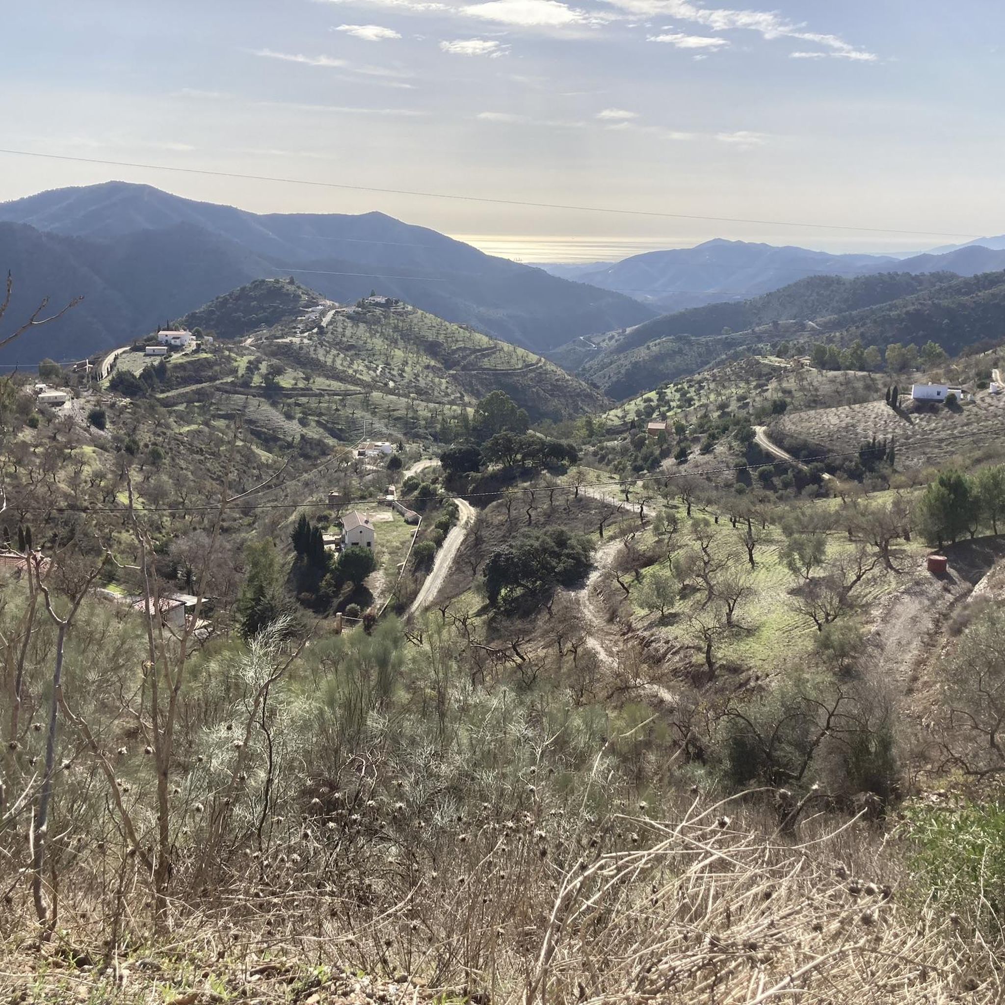
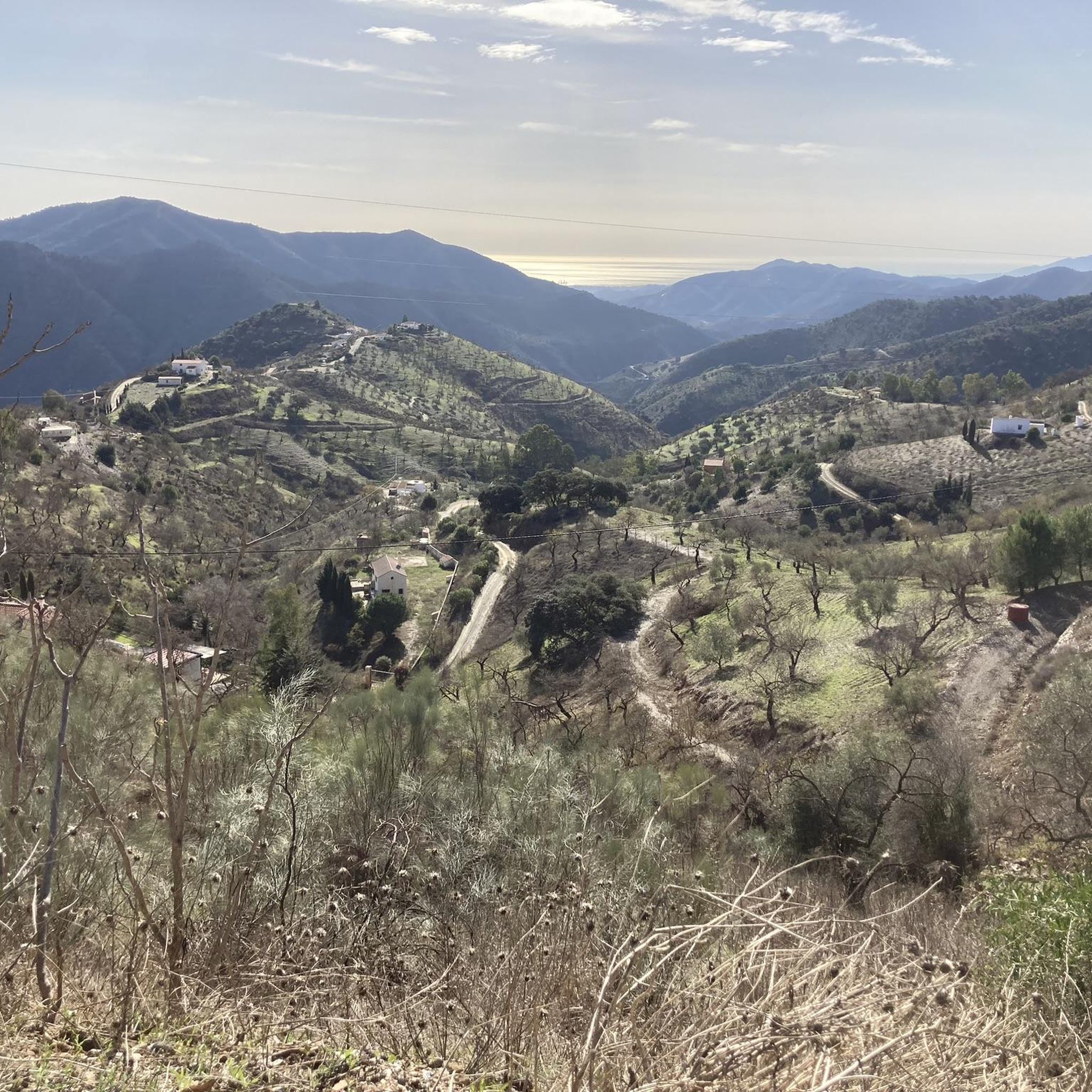
The route follows a winding, scenic road and is particularly rewarding for experienced cyclists. It leads through the rolling hills on the edge of the El Torcal Natural Park, past olive groves and striking rock formations. The constant climbs and descents require some stamina, but are rewarded with sweeping views across the Andalusian landscape. The route is especially atmospheric in the evening when the sun sets behind the mountains and bathes the surroundings in warm, golden light – a spectacular end to a varied stage.
0
0

I was there mid november and the fountain was empty...
0
1
A little refreshment on warm days and an ideal opportunity to refill your water bottles on your bike ride – especially practical and welcome after a climb!
0
0
The Camino Real de Carlos III near Antequera was part of the great royal road built in the 18th century under King Charles III to improve the connection between Madrid and Andalusia. In the region around Antequera, the route ran through a particularly scenic area – along the edge of the Torcal de Antequera, between hills, olive groves, and limestone cliffs. At that time, the route served as an important trade and travel link between the Guadalquivir Valley, Antequera, and the Málaga coast. Today, some sections of the historic Camino Real near Antequera are still recognizable and marked as cycle paths. You can cycle along these old paths through a typical Andalusian cultural landscape of grain fields, olive trees, and whitewashed villages. The section that descends from the Torcal de Antequera towards the city is particularly rewarding, offering magnificent views of the Antequera Valley, the Peña de los Enamorados, and the vast plains extending to the Sierra de las Nieves. The Camino Real was not only a transport link here, but also a symbol of the Enlightenment-style reform spirit of King Charles III, who built roads, post stations, and new villages to develop and modernize Andalusia. Today, the route invites you to hike or cycle along historical trails—between history, nature, and impressive geology.
1
0

I think he's referring to walking alone along the Torrijos Trail. Starting from the wine press, you reach the end of the trail and turn around. This trail is perfectly suitable for children and people who are not in very good physical shape, as there are no steep slopes and you can stop and rest in the areas with benches.
1
0
Frequently Asked Questions
What is the general terrain like for gravel biking around Casabermeja?
The region around Casabermeja offers a diverse and mountainous natural environment, characterized by undulating terrain, significant elevation gains, and a mix of paved roads, vehicle-width gravel tracks, and single-track trails. You'll find extensive pine forests, olive groves, and deep valleys, particularly within the Montes de Málaga Natural Park. The terrain is often dry, dusty, and fast-flowing, with rocky sections and switchbacks, making it ideal for gravel bike adventures.
Are there any easy gravel bike routes suitable for beginners in Casabermeja?
While the routes listed in this guide are generally rated as 'difficult' due to the mountainous terrain and elevation gains, the region does offer varied paths. For beginners, it's advisable to look for shorter sections of wider gravel tracks or less steep climbs. Always check the route profile and difficulty before heading out to ensure it matches your skill level.
What kind of elevation can I expect on gravel bike trails near Casabermeja?
Gravel biking around Casabermeja is defined by its mountainous relief, with elevations ranging from 500 to 900 meters. Routes often feature significant climbs and exhilarating descents. For example, the Royal Road of Charles III – Winding Road with Sunset View loop involves over 900 meters of ascent, while the Hundred‑Spout Fountain – Upper Guadalhorce River Valley loop has over 1400 meters of climbing.
Are there any circular gravel bike routes in the Casabermeja area?
Yes, several routes in the area are designed as loops, allowing you to start and finish in the same location. Examples include the Royal Road of Charles III – Winding Road with Sunset View loop from Villanueva de la Concepción and the Carretera/Serranilla Monolith – Monolith of the Wind loop from Venta Galwey. These circular routes are great for exploring without needing a return trip arrangement.
What natural landmarks or viewpoints can I see along the gravel bike trails?
The Casabermeja area is rich in natural beauty and offers spectacular panoramic views. You can find several viewpoints, such as Repeater viewpoint, which offers expansive vistas. The region is also home to fascinating limestone rock formations, particularly near the Torcal de Antequera, and features like Peñas de Cabrera with prehistoric rock paintings. The Guadalmedina River also contributes to the scenic routes.
What is the best season for gravel biking in Casabermeja?
Given the dry and often warm climate of Andalusia, the best seasons for gravel biking in Casabermeja are typically spring (March to May) and autumn (September to November). During these times, temperatures are milder, and the natural landscapes are vibrant. Summer can be very hot, making early morning or late afternoon rides preferable, while winter offers cooler, but often pleasant, riding conditions.
Are there any family-friendly gravel bike routes in Casabermeja?
While many routes in the immediate Casabermeja area feature significant climbs and are rated as difficult, families might find suitable sections on wider, flatter gravel tracks within the Montes de Málaga Natural Park. It's recommended to look for routes specifically designated as easy or moderate, or to explore shorter, less challenging segments of longer trails that avoid steep ascents and technical descents.
Can I bring my dog on the gravel bike trails around Casabermeja?
Many natural areas and trails in Spain, including those around Casabermeja, are generally dog-friendly, especially if your dog is well-behaved and kept on a leash where necessary. However, always be mindful of local regulations, wildlife, and other trail users. Ensure your dog is fit enough for the distance and terrain, and carry enough water for both of you, especially on longer rides.
Where can I find parking when starting a gravel bike route in Casabermeja?
For routes starting from specific villages or points, you can often find public parking available. For example, routes like the Royal Road of Charles III loop starts from Villanueva de la Concepción, where village parking would be available. Similarly, the Carretera/Serranilla Monolith loop starts from Venta Galwey. Always check the specific starting point of your chosen route for the most convenient parking options.
What do other gravel bikers enjoy most about riding in Casabermeja?
Gravel bikers frequently praise the region for its challenging climbs, open views, and the sense of freedom experienced on its varied terrain. The ability to explore places inaccessible by road alone, often on vehicle-width gravel tracks through traditional white villages and typical Andalusian landscapes, is a major draw. The extensive network of quiet roads and trails within the Montes de Málaga Natural Park is also highly valued.
Are there any places to stop for refreshments or food along the gravel bike routes?
While many routes traverse natural and rural areas, you'll often find opportunities for refreshments in the charming villages you pass through, such as Casabermeja itself or Villanueva de la Concepción. The Hundred‑Spout Fountain loop, for instance, starts from Restaurante Casona los Moriscos, offering a convenient stop. The Fuente de la Reina, a natural water source, is also a popular rest stop for cyclists.
Most popular attractions around Casabermeja

Get inspired with the komoot mobile app


Explore more
Browse the best Gravel rides in other regions.
