The 7 Most Amazing Peaks around Niedert
Best mountain peaks around Niedert offer diverse terrain for outdoor enthusiasts. The region features elevations such as Fleckertshöhe, the highest point in Boppard, and valleys like the Brodenbach, which flows into the Moselle. Visitors can explore various viewpoints and summit crosses, providing insights into the local landscape and history. The area combines natural features with cultural landmarks, making it a destination for exploration.
Best mountain peaks around Niedert
- The most popular mountain peaks is Vogelsnack Summit Cross, a summit…
Last updated: August 6, 2026
Vogelsnack Summit Cross
Highlight • Summit
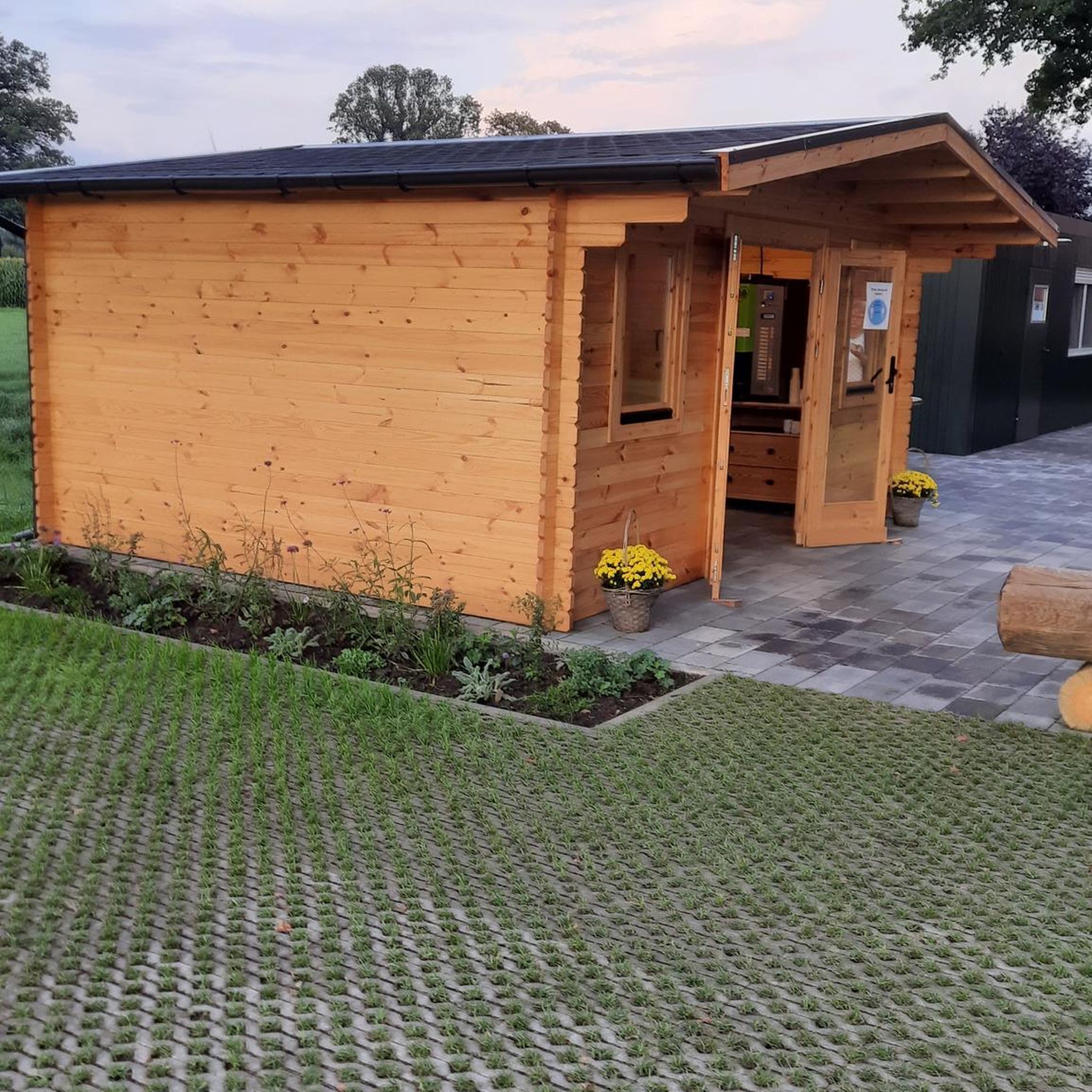
A secured by railing rest area offers a great view, a guest book and a small self-service wine store (was unfortunately empty).
Translated by Google •
Tip by

Summit Cross Aufm Nack
Highlight • Summit
The rock was freed from overgrown vegetation in 2018/19 so that it …
Translated by Google •
Tip by
Sign up now to discover places like this
Get recommendations on the best single tracks, peaks, & plenty of other exciting outdoor places.
Sign up for free
Hohenstein
Highlight • Natural Monument
Translated by Google •
Tip by
View from Fleckertshöhe
Highlight • Viewpoint
Translated by Google •
Tip by

Rheingold View
Highlight • Viewpoint
Translated by Google •
Tip by

Sign up for free to discover even more peaks around Niedert.
Sign up for free
Already have an account?
Start today with a free account
Your next adventure awaits.
Login or Signup
Tips from the Community

Little view, but a wonderfully relaxing spot for a break on the benches.
0
0


From the Fleckertshöhe at a height of about 530 meters you have a wonderful view of the Ehrenthaler Werth.
2
0

A very nice single trail leads to the rock
0
0
Beautiful rest area with a great view... you should really take your time to rest here 😃🥪
0
0

Super nice stop with a wine tavern and a great view
0
0

A little information about the cross erected in 1940 and then renewed in 1946, 1968, 1992 and 2017: The cross (3.30 x 2.00 m) was erected as a sign of resistance against the Nazi ban on church youth organizations as a simple cross on this then hidden place. After the war it was renewed and later received the inscription "Jesus Christ our hope". In the Weseler Bergsteigerlied it says in the refrain: "Yes, yes, at the Vogelsnack the world is still rack there is nature still really pure" Just a personal assumption about the name finding through observation on site: Large flocks of wild birds stay at the foot of the rock - even in winter - and find shelter in the rugged rock, the towering deciduous trees and the lush undergrowth. When I visited down there, there was a loud jumble of chirping.
2
0

really a great rest area with a fantastic view
1
0
Frequently Asked Questions
What are some popular mountain peaks and viewpoints around Niedert?
The region around Niedert features several notable peaks and viewpoints. Among the most popular are the Vogelsnack Summit Cross, known for its imposing rock nose and a secured rest area with views. Another favorite is the Buchhöller Kopf Viewpoint, offering a great view of the Brodenbach valley from a rustic wooden bench on a rocky outcropping.
Are there any family-friendly mountain peaks or viewpoints in the Niedert area?
Yes, for families, the View from Fleckertshöhe is an excellent choice. It is the highest elevation in the city of Boppard and offers views with convenient parking, including spots suitable for mobile homes. The Rheingold View also provides a beautiful panorama of the Rhine Valley and is considered family-friendly.
What kind of natural features can I expect to see on the mountain peaks around Niedert?
The mountain peaks around Niedert offer diverse natural features. You can find imposing rock formations, dense forests, and scenic valleys like the Brodenbach valley. Highlights such as the Vogelsnack Summit Cross are situated on prominent rock noses, while the Buchhöller Kopf Viewpoint provides vistas over the forested Brodenbach valley.
Are there any historical or cultural landmarks on the mountain peaks?
Yes, several peaks feature cultural landmarks. The Vogelsnack Summit Cross has a rich history, originally erected in 1940 as a sign of resistance and renewed multiple times. Similarly, the Summit Cross Aufm Nack, a wooden cross on a large quartzite rock near Wiebelsheim, serves as a visible sign of Christian hope and is a site for annual events like Martinsfeuer.
What outdoor activities can I do near the mountain peaks around Niedert?
Beyond exploring the peaks, the Niedert region offers a variety of outdoor activities. You can find numerous hiking trails, including easy, moderate, and difficult options. There are also extensive routes for road cycling and touring bicycles. For detailed routes, explore the Hiking around Niedert, Road Cycling Routes around Niedert, and Cycling around Niedert guides.
Are there specific hiking trails near these mountain peaks?
Yes, the area around Niedert offers a range of hiking trails. For example, you can find the 'Upper Baybachtal dream loop' which is a moderate 15 km hike, or easier options like the 'Dream Loop Upper Baybach Valley – Kehlenmühle loop' at 4.6 km. More challenging routes like the 'Baybachklamm Waterfall – Baybach Tree Trunk Bench loop' are also available. You can find more details in the Hiking around Niedert guide.
What do visitors enjoy most about the mountain peaks in Niedert?
Visitors particularly appreciate the stunning views and the natural beauty of the area. Many enjoy the secured rest areas at viewpoints like the Vogelsnack Summit Cross, which even features a small self-service wine store. The panoramic views of the Rhine and Brodenbach valleys from various points are also highly praised, offering inspiring and captivating experiences.
Is there parking available near the mountain peaks?
Yes, some locations offer convenient parking. For instance, the View from Fleckertshöhe provides parking that is also suitable for mobile homes, complete with tables and benches for a break.
What is the highest point in the Niedert region?
The highest elevation in the city of Boppard, which is part of the Niedert region, is the View from Fleckertshöhe, standing at 531 meters above sea level. It offers expansive views and is easily accessible.
Are there any unique features at the summit crosses in Niedert?
The summit crosses in Niedert often have unique characteristics. The Vogelsnack Summit Cross is notable for its location on an imposing rock nose and its small self-service wine store. The Summit Cross Aufm Nack is situated on a large quartzite rock with historical tunnels and is a focal point for local traditions like the annual Martinsfeuer.
Can I find viewpoints with benches for resting?
Absolutely. The Buchhöller Kopf Viewpoint features a rustic but stable wooden bench on a rocky outcropping, perfect for taking a break while enjoying the view of the Brodenbach valley. The Vogelsnack Summit Cross also has a secured rest area with seating.
What kind of cycling routes are available near the mountain peaks?
Near the mountain peaks, you can find a variety of cycling routes for different preferences. Options range from easy touring bicycle routes like the 'Welcome sign of Norath – View of the Hunsrück loop' to more challenging road cycling routes such as the 'Pfalzfeld Railway Station – Gleis 3 Café & Restaurant loop'. Explore these and more in the Road Cycling Routes around Niedert and Cycling around Niedert guides.
Most popular routes around Niedert
Most popular attractions around Niedert

Get inspired with the komoot mobile app


Explore more
See even more amazing summits around Niedert with these guides:
