The best gravel rides around Pietraporzio
4.8
(8)
150
riders
4
rides
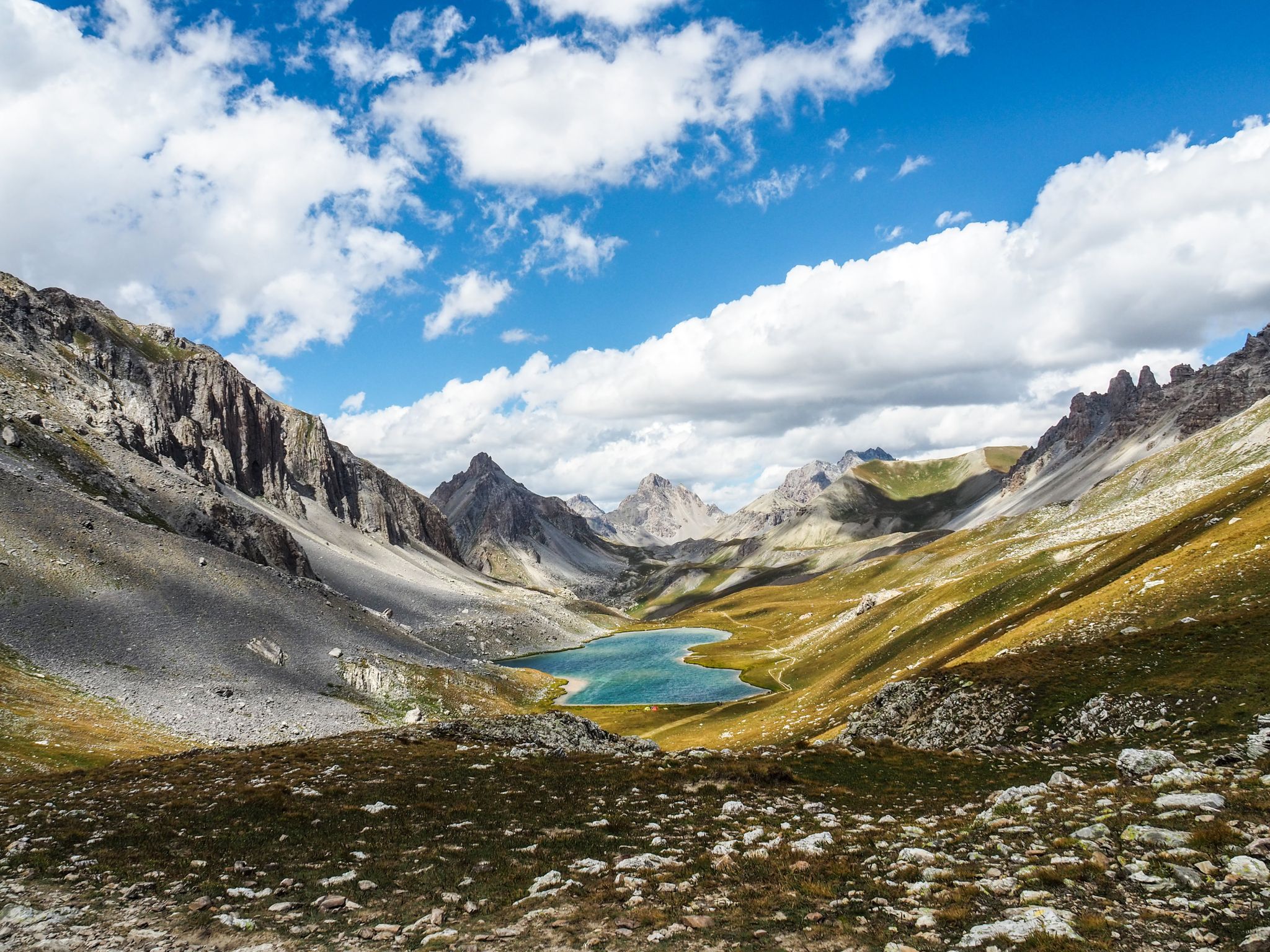
Gravel biking around Pietraporzio offers diverse terrain within Italy's Stura Valley, characterized by dramatic alpine landscapes and high ridges. The region features a network of white roads, gravel, and dirt roads, providing varied surfaces for cycling. Riders encounter mountainous terrain with treeless peaks and an exuberant watercourse, alongside challenging passes and plateaus. This environment is suitable for gravel cyclists seeking both demanding routes and scenic views.
Best gravel bike trails around Pietraporzio
- The most popular gravel bike trail is Devil's…
Last updated: October 31, 2026
4.5
(4)
90
riders
85.1km
06:35
2,630m
2,630m
Hard gravel ride. Very good fitness required. Mostly paved surfaces.
5.0
(1)
40
riders
Hard gravel ride. Very good fitness required. Mostly paved surfaces.

9
riders
26.8km
02:40
1,000m
1,000m
Hard gravel ride. Very good fitness required. Mostly paved surfaces.
4.5
(2)
7
riders
82.9km
07:05
3,020m
3,010m
Hard gravel ride. Very good fitness required. Mostly paved surfaces.
2
riders
44.3km
04:11
1,520m
1,520m
Hard gravel ride. Very good fitness required. Mostly paved surfaces.
Our route recommendations are based on thousands of hikes, rides, and runs completed by other people on komoot.
Start today with a free account
Your next adventure awaits.


Other adventures around Pietraporzio

Tips from the Community

Leisurely place at the beginning of the route to Mercantour National Park
0
0

Built in the 19th century to block potential French invasions, and never used in that sense, it remains a beautiful example of military architecture, which has given its current identity to the town of Vinadio (which also has other points of interest). A visit is mandatory.
0
0
A country centered on its fort, but which also reveals other beauties worth seeking out deliberately.
0
0
The Albertine Fort of Vinadio is a 19th-century work that characterizes the Stura di Demonte Valley and constitutes the deep identity of Vinadio (which also shows other points of interest). Beautiful from the outside, definitely worth visiting inside too.
0
0

I rode up to the Col de Moutiere from Saint Etienne via Saint Dalmas, and then took the 3km of gravel road link to the Col de la Bonette. I returned to Saint Etienne via the more classic D64. It makes for a much quieter, wilder and steeper ascent, with a better (but busier) road surface and more gradual decline for the D64 descent. Also this way it's a loop and you see more of the incredible scenery. The 3km gravel section is very doable with my moutain bike (i would rate it as a 'blue'). I didnt need to carry or push the bike even though some parts were boken up by small water crossings. I was overtaken by a motorbike at one point. Be careful of the weather here, especially the potentially violent afternoon thunderstorms. There is no shelter nearby
0
0

A splendid isolated pass accessible from Saint-Dalmas-le-Selvage, it allows an off-road ascent of the Bonette, passing through the sublime valleys of Sestrière and Sagnas to the pass itself, then via a beautiful gravel track under the north side of the Cime de la Bonette which joins the departmental road towards Jausiers, about two kilometers below the summit.
0
0
If there were a ranking of the most beautiful, undiscovered Alpine passes in the cycling world, the Moutière would certainly be a contender. Starting from Saint-Dalmas-le-Selvage, the climb through the valleys of Sestrière and Sagnas is simply sublime.
1
0
One of the most beautiful ways to reach the Bonette Pass from Saint Delmas le Selvage via the Col de la Moutière. Wild and isolated, the surroundings are breathtaking. However, be prepared for a long and difficult climb.
0
0
Frequently Asked Questions
What kind of terrain can I expect on gravel bike trails around Pietraporzio?
Pietraporzio, located in Italy's Stura Valley, offers a diverse mix of terrain. You'll encounter extensive networks of white roads, gravel, and dirt roads. The region is characterized by dramatic alpine landscapes, high ridges, and mountainous areas with treeless peaks, providing both challenging climbs and scenic views. Expect varied surfaces, including demanding sections with steep gradients.
What is the general difficulty level of gravel biking routes in Pietraporzio?
The gravel biking routes around Pietraporzio are generally considered challenging. They often feature significant elevation gain and traverse high-altitude passes. For example, routes like Devil's Bridge of Dronero – Birrone Pass loop involve nearly 3,000 meters of ascent over 111 kilometers, making them suitable for experienced gravel bikers.
Are there any loop routes available for gravel biking in Pietraporzio?
Yes, several loop routes are available. An example is the challenging Col de la Lombarde – Col de la Lombarde loop, which covers over 82 kilometers with significant elevation. Another option is the The Demandols cow sheds – Estive Lake loop, a shorter but still demanding 26.9 km ride.
What are some notable natural features or landmarks I might see while cycling in the Stura Valley?
The Stura Valley is rich in natural beauty and historical sites. You can encounter dramatic alpine landscapes, high ridges, and treeless mountains. Specific natural highlights include the Preit Pass and Colle Fauniera, both offering expansive mountain vistas. You might also pass by Lago Nero (Valle Maira) or the Refuge de Vens. Historical remnants like the Bandia barracks, dating back to World War II, are also found amidst the mountain scenery.
What is the best time of year for gravel biking in Pietraporzio?
The best time for gravel biking in Pietraporzio is typically during the warmer months, from late spring to early autumn. The region features high-altitude passes, which means snowmelt can affect trail accessibility in spring. Always check local weather conditions and trail status, especially for higher elevations, before planning your ride.
Are there any family-friendly gravel biking options near Pietraporzio?
The routes directly around Pietraporzio, as highlighted in this guide, are generally classified as difficult due to significant elevation gain and challenging terrain. While the broader Stura Valley may offer easier sections, these specific routes are more suited for experienced gravel bikers. For family-friendly options, it's advisable to look for flatter, less technical paths in lower valley areas or dedicated bike parks.
What do other gravel bikers say about their experience in Pietraporzio?
The gravel biking experience in Pietraporzio is highly rated by the komoot community, with an average score of 5.0 stars from 4 reviews. Over 80 gravel bikers have used komoot to explore the area, often praising the stunning alpine scenery, the extensive network of gravel and dirt roads, and the challenging nature of the routes.
Where can I find parking facilities for my bike in Pietraporzio?
While specific parking facilities for cyclists in Pietraporzio are not detailed in the route information, many routes start from designated parking areas. For example, the Devil's Bridge of Dronero – Birrone Pass loop starts from Parcheggio P2 Gardetta, and the Col de la Lombarde loop begins from Parking 1745. It's recommended to check the starting points of individual routes for specific parking information.
Are there any cultural attractions or ecomuseums near the gravel trails?
Yes, a few kilometers from Pietraporzio, in the hamlet of Pontebernardo, you can find the Ecomuseum of Pastoralism. This offers a cultural insight into the region's heritage and provides an interesting stop for those looking to explore off the bike.
What kind of views can I expect from the high-altitude passes?
The high-altitude passes in the Pietraporzio area, such as the Gardetta Pass (over 2,400 meters) and Colle del Preit (over 2,000 meters), offer breathtaking and expansive mountain vistas. You'll experience treeless mountains, alpine scenery, and unique geological formations like the 'lunar' rock formations on the Gardetta plateau.
Are there any specific routes that feature waterfalls or significant watercourses?
The Stura Valley is known for its 'exuberant watercourse.' While specific waterfalls are not detailed for every route, the Gravel track Col de la Bonette – The Waterfall - Torrent de Vens loop explicitly mentions 'The Waterfall' and 'Torrent de Vens' in its name, indicating a focus on water features along this challenging route.
How long are the gravel biking routes typically in Pietraporzio?
The gravel biking routes in Pietraporzio vary in length, catering to different endurance levels. They range from shorter, yet still challenging, options like the Estive Lake – Pose coffee loop at around 16 kilometers, to much longer, epic rides such as the Devil's Bridge of Dronero – Birrone Pass loop which spans over 111 kilometers.
Most popular routes around Pietraporzio
Most popular attractions around Pietraporzio

Get inspired with the komoot mobile app


Explore more
Browse the best Gravel rides in other regions.
