The best gravel rides around Champey
3.7
(3)
27
riders
5
rides
Gravel biking around Champey features a diverse landscape of rolling hills, forested sections, and open agricultural areas. The region offers a network of routes that combine paved surfaces with dedicated gravel paths, providing varied terrain for cyclists. Riders can expect routes with both challenging climbs and more scenic, undulating trails. The area's natural features include local lakes and canals, contributing to a varied cycling experience.
Best gravel bike trails around Champey
- The most popular gravel bike trail is Four Ends…
Last updated: September 30, 2026
8
riders
Hard gravel ride. Very good fitness required. Mostly paved surfaces. Suitable for all skill levels.
2
riders
57.4km
03:57
760m
760m
Hard gravel ride. Very good fitness required. You may need to push your bike for some segments of this route.

3.0
(1)
4
riders
27.1km
01:39
290m
290m
Moderate gravel ride. Good fitness required. Mostly paved surfaces. Suitable for all skill levels.
2
riders
62.1km
04:17
740m
740m
Hard gravel ride. Very good fitness required. Mostly paved surfaces. Suitable for all skill levels.
3
riders
34.0km
02:04
420m
420m
Moderate gravel ride. Good fitness required. Mostly paved surfaces. Suitable for all skill levels.
Our route recommendations are based on thousands of hikes, rides, and runs completed by other people on komoot.
Start today with a free account
Your next adventure awaits.
Tips from the Community

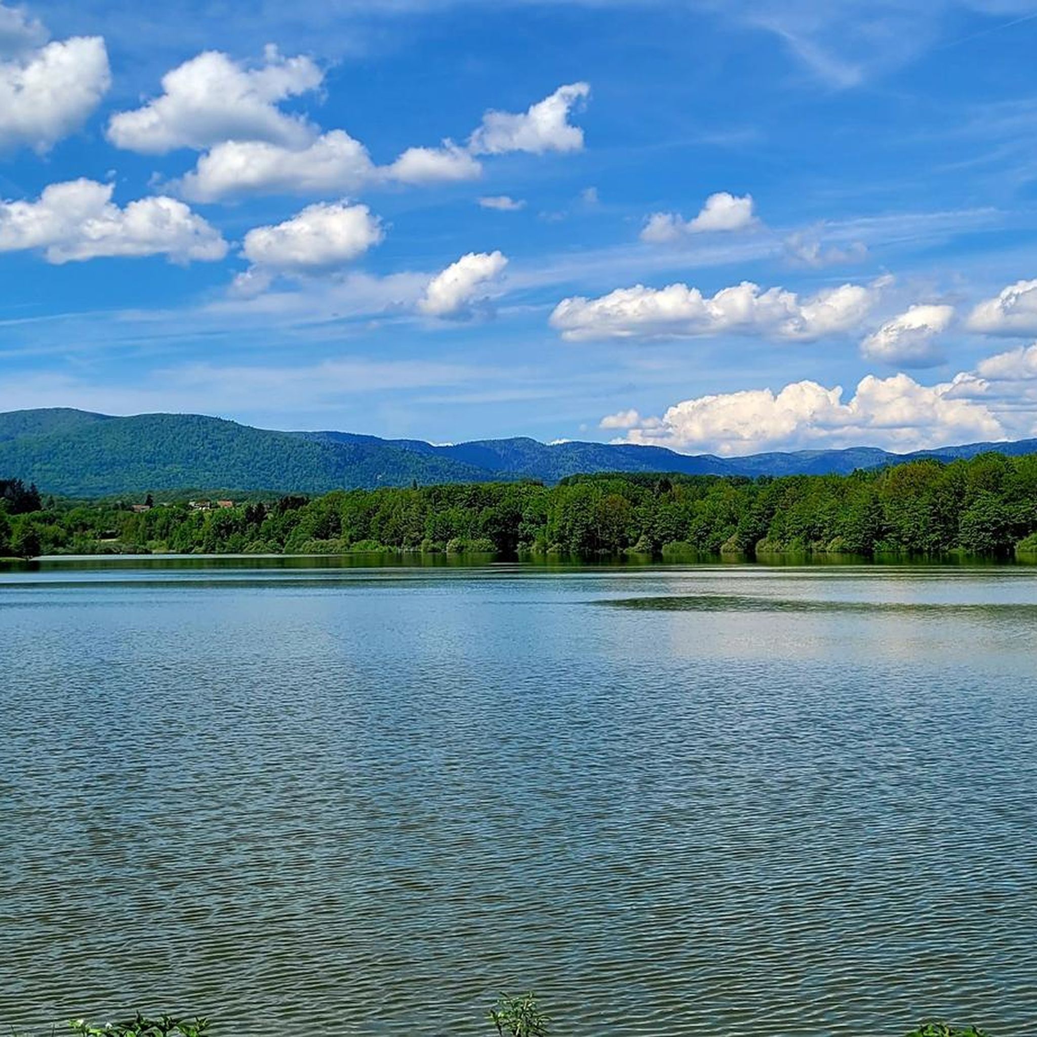
The dam is an impressive piece of historical engineering: it is 785 meters long and rises 41 meters from the foundation. Walking on or along the dam offers a wide view of the deep blue water and the surrounding forests. Nice for cycling along the dam!
4
0
The Bassin de Champagney (or Champagney Reservoir) is an impressive artificial reservoir with a surface area of 107 hectares, located in the French department of Haute-Saône (Bourgogne-Franche-Comté region). The reservoir is situated in the southern foothills of the Vosges and was built between 1882 and 1905 to supply water to the never fully completed Canal de la Haute-Saône. Today, the lake has a capacity of 13 million m³ and is a popular destination for nature lovers, hikers, and fishermen.
4
0
This large lake is a popular stop along the cycling routes around Belfort, with beautiful views over the water and the surrounding nature.
4
0
The Étang du Malsaucy (often also called Lac du Malsaucy) is, with an area of 55 hectares, the largest lake in the French department of Territoire de Belfort. It is nestled in the Parc naturel régional des Ballons des Vosges, spread across the municipalities of Évette-Salbert, Lachapelle-sous-Chaux, and Sermamagny. Originally built at the end of the 15th century for fish farming, it is now one of the most important recreational and natural areas in the region.
4
0
A comfortable, car-free and beautiful cycle path to Lac du Malsaucy, one of the most beautiful recreational areas of the Territoire de Belfort.
1
0
La Planche des Belles Filles is a 5.8 kilometer climb. It is a category 1 climb. It is located in Plancher Les Mines, Franche-Comté, France. The average gradient of this climb is 8.6% with a maximum of 13.6%. La Planche des Belles Filles climbs from 527 meters at the start to 1,033 meters at the summit, for a total elevation gain of 506 meters.
5
0
This 5.9-kilometer climb from the village of Plancher-les-Mines in Haute-Saône is one of the most difficult in the Vosges. Indeed, cyclists who want to try it will need to be at least somewhat trained. With a gradient of 24% towards the end of the route, it's better to be well-attached. The gradient never seems to ease, with its hairpin bends and, upon reaching the resort, the last 2 kilometers rise like a wall. However, you'll be able to say that you've done it, so come and try the climb of La Planche too!
6
0

It starts gently... but that's just the beginning.
1
0
Frequently Asked Questions
How many gravel bike trails are available around Champey?
There are 4 gravel bike trails around Champey, offering a diverse range of experiences for cyclists. These routes are highly rated by the komoot community, with an average score of 4.5 stars.
What kind of terrain can I expect on gravel bike trails in Champey?
Gravel biking around Champey features a varied landscape of rolling hills, forested sections, and open agricultural areas. Routes combine paved surfaces with dedicated gravel paths, offering both challenging climbs and more scenic, undulating trails. You'll encounter diverse terrain, including local lakes and canals.
Are there any easy or beginner-friendly gravel routes in Champey?
While many routes in Champey offer a challenge, there are options suitable for varying fitness levels. For instance, the Malsaucy cycling link – Lac du Malsaucy loop from Échavanne is a moderate 20.3-mile trail, and the Duck on the Canal – WWII - memory monument loop from Châlonvillars is another moderate option, making them good choices for those looking for a less strenuous ride.
What are some notable natural landmarks or attractions I can see along the gravel routes?
Along the gravel routes, you can explore various points of interest. The Malsaucy cycling link – Lac du Malsaucy loop from Échavanne takes you through areas around Lac du Malsaucy. You might also encounter the Champagney Dam or the tranquil Réchal Pond. For historical sites, consider visiting the Mont Vaudois Fort or the Dolmen de Brevilliers.
Are there any circular gravel bike routes in Champey?
Yes, all the gravel bike routes listed for Champey are designed as loops, allowing you to start and finish at the same point. Examples include the Four Ends Boundary Stone – Super directional cycle path! loop from Montenois and the Lac du Malsaucy – Véronne Pond loop from Châlonvillars.
What is the best time of year to go gravel biking in Champey?
The region around Champey in France offers pleasant conditions for gravel biking during spring, summer, and early autumn. These seasons generally provide milder weather and lush landscapes. Winter conditions can vary, so it's advisable to check local forecasts for snow or ice, especially on higher elevation sections.
Are there options for parking near the gravel bike trails in Champey?
While specific parking areas are not detailed for each route, many trailheads in rural French regions like Champey often have designated parking, especially in or near villages like Montenois, Échavanne, or Châlonvillars, where several routes begin. It's recommended to check the starting point of your chosen route on komoot for more precise parking information.
Can I find cafes or restaurants along the gravel bike routes in Champey?
The region around Champey, France, features small towns and villages where you can often find local cafes and restaurants to refuel. While specific establishments aren't listed for each trail, routes starting or passing through places like Montenois, Échavanne, or Châlonvillars are likely to offer opportunities for a break and refreshments.
What do other gravel bikers enjoy most about gravel biking in Champey?
The area is highly rated by the komoot community, with an average score of 4.5 stars from over 2 reviews. Reviewers often praise the diverse terrain, which includes rolling hills, forested paths, and open countryside, as well as the varied experience offered by routes that combine paved and dedicated gravel sections.
Are there any challenging gravel bike routes for experienced riders?
Yes, Champey offers several challenging routes for experienced gravel bikers. The Four Ends Boundary Stone – Super directional cycle path! loop from Montenois is a difficult 27.4-mile trail with significant elevation gain. Another demanding option is the Super directional cycle path! – Voujeaucourt Lock loop from Montenois, a difficult 23.0-mile path known for its sustained climbs.
Is public transport available to access the gravel bike trails in Champey?
Access to trailheads in rural areas like Champey, France, often relies more on personal vehicles. While some regional bus services might connect larger towns, direct public transport links to specific gravel trail starting points may be limited. It's advisable to research local transport options for your specific starting location if you plan to use public transport.
Most popular attractions around Champey

Get inspired with the komoot mobile app


Explore more
Browse the best Gravel rides in other regions.
