Easy hikes and walks in Perry County
4.7
(11)
153
hikers
17
hikes
Easy hiking trails in Perry County, Pennsylvania, offer diverse landscapes characterized by narrow valleys, steep ridges, and extensive forested areas. The region is situated between the Susquehanna River and the Blue Mountain range, contributing to its varied topography. Hikers can explore a network of trails that traverse woodlands, provide views of waterways, and feature gentle elevation changes suitable for easy excursions.
Best easy hiking trails in Perry County
- The most popular easy hiking route is Ouachita and Lake Sylvia Trail, a 4.5 miles (7.2 km) trail that takes 1 hour 59 minutes to complete. This route features a loop around Lake Sylvia with gentle ascents.
- Another top favourite among local hikers is Seven Hollows Trail, an easy 4.1 miles (6.6 km) path. This trail leads through scenic hollows and offers varied natural features.
- Local hikers also love the Ouachita Trail: Highway 9 to Nancy Mountain Shelter, a 2.3 miles (3.8 km) trail leading through forested terrain, often completed in about 1 hour 4 minutes.
- Hiking in Perry County is defined by forested paths, river views, and gentle hills, with options for various ability levels.
- The routes in Perry County are highly rated by the komoot community with an average score of 4.8 stars from 9 reviews. More than 100 hikers have used komoot to explore Perry County's varied terrain.
Last updated: August 3, 2026
6
hikers
7.20km
01:59
110m
140m
The Ouachita and Lake Sylvia Trail offers a delightful, easy hike through the varied landscapes of the Ouachita National Forest. You'll wander through open hardwood forests, sections of unbroken pine, and past rocky outcroppings, with clear running streams adding to the serene atmosphere. Keep an eye out for the scenic View of Lake Winona, a highlight along this peaceful route.
This 4.5-mile (7.2 km) trail, with a gentle 363 feet (111 metres) of elevation gain, is easily accessible from the Lake Sylvia Recreation Area. It's rated as easy and takes approximately 1 hour and 58 minutes to complete, making it a great option for families or anyone seeking a relaxed outdoor experience. Arriving early can help secure parking, especially on busy days.
Beyond the trail itself, the Lake Sylvia Recreation Area is a hub for outdoor activities, including swimming, fishing, and picnicking. The area is also home to the historic Camp Ouachita, a Civilian Conservation Corps-constructed Girl Scout camp from the 1930s, offering a glimpse into the region's past. This trail provides an excellent introduction to the natural beauty and history of the Ouachita National Forest.
1
hikers
604m
00:11
30m
0m
The Flatside Pinnacle Spur Trail delivers massive views for minimal effort, making it a standout in the Ouachita Mountains. You'll wind through pine and hardwood forests before the terrain gets rockier and steeper, leading to the 1,550-foot Flatside Pinnacle. From there, you're treated to expansive vistas of the Ouachita Mountains, including Forked Mountain and White Oak Mountain, which are anything but flat. This easy hiking route covers just 0.4 miles (0.6 km) with 108 feet (33 metres) of elevation gain, typically taking only 11 minutes to complete.
Planning your visit is straightforward; the trailhead is easily accessible, and the drive along Scenic Highway 7 is scenic itself. This trail is family-friendly and dog-friendly, making it a great option for a quick outing. For the best experience, consider visiting in the fall for vibrant colors or in the spring for wildflowers. The west-facing outlook also makes it an ideal spot to catch a dramatic sunset.
Flatside Pinnacle is a significant natural landmark within the Ouachita National Forest, known for offering one of the most accessible and rewarding overlooks in the region. It's a spur off the much longer Ouachita Trail, and a plaque at the trailhead honors Senator Dale Bumpers' conservation efforts. This trail is perfect for beginners or anyone seeking a high-reward hike without a strenuous journey.

Sign up for free
1.14km
00:19
10m
10m
Explore the unique geology of Bear Cave Trail, an easy hike that winds through massive sandstone boulders and bluff formations. This 0.7-mile (1.1 km) route involves a gentle 49 feet (15 metres) of elevation gain, taking about 18 minutes to complete. You will navigate a natural maze, walking under and around ancient rocks, with a highlight being the 'Eye of the Needle,' a very narrow opening to experience.
When planning your visit, remember that while the trail is easy, it does include some steps and rocky sections. Wearing sturdy shoes is a good idea, especially if you plan to explore the various rock formations. The trail is generally accessible and suitable for most visitors looking for a quick outdoor adventure.
This trail is notable for its distinctive landscape, where wind and water have sculpted the sandstone into impressive shapes, some reaching 50 feet high. It offers a close-up look at the geological forces that shaped the area, providing a memorable experience within Petit Jean State Park.
2.30km
00:35
0m
0m
Embark on an easy hike along the Tucker Creek Trail, a paved multi-use path that stretches for 1.4 miles (2.3 km). You will find yourself surrounded by lush greenery as the route gently winds alongside the tranquil waters of Tucker Creek. The trail is mostly tree-lined, providing ample shade, and you will cross several charming bridges over the creek. This pleasant outing involves a minimal elevation gain of just 14 feet (4 metres) and takes approximately 34 minutes to complete, making it perfect for a quick, refreshing walk. Keep an eye out for unique mosaics and painted animal footprints that add a touch of whimsy to your journey.
Maintained by Conway Parks and Recreation, the Tucker Creek Trail offers convenient amenities for your visit. You will find restrooms, picnic tables, and doggie doo stations along the route, ensuring a comfortable experience. While parts of the trail pass through urban areas, new crosswalks with motion-activated lighting enhance safety. Certain sections are also well-lit, allowing you to enjoy the trail even after sunset.
This multi-use path is ideal for a leisurely stroll or a brisk walk, offering a peaceful escape within the city. The serene views and natural surroundings make it a popular choice for observing local flora and fauna. Whether you are looking for a short exercise break or a quiet moment outdoors, the Tucker Creek Trail provides an accessible and enjoyable option for everyone.
3.75km
01:04
130m
0m
This section of the Ouachita Trail, from Highway 9 to Nancy Mountain Shelter, offers a delightful and accessible hike through the eastern Ouachita Forest. You'll follow a hard-packed path that gently winds around ridgelines and saddles, providing continuous, mild ascents and descents. The scenery is particularly charming around Nancy Mountain, featuring flowing creeks, lush moss, and the promise of wildflowers and blooming trees in the spring, making it a truly picturesque experience.
Planning your visit is straightforward, as accessibility from Highway 9 is noted as very easy. This makes it a convenient option for a quick outdoor adventure. While specific parking information isn't detailed, the easy access suggests a hassle-free start to your hike. Consider a spring visit for the best chance to see wildflowers, or autumn for vibrant fall foliage.
This segment is part of the extensive 223-mile Ouachita Trail, which is the longest trail within the Ouachita National Forest. The Nancy Mountain Shelter itself is a notable feature, an Adirondack-type structure providing amenities like a picnic table and fireplace, and even cell service. It's considered one of the oldest and most scenic parts of the trail, offering a remote feel and opportunities for solitude on an easy 2.3-mile (3.8 km) hike with 418 feet (128 metres) of elevation gain, typically taking just over an hour.
4.7
(6)
43
hikers
6.55km
01:48
110m
110m
The Seven Hollows Trail offers an easy hiking experience through diverse landscapes, covering 4.1 miles (6.6 km) with a gentle elevation gain of 356 feet (109 metres). You can expect to complete this loop in about 1 hours and 48 minutes, making it a perfect outing for many skill levels. As you hike, you will encounter impressive bluff lines and unique "turtle rocks," leading you to the remarkable Natural Bridge, a massive rock formation you can walk under.
When planning your visit, remember that the trail is rated as easy, but its rocky sections and continuous ups and downs mean you should wear sturdy hiking shoes to protect your ankles. While much of the route is shaded, bringing enough water is always a good idea, especially on warmer days. The trailhead provides ample parking, making access straightforward for visitors.
This trail stands out for its captivating geological features and varied terrain, showcasing the power of natural erosion. Beyond the Natural Bridge, you will discover the Grotto, a distinctive box canyon featuring a large rock overhang and a seasonal waterfall that is particularly impressive after rainfall. The route winds through dense hardwood and pine forests, offering a rich natural environment to explore.
Get access to more routes and recommendations from other explorers.
Sign up for free
Already have an account?
Our route recommendations are based on thousands of hikes, rides, and runs completed by other people on komoot.
Start today with a free account
Your next adventure awaits.
Login or Signup
Popular around Perry County
Other adventures in Perry County

Tips from the Community

This high point on the trail offers a beautiful view of Lake Winona to the southeast, nestled within the beautiful trees of the Ouachita National Forest. For a higher vantage point, the Lake Sylvia trail junction here leads 1/2 mile north to the spur trail of the Chinquapin Mountain summit, which offers excellent views of the valley, Pinnacle Mountain, and Lake Maumelle to the east.
0
0

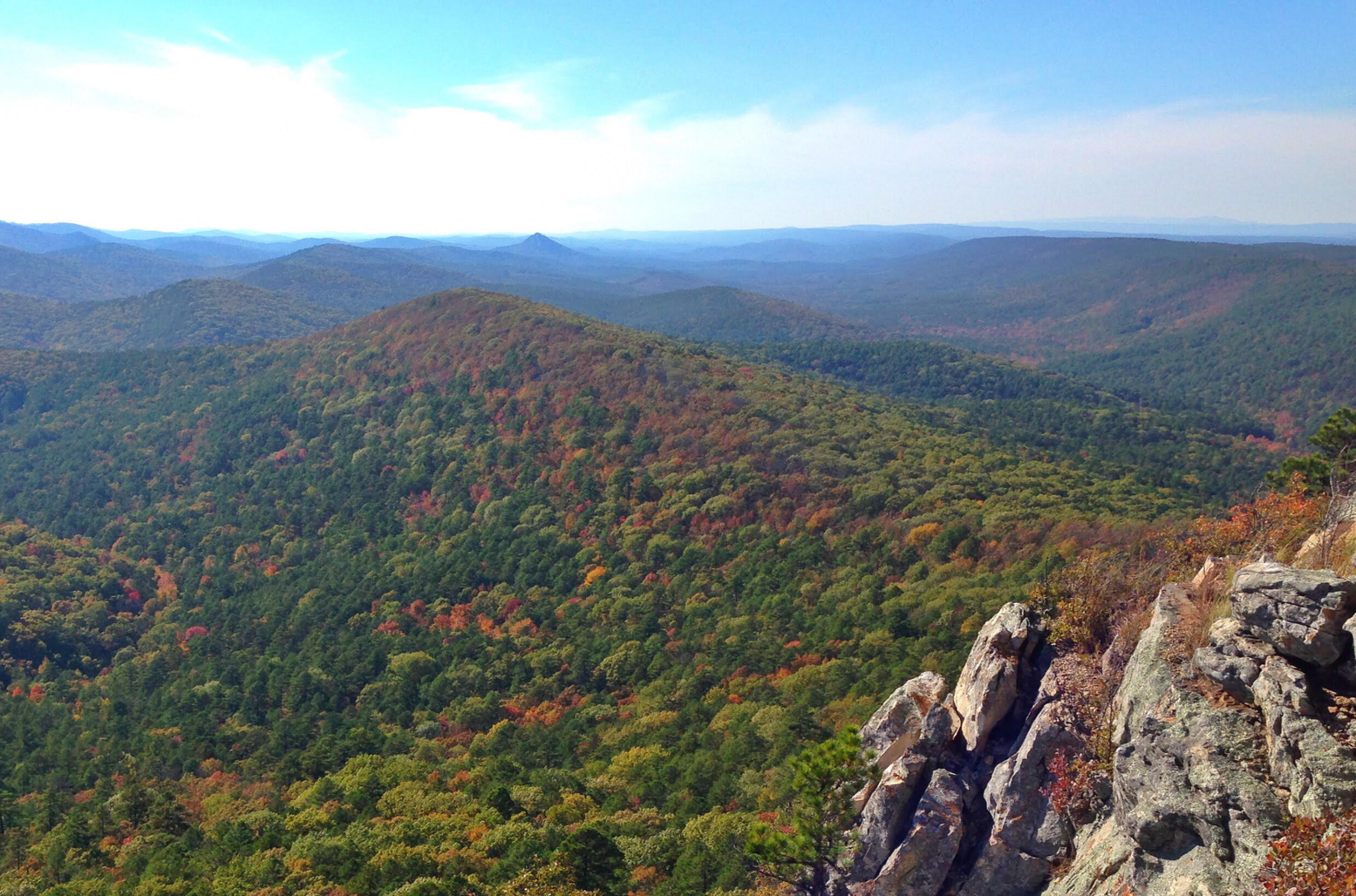
Flatside Pinnacle stands at 1,550 feet and offers stunning panoramic views. The short 0.2-mile trail from the gravel road to the summit is clearly marked and relatively easy, though it does get rocky and a little steep at the end. At the top are some of the best views in the state, including Pinnacle Mountain and Rattlesnake Ridge to the east. On clear days, you may even spot Mt. Nebo, Petit Jean, and Mt. Magazine. It's a perfect spot to hang a hammock, have lunch, or simply enjoy some solitude. Dispersed camping is allowed here, making it an ideal spot for thru-hikers to unwind and soak in the scenery.
0
0

This loop trail travels through 4 small but specatcular canyons under a canopy of dense hardwood trees. Features include bluff lines, a natural stone arch, rock shelters and Native American bluff dwellings. This moderately strenuous trail is considered as one of the most scenic in Arkansas.
0
0
The Civilian Conservation Corps constructed this Girl Scout camp between 1936 and 1940 and is located on the northern tip of Lake Sylvia. The Rustic architectural style buildings include the Great Hall, administration buildings, and cabins. Its a good site to learn about the CCC's impact on the area's development, and appreciate the conservation work accomplished during that era.
0
0
Frequently Asked Questions
How many easy hiking trails can I find in Perry County?
Perry County offers a good selection of easy hiking trails. Our guide features 6 easy routes, perfect for a relaxed outing. In total, there are 17 hiking routes across various difficulty levels in the region.
What do hikers say about the easy trails in Perry County?
The komoot community highly rates the trails in Perry County, with an average score of 4.8 stars. Hikers often praise the tranquil streams, diverse wildlife, and scenic vistas found along these paths, making for a rewarding outdoor experience.
Are the easy hiking trails in Perry County suitable for families with children?
Yes, many easy trails in Perry County are ideal for families. Routes like the Bear Cave Trail offer shorter distances and gentle terrain, perfect for younger adventurers. Little Buffalo State Park also provides family-friendly options with views of Holman Lake and historic sites.
Can I bring my dog on the easy hikes in Perry County?
Many trails in Perry County are dog-friendly, but it's always best to check specific trail regulations before you go. Generally, dogs are welcome on leash in most state forests and parks, allowing your furry friend to enjoy the natural beauty with you.
Are there any easy loop trails in Perry County?
Yes, Perry County features several easy loop trails. For example, the Seven Hollows Trail is an easy loop that allows you to experience varied scenery without retracing your steps. Little Buffalo State Park also offers loop trails like the Little Buffalo Lake loop.
What kind of scenery can I expect on easy hikes in Perry County?
Easy hikes in Perry County often lead through vast forested areas, alongside tranquil streams, and offer glimpses of the region's narrow valleys and rocky ridges. You can expect picturesque views, especially during fall foliage season, and opportunities to spot diverse wildlife.
When is the best time of year to go hiking on easy trails in Perry County?
Perry County offers great hiking opportunities year-round. Spring brings lush greenery and wildflowers, while summer is perfect for shaded forest walks. Fall is particularly stunning with vibrant foliage, and even winter offers peaceful, crisp walks, especially on well-maintained easy paths.
Are there any trails that are wheelchair accessible?
While many trails in Perry County feature natural surfaces, some parks and recreational areas may offer paved or compacted gravel paths suitable for wheelchairs. It's recommended to check directly with specific park websites for detailed accessibility information on their easy trails.
What are some notable natural features or landmarks I might see on easy hikes?
Perry County is rich in natural beauty. On easy hikes, you might encounter features like the Susquehanna River, parts of the Blue Mountain range, and the serene Holman Lake within Little Buffalo State Park. The region's diverse landscapes of valleys and forests are a constant highlight.
Are there any easy trails that offer scenic viewpoints?
Yes, even on easy trails, you can find rewarding viewpoints. While Hawk Rock via the Appalachian Trail is a short, easy hike offering panoramic views, other trails might provide glimpses of the Cumberland Valley or scenic overlooks within the Tuscarora State Forest, showcasing the region's natural beauty.
How long do easy hikes in Perry County typically take?
The duration of easy hikes varies, but many can be completed within an hour or two. For instance, the Flatside Pinnacle Spur Trail is a short option, while the Ouachita and Lake Sylvia Trail offers a slightly longer, yet still easy, experience.
Are there any easy trails along water bodies?
Yes, several easy trails in Perry County offer pleasant walks alongside water. The Little Buffalo Lake loop in Little Buffalo State Park provides beautiful views of Holman Lake. Additionally, trails like the Tucker Creek Trail may follow creeks, offering a refreshing experience.

Get inspired with the komoot mobile app


Explore more
Browse the best Hikes in other regions.
