The best cycling routes around Area J (Lower Arrow/Columbia)
4.5
(2)
31
riders
4
rides
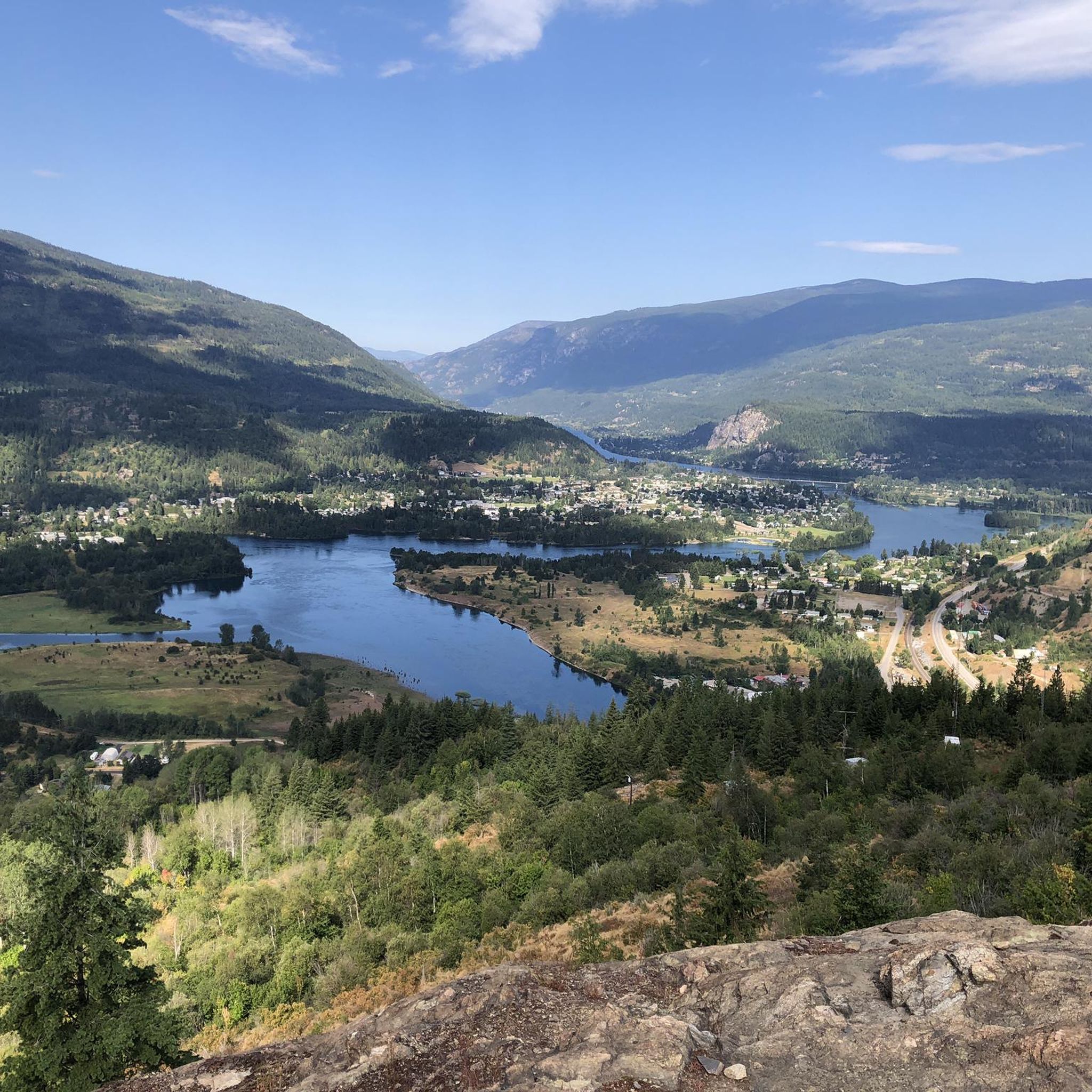
Touring cycling routes around Area J (Lower Arrow/Columbia) are set amidst the dramatic landscapes of British Columbia, nestled between the Selkirk and Monashee Mountains. The region is characterized by the expansive Arrow Lakes, which are natural widenings of the Columbia River, and heavily forested mountains. Cyclists can expect diverse terrain, from scenic lakefront paths to routes winding through river valleys and along abandoned railway lines.
Best touring cycling routes around Area J (Lower Arrow/Columbia)
- The most popular touring cycling route…
Last updated: July 15, 2026
4.5
(2)
9
riders
Moderate bike ride. Good fitness required. Mostly paved surfaces. Suitable for all skill levels.
5
riders
Hard bike ride. Very good fitness required. Mostly paved surfaces. Suitable for all skill levels.

Sign up for free
7
riders
104km
06:57
1,550m
1,550m
Hard bike ride. Very good fitness required. Mostly paved surfaces. Suitable for all skill levels.
6
riders
Hard bike ride. Very good fitness required. Mostly paved surfaces. Suitable for all skill levels.
4
riders
78.6km
06:41
780m
780m
Hard bike ride. Very good fitness required. Mostly paved surfaces. Suitable for all skill levels.
Our route recommendations are based on thousands of hikes, rides, and runs completed by other people on komoot.
Start today with a free account
Your next adventure awaits.
Login or Signup
Popular around Area J (Lower Arrow/Columbia)

Tips from the Community


A quiet, scenic (but hilly) alternative to the highway.
0
0

Another station turned shelter. A small creek ran next to this one, take the opportunity to refill water.
0
0
Looking back on the next trestle we crossed while climbing the C&W towards Christina Lake
0
0
Old rail station turned shelter on the C&W
0
0
Frequently Asked Questions
How many touring cycling routes are available in Area J (Lower Arrow/Columbia)?
Komoot features 4 touring cycling routes in Area J (Lower Arrow/Columbia). These routes offer a range of experiences, from moderate to difficult, allowing cyclists to explore the diverse landscapes of the region.
What makes touring cycling in Area J (Lower Arrow/Columbia) unique?
The region is uniquely defined by the expansive Arrow Lakes, which are natural widenings of the majestic Columbia River, and heavily forested mountains. Cyclists can expect breathtaking vistas, especially along trails that follow abandoned railway lines, offering continuous views of Lower Arrow Lake and the Columbia River Valley. The blend of challenging and leisurely options amidst dramatic natural beauty sets this area apart.
Are there any easy touring cycling routes suitable for beginners in Area J (Lower Arrow/Columbia)?
While many routes in Area J (Lower Arrow/Columbia) are rated as difficult, there is one moderate route available: View of the Columbia River – Old Railway Trestle Bridge loop from Hugh Keenleyside Dam. This 15.6-mile (25.1 km) loop offers scenic views and is a good option for those looking for a less strenuous ride compared to the more challenging trails.
What are the general conditions of bike trails in Area J (Lower Arrow/Columbia)?
Many trails, especially rail trails like the Columbia & Western Rail Trail, are bike-friendly. However, some trail surfaces can be challenging due to degradation or sand. Recent upgrades have improved accessibility on certain routes, such as the Columbia River Trail. It's advisable to be prepared for varied conditions and to carry good lighting for tunnels, like the 900m long Bulldog Tunnel, which can be very dark.
What is the best time of year for touring cycling in Area J (Lower Arrow/Columbia)?
The region is best enjoyed during warmer months when the trails are clear of snow and the weather is pleasant for cycling. The diverse landscapes, including the Arrow Lakes and Columbia River, are particularly stunning from spring through fall. Always check local weather conditions before heading out.
Are there any circular touring cycling routes in Area J (Lower Arrow/Columbia)?
Yes, several routes are designed as loops. For example, the View of the Columbia River – Old Railway Trestle Bridge loop from Hugh Keenleyside Dam is a popular circular route. Another option is the Old Railway Trestle Bridge – View of the Columbia River loop from West Kootenay Regional Airport, which offers extensive views of the Columbia River valley.
What kind of scenic viewpoints can I expect along the touring cycling routes?
Touring cycling routes in Area J (Lower Arrow/Columbia) offer spectacular views of the Columbia River Valley, the expansive Arrow Lakes, and the surrounding forested Selkirk and Monashee Mountains. Many trails, especially those following old railway lines, provide continuous panoramic vistas. You might also encounter old railway trestle bridges and wetlands, adding to the scenic diversity.
What can I see along the touring cycling routes in Area J (Lower Arrow/Columbia)?
Along the touring cycling routes, you can explore various points of interest. The Columbia and Western Rail Trail itself is a major attraction, offering a glimpse into the region's history. You might also pass by the Bulldog Tunnel, a significant feature on the rail trail, or the impressive Brilliant Suspension Bridge. The Kootenay River and Kootenay Lake Route also offers scenic stretches.
Are there any routes that pass by cafes or places to refuel?
Yes, the Frog Peak Cafe – Official Start of the Route loop from West Kootenay Regional Airport is specifically named for a cafe along its path, suggesting opportunities for refreshments. Additionally, the Columbia & Western Rail Trail passes through small, former pioneer towns where you can often find food and water, making it convenient for touring cyclists.
What do other touring cyclists enjoy most about touring cycling in Area J (Lower Arrow/Columbia)?
The area is highly rated by the komoot community, with an average score of 4.5 stars. Reviewers often praise the stunning natural beauty, particularly the views of the Columbia River and the unique experience of cycling along old railway trestle bridges. The varied terrain and options for different ability levels also contribute to a positive cycling experience.
Are there any specific challenges or considerations for touring cyclists in this region?
Cyclists should be aware that some trail surfaces can be challenging due to degradation or sandy sections, particularly on older rail trails. The 900m long Bulldog Tunnel on the Columbia & Western Rail Trail can be pitch black, so carrying good lighting is essential. Additionally, the region's mountainous terrain means some routes involve significant elevation changes, requiring a good level of fitness for difficult-rated tours.
Can I find routes that offer views of the Arrow Lakes?
Absolutely. The Arrow Lakes are a defining feature of Area J (Lower Arrow/Columbia). Many routes, especially sections of the Columbia & Western Rail Trail, offer continuous views of Lower Arrow Lake. The region's landscape is characterized by these expansive lakes, providing a beautiful backdrop for your cycling adventures.
Most popular routes around Area J (Lower Arrow/Columbia)
Most popular attractions around Area J (Lower Arrow/Columbia)

Get inspired with the komoot mobile app


Explore more
Browse the best Cycling routes in other regions.
