Easy hikes and walks around Breitenwang
4.5
(15334)
71,611
hikers
72
hikes
Easy hiking trails around Breitenwang offer access to the diverse landscapes of the Reutte Nature Park Region in Tyrol, Austria. The area is characterized by the Ammergau Alps, dense forests, and significant bodies of water like Plansee and Heiterwanger See. Hikers can explore varied terrain, from lakeside paths to routes with views of surrounding peaks and valleys. This region provides numerous options for accessible outdoor exploration.
Best easy hiking trails around Breitenwang
- The most popular easy hiking route is Along…
Last updated: October 3, 2026
4.5
(27)
224
hikers
5.30km
01:26
70m
60m
Easy hike. Great for any fitness level. Easily-accessible paths. Suitable for all skill levels.
4.8
(25)
89
hikers
6.71km
01:48
80m
80m
Easy hike. Great for any fitness level. Easily-accessible paths. Suitable for all skill levels.

4.7
(46)
294
hikers
Easy hike. Great for any fitness level. Easily-accessible paths. Suitable for all skill levels.
4.5
(6)
31
hikers
6.72km
01:59
200m
200m
Easy hike. Great for any fitness level. Easily-accessible paths. Suitable for all skill levels.
4.0
(2)
14
hikers
3.57km
00:59
60m
60m
Easy hike. Great for any fitness level. Easily-accessible paths. Suitable for all skill levels.
Get access to more routes and recommendations from other explorers.
Already have an account?
Our route recommendations are based on thousands of hikes, rides, and runs completed by other people on komoot.
Start today with a free account
Your next adventure awaits.
Popular around Breitenwang


Tips from the Community

The Ehrenberg castle ruins, built in the 13th century, rise imposingly above the Ausserfern and formed the heart of a mighty Tyrolean fortress system for centuries to secure the historic trade route. Today, the extensive area impresses not only with its over 500-year defense history but also serves as a spectacular culmination point between the Schlosskopf, Fort Claudia, and the dizzying pedestrian suspension bridge Highline 179.
0
0
The Highline 179 is a spectacular 406-meter-long suspension bridge for pedestrians, which boldly spans the valley and the B179 at a height of 114 meters. It connects the Ehrenberg castle ruins directly with Fort Claudia and offers breathtaking panoramic views of the surrounding Tyrolean mountains, in addition to a good dose of adrenaline.
0
0

Beautiful view of the castle and the Highline there is a thrilling experience.
0
0

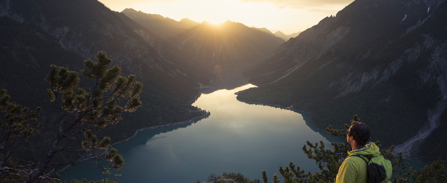
A very elegant bridge spans the narrow point between Plansee and Kleiner Plansee here.
3
0


The view over the bridge is already spectacular and crossing it is even more so. If there's a lot going on, it sways a lot😅
0
0

Beautiful wide, easily walkable path...great for running...great viewpoints of the lake
1
0
Beautiful place for photos... optimal for those who don't go over it
1
0
Frequently Asked Questions
How many easy hiking trails are there around Breitenwang?
The Breitenwang area offers approximately 25 easy hiking trails, providing accessible options within the broader network of over 75 routes in the region.
What kind of terrain can I expect on easy hikes in Breitenwang?
Easy hikes in Breitenwang feature diverse terrain, including serene lakeside paths along Plansee and Heiterwanger See, as well as forested trails. You'll find routes with gentle ascents offering views of the Ammergau Alps and the Lechtal valley.
Are there any easy circular hiking routes in Breitenwang?
Yes, several easy circular routes are available. For example, the View of the Plansee – Plansee loop from Kleiner Plansee offers panoramic lake views, and the View of Ehrenberg Castle – View of Reutte loop from Breitenwang provides scenic vistas of the historic castle.
What natural landmarks or viewpoints can I see on easy trails?
Many easy trails offer stunning natural landmarks and viewpoints. You can enjoy views of the fjord-like Plansee, the impressive Stuiben Falls, or the tranquil Kreckelmooser Lake. Some routes also provide vistas of the Ammergau Alps and the Lechtal valley. For specific viewpoints, consider the View of Lake Eibsee or the View from Kalvarienberg of Füssen, Schwansee, and Neuschwanstein Castle.
Are there any easy hikes that pass by historical sites or castles?
Yes, you can combine easy hiking with historical exploration. The View of Ehrenberg Castle – View of Reutte loop from Breitenwang offers views of the Ehrenberg castle ruins. The iconic Neuschwanstein Castle is also nearby and can be integrated into themed trails.
What is the best time of year for easy hikes in Breitenwang?
Spring and autumn are considered ideal for hiking in Breitenwang, offering pleasant temperatures and vibrant natural colors, from blooming flower meadows to changing autumn leaves. Even in summer, cool mountain lakes like Plansee are inviting, and winter provides opportunities for snowshoe hikes in snow-covered landscapes.
Are there family-friendly easy hikes in Breitenwang?
Breitenwang is well-suited for family-friendly hikes. Many easy trails are accessible and suitable for all fitness levels. The region's diverse landscapes, including lakes and forests, provide engaging environments for children. The 'In the footsteps of King Ludwig' themed trail near Neuschwanstein Castle is particularly suitable for families.
What do other hikers enjoy most about hiking in Breitenwang?
The Breitenwang area is highly rated by the komoot community, with an average score of 4.6 stars from over 11,800 reviews. Hikers often praise the serene lake paths, forested trails, and the stunning viewpoints overlooking the Lechtal valley and Ammergau Alps.
Are there short, easy hiking trails suitable for a quick walk?
Yes, there are several short and easy options. The Along Plansee route is a popular 3.3-mile (5.3 km) trail that can be completed in about 1 hour 25 minutes, perfect for a quick scenic walk along the lake.
Are there easy hikes with good parking facilities?
Many easy hikes in Breitenwang, especially those around Plansee and near popular attractions, typically have designated parking areas. It's advisable to check specific route details for parking information, but accessibility by car is generally good in the region.
Can I find refreshments or cafes near the easy hiking trails?
Yes, the Breitenwang region, being a popular tourist destination, offers various options for refreshments. You'll find cafes and restaurants in Breitenwang itself and in nearby towns like Reutte, as well as establishments located near popular lakes like Plansee, providing opportunities for a break during or after your hike.
Are there any easy hikes that offer views of waterfalls?
Yes, the region features the impressive Stuiben Falls, which are often incorporated into hiking routes. These waterfalls cascade into the valley, offering a spectacular natural sight that can be enjoyed on some of the area's trails.
Most popular routes around Breitenwang
Most popular attractions around Breitenwang

Get inspired with the komoot mobile app


Explore more
Browse the best Hikes in other regions.
