Easy hikes and walks around Bettyhill, Strathnaver And Altnaharra
4.3
(223)
1,679
hikers
18
hikes
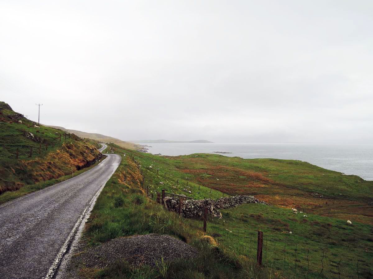
Easy hiking trails around Bettyhill, Strathnaver And Altnaharra traverse a diverse landscape of coastal scenery, inland wilderness, and historical sites. The region features dramatic cliffs, white-sand beaches, extensive moorland, and numerous lochs and rivers. Trails often lead through areas like Borgie Forest, offering woodland experiences, or along the coast with views of the Atlantic. The terrain varies from gentle coastal paths to routes exploring the unique peatlands of the Flow Country.
Best easy hiking trails around Bettyhill, Strathnaver And Altnaharra
- The most popular easy hiking route is Castle Varrich Trail, a 2.0 miles (3.3 km) trail that takes 58 minutes to complete. This path leads to historical ruins with panoramic views over the Kyle of Tongue.
- Another top favourite among local hikers is Tongue to Castle Varrich loop, an easy 3.0 miles (4.9 km) path. This route combines coastal views with a visit to the historic Castle Varrich.
- Local hikers also love the Borgie Forest & the River Borgie loop from Borgie Bridge — Kyle of Tongue, a 1.2 miles (1.9 km) trail leading through woodlands and alongside the River Borgie, often completed in about 28 minutes.
- Hiking around Bettyhill, Strathnaver And Altnaharra is defined by coastal paths, tranquil lochs, and varied forest trails. The network offers options for different ability levels, focusing on accessible and less strenuous routes.
- The routes in Bettyhill, Strathnaver And Altnaharra are highly rated by the komoot community with an average score of 4.4 stars from over 170 reviews. More than 1400 hikers have used komoot to explore Bettyhill, Strathnaver And Altnaharra's varied terrain.
Last updated: August 10, 2026
4.6
(47)
462
hikers
3.30km
00:58
100m
100m
Hike the easy 2.0-mile Castle Varrich Trail to explore a historic ruin and enjoy panoramic views of the Kyle of Tongue and Highland mountain
3.6
(10)
33
hikers
4.88km
01:22
100m
100m
Easy hike. Great for any fitness level. Easily-accessible paths. Suitable for all skill levels.

Sign up for free
Easy hike. Great for any fitness level. Easily-accessible paths. Suitable for all skill levels.
4.4
(9)
63
hikers
2.10km
00:35
30m
30m
Easy hike. Great for any fitness level. Easily-accessible paths. Suitable for all skill levels.
4.6
(16)
56
hikers
Easy hike. Great for any fitness level. Easily-accessible paths. Suitable for all skill levels.
Get access to more routes and recommendations from other explorers.
Sign up for free
Already have an account?
Our route recommendations are based on thousands of hikes, rides, and runs completed by other people on komoot.
Start today with a free account
Your next adventure awaits.
Login or Signup
Popular around Bettyhill, Strathnaver And Altnaharra
Other adventures around Bettyhill, Strathnaver And Altnaharra


Tips from the Community

In the last part of the hike, walk along the sea side of the natural stone wall to the small tarmac road.
0
0

From the river you can reach the castle ruins in about 15 minutes
2
0
A few meters to walk here - but it is very beautiful and worth seeing
0
0

The castle’s precise origins and age are unknown, but it is believed to be over one thousand years old1. It is thought that the Mackays may have built their castle on the site in the 14th century, on top of an existing old Norse fort1. The walls are generally 1.4 metres (5 ft) thick, or thicker, and have been built from roughly squared blocks of metamorphosed sandstone rock of varying thickness, laid in rough courses of random depth.
1
0

Great place. Warm. Excellent food.
0
0

Frequently Asked Questions
How many easy hiking trails are available in Bettyhill, Strathnaver And Altnaharra?
Bettyhill, Strathnaver And Altnaharra offers a good selection of easy hiking trails. There are 11 easy routes available, providing diverse options for exploring the region's landscapes.
What kind of landscapes can I expect on easy hikes in this region?
Easy hikes in Bettyhill, Strathnaver And Altnaharra traverse a diverse landscape. You can expect dramatic coastal scenery with white-sand beaches and cliffs, extensive moorland, tranquil lochs, and rivers. Trails also lead through woodlands like Borgie Forest, and some offer views of the unique peatlands of the Flow Country.
What is the best time of year for easy hiking in Bettyhill, Strathnaver And Altnaharra?
The summer months are generally ideal for easy hiking in Bettyhill, Strathnaver And Altnaharra. During this time, you can enjoy warmer weather, longer daylight hours, and the opportunity to spot cetaceans along the coast. The Flow Country also offers beautiful summer flowering periods.
Are there easy circular walks in the area?
Yes, there are several easy circular walks. For example, the Borgie Forest & the River Borgie loop from Borgie Bridge — Kyle of Tongue is a pleasant circular trail through woodlands. Another option is the Strathy Point Lighthouse loop from Glas-eilean Beag, offering excellent coastal views.
Are the easy hiking trails in Bettyhill, Strathnaver And Altnaharra suitable for families?
Many easy hiking trails in the region are suitable for families. Routes like the Borgie Forest & the River Borgie loop are relatively short and flat, making them enjoyable for all ages. The diverse scenery, from beaches to forests, also keeps younger hikers engaged.
Can I bring my dog on easy hikes in Bettyhill, Strathnaver And Altnaharra?
Yes, many easy hiking trails in Bettyhill, Strathnaver And Altnaharra are dog-friendly. However, it's always recommended to keep dogs on a lead, especially in areas with livestock or ground-nesting birds, and to follow the Scottish Outdoor Access Code.
Are there any easy trails where I can see waterfalls?
While not directly on an easy trail listed in this guide, the Allt a' Mhuiseil Waterfalls are a notable natural monument in the region. You can find routes that pass near or lead to this beautiful feature, offering a chance to enjoy the cascading water.
What historical sites or landmarks can I visit on an easy hike?
You can combine easy hikes with visits to historical sites. The Castle Varrich Trail leads to the ruins of Castle Varrich, offering panoramic views. The broader Strathnaver Trail, while moderate in places, links numerous archaeological sites, including Neolithic cairns and abandoned clearance villages, providing a poignant historical experience.
Are there opportunities for wildlife spotting on easy trails?
Yes, the diverse natural environment of Bettyhill, Strathnaver And Altnaharra offers excellent opportunities for wildlife spotting. On easy trails, you might encounter red deer, otters, and various bird species. Coastal walks, such as those near Strathy Point, can offer chances to see seals and, in summer, even cetaceans like whales and dolphins.
What do other hikers enjoy the most about hiking in Bettyhill, Strathnaver And Altnaharra?
The area is highly rated by the komoot community, with an average score of 4.4 stars from over 170 reviews. Reviewers often praise the stunning coastal views, the tranquility of the woodlands, and the historical insights offered by routes like the Castle Varrich Trail.
Are there any easy routes that offer views of the famous North Coast 500?
While the North Coast 500 is a driving route, many easy hiking trails in Bettyhill, Strathnaver And Altnaharra run parallel to or intersect with sections of it, offering similar scenic vistas. For example, coastal walks near Bettyhill provide views that are characteristic of the NC500's dramatic northern stretch. The North Coast 500 (NC500) Scenic Road itself is a highlight in the region.
Are there any easy trails that pass by a cafe or place to eat?
Yes, the The Store Cafe, Bettyhill – Coastal View Near Oldshoremore loop from Crask is an easy route that specifically includes a cafe, allowing you to enjoy refreshments during or after your walk. The village of Bettyhill also has local amenities.
Most popular routes around Bettyhill, Strathnaver And Altnaharra
Most popular attractions around Bettyhill, Strathnaver And Altnaharra

Get inspired with the komoot mobile app


Explore more
Browse the best Hikes in other regions.
