Top 8 Mountain Passes around Oggebbio
Mountain passes around Oggebbio are characterized by elevated routes and scenic peaks offering panoramic views over Lake Maggiore. The region features a collection of villages nestled along the lake's shores and hillsides. These routes provide opportunities for exploring the natural landscape and historical sites, including fortifications from the Linea Cadorna. The area's terrain offers diverse experiences for those seeking elevated journeys.
Best mountain passes around Oggebbio
- The most popular mountain passes is Cuvignone Pass, a mountain_pass that connects Valcuvia…
Last updated: October 26, 2026
Cuvignone Pass
Highlight • Mountain Pass
The Cuvignone Pass (1,036 m above sea level) is a pass near Vararo, in the Varese area between Valcuvia and …
Showing Translation
Tip by

Ascent from Cannobio to Passo Marco Pantani
Highlight (Segment) • Climb
Translated by Google •
Tip by

Sign up now to discover places like this
Get recommendations on the best single tracks, peaks, & plenty of other exciting outdoor places.
Start of the Cadorna Road towards the Monte Morissolo tunnels
Highlight • Trail
Translated by Google •
Tip by

Passo Folungo
Highlight • Mountain Pass
Translated by Google •
Tip by

Pradecolo Pass (1180 m)
Highlight • Mountain Pass
Translated by Google •
Tip by

Sign up for free to discover even more mountain passes around Oggebbio.
Already have an account?
Start today with a free account
Your next adventure awaits.



Other adventures around Oggebbio

Tips from the Community

Passo S. Antonio Vararo / Cuvignone 1,036 m Passage at 1,036 meters above sea level From the South: Cittiglio to the North: Porto Valtravaglia About 200 hairpin bends on asphalt Strada Provinciale 8 https://stradedamoto.it/strade.asp?RicPas=4281
14
0
Passo del Monte Cuvignone Via Vararo, Cittiglio / Castelveccana VA The Cuvignone Pass (1,036 m above sea level) is a pass near Vararo, in the Varese area between Valcuvia and Luinese. In cycling, it is known for its demanding climb, which can be tackled from various sides (directly from Cittiglio or Castelveccana, or indirectly after climbing Sant'Antonio or crossing the San Michele Pass). It has been used for training since the time of Alfredo Binda (originally from the area) and offers particularly technical and demanding descents. Ivan Basso also trained there. The pass is also famous in the automotive world, as it has been the most selective timed section of the "ACI Varese Rally" since the 80s, today the "Rally dei Laghi". Even in motorsport, as in cycling, it has been tackled in all directions, and in all directions it has always stood out for its difficulty, consisting of fast sections, others slower but very technical, narrow hairpin bends uphill and downhill – all over a length of about 12/14 km at the discretion of the organizer. Text / Source: wikipedia.org/wiki/Passo_del_Cuvignone https://it.wikipedia.org/wiki/Passo_del_Cuvignone
14
0

Memorial to cyclist Marco Pantani. PS The pass summit is also accessible with a 2-speed road bike.
1
0

Very nice climb surrounded by greenery.
8
0

a classic from the Varese area. It's worth it.
2
0

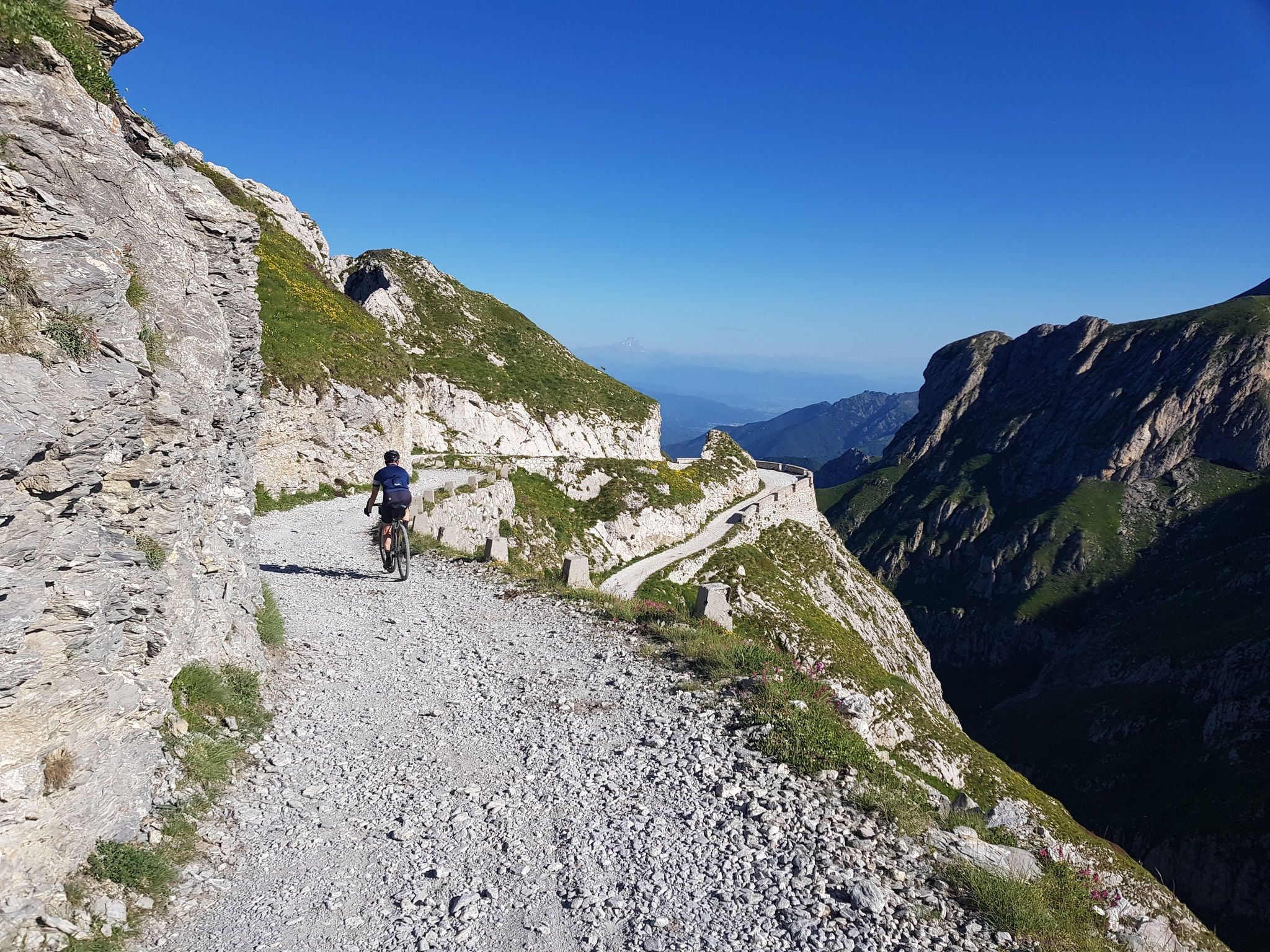
Entrance to the panoramic military road. This runs at a height of about 1250 meters and thus about 1000 meters above Lake Maggiore. Therefore, when the weather is good, there are fantastic views of the lake.
1
0
Great climb with never bad gradients.
22
0

A beautiful climb leads to this pass, which is very famous among bikers in the area and also beautiful for a nice cycling trip. There are no views from the pass, but the two roads that lead to it are very scenic with views of the lakes!
2
0
Frequently Asked Questions
What are some of the most popular elevated routes and peaks around Oggebbio?
The region around Oggebbio features several notable elevated routes and peaks that offer stunning views and diverse experiences. Among the most popular are Cuvignone Pass, known for connecting Valcuvia with Luinese and offering various hiking trails with Lake Maggiore views. Another highly regarded route is the Ascent from Cannobio to Passo Marco Pantani, which is appreciated for its consistent gradients and low traffic, making it a great long climb.
Are there any mountain passes or elevated routes with historical significance near Oggebbio?
Yes, the area around Oggebbio is rich in history, particularly with fortifications from the Linea Cadorna, a WWI defense line. You can explore these historical sites, for example, by starting at the Start of the Cadorna Road towards the Monte Morissolo tunnels. Monte Morissolo itself offers well-preserved WWI fortifications and tunnels, adding a significant historical dimension to your trek.
What kind of views can I expect from the mountain passes and elevated routes in Oggebbio?
From the elevated routes and peaks around Oggebbio, you can expect breathtaking panoramic views. Locations like Monte Morissolo and Monte Spalavera offer expansive vistas over Lake Maggiore and the surrounding Alps, including glimpses of the Borromean Gulf and Monte Rosa. Many routes, such as the roads leading to Cuvignone Pass, are described as very scenic with views of the lakes.
What outdoor activities can I do near these mountain passes?
The region offers a variety of outdoor activities. For road cycling enthusiasts, there are numerous routes, including those around Oggebbio itself. Gravel biking is also popular, with challenging routes like the 'Madonna dei Ciclisti Shrine – Lake Ghirla loop'. If you prefer hiking, you'll find many mountain hikes, such as the 'Monte Carza loop' from Cannero Riviera. You can find more details on these activities in our dedicated guides for Road Cycling Routes around Oggebbio, Gravel biking around Oggebbio, and Mountain Hikes around Oggebbio.
Are there any easy or beginner-friendly elevated routes around Oggebbio?
While many routes in the Oggebbio area offer challenging terrain, some are relatively accessible. For instance, Monte Spalavera is often praised for its great views and relatively easy accessibility, with routes like the Historic WWI Military Road (Route R34) providing a manageable journey. The Pradecolo Pass (1180 m) is also noted as very easy to drive up and down, with part of it recently asphalted.
What is the best time of year to visit the mountain passes and elevated routes in Oggebbio?
The best time to visit the elevated routes and peaks around Oggebbio is generally during the spring, summer, and autumn months. During these seasons, the weather is more favorable for hiking and cycling, and the trails are typically clear. The diverse natural experience, with woodlands, terraced slopes, and alpine meadows, is best enjoyed when the foliage is vibrant.
Are there any routes that connect charming Italian villages?
Yes, the R24 Gonte - Casola - Manegra Trail is a moderate route that connects several Italian villages. This trail offers a wonderful opportunity to experience the local charm and enjoy impressive lake views, making it suitable for those looking for a cultural and scenic hike.
What are some notable features of Passo Folungo?
Passo Folungo serves as an interface for several routes and is known for having a water point, which can be very convenient for hikers and cyclists. It also offers excellent views along a former military mule track, blending natural beauty with historical context.
What do visitors appreciate most about the mountain passes and elevated routes in Oggebbio?
Visitors consistently appreciate the stunning panoramic views of Lake Maggiore and the Alps, the diverse natural landscapes including woodlands and alpine meadows, and the significant historical elements like the WWI fortifications. The combination of challenging terrain and rewarding vistas, along with the opportunity to explore charming villages, makes the area highly appealing.
Are there any specific routes recommended for those interested in military history?
For those interested in military history, the routes leading to Monte Morissolo are highly recommended. The area features historical fortifications from the Linea Cadorna, a WWI defense line, which can be explored via tunnels. Additionally, the Historic WWI Military Road (Route R34) on Monte Spalavera provides a unique journey through Piedmont peaks, complete with trenches and historical significance.
What are the typical difficulty levels for hiking trails around Oggebbio's elevated routes?
The hiking trails around Oggebbio's elevated routes vary in difficulty. For example, the 6.1-mile loop from Manegra to Monte Morissolo is considered difficult, with a significant elevation gain. Other routes, like the R24 Gonte - Casola - Manegra Trail, are rated as moderate. It's advisable to check specific trail details for elevation gain and distance to match your fitness level.
Most popular routes around Oggebbio
Most popular attractions around Oggebbio

Get inspired with the komoot mobile app


Explore more
See even more epic mountain passes by checking out these guides around Oggebbio:
