The best running trails around Laurel
17
runners
7
runs
If you've ever tried to find the perfect jogging route around Laurel, you know how quickly the options can become overwhelming. With so many parks and trails, it's tough to tell which ones are genuinely worth your time and effort, and which are just filler. That's where we come in. Our komoot community has explored, mapped, and reviewed countless routes, so we've done the legwork to bring you a curated shortlist of the best jogging routes Laurel has to offer, saving you all the guesswork.
Jogging around Laurel feels like stepping into a green oasis, with a fantastic mix of preserved forests, wetlands, and riverfront paths. You'll find everything from easy, flat loops perfect for a casual run to more challenging trails with gentle elevation changes. The area truly shines in late April or early May when the azaleas burst into bloom, adding an extra layer of beauty to your run.
If you're looking for an easy, scenic outing, we'd start with the Indian Island County Park and Indian Island Beach loop, a pleasant 2.7 miles (4.4 km) that's perfect for a relaxed jog. For something a bit longer with a mix of urban and suburban charm, the Pretty Post Office loop from Laurel is a solid moderate choice at 4.4 miles (7.1 km). Ready to explore? Dive into these routes and more, trusted by over 20 runners on komoot.
Last updated: June 1, 2026
7
runners
4.41km
00:29
10m
10m
The Indian Island County Park and Indian Island Beach loop offers a wonderfully serene and uncrowded jogging experience, perfect for a peaceful escape. You'll wind through lush forests and enjoy picturesque views of the Peconic River, Flanders Bay, and Oak Bay, culminating in the tranquil Indian Island Beach. This easy 2.7-mile (4.4 km) route has a minimal 33 feet (10 metres) of elevation gain and takes about 29 minutes, making it an ideal choice for a relaxing run.
Planning your visit is straightforward, as the park is accessible year-round with well-maintained trails. It's also a dog-friendly location, though remember to bring proof of vaccinations for your canine companion. The trail is predominantly flat and clearly marked, ensuring an easy and enjoyable experience for various fitness levels.
What sets this trail apart is its unique blend of environments, offering both the quiet solitude of woodland paths and the expansive beauty of coastal views. It's a great option if you're seeking a quiet alternative to more crowded spots, providing a consistent sense of peace and opportunities to observe local wildlife like birds and swans.
24.4km
02:41
120m
120m
If you're looking for a substantial jogging challenge on Long Island, this 15.2-mile (24.4 km) segment of the Paumanok Path delivers a difficult workout with 401 feet (122 metres) of elevation gain, typically taking around 2 hours and 40 minutes. The route winds through diverse landscapes, from dense pine barrens and rolling hills to unique kettle holes, offering a true journey through the region's natural beauty. You'll pass by the Shinnecock Canal and the Stony Brook Southampton Campus, experiencing a mix of natural and man-made features.
Planning your visit requires some foresight, as the Paumanok Path can have remote sections and limited public transport access. While specific parking details for this segment aren't provided, it's wise to research trailhead parking information in advance and consider carpooling or drop-off points for longer runs. Always carry enough water, especially on warm days, and be prepared for varied trail conditions, including sandy or overgrown patches.
This trail is part of the larger 125-mile Paumanok Path, which traverses the eastern half of Long Island and is known for showcasing a different side of the region. It's almost entirely off-road, offering a unique perspective of ecologically significant open spaces, including enchanting beech forests and spectacular vistas of the Peconic Bay Estuary. The path honors Stephen Talkhouse, a 19th-century Montaukett Native American, and provides a valuable resource for outdoor enthusiasts in a densely populated area.

2
runners
6.36km
00:40
60m
60m
Moderate run. Good fitness required. Mostly paved surfaces. Suitable for all skill levels.
1
runners
7.14km
00:44
20m
20m
Moderate run. Good fitness required. Mostly paved surfaces. Suitable for all skill levels.
4
runners
9.60km
00:59
30m
30m
Moderate run. Good fitness required. Mostly paved surfaces. Suitable for all skill levels.
Get access to more routes and recommendations from other explorers.
Already have an account?
Our route recommendations are based on thousands of hikes, rides, and runs completed by other people on komoot.
Start today with a free account
Your next adventure awaits.
Popular around Laurel


Tips from the Community

Just across the street, less than half a mile off of Paumanok Path, is Stony Brook's Southampton Campus. It has a little windmill on its 84-acre campus and might be worth a detour!
0
0
Just across the street, a short detour, less than half a mile, off of Paumanok Path to the south, is Stony Brook Southampton Campus. This campus has a little windmill on its 84-acre campus and might be worth a detour for windmill enthusiasts.
0
0

Tuckahoe Woods Preserve, nestled in Southampton, is a serene natural oasis spanning 84 acres. It boasts lush woodlands, meandering trails, and diverse wildlife. This is a particularly special spot for birdwatchers, as the avian wildlife is plentiful.
0
0

The Shinnecock Canal was the first saltwater canal in New York State, built between 1884 and 1892. Once a site used by Native Americans to carry canoes over land, the Canal today connects two of the most stunning bays on Long Island's eastern side, Shinnecock Bay and Great Peconic Bay, which had become landlocked over time. Though the Hamptons officially begin 10 miles (16.09 km) west of the Canal, it is known as the starting point of this exclusive summer resort, as every modern bridge leading to the Hamptons crosses the Canal.
0
0
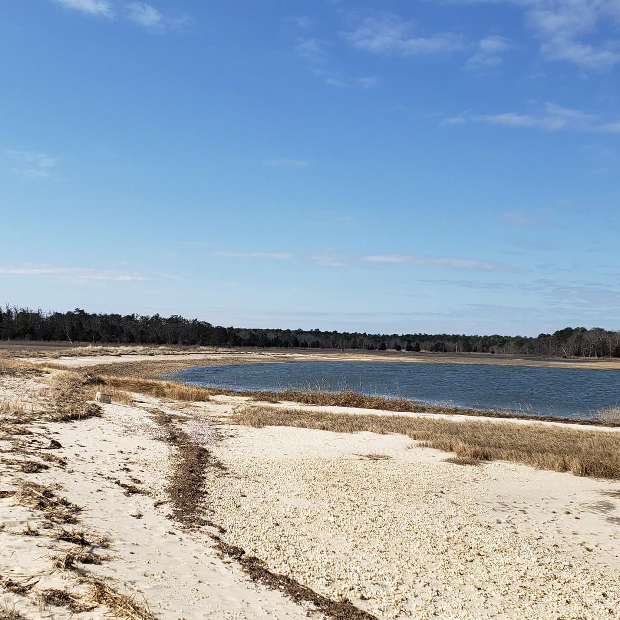
Indian Island Beach, on Indian Island, is a white sand beach where Indian Island County Park meets Flanders Bay. Runners can use the trails and quiet roads here to get close to nature and enjoy the coastal atmosphere.
0
0
The Shinnecock Canal was the first saltwater canal in New York State, built between 1884 and 1892. Once a site used by Native Americans to carry canoes over land, the Canal today connects two of the most stunning bays on Long Island's eastern side, Shinnecock Bay and Great Peconic Bay, which had become landlocked over time. Though the Hamptons officially begin 10 miles (16.09 km) west of the Canal, it is known as the starting point of this exclusive summer resort, as every modern bridge leading to the Hamptons crosses the Canal.
0
0

Laurel Post Office is a lovely white clad building that is a pretty sight whilst you cycle past. This Post Office building is a classic example of quaint American architecture.
0
0
Frequently Asked Questions
How many running routes are available in Laurel, Maryland?
The Laurel area offers a good selection of running routes. Komoot features 6 routes for jogging, with options ranging from easy to moderate difficulty. These paths are enjoyed by over 20 runners in the community.
What kind of terrain can I expect on running paths around Laurel?
Jogging routes in Laurel feature diverse terrain. You'll find extensive park systems with trails winding through forests, around ponds, and across wetlands, particularly within the Patuxent Research Refuge. Other areas offer paved paths along the Patuxent River at Riverfront Park, and natural surface trails through wooded perimeters like at Laurel Springs Regional Park. This variety ensures options for different running preferences.
Are there any easy or beginner-friendly jogging routes in the Laurel area?
Yes, Laurel has several easy running options perfect for beginners or a relaxed jog. For instance, the Indian Island County Park and Indian Island Beach loop is an easy 2.7-mile trail. The Cash Lake Trail within the Patuxent Research Refuge is also an easy 1.4-mile loop, offering beautiful views and opportunities to see wildlife.
Can I bring my dog on the jogging trails in Laurel?
Many outdoor areas around Laurel are dog-friendly, but it's always best to check specific park regulations. Popular spots like the Cash Lake Trail, Forest Trail at Patuxent Research Refuge, Lake Elkhorn loop, and Riverfront Park are generally welcoming to dogs, often requiring them to be on a leash. Always ensure you clean up after your pet.
Are there any running routes suitable for families with children?
Absolutely! Many of Laurel's trails are suitable for families. The paved paths at Riverfront Park are great for strollers and younger children, offering scenic views of the Patuxent River. The easy 1.4-mile Cash Lake Trail at Patuxent Research Refuge is also a fantastic option for a family outing, providing opportunities for wildlife viewing in a safe environment.
Where can I find scenic views or natural landmarks while running in Laurel?
For scenic views, consider routes within the Patuxent Research Refuge, which offers trails through forests, wetlands, and around two scenic lakes, including Cash Lake. Riverfront Park provides picturesque views along the Patuxent River and features historic dam ruins. Lake Elkhorn, though just outside Laurel, also offers a beautiful loop trail surrounded by woodland.
Are there any circular jogging routes in Laurel?
Yes, Laurel offers several excellent circular running routes. The Indian Island County Park and Indian Island Beach loop is a popular option. Within the Patuxent Research Refuge, the Cash Lake Trail is an easy loop, and the North Tract features the 2.5-mile Forest Trail loop. Lake Elkhorn also provides a paved loop trail perfect for a continuous run.
Is parking available at the trailheads for running routes in Laurel?
Yes, parking is generally available at major outdoor destinations in Laurel. The Patuxent Research Refuge (both North and South Tracts), Riverfront Park, and Lake Elkhorn all provide designated parking areas for visitors accessing their trails. It's always a good idea to check specific park websites for any potential parking fees or restrictions.
Can I reach any of Laurel's running trails using public transportation?
While some areas are more accessible than others, public transportation options to specific trailheads like Patuxent Research Refuge, Lake Elkhorn, or Riverfront Park can be limited. It's recommended to check local bus schedules and routes for the most up-to-date information on reaching these locations without a car. Planning ahead is key for public transport access.
Are there any permits required for jogging on trails in Laurel's parks?
Generally, permits are not required for casual jogging on public trails within Laurel's parks, including the Patuxent Research Refuge, Riverfront Park, and other local parks. However, for specific activities or larger groups, it's always wise to consult the official websites of the respective park or refuge for any special regulations or permit requirements.
What is the best time of year for jogging in Laurel, Maryland?
Spring and fall are generally considered the best times for jogging in Laurel due to mild temperatures and beautiful foliage. Summer can be hot and humid, so early mornings or late evenings are preferable. Winter jogging is possible, but trails might be icy or muddy, so appropriate gear is recommended. The diverse landscapes offer beauty in every season.
Are there any longer, more challenging running routes in the Laurel area?
For runners seeking a longer challenge, the Paumanok Path offers a significant distance, though it is rated as difficult. The North Tract of the Patuxent Research Refuge also provides 25 miles of trails, allowing for extended runs through a more secluded, natural environment with varying elevation gains, suitable for more strenuous jogs.
What do other runners enjoy most about jogging in Laurel?
Runners in the komoot community appreciate the variety of routes in Laurel, from park trails to riverfront paths. They often highlight the natural beauty and peacefulness of areas like the Patuxent Research Refuge and the scenic views along the Patuxent River. The mix of easy and moderate paths also caters to different fitness levels, making it a versatile destination for running.
Most popular routes around Laurel

Get inspired with the komoot mobile app


Explore more
Browse the best Running Trails & Routes in other regions.
