The best waterfall hikes and walks around Coniston Water
4.6
(10327)
86,243
hikers
139
hikes
Waterfall hiking trails around Coniston Water are set within the Lake District, a region characterized by diverse landscapes. The area features towering fells, serene tarns, and dense woodlands, alongside historic industrial sites. Hikers can expect varied terrain, from open moorland and rocky paths to well-maintained lakeside trails. The region's geology includes remnants of old slate mines and copper mining sites, adding to the scenic and historical interest.
Best waterfall hiking trails around Coniston Water
- The most popular waterfall hiking route is Banishead Quarry Waterfall – Coniston Water loop from Coniston, a 10.9 miles (17.5 km) trail that takes 5 hours 12 minutes to complete. This difficult route features significant elevation gain and passes through historic quarry areas.
- Another top favourite among local hikers is Low Tilberthwaite – Coniston Waterfall loop from Coniston, a moderate 7.6 miles (12.3 km) path. This trail offers views of waterfalls and varied terrain, including woodlands and open areas.
- Local hikers also love the Low Tilberthwaite – View of Coniston Water loop from Coniston, a 9.3 miles (15.0 km) trail leading through fells and offering expansive views, often completed in about 5 hours 9 minutes.
- Hiking around Coniston Water is defined by fells, tarns, and woodlands. The network offers options for different ability levels, from easy strolls to challenging ascents.
- The routes in Coniston Water are highly rated by the komoot community with an average score of 4.6 stars from more than 4,800 reviews. More than 41,000 hikers have used komoot to explore Coniston Water's varied terrain.
Last updated: August 3, 2026
4.8
(28)
192
hikers
17.5km
05:17
500m
500m
Hard hike. Very good fitness required. Mostly accessible paths. Sure-footedness required.
5.0
(3)
16
hikers
16.1km
04:53
500m
500m
Moderate hike. Good fitness required. Easily-accessible paths. Suitable for all skill levels.

Sign up for free
21
hikers
15.2km
05:16
780m
780m
Hard hike. Very good fitness required. Easily-accessible paths. Suitable for all skill levels.
4.3
(3)
15
hikers
7.03km
01:58
130m
130m
Easy hike. Great for any fitness level. Easily-accessible paths. Suitable for all skill levels.
4.8
(321)
1,338
hikers
10.5km
04:23
730m
730m
Moderate hike. Good fitness required. Mostly accessible paths. Sure-footedness required.
Get access to more routes and recommendations from other explorers.
Sign up for free
Already have an account?
Our route recommendations are based on thousands of hikes, rides, and runs completed by other people on komoot.
Start today with a free account
Your next adventure awaits.
Login or Signup


Tips from the Community

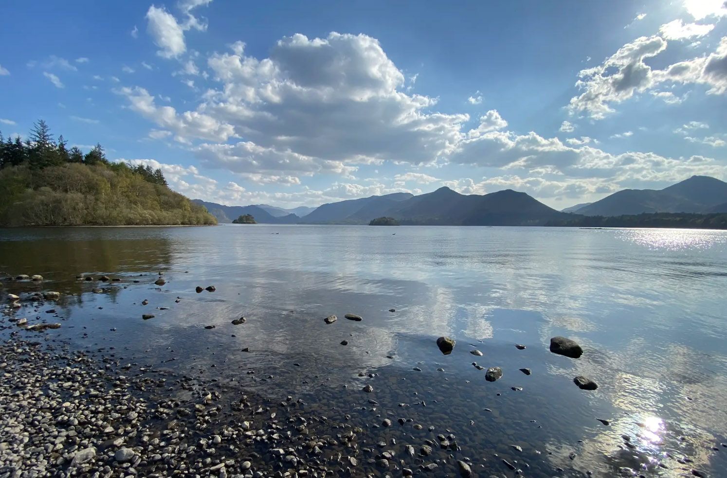
Coniston is located at the northern end of the third largest lake in the Lake District: Coniston Water. Steam yacht cruises are offered on this lake. Coniston is said to be derived from the Old Norse words Konigs Tun or king's settlement. That king is said to have been Thorstein, a Viking who gave his name to Thurstinii Watra, the old name of Coniston Water. (Wikipedia)
5
0
Around 1590, the Company of Mines Royal began extracting copper from the Coniston copper veins. The first work was carried out entirely by hand. With brute force, the rock face was broken and tunnels were excavated very slowly. Only enough rock was removed to allow one person to pass through the tunnel, and these access tunnels are called 'coffin levels' because of their characteristic coffin shape. Excavating a 17th-century tunnel like Cobbler's Level could still take three years. The Elizabethan Company of Mines Royal was led by German experts from the Tyrol and Bavaria. Their mines penetrated more than 55 metres into the earth. Work continued after the English Civil War, but perhaps not to a great extent. At the end of the 17th century, gunpowder was introduced, which changed everything. Work went much faster and mines could go much deeper than before, up to more than 90 metres below the surface. The charges were placed in a hole drilled into the rock using 'jumpers', iron rods made on site. You can still see hand-drilled shot holes. Gunpowder was replaced by dynamite in 1877 and jumpers by compressed air drills in 1883. (Lake district national park)
5
0
During the descent, you get a good view of Levers Water, a beautiful mountain lake.
6
0
Brim Fell connects Coniston Old Man with Swirl How, the two main fells of the Coniston group. Its disadvantage is that it is very close to the Old Man, only a short walk away.
6
0
To describe this mountain, here is a quote: "Although cruelly scarred and disfigured by the quarries, the Old Man has retained a dignified bearing and still lifts his proud and venerable head to the sky. His tears flow quietly into Low Water and Goats Water, two beautiful mountain tarns, whence they eventually... find their way to Coniston Water, bathing his ancient feet." Alfred Wainwright, "A Pictorial Guide to the Lakeland Fells, Book Four: The Southern Fells"
5
0
The most spectacular angles for photographing Low Water are from above: it can be seen from the ridge between Brim Fell Rake and the Old Man, but also from the steep, rugged path between the Old Man and the village of Coniston. The shores of the Tarn can also be reached via this latter path. (Lakes, Meres, Tarns & Waters)
7
0
The ruins of Saddlestone Mill are fascinating, derelict remnants of the old "Coniston slate and copper mines" on the northeastern flank of the Old Man of Coniston. The site is located approximately 2 km west of the village of Coniston and includes huge steel cables, old railway tracks, winding gear, buildings, and abandoned quarry tunnels.
7
0
A beautiful waterfall, but difficult to view in the summer due to dense vegetation.
7
0
Frequently Asked Questions
How many waterfall hiking trails are there around Coniston Water?
There are over 140 hiking trails around Coniston Water that feature waterfalls. These range in difficulty from easy strolls to challenging ascents, offering a wide variety of options for all hikers.
What kind of terrain can I expect on waterfall hikes near Coniston Water?
The terrain around Coniston Water is diverse, featuring everything from towering fells and open moorland to dense woodlands and well-maintained lakeside paths. You'll encounter rocky sections, historic quarry areas, and remnants of old slate and copper mines, providing both scenic beauty and historical interest.
Are there easy waterfall hikes suitable for beginners around Coniston Water?
Yes, there are approximately 38 easy hiking trails in the Coniston Water area that feature waterfalls. A great option is the Tarn Hows – Tom Ghyll Waterfalls loop from Coniston, which is a picturesque and accessible walk suitable for those seeking a gentler experience.
Are there challenging waterfall hikes for experienced hikers in the Coniston Water area?
Absolutely. For experienced hikers seeking a challenge, there are around 35 difficult routes. One such trail is the Banishead Quarry Waterfall – Coniston Water loop from Coniston, which covers 10.9 miles (17.5 km) with significant elevation gain and passes through historic quarry areas.
What do other hikers enjoy most about waterfall trails around Coniston Water?
The waterfall trails around Coniston Water are highly rated by the komoot community, with an average score of 4.6 stars from over 4,800 reviews. Hikers often praise the stunning natural beauty, the varied terrain, and the opportunity to explore both serene woodlands and dramatic fells, often with glimpses into the region's industrial past.
Are there family-friendly waterfall walks around Coniston Water?
Yes, many trails are suitable for families. The area around Tarn Hows, for instance, offers well-maintained paths and majestic mountain views, making it ideal for children. Easy routes like the Tarn Hows – Tom Ghyll Waterfalls loop from Coniston are excellent choices for a family outing.
Can I find circular waterfall walks around Coniston Water?
Many of the waterfall hikes around Coniston Water are designed as circular routes, allowing you to start and end in the same location. An example is the Low Tilberthwaite – Coniston Waterfall loop from Coniston, which offers varied terrain and waterfall views.
What natural features and landmarks can I see on waterfall hikes around Coniston Water?
Beyond the waterfalls themselves, you can explore a rich tapestry of natural features and historical landmarks. These include the iconic Coniston Water, remnants of old slate and copper mines in areas like Coppermines Valley, and picturesque tarns. Some trails also offer views of the dramatic fells like The Old Man of Coniston.
Are dog-friendly waterfall trails available near Coniston Water?
The Lake District is generally very dog-friendly, and many waterfall trails around Coniston Water welcome dogs. It's always recommended to keep dogs on a lead, especially near livestock, and to follow the Countryside Code to protect the natural environment and wildlife.
What is the best time of year to visit the waterfalls around Coniston Water?
The waterfalls are particularly impressive after periods of rain, which can occur throughout the year. Spring brings lush greenery and blooming wildflowers, while autumn offers stunning foliage. Summer provides generally milder weather for hiking, and winter can offer a dramatic, often quieter, experience, though conditions can be more challenging.
Are there any pubs or cafes near the waterfall hiking trails for refreshments?
The village of Coniston serves as a convenient starting point for many trails and offers various pubs and cafes where you can find refreshments before or after your hike. While specific establishments aren't listed for each trail, the general area is well-equipped with amenities for visitors.
How long do waterfall hikes around Coniston Water typically take?
The duration of waterfall hikes varies significantly depending on the route's length and difficulty. Easy trails, like the Tarn Hows – Tom Ghyll Waterfalls loop, might take around 2 hours. More challenging routes, such as the Low Tilberthwaite – View of Coniston Water loop, can take over 5 hours to complete.
Most popular routes around Coniston Water
Most popular attractions around Coniston Water

Get inspired with the komoot mobile app


Explore more
Browse the best Hikes in other regions.
