The best waterfall hikes and walks around South Arran Marine Protected Area
4.6
(663)
5,239
hikers
16
hikes
Waterfall hiking trails around South Arran Marine Protected Area are characterized by a diverse terrain, ranging from coastal paths to lush forests. The region features impressive waterfalls, such as Glenashdale, which are highlights on several hiking routes. The landscape includes a complex shoreline, offering views of the sea and nearby islands, alongside inland areas with ancient sites. This area provides a blend of natural beauty and historical interest for hikers.
Best waterfall hiking trails around South Arran Marine Protected Area
…Last updated: August 3, 2026
4.8
(62)
442
hikers
5.89km
01:42
150m
150m
Embark on an easy hike along the Glenashdale Waterfall loop from Ashdale Bridge, a route that takes you through lush wooded glens and past impressive natural features. You will cover…
4.8
(12)
128
hikers
5.90km
01:40
130m
130m
Embark on an easy hiking adventure to the Iron Age Fort & Glenashdale Falls from Whiting Bay, a route that spans 3.7 miles (5.9 km) and involves a gentle ascent…

Sign up for free
3.6
(5)
15
hikers
The Kildonan & Giants' Graves loop on the Isle of Arran offers a diverse hiking experience, combining woodland paths with open views to the sea. This moderate 9.5-mile (15.3 km)…
4.9
(21)
120
hikers
6.23km
01:49
180m
180m
Easy hike. Great for any fitness level. Easily-accessible paths. Suitable for all skill levels.
5.0
(5)
30
hikers
5.50km
01:36
150m
150m
Easy hike. Great for any fitness level. Easily-accessible paths. Suitable for all skill levels.
Get access to more routes and recommendations from other explorers.
Sign up for free
Already have an account?
Our route recommendations are based on thousands of hikes, rides, and runs completed by other people on komoot.
Start today with a free account
Your next adventure awaits.
Login or Signup
Popular around South Arran Marine Protected Area
Other adventures around South Arran Marine Protected Area

Tips from the Community

One of the best beaches on Arran, with plenty of scenery, sand and geology!
0
0
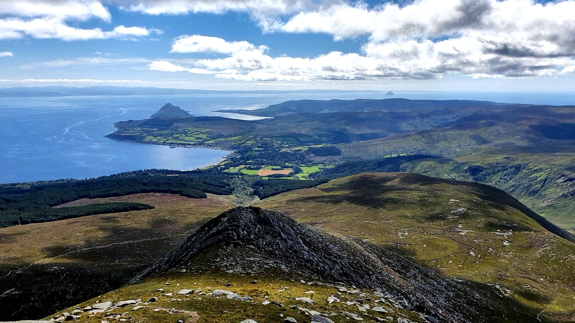
The panoramic view over the forest to the island of Plodda with its lighthouse, and to the distant cone of Ailsa Craig.
1
0
Eas a' Chrannaig is the biggest and best waterfall on Arran.
0
0
Eas a' Chrannaig is the biggest and best waterfall on Arran!
0
0

If attempting to hike towards Glenashdale Falls - Left of loch, a lot of deforestation & uprooted trees blocking visibility/pathway. Unable to find much of a path without roughly following app but had to abandon once a path leading to Whiting Bay/Kildonan. Forest area was extremely soft moss/boggy. Don’t attempt besides enjoying the spot at the picnic part by the loch.
0
0

great place with the "bar" and the "amphitheater" with fairy lights hanging everywhere, it's definitely beautiful in the dark when there's something going on there
1
0

When it rains, the rain unfolds its mystical aura. Crossing the stream is also quite slippery. The rest of the path along the lake is also quite adventurous.
0
0
Frequently Asked Questions
How many waterfall hiking trails are available in the South Arran Marine Protected Area?
There are approximately 16 waterfall hiking trails in the South Arran Marine Protected Area. These routes offer a diverse range of experiences, from easy strolls to more challenging treks through varied terrain.
What are the general difficulty levels of waterfall hikes in this region?
The waterfall hikes in the South Arran Marine Protected Area cater to various skill levels. You'll find a good mix, with about 8 easy trails perfect for casual walks, 5 moderate routes for those seeking a bit more challenge, and 3 more difficult trails for experienced hikers.
What do other hikers say about the waterfall trails in South Arran Marine Protected Area?
The trails in the South Arran Marine Protected Area are highly regarded by the komoot community, boasting an average rating of 4.6 stars from over 370 reviews. Hikers often praise the stunning natural beauty, the impressive waterfalls like Glenashdale, and the blend of coastal and forest paths.
Are there any circular waterfall walks in the South Arran Marine Protected Area?
Yes, several waterfall hikes in the region are circular, allowing you to start and end at the same point. A popular option is the Glenashdale Waterfall loop from Ashdale Bridge, which is an easy 3.7-mile (5.9 km) trail featuring the prominent Glenashdale Falls.
Are there easy waterfall hikes suitable for beginners or casual walkers?
Absolutely. Many of the waterfall trails are considered easy, making them ideal for beginners or those looking for a relaxed outing. The Glenashdale Waterfall loop from Ashdale Bridge is a great example, offering impressive falls on an accessible path. Another easy option is the Iron Age Fort & Glenashdale Falls from Whiting Bay.
What are some of the longer waterfall hiking options for a more challenging experience?
For a longer and more challenging experience, consider routes that combine waterfalls with other regional highlights. The Kildonan & Giants' Graves loop via The Library in the Woods — Isle of Arran is a moderate 9.5-mile (15.3 km) trail that takes about 4 hours 28 minutes, leading through varied terrain including historical sites, and often incorporates views of the island's natural features.
Are the waterfall trails in South Arran Marine Protected Area family-friendly?
Many waterfall trails in the South Arran Marine Protected Area are suitable for families. Easy loops like the Glenashdale Waterfall loop from Ashdale Bridge are popular choices, offering engaging scenery without being overly strenuous. Always check the specific trail details for distance and elevation to ensure it matches your family's capabilities. For more general accessible walks on Arran, you can consult resources like this guide from VisitArran.
Are dogs allowed on the waterfall hiking trails?
Generally, dogs are welcome on most hiking trails in the South Arran Marine Protected Area. However, it's always best to keep them on a lead, especially in areas with livestock or ground-nesting birds, and to follow the Scottish Outdoor Access Code. Be mindful of other hikers and wildlife, and always clean up after your dog.
What interesting landmarks or viewpoints can be seen along the waterfall trails?
Beyond the waterfalls themselves, the region offers several intriguing landmarks and viewpoints. You might encounter ancient graves and standing stones, such as those near the Kildonan & Giants' Graves loop. Other notable points of interest include the King's Cave, the Doon Hillfort, and various viewpoints offering stunning vistas of Holy Isle or Pladda Island and Ailsa Craig from Kildonan Beach.
What is the best time of year to visit the waterfalls in South Arran Marine Protected Area?
The waterfalls in South Arran are beautiful year-round, but they are often at their most impressive after periods of heavy rainfall, typically in autumn and winter. Spring and summer offer milder weather for hiking, though the water flow might be less dramatic. Each season provides a unique experience of the landscape.
Are there public transport options to reach the waterfall trailheads?
Public transport on the Isle of Arran, primarily bus services, can connect you to various villages and trailheads. For specific waterfall trails, you may need to check local bus routes and timetables to see if they stop near your desired starting point. For example, trails around Glenashdale Falls are often accessible from Whiting Bay or Ashdale Bridge, which are served by local buses.
Where can I find parking for waterfall hikes in the South Arran Marine Protected Area?
Parking is generally available at or near many of the popular trailheads. For instance, routes like the Glenashdale Waterfall loop from Ashdale Bridge typically have designated parking areas. It's advisable to check specific route details or local signage upon arrival, especially during peak seasons, as spaces can be limited.
Can I find cafes or pubs near the waterfall hiking trails?
Yes, the villages around the South Arran Marine Protected Area, such as Whiting Bay and Kildonan, offer amenities including cafes, pubs, and accommodation. These can be convenient stops before or after your waterfall hike for refreshments or a meal. It's a good idea to check opening times, especially outside of peak tourist season.
Most popular routes around South Arran Marine Protected Area
Most popular attractions around South Arran Marine Protected Area

Get inspired with the komoot mobile app


Explore more
Browse the best Hikes in other regions.
