The best mountain hikes around La Table
4.4
(8)
58
hikers
3
hikes
Mountaineering routes around La Table are characterized by the rugged terrain of the French Alps, offering challenging ascents and panoramic views. The region features a mix of high mountain passes, alpine lakes, and dense forests, providing varied landscapes for exploration. Elevations can be significant, with routes often involving substantial vertical gain. The area is well-suited for experienced mountaineers seeking demanding trails.
Best mountaineering routes around La Table
- The most popular mountaineering route is Lac du Collet – Les Plagnes loop…
Last updated: July 19, 2026
19
hikers
8.46km
03:16
600m
600m
Moderate mountaineering route. Good fitness required. Mostly accessible paths. Sure-footedness required.
4.3
(4)
17
hikers
11.5km
05:39
930m
930m
Hard mountaineering route. Very good fitness required. Mostly accessible paths. Sure-footedness required.

Sign up for free
4.0
(3)
12
hikers
19.8km
08:34
1,380m
1,380m
Hard mountaineering route. Very good fitness required. Mostly accessible paths. Sure-footedness required.
6
hikers
13.9km
05:36
990m
990m
Hard mountaineering route. Very good fitness required. Mostly accessible paths. Sure-footedness required.
5.0
(1)
4
hikers
8.27km
03:03
330m
330m
Hard mountaineering route. Good fitness required. Sure-footedness, sturdy shoes and alpine experience required.
Our route recommendations are based on thousands of hikes, rides, and runs completed by other people on komoot.
Start today with a free account
Your next adventure awaits.
Login or Signup


Tips from the Community

Beware of the dwarf king who protects the place.
0
0

And also and especially in good weather on Mont Blanc my dear Chloé 🤪
0
0

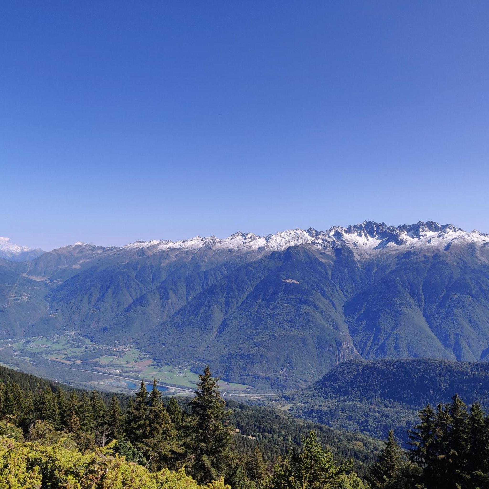
Here, you can enjoy a 360° panorama of all the surrounding mountains: Belledonne, Vercors, Chartreuse, Bauges, and even Mont Blanc on a clear day! An orientation table makes it possible to identify the surrounding peaks.
0
0
This passage at 1,868 meters above sea level offers pretty views of the peaks of the Grands Moulins (2,498 meters) and the Grand Miceau (2,631 meters) in particular. 400 meters separate you here from the summit of Grand Collet.
0
0
The Perrière refuge is an unguarded refuge that was renovated in 2018. It is nestled at the foot of the Grands Moulins (2,498 meters above sea level). There you will find 18 beds on mattresses, blankets, a stove, kitchen utensils and water. It is also equipped with solar electricity, which allows its smartphones and GPS devices to be recharged. A beautiful place to spend a night in the mountains!
1
0
The Col de la Perrière is located at an altitude of 2,003 meters. It offers a superb view of the Grand Charnier, the Grands Moulins, the Frêche, the Tête de la Perrière and the Grand Miceau.
0
0


Point of view not easy to access for everyone but very nice!
1
0
Frequently Asked Questions
What are the typical difficulty levels for mountaineering routes around La Table?
Mountaineering routes around La Table are generally challenging, catering primarily to experienced mountaineers. While there is one moderate route, the majority involve significant elevation changes and rugged terrain. For example, the Les Grands Moulins – Grande Montagne d'Arvillard loop from Parking de Val Pelouse is rated as difficult, traversing high mountain ridges.
How long do mountaineering routes in La Table usually take to complete?
The duration of mountaineering routes in La Table varies depending on the distance and elevation gain. You can expect routes to take anywhere from around 3 hours 15 minutes for shorter, moderate trails like the Lac du Collet – Les Plagnes loop from Le Collet d'Allevard, up to 8 hours 35 minutes for longer, more demanding ones such as the Grande Montagne d'Arvillard – Les Grands Moulins loop from Institut Karma Ling.
Where can I find parking and trailhead access for mountaineering routes in La Table?
Common starting points for mountaineering routes in the La Table region include Le Collet d'Allevard, Parking de Val Pelouse, Institut Karma Ling, and La Thuile. These locations typically offer access to various trails, with some specifically mentioning parking in their names, like the route starting from Parking de Val Pelouse.
Are there any suitable mountaineering routes for beginners in La Table?
The mountaineering routes around La Table are primarily designed for experienced individuals due to their challenging nature, significant elevation gains, and rugged alpine terrain. There are no easy routes listed in this guide, and only one is rated as moderate. Beginners should exercise caution and consider guided tours or less demanding trails in other regions.
What are some of the more challenging mountaineering routes in La Table?
For those seeking a significant challenge, the Grande Montagne d'Arvillard loop from Institut Karma Ling is a difficult 13.9-mile (22.4 km) trail with nearly 1,000 meters of elevation gain. Another demanding option is the Watch Rock – Lake La Thuile loop from La Thuile, which is also rated difficult.
Are there any family-friendly walks or less strenuous options near La Table?
This guide focuses on mountaineering routes, which are generally challenging and best suited for experienced hikers. While the immediate area around La Table offers demanding trails, you might find less strenuous walking options in the broader French Alps region, though they may not be classified as mountaineering. Always check individual route details for suitability.
What is the best season for mountaineering in La Table?
Given the high mountain passes and significant elevations, the best season for mountaineering in La Table is typically from late spring to early autumn (June to September). During these months, snowmelt allows for clearer trails, and weather conditions are generally more stable. Always check local weather forecasts and trail conditions before heading out.
What kind of terrain can I expect on mountaineering routes in La Table?
Mountaineering routes in La Table feature the rugged terrain characteristic of the French Alps. You can expect a mix of high mountain passes, alpine lakes, and dense forests. Routes often involve substantial vertical gain, traversing rocky paths and sometimes exposed ridges. The landscape offers varied scenery, from open alpine meadows to forested sections.
What do other mountaineers enjoy the most about mountaineering in La Table?
The komoot community highly rates the mountaineering experience in La Table, with an average score of 4.2 stars. Mountaineers often praise the challenging ascents, the panoramic views from high mountain passes, and the diverse landscapes that include alpine lakes and dense forests, providing a true alpine adventure.
Are there any circular mountaineering routes available in La Table?
Yes, many of the mountaineering routes in La Table are designed as loops, allowing you to start and end at the same point. Examples include the Lac du Collet – Les Plagnes loop from Le Collet d'Allevard and the Les Grands Moulins – Grande Montagne d'Arvillard loop from Parking de Val Pelouse, which offer comprehensive tours of the area's alpine scenery.
What interesting landmarks or attractions can I see near the mountaineering routes in La Table?
While focusing on the routes themselves, the region around La Table also offers points of interest. You might encounter mountain passes like Marocaz Pass or Col du Grand Cucheron. For a historical perspective, Fort Montgilbert is also in the vicinity.
Most popular routes around La Table
Most popular attractions around La Table

Get inspired with the komoot mobile app


Explore more
Browse the best Mountain Hikes & Routes in other regions.
