The best running trails in Kootenay National Park
4.5
(2)
65
runners
4
runs
Jogging in Kootenay National Park offers diverse terrain across rugged mountains, deep valleys, and alpine meadows. The landscape is characterized by dramatic canyon walls, dense forests, and rivers like the Kootenay and Vermilion. Runners can experience trails winding past waterfalls, through mineral-stained earth, and towards glacier-clad peaks. This Canadian Rocky Mountain Parks World Heritage Site provides a varied environment for all levels of running.
Best jogging routes in Kootenay National Park
- The most popular jogging route is Floe Lake loop…
Last updated: August 25, 2026
17
runners
19.9km
02:30
820m
820m
Hard run. Very good fitness required. Mostly paved surfaces. Suitable for all skill levels.
5.0
(1)
5
runners
6.85km
00:54
210m
220m
Moderate run. Good fitness required. Mostly paved surfaces. Suitable for all skill levels.

Sign up for free
4.0
(1)
4
runners
6.23km
00:40
80m
80m
Moderate run. Good fitness required. Mostly paved surfaces. Suitable for all skill levels.
16
runners
25.0km
03:35
1,040m
1,040m
Hard run. Very good fitness required. Mostly paved surfaces. Suitable for all skill levels.
23
runners
16.0km
02:20
730m
730m
Hard run. Very good fitness required. Mostly paved surfaces. Suitable for all skill levels.
Our route recommendations are based on thousands of hikes, rides, and runs completed by other people on komoot.
Start today with a free account
Your next adventure awaits.
Login or Signup
Popular around Kootenay National Park
Tips from the Community


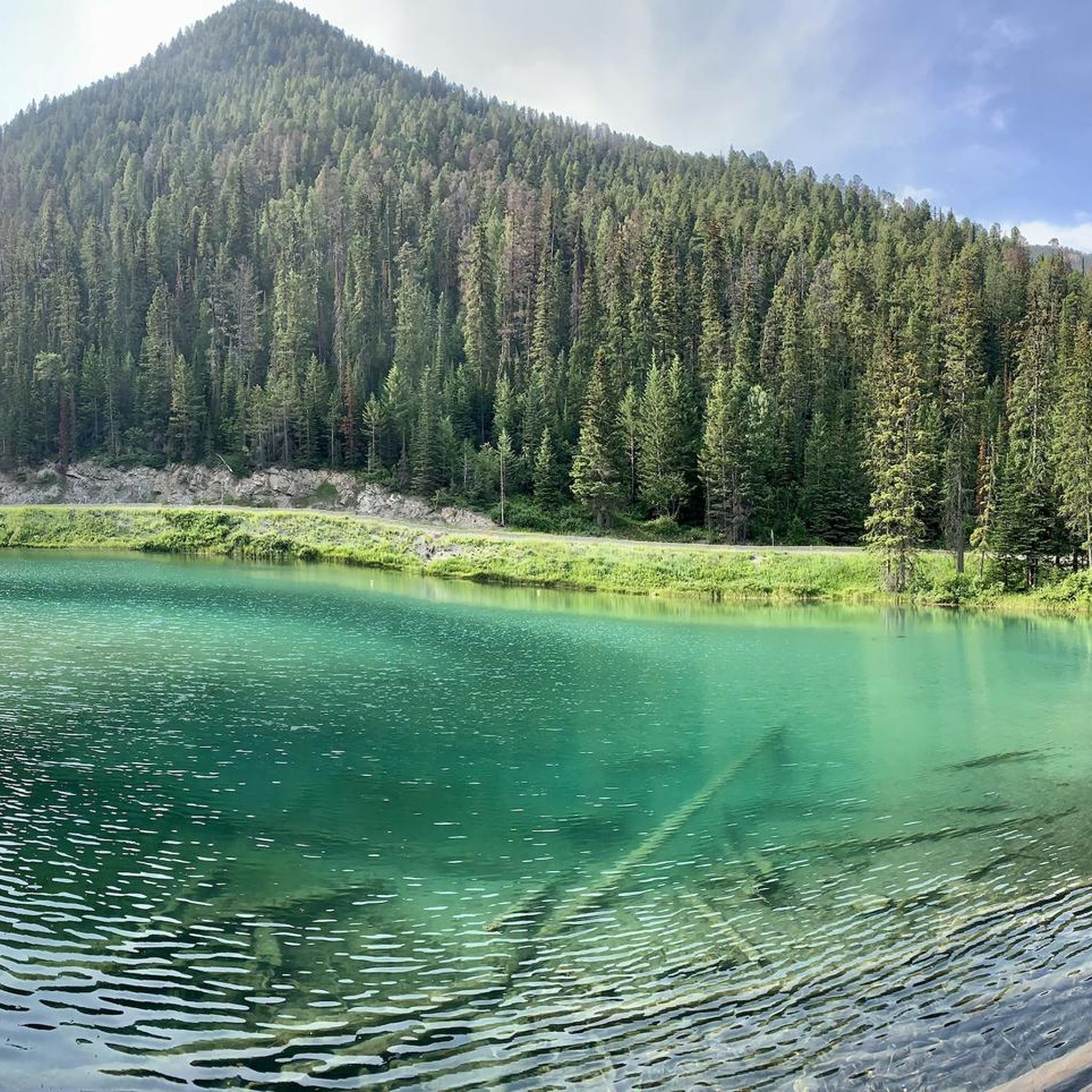
One of three lakes in the Sunshine Meadows with crystal clear water against a magnificent mountain backdrop. This one has a small island in the middle.
3
0
Frequently Asked Questions
How many running routes are available in Kootenay National Park?
Kootenay National Park offers a diverse network with over 4 dedicated running routes, ranging from moderate to difficult. These trails provide varied terrain across rugged mountains, deep valleys, and alpine meadows, catering to different fitness levels.
Are there any easy or moderate jogging routes suitable for beginners or families?
Yes, while the park is known for its challenging terrain, there are moderate options. For a less strenuous run with scenic views, consider the Rock Isle Lake loop from Mount Standish, which is 4.3 miles (6.9 km). The Kinsmen Beach loop from James Chabot Provincial Park is another moderate option, 3.9 miles (6.2 km) through a park setting near the lake. The region research also mentions easy trails like the 1.3-mile Paint Pots trail, which is relatively flat.
What kind of natural attractions can I expect to see along the running trails?
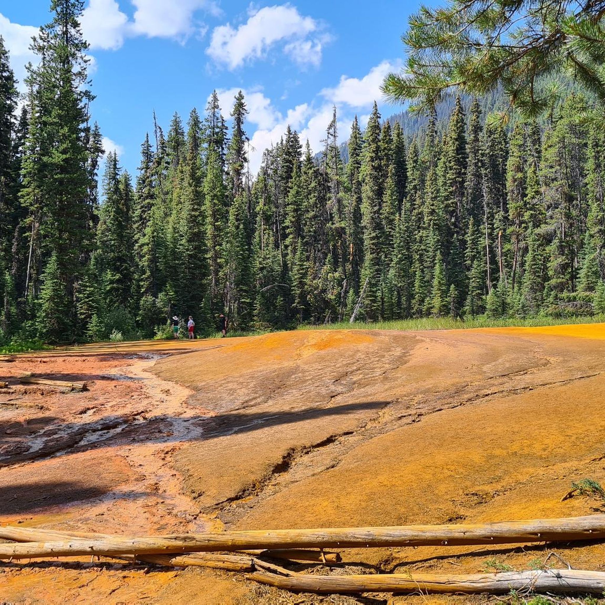
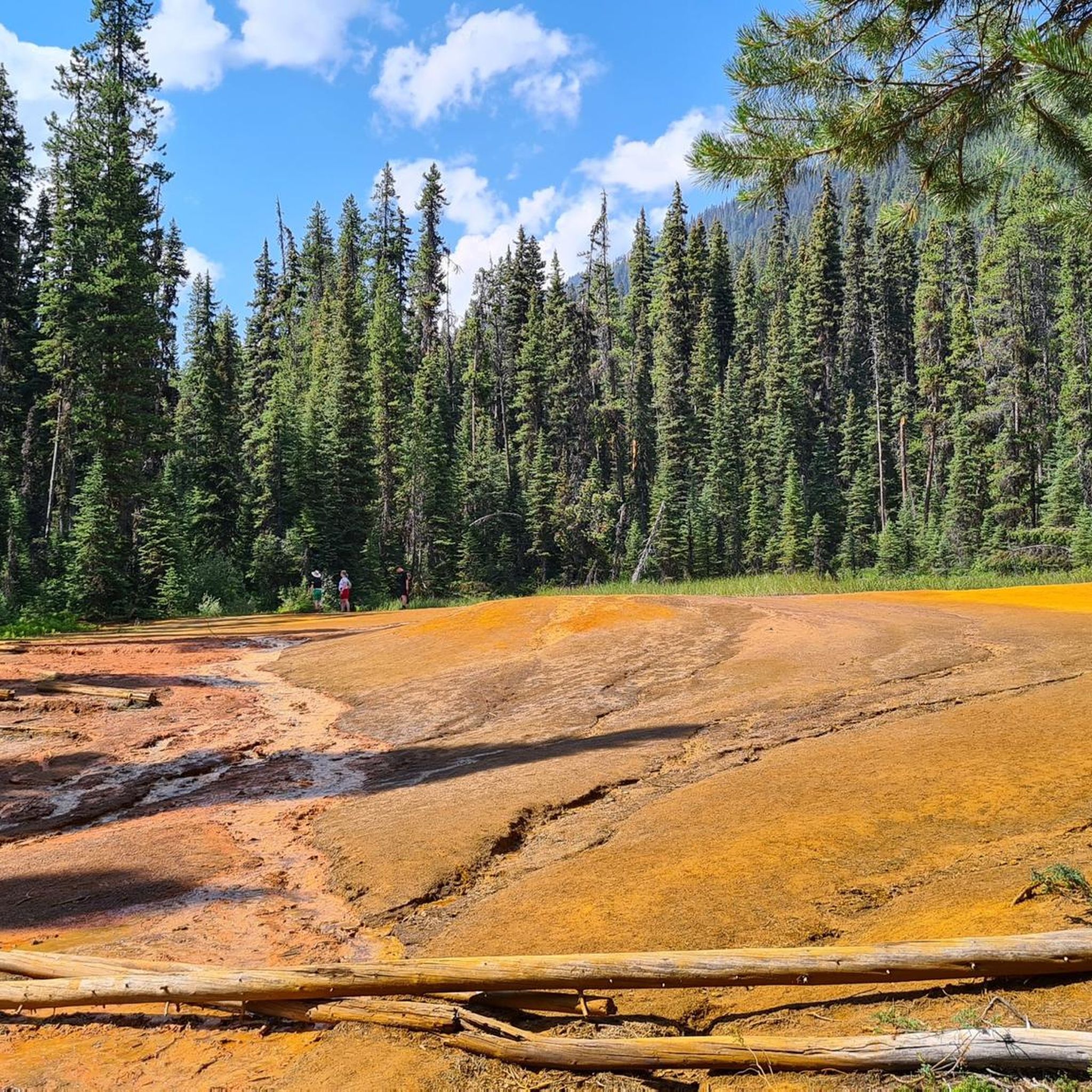
Kootenay National Park is rich in natural beauty. Along various routes, you might encounter dramatic canyon walls, dense forests, and rivers like the Kootenay and Vermilion. Notable attractions include the vibrant Paint Pots, where mineral springs stain the earth in vivid hues, and the stunning Marble Canyon with its carved gorge. You can also find tranquil spots like Olive Lake and the cascading Numa Falls.
Are there any circular running routes in Kootenay National Park?
Yes, several routes offer a loop experience. The challenging Floe Lake loop from Floe Lake / Ball Pass Trailhead is a 12.4 miles (19.9 km) circular route with significant elevation gains. For a moderate option, consider the Rock Isle Lake loop from Mount Standish (4.3 miles / 6.9 km) or the Kinsmen Beach loop from James Chabot Provincial Park (3.9 miles / 6.2 km).
What do other runners say about the trails in Kootenay National Park?
The running routes in Kootenay National Park are highly rated by the komoot community, with an average score of 5.0 stars. Runners often praise the park's diverse terrain, from forested paths to alpine routes, which ensures a constantly changing and engaging experience. The stunning natural landscapes and varied attractions are frequently highlighted as key reasons for the positive reviews.
Are there any trails with significant elevation gain for a challenging run?
Absolutely. Kootenay National Park offers several challenging routes with considerable elevation gains. The Floe Lake loop from Floe Lake / Ball Pass Trailhead, for instance, involves over 820 meters of ascent over 12.4 miles (19.9 km). Another demanding option is the Tower Lake – Tower lake viewpoint loop from Water Falls, which features over 720 meters of elevation gain.
Can I bring my dog on the jogging trails in Kootenay National Park?
Kootenay National Park has specific regulations regarding pets to protect wildlife and ensure visitor safety. While some trails may be dog-friendly, it's crucial to check the most current park regulations before heading out. Generally, dogs must be on a leash at all times, and certain areas or trails might be restricted. Always be prepared to pack out pet waste.
What is the best time of year for jogging in Kootenay National Park?
The best time for jogging in Kootenay National Park is typically from late spring through early fall (June to September) when trails are clear of snow and weather conditions are most favorable. During these months, you can enjoy wildflowers and comfortable temperatures. Always check current trail conditions and weather forecasts before your run, as alpine areas can experience sudden changes.
Are there any specific viewpoints or landmarks to look out for on the running routes?
Many routes offer spectacular views. The Tower Lake – Tower lake viewpoint loop from Water Falls explicitly highlights a viewpoint. Beyond specific routes, the park itself is a landmark, part of the Canadian Rocky Mountain Parks World Heritage Site. Keep an eye out for the dramatic canyon walls of Marble Canyon, the colorful Paint Pots, and the serene Olive Lake.
Are there any facilities like parking or public transport access near the trailheads?
Most major trailheads within Kootenay National Park, especially for popular routes, typically have designated parking areas. However, public transport options directly to trailheads are generally limited within the park itself. It's advisable to plan for personal vehicle access. For specific routes, check park information for trailhead access and parking availability.
What should I know about wildlife encounters while running in the park?
Kootenay National Park is home to diverse wildlife. While running, it's important to be aware of your surroundings. Make noise to avoid surprising animals, especially bears. Carry bear spray and know how to use it. Do not approach or feed wildlife. The park is committed to wildlife protection, including measures for animals to safely cross busy roads, highlighting its dedication to preserving the natural environment.
Are there any multi-day running or backpacking options that can be done in sections?
Yes, for experienced runners seeking a significant challenge, sections of the extensive Rockwall Trail system can be tackled. For example, the Floe Lake loop from Floe Lake / Ball Pass Trailhead is part of this system. The Rockwall Trail itself is renowned for its towering limestone cliff and features waterfalls, creeks, glaciers, and alpine lakes, offering options for hard runs with considerable elevation changes over multiple days.
Most popular routes in Kootenay National Park
Most popular attractions in Kootenay National Park

Get inspired with the komoot mobile app


Explore more
Browse the best Running Trails & Routes in other regions.
