The best waterfall hikes and walks in Boundary Waters Canoe Area Wilderness
5.0
(8)
135
hikers
3
hikes
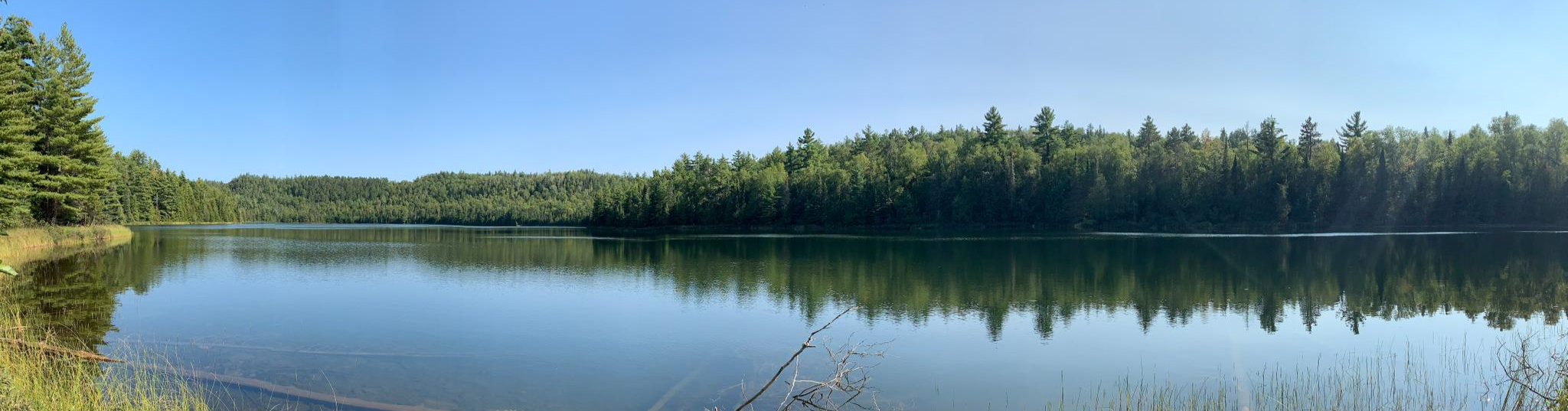
Waterfall hiking trails in Boundary Waters Canoe Area Wilderness are set within a vast, glaciated landscape of over one million acres in northeastern Minnesota. The region features rugged cliffs, rocky shores, and thousands of lakes and streams, all sculpted by ancient glaciers. It is characterized by extensive boreal and mixed forests, offering diverse tree species and varied terrain for hikers. The area also includes Eagle Mountain, Minnesota's highest peak at 2,301 feet, and is part of the Canadian Shield, contributing…
Last updated: July 7, 2026
12.3km
03:33
320m
320m
Moderate hike. Good fitness required. Easily-accessible paths. Suitable for all skill levels.
1
hikers
7.12km
01:55
80m
100m
Easy hike. Great for any fitness level. Easily-accessible paths. Suitable for all skill levels.

Sign up for free
5
hikers
1.28km
00:20
10m
10m
Easy hike. Great for any fitness level. Easily-accessible paths. Suitable for all skill levels.
5.0
(2)
17
hikers
5.34km
01:23
30m
30m
Easy hike. Great for any fitness level. Easily-accessible paths. Suitable for all skill levels.
5.0
(1)
14
hikers
9.24km
02:26
80m
80m
Moderate hike. Good fitness required. Easily-accessible paths. Suitable for all skill levels.
Our route recommendations are based on thousands of hikes, rides, and runs completed by other people on komoot.
Start today with a free account
Your next adventure awaits.
Login or Signup
Popular around Boundary Waters Canoe Area Wilderness
Other adventures in Boundary Waters Canoe Area Wilderness

Tips from the Community


Dry Falls is formed by a small stream flowing from Dry Lake into Bass Lake. Beautiful spot to stop and have a look out over Bass Lake.
0
0
Crab Lake can be accessed from BWCAW Access Point #4, just off of County Road 404. The lake is popular for canoeing, and is an easy portage from the trailhead. There is a campsite along the Crab Lake Spur Trail that has shoreline pitches.
0
0
Bridal Falls is one of the tallest waterfalls in all of the BWCAW. The falls can be found on the Border Route Trail (BRT), and the easiest way to reach the falls is by taking the Crab Lake Spur Trail to the BRT. The falls are named after their similar appearance to a bridal veil, especially when the water is quite high.
0
0
This 70 foot tall waterfall is an easy walk from the car park. The name comes from the Ojibwe word meaning "river full of beaver or muskrat houses".
0
0
As Duncan Lake empties into Rose Lake to the north, the water cascades down this beautiful 20 foot tall waterfall. The waterfall can be seen just off of the Border Route Trail.
0
0
There are many overlooks as you cross the top of the cliffs along the edges of Duncan Lake. This is a popular area for canoeists, and you may see them portaging to either Rose or Moss Lake.
0
0
Dry Lake is a short walk from the trailhead, making it an easy portage for canoeing. The lake empties into Bass Lake to the south, and Dry Falls can be found between the two lakes.
0
0
Frequently Asked Questions
What kind of terrain can I expect on waterfall hikes in Boundary Waters Canoe Area Wilderness?
The Boundary Waters Canoe Area Wilderness features a rugged and varied terrain, sculpted by ancient glaciers. You'll encounter rugged cliffs, rocky shores, and vast forests of boreal and mixed tree species. Trails can be remote and may lack typical trail luxuries like bridges, offering a true wilderness experience. For example, the Caribou Rock Trail — Superior National Forest is a moderate hike with significant elevation changes, guiding you past three different Boundary Waters lakes.
Are there any easy waterfall hikes suitable for beginners or families?
Yes, there are options for easier walks. The Kawishiwi Falls Loop — Superior National Forest is an easy 0.8-mile path that takes about 20 minutes to complete, offering direct views of the Kawishiwi Falls. This short and accessible trail is ideal for those looking for a less strenuous option.
What permits are required for hiking in the Boundary Waters Canoe Area Wilderness?
Permits are required for both day and overnight trips into designated areas of the Boundary Waters Canoe Area Wilderness. This regulated access helps maintain the wilderness character and ensures a more isolated experience. It's advisable to check with the U.S. Forest Service for specific permit requirements and to book in advance, especially during peak seasons.
What are some notable natural features or landmarks to look out for on these trails?
The region is rich in natural beauty. You'll find glacial topography, vast forests, and abundant waterways. Some trails, like the Caribou Rock Trail — Superior National Forest, will lead you past several Boundary Waters lakes. The area also includes Minnesota's highest peak, Eagle Mountain, and features like the Rove Formation, evident in places like Pine Lake, which boasts impressive ridgelines rising up to 500 feet above the water.
What is the best time of year to visit for waterfall hiking?
The best time to visit for waterfall hiking is typically during spring and early summer when snowmelt contributes to higher water levels, making the waterfalls more impressive. Fall also offers beautiful scenery with vibrant foliage, though water flow might be reduced. Winters can be challenging due to snow and ice, requiring specialized gear and experience.
Can I bring my dog on waterfall hiking trails in the Boundary Waters Canoe Area Wilderness?
Regulations regarding dogs in the Boundary Waters Canoe Area Wilderness can vary. While some areas may allow leashed dogs, it's crucial to verify specific rules for each trail and entry point with the U.S. Forest Service before planning your trip. Always ensure your dog is under control and that you pack out all waste.
Are there any circular waterfall hiking routes?
Yes, some trails offer a loop experience. For instance, the Kawishiwi Falls Loop — Superior National Forest is a short, easy circular path that provides views of the falls. Another option is the Bass Lake Trail Loop — Superior National Forest, which is a moderate 5.7-mile loop through varied forest terrain.
What kind of wildlife might I see while hiking near waterfalls?
The Boundary Waters Canoe Area Wilderness is a critical habitat for diverse wildlife. Hikers might spot animals such as moose, bear, deer, lynx, and various bird species including grouse and waterfowl. Keep an eye out near water sources for opportunities to observe these creatures in their natural environment.
What do other hikers enjoy most about hiking in Boundary Waters Canoe Area Wilderness?
The trails in Boundary Waters Canoe Area Wilderness are highly rated by the komoot community, with an average score of 5.0 stars. Hikers often praise the pristine wilderness, the solitude, and the unique glacial topography that defines the region. The opportunity to experience unspoiled boreal forests and stunning waterways is a common highlight.
Are there any other lakes or points of interest near the waterfall trails?
Absolutely. The region is dotted with numerous lakes and natural features. Beyond the waterfalls, you can explore areas like Rose Lake, known for cliffs rising 300 to 400 feet, or Pine Lake with its impressive ridgelines. Other nearby highlights include Gogebic Lake and Partridge Lake, offering more opportunities to experience the area's abundant waterways.
How challenging are the waterfall hiking trails in this area?
The difficulty of waterfall hiking trails in Boundary Waters Canoe Area Wilderness varies. You can find easy paths like the Kawishiwi Falls Loop — Superior National Forest, which is a short, accessible walk. More challenging options include the Caribou Rock Trail — Superior National Forest, a moderate 7.6-mile route with notable elevation changes, offering a more strenuous wilderness experience.
What should I pack for a waterfall hike in Boundary Waters Canoe Area Wilderness?
Given the wilderness nature of the area, it's essential to be well-prepared. Pack appropriate layers for varying weather, sturdy hiking boots, plenty of water, snacks, a map and compass (or GPS device), insect repellent, and a first-aid kit. For longer or more remote trails, consider bringing water purification tablets and emergency shelter. Always remember to pack out everything you pack in.
Most popular routes in Boundary Waters Canoe Area Wilderness
Most popular attractions in Boundary Waters Canoe Area Wilderness

Get inspired with the komoot mobile app


Explore more
Browse the best Hikes in other regions.
