The best waterfall hikes and walks in Inyo National Forest
4.7
(255)
5,004
hikers
10
hikes
Waterfall hiking trails in Inyo National Forest traverse a vast landscape covering nearly two million acres, primarily on the eastern slope of the Sierra Nevada. The region features towering mountains, including peaks over 14,000 feet, and numerous alpine lakes. Diverse ecosystems range from semi-arid deserts to high-alpine meadows, with significant elevation changes across its terrain.
Best waterfall hiking trails in Inyo National Forest
- The most popular waterfall hiking route is Big Pine Lakes Trail, an 8.3 miles (13.3 km) trail that takes 4 hours 29 minutes to complete. This difficult route leads to a series of pristine alpine lakes and offers views of glacial features.
- Another top favourite among local hikers is Rainbow Falls Trail, an easy 1.9 miles (3.1 km) path. This trail provides access to the notable Rainbow Falls, known for its scenic cascades.
- Local hikers also love the Big Pine Creek Campground and Glacier Lodge Loop Trail, a 1.4 miles (2.3 km) trail leading through forested areas, often completed in about 45 minutes.
- Hiking in Inyo National Forest is defined by towering mountains, pristine alpine lakes, and diverse ecosystems. The network offers options for various ability levels, from easy walks to challenging multi-day ascents.
- The routes in Inyo National Forest are highly rated by the komoot community with an average score of 4.7 stars from more than 250 reviews. More than 4000 hikers have used komoot to explore Inyo National Forest's varied terrain.
Last updated: August 31, 2026
21
hikers
13.3km
04:30
1,080m
40m
Hike the challenging Big Pine Lakes Trail, a difficult 8.3-mile route with 3555 feet of elevation gain, leading to stunning alpine lakes.
1
hikers
3.13km
00:51
0m
130m
The Rainbow Falls Trail is a delightful, easy hike that leads you directly to the captivating Rainbow Falls. This short route offers a refreshing escape into nature, with the sound of the falls growing louder as you approach. It's a perfect choice for those who appreciate a scenic destination without the challenge of a long or steep ascent, providing a tranquil experience amidst the natural landscape.
Planning your visit to the Rainbow Falls Trail is straightforward, though an early start is recommended to ensure parking availability, especially during peak times. The trail is an easy 1.9 miles (3.1 km) round trip, with a negligible 5 feet (2 metres) of elevation gain, taking approximately 51 minutes to complete. It's a well-maintained path, making it suitable for most visitors, but always wear comfortable footwear.
What makes the Rainbow Falls Trail stand out is its accessibility and the immediate reward of the waterfall itself, making it one of the most popular trails for a quick nature fix. It's an excellent option for families or anyone looking for a gentle introduction to hiking in the area, offering a beautiful natural landmark without requiring significant time or effort.

Sign up for free
2
hikers
2.31km
00:45
120m
90m
Embark on an easy hike along the Big Pine Creek Campground and Glacier Lodge Loop Trail, a family-friendly route that winds through scenic mountain terrain. This loop covers 1.4 miles (2.3 km) with a gentle elevation gain of 407 feet (124 metres), making it perfect for a quick outing. You can expect to complete the hike in about 45 minutes, enjoying views of the cascading creek as you go. A highlight is crossing the footbridge over Big Pine Creek, where you can pause to appreciate the sounds and sights of the water. Keep an eye out for local wildlife, as the area is rich in natural beauty.
When planning your visit, be aware that trail conditions can become challenging if Big Pine Creek is experiencing floodwaters. It is wise to check local conditions before heading out, especially after heavy rain or snowmelt. Additionally, mosquitoes can be quite active during certain times of the year, so remember to pack bug spray and consider wearing protective clothing. Taking these precautions will help ensure a more comfortable and enjoyable experience on the trail.
This route is nestled within the vast Inyo National Forest, an area renowned for its diverse ecosystems and stunning alpine landscapes. The trail offers a glimpse into the region's natural splendor, from its mountain terrain to the vibrant creek. It serves as an excellent introduction to the area's outdoor offerings, providing a peaceful escape into nature without requiring a strenuous effort. The trail's accessibility and gentle nature make it a popular choice for those looking to connect with the environment.
108km
34:30
3,840m
3,830m
Hike the difficult 67.0-mile North Lake South Lake Loop through Kings Canyon National Park, gaining 12601 feet over three high passes.
39
hikers
3.85km
01:06
90m
90m
The Rainbow Falls Trail is a delightful, easy hike that leads you through a landscape recovering from the 1992 Rainbow Fire, culminating at the picturesque Rainbow Falls. You'll experience a gentle journey, observing the forest's regrowth and the natural beauty of the area. It's a perfect short escape for anyone wanting to connect with nature without a strenuous climb.
Planning your visit to the Rainbow Falls Trail is generally straightforward, as it's an accessible route. Check with local park authorities for current parking availability and any specific access requirements. Given its easy difficulty and short duration of about 1 hour and 5 minutes, it's an ideal hike for a casual outing, perhaps combined with other activities in the region.
This trail offers a unique opportunity to witness forest recovery firsthand, showcasing nature's ability to rebound after significant events like the 1992 Rainbow Fire. With a total distance of 2.4 miles (3.9 km) and a modest elevation gain of 290 feet (89 metres), it's a rewarding experience for families and casual hikers alike, providing a peaceful natural setting.
Get access to more routes and recommendations from other explorers.
Sign up for free
Already have an account?
Our route recommendations are based on thousands of hikes, rides, and runs completed by other people on komoot.
Start today with a free account
Your next adventure awaits.
Login or Signup
Popular around Inyo National Forest



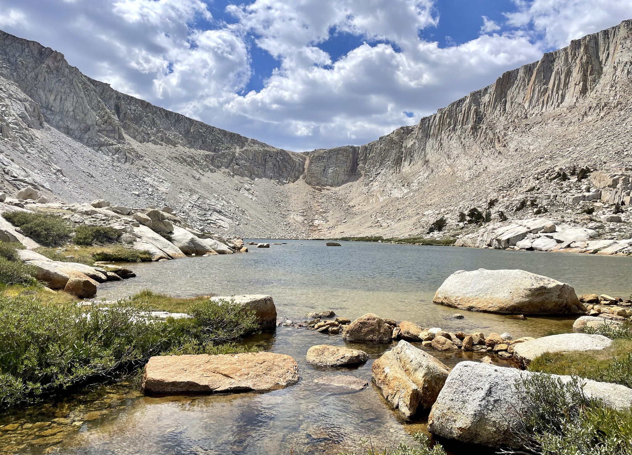
Other adventures in Inyo National Forest


Tips from the Community

The name says it all! Absolutely unreal views south onto the Palisade group!
1
0
The pictures taken from this small rocky outcrop above Second Lake, marked here by a tentsite symbol, are ICONIC. If the pictures above look familiar, that’s because… well.. they are! Temple Crag from across Second Lake is one of the most frequently photographed “scenes” of the Eastern Sierras. Just a quick search on the internet of “Big Pine Lakes” will pull up countless pictures almost identical to each other of this exact lake/peak combo. (Seriously, try it 😂) And honestly, it’s easy to understand why! The setting is otherwordly!
1
0
FIRST Lake is, ironically, the LAST place for this water to rest before heading down through Big Pine Valley as the North Fork Big Pine Creek and entering, as a tributary, the Owens River 6,000ft below! To the east you are offered a lovely view to Mount Alice, while to the south Temple Crag commands your attention! The water in First Lake, as well as the ither Big Pine Lakes, often can be seen with a beautiful teal hue, caused by the refraction of sunlight on particles of glacial silt in the water!
0
0
Behold! to the southeast! Mount Alice! In his book, “The High Sierra,” author R.J. Secor describes Mount Alice as, “… the biggest pile of rubble in the High Sierra.” 😂
2
0
Cascade created by the North Fork Big Pine Creek!
1
0

Third Lake, like the other reservoirs along the North Fork Big Pine Creek Trail, has a bunch of camping around the shores of the water. Just make sure to follow LNT principles if you stay overnight (or even if you just hang out by the lake for part of the day).
0
0

Rainbow Falls is a 101-foot waterfall, which is the largest falls on the San Joaquin River. The falls are located a short distance off the Pacific Crest Trail.
0
0
Every alpine lake has its own qualities that make it stand out, but Second Lake has often been called the most beautiful of the numbered lakes in this part of the John Muir Wilderness. This could be because it's the biggest or because it's the easiest to explore in depth since there is a spur trail that travels between this lake and First Lake.
0
0
Frequently Asked Questions
How many waterfall hiking trails are available in Inyo National Forest?
Inyo National Forest offers a selection of 13 waterfall hiking trails, catering to various skill levels. You'll find 4 easy routes, 6 moderate paths, and 3 more challenging hikes to explore.
What are some easy waterfall hikes suitable for beginners in Inyo National Forest?
For an accessible experience, consider the Rainbow Falls Trail, an easy 1.9-mile path leading directly to the notable Rainbow Falls. Another great option is the Big Pine Creek Campground and Glacier Lodge Loop Trail, a 1.4-mile loop through forested areas, typically completed in about 45 minutes.
Are there any challenging waterfall hikes in Inyo National Forest?
Yes, for a more strenuous adventure, the Big Pine Lakes Trail is a difficult 8.3-mile route that takes approximately 4 hours and 29 minutes to complete. This trail leads to a series of pristine alpine lakes and offers stunning views of glacial features, often with smaller cascades along the way.
What is the best time of year to experience waterfalls in Inyo National Forest?
The best time to witness the waterfalls in their full glory is typically during late spring and early summer (May to July), when snowmelt from the Sierra Nevada peaks feeds the rivers and streams, resulting in powerful cascades. Fall offers beautiful foliage, but water flow might be reduced.
What do other hikers say about the waterfall trails in Inyo National Forest?
The waterfall trails in Inyo National Forest are highly regarded by the komoot community, boasting an average rating of 4.7 stars from over 250 reviews. Hikers frequently praise the breathtaking scenery, the rewarding views of alpine lakes and towering peaks, and the diverse ecosystems encountered along the routes.
Are there any family-friendly waterfall hikes in the area?
Absolutely! Easy trails like the Rainbow Falls Trail are excellent for families. Its relatively short distance and gentle incline make it suitable for children and those looking for a less strenuous outing to a beautiful waterfall.
What interesting natural features or landmarks can I see near the waterfall trails?
Beyond the waterfalls themselves, Inyo National Forest is rich with natural wonders. You can explore iconic peaks like Mount Whitney, discover unique geological formations at Devils Postpile National Monument (often visited in conjunction with Rainbow Falls), or marvel at the ancient trees in the Bristlecone Pine Forest. Many trails also lead to picturesque alpine lakes, such as those found along the Big Pine Creek drainage.
Are there any circular waterfall hikes in Inyo National Forest?
Yes, the Big Pine Creek Campground and Glacier Lodge Loop Trail is a pleasant 1.4-mile circular route that takes you through forested areas, offering a refreshing walk with the sounds of the creek nearby, which often features small cascades.
What should I pack for a waterfall hike in Inyo National Forest?
Given the diverse terrain and elevation changes, it's wise to pack layers of clothing, sturdy hiking boots, plenty of water, snacks, and sun protection. Depending on the season, waterproof gear might be beneficial due to mist near waterfalls or unexpected showers. Always carry a map or GPS device, and consider trekking poles for stability on uneven paths.
Are there any less crowded waterfall hikes in Inyo National Forest?
While popular spots like Rainbow Falls can attract crowds, exploring some of the longer or more challenging routes, such as the upper sections of the Big Pine Creek drainage, can offer a more secluded experience. Visiting during weekdays or outside of peak summer months can also help you find quieter moments on the trails.
What are the typical distances and durations for waterfall hikes in this region?
Waterfall hikes in Inyo National Forest vary significantly. Easy trails like the Rainbow Falls Trail are around 1.9 miles and take about an hour. More challenging routes, such as the Big Pine Lakes Trail, can be 8.3 miles or more, requiring several hours to complete, often a full day for a round trip.
Are there any places to stay or facilities near the waterfall trails?
Yes, the region offers various accommodations and facilities. You can find resorts and shops like Reds Meadow Resort & Shop or Saddlebag Lake Resort. Additionally, there are numerous campgrounds throughout Inyo National Forest, including those near Big Pine Creek, providing convenient access to many trails.
Most popular routes in Inyo National Forest
Most popular attractions in Inyo National Forest

Get inspired with the komoot mobile app


Explore more
Browse the best Hikes in other regions.
