The best walks and hikes in Mount Holyoke Range State Park
4.5
(50)
485
hikers
26
hikes
Hiking in Mount Holyoke Range State Park offers access to an extensive network of trails traversing diverse terrain, including wetlands, streams, and elevated ridgelines. The park is defined by its 7-mile Mount Holyoke Range ridgeline, which provides views of the surrounding Pioneer Valley. This area features unique geology shaped by ancient volcanic lava flows, creating distinctive basalt formations. Hikers can explore a variety of landscapes, from dense woodlands to open ridgelines, with trails suitable for different experience levels.
Best hiking…
Last updated: September 27, 2026
4.7
(3)
11
hikers
6.18km
02:13
210m
210m
Embark on the Mt. Bare, Mt. Hitchcock, Triple B Trail for a challenging hike through the picturesque natural surroundings of the Mount Holyoke Range. This difficult route spans 3.8 miles…
5
hikers
7.03km
02:32
250m
250m
Prepare for a difficult hike on the Robert Frost, NET, North Side, and Laurel Loop Trail, covering 4.4 miles (7.0 km) with a significant 829 feet (253 metres) of elevation…

3
hikers
1.88km
00:55
170m
20m
Embark on a challenging hike up Mount Norwottuck, a difficult 1.2-mile (1.9 km) route that will test your endurance. As you ascend, you'll traverse diverse terrain, winding through a beautiful…
2
hikers
7.75km
03:16
280m
330m
Prepare for a difficult hike on MA NET: Section 8, a route that spans 4.8 miles (7.8 km) and climbs 931 feet (284 metres). You can expect to spend about…
4.27km
01:09
40m
80m
Hike the easy 2.7-mile Lithia Springs Reservoir Loop in Mount Holyoke Range State Park, featuring forests, reservoir views, and gentle eleva
Get access to more routes and recommendations from other explorers.
Already have an account?
Our route recommendations are based on thousands of hikes, rides, and runs completed by other people on komoot.
Start today with a free account
Your next adventure awaits.


Tips from the Community

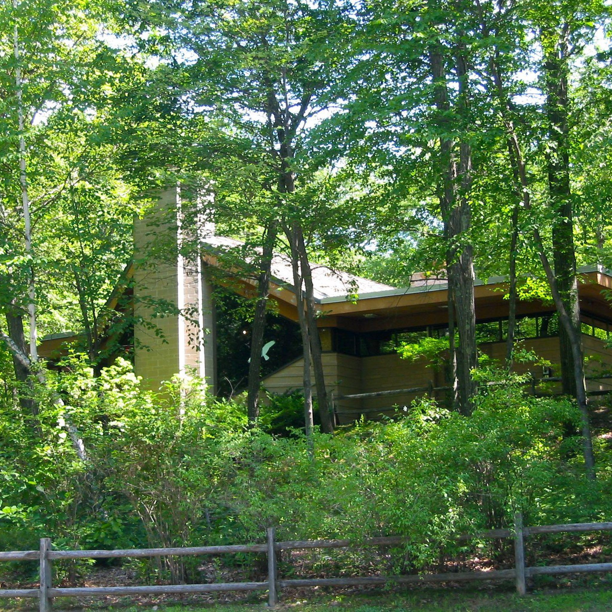
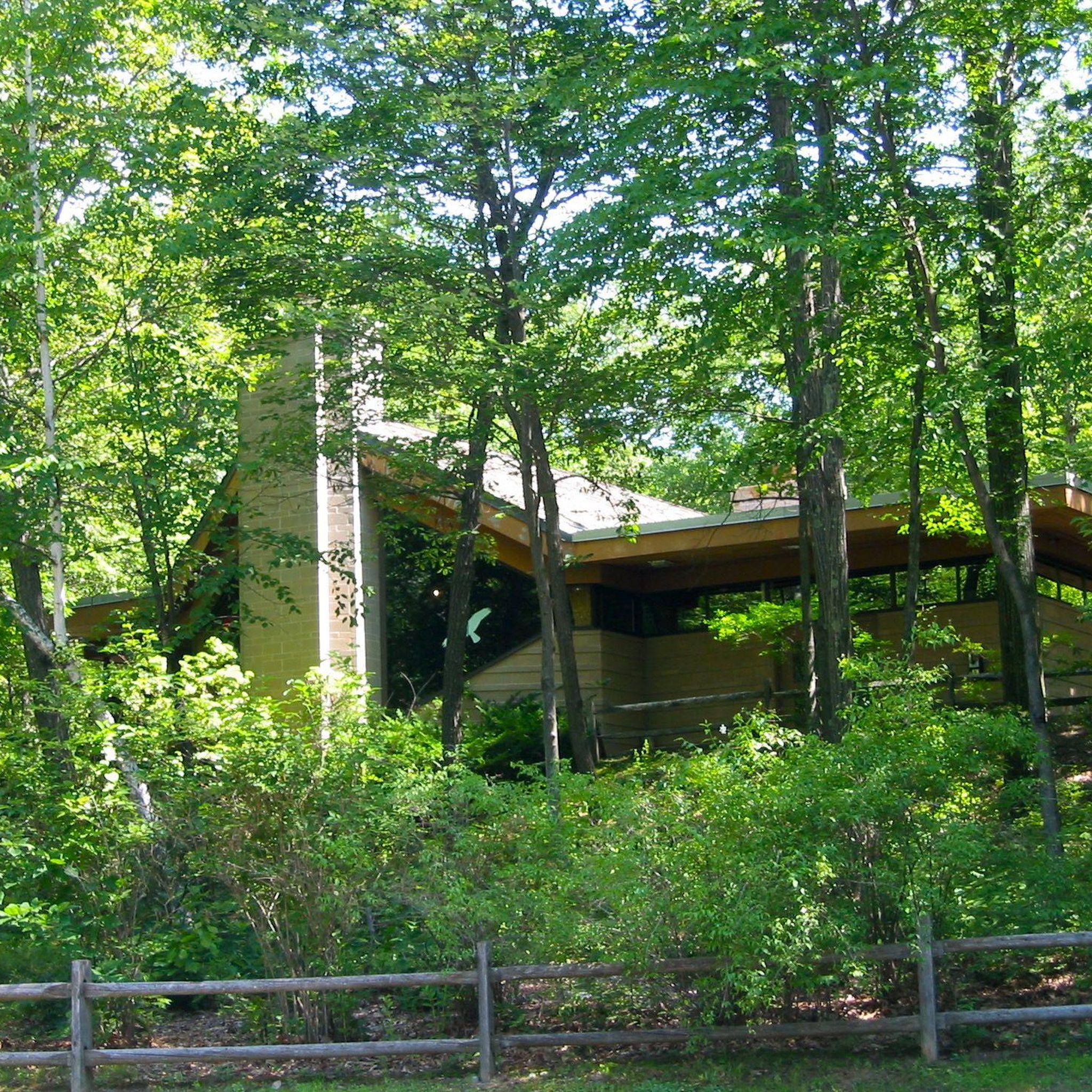
The Notch Visitor's Center is open daily from sunrise-sunset from Memorial Day to Labor Day. There are exhibits about the local flora and fauna, the unique geology of the Holyoke Range, and the history of the area. The Visitor Center is staffed with knowledgeable rangers, has parking, bathrooms, and picnic areas, and is also where several popular hiking trails leave from, including the Metacomet-Monadnock, which crosses right in front of the Visitor Center.
0
0

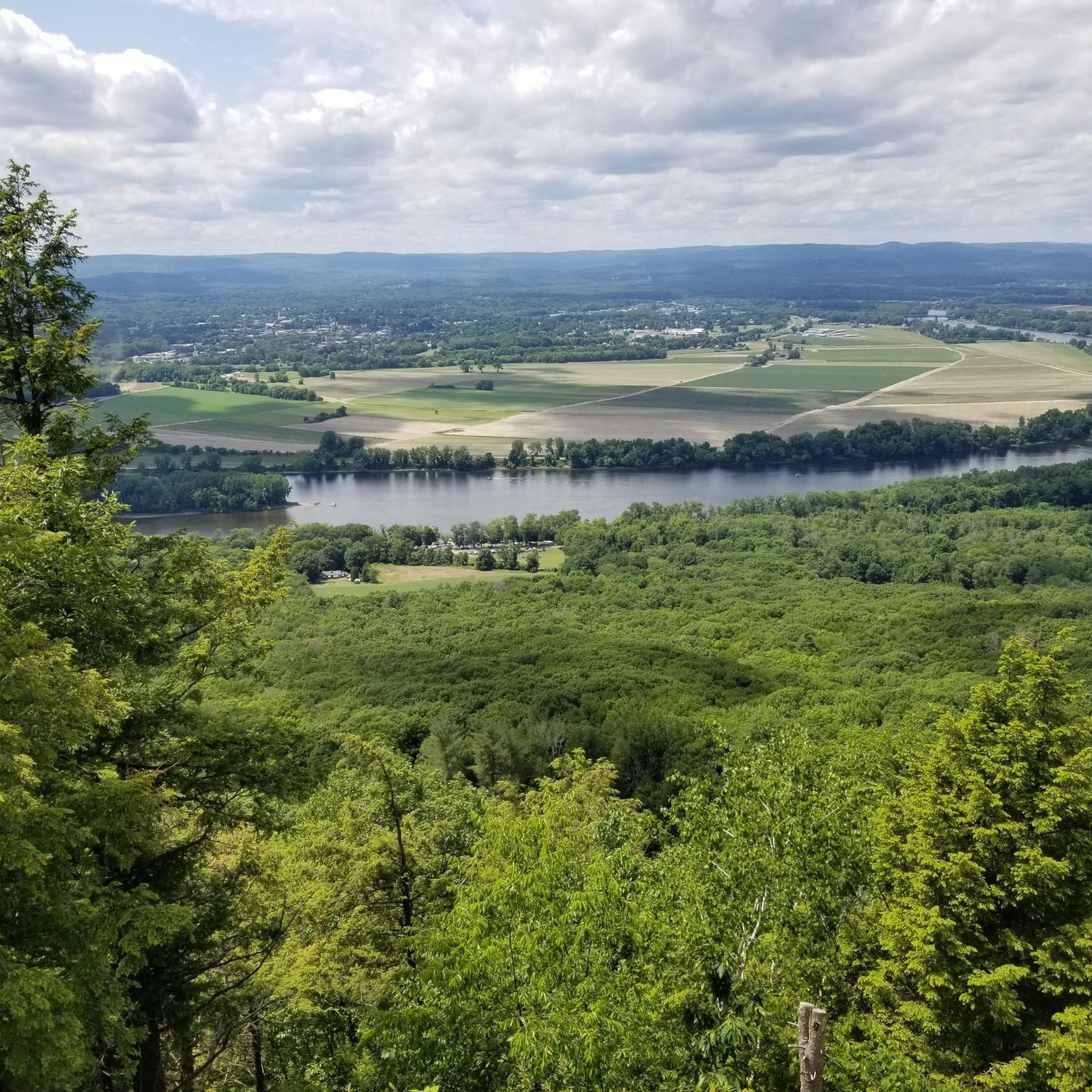
This 3,000-acre park showcases 7 miles of mountain ridge line and encompasses a diverse range of terrains. It provides an excellent experience for hikers, mountain bikers, snowmobilers, and cross-country skiers. Scattered throughout the park, there are several scenic viewpoints to take advantage of.
0
0

This scenic reservoir was once the town's main water source. While swimming is prohibited, visitors can still enjoy the peaceful views and abundant wildlife along its trails.
0
0
Long Mountain stands at 920 feet on the eastern side of the Holyoke Range. Rising 600 feet above the surrounding landscape, this mountain dominates the landscape. Although you get nice views from the summit, several rocky outcroppings and ledges provide even better views of the Amherst region and the Fort River valley.
0
0
Rattlesnake Knob is a fantastic overlook between Mt. Norwottuck and Long Mountain. Although the trail can be a little steep and slippery, it's well-worth the fantastic, sweeping views over the eastern portion of the Holyoke Range.
0
0
The Horse Caves are a series of rocky outcroppings that played a role in American history. During Shays’ Rebellion, Daniel Shays and some of his men supposedly took refuge in the Horse Caves after their defeat by the Massachusetts militia. They were also used by soldiers during the Civil War. Even if you're not a history buff, these caves are an interesting and unique geological feature to explore.
1
0
The Notch Visitor's Center is open daily from sunrise-sunset from Memorial Day to Labor Day. There are exhibits about the local flora and fauna, the unique geology of the Holyoke Range, and the history of the area. The Visitor Center is staffed with knowledgeable rangers, has parking, bathrooms, and picnic areas, and is also where several popular trails leave from, including the Metacomet-Monadnock, which crosses right in front of the Visitor Center.
0
0
Bare Mountain stands at 1,014 feet above sea level and is part of the greater Metacomet Ridge and the Holyoke Range. This steep mountain is popular with students from the many elite colleges in the nearby towns. From the summit you get great views of the surrounding valleys to the north and south, views to Mount Norwottuck and the eastern peaks of the Holyoke Range, and of the campuses of the University of Massachusetts Amherst and Hampshire College. Bare Mountain also is home to a bunker that was used as the command center for U.S. forces during the Cuban Missile Crisis.
0
0
Frequently Asked Questions
How many hiking trails are available in Mount Holyoke Range State Park?
Mount Holyoke Range State Park offers a network of over 20 hiking trails. These routes traverse diverse terrain, from wetlands and streams to elevated ridgelines, providing options for various skill levels.
What is the best time of year to hike in Mount Holyoke Range State Park?
The park offers distinct experiences throughout the year. Spring brings blossoming flora, while higher elevations provide a cool retreat from summer heat. The autumn foliage is globally celebrated, and winter allows for cross-country skiing, snowshoeing, and snowmobiling. Each season presents unique beauty and conditions.
What kind of terrain and elevation changes can I expect on the trails?
The trails in Mount Holyoke Range State Park are known for their varied and often challenging terrain. The park's 7-mile ridgeline, uniquely oriented east to west, features strenuous elevation changes. Many routes, like the Mount Norwottuck loop, ascend to significant peaks, providing panoramic views. The area's unique geology, shaped by ancient volcanic lava flows, also creates distinctive basalt formations.
Are there any family-friendly hiking options in Mount Holyoke Range State Park?
While many trails in the park are rated as difficult, there is at least one easy route available, making it possible to find options suitable for families or those seeking a less strenuous experience. It's always recommended to check the specific trail details for distance and elevation before heading out with children.
What interesting natural features or landmarks can I see along the trails?
The park is rich in natural and historical features. You can explore the intriguing Horse Caves, a series of natural ledges and alcoves located below Mount Norwottock's summit. The historic Summit House, in the adjacent Joseph Allen Skinner State Park, offers 360-degree views. Hikers can also encounter the Lithia Springs Reservoir and various summits like Mount Hitchcock.
Are there any loop trails in Mount Holyoke Range State Park?
Yes, there are several loop trails available. For instance, the Mount Norwottuck loop via the Robert Frost and Metacomet-Monadnock Trails is a popular 3.4-mile option. Another is the Lithia Springs Reservoir via M&M Trail loop, offering a longer experience.
What kind of wildlife might I encounter while hiking?
Mount Holyoke Range State Park is recognized for its biodiversity and unique microclimates, supporting a diverse array of ecosystems. It's a habitat for several listed animal species, including the blackpoll warbler and peregrine falcon. The park also serves as a crucial stopover point for seasonal raptor migrations, and timber rattlesnakes thrive among its rocky outcroppings.
What are some of the best viewpoints in the park?
The park's prominent east-west ridgeline consistently provides breathtaking views of the surrounding Pioneer Valley. Mount Norwottock, the highest point in the range, offers expansive vistas. Additionally, the Summit House in the adjacent state park provides 360-degree panoramic views, especially stunning during fall foliage.
What do other hikers enjoy most about Mount Holyoke Range State Park?
The area is highly rated by the komoot community, with an average score of 3.98 stars from over 20 reviews. Hikers often praise the diverse terrain, the challenging ridgeline routes, and the rewarding panoramic views of the Pioneer Valley from various summits.
How long do hikes typically take in Mount Holyoke Range State Park?
Hike durations vary significantly depending on the trail's length and difficulty. For example, the Mount Norwottuck loop typically takes around 2 hours, while longer routes like Mount Norwottuck and Long Mountain from the Notch Visitor's Center can take nearly 5 hours to complete.
Are there any visitor centers or facilities in the park?
Yes, the Notch Visitor's Center serves as a key starting point for many trails, including the route to Mount Norwottuck and Long Mountain. This center can provide information and potentially facilities for hikers.
What is the Metacomet-Monadnock Trail and how does it relate to the park?
The Metacomet-Monadnock Trail (M-M Trail) is a significant long-distance path that traverses Mount Holyoke Range State Park as part of the broader New England Trail. A challenging 10-mile segment of the M-M Trail within the park and the adjacent Joseph Allen Skinner State Park ascends to the highest peaks in the region, offering a comprehensive hiking experience.
Most popular routes in Mount Holyoke Range State Park
Most popular attractions in Mount Holyoke Range State Park

Get inspired with the komoot mobile app


Explore more
Browse the best Hikes in other regions.
