The best walks and hikes in Westridge-Canyonback Wilderness Park
4.6
(174)
5,046
hikers
183
hikes
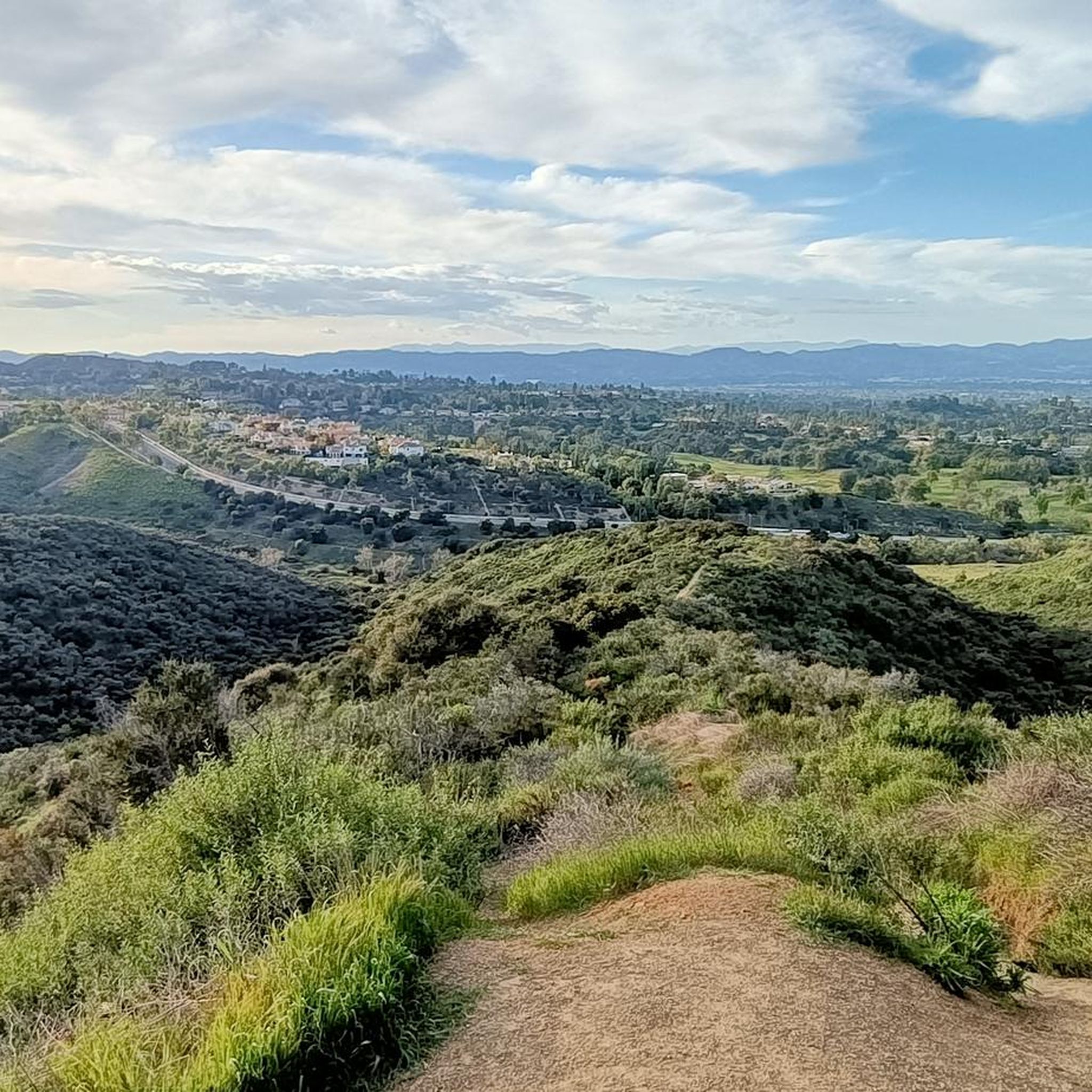
Hikes in Westridge-Canyonback Wilderness Park explore a 1,500-acre natural area within the eastern Santa Monica Mountains. The park's terrain is defined by a network of fire roads and singletrack trails that traverse deep canyons and follow prominent ridgelines. The landscape is primarily Southern California chaparral, with some oak groves in the canyon bottoms, offering expansive views over the Los Angeles Basin and San Fernando Valley.
Best hiking trails in Westridge-Canyonback Wilderness Park
- The most popular hiking route is San Vincente Mountain loop — Westridge-Canyonback Wilderness Park, a 4.9 mile (7.9 km) trail that takes around 2 hours 20 minutes to complete. This moderate hike leads to the historic San Vicente Mountain Park, a former Nike missile control site.
- Another top favourite among local hiking enthusiasts is Sullivan Canyon loop — Sullivan Canyon Park, a moderate 8.7 mile (13.9 km) path. The route descends into the shaded canyon before climbing back up to the exposed ridgeline.
- Local hiking enthusiasts also love the West Mandeville Ridge Trail loop — Mandeville Canyon Park, a 3.4 mile (5.4 km) trail leading through the chaparral landscape, often completed in about 1 hour 45 minutes.
- Hiking in Westridge-Canyonback Wilderness Park is defined by wide fire roads, canyon trails, and exposed ridgelines. The trail network provides options for various ability levels, from short, easy loops to longer, more challenging routes.
- The routes in Westridge-Canyonback Wilderness Park are highly rated by the komoot community with an average score of 4.8 stars from over 150 reviews. More than 4,000 hikers have used komoot to explore Westridge-Canyonback Wilderness Park's varied terrain.
Last updated: October 11, 2026
19
hikers
3.14km
00:57
110m
100m
The West Mandeville Fire Road and Ridge Trail offers an easy hike through Southern California chaparral. You will cover 2.0 miles (3.1 km) with a gentle elevation gain of 352 feet (107 metres), making it a quick adventure that takes about 56 minutes. As you walk, you will experience expansive views over the Los Angeles Basin and the Pacific Ocean. The trail provides a sense of escape, with the cityscape stretching out below you. Look for the distant San Gabriel Mountains on clear days, adding to the panoramic scenery.
Accessing the West Mandeville Fire Road is straightforward, typically starting from Mandeville Canyon Park. You can find the staging area at the end of Westridge Road, which serves as a convenient starting point. Be aware that the fire road offers little shade, especially during warmer parts of the day. It is wise to bring plenty of water to stay hydrated and wear sun protection. Consider starting your hike earlier in the morning or later in the afternoon to avoid the midday sun.
This trail is notable for its expansive vistas, providing a unique perspective of the Los Angeles area. While the landscape is dominated by chaparral, the true highlight is the sweeping outlooks over the city, ocean, and San Fernando Valley. It offers a quick and accessible way to immerse yourself in nature without venturing too far from urban conveniences. The route is a popular choice for those seeking a short, rewarding outdoor experience with impressive views.
5.0
(1)
22
hikers
7.85km
02:20
230m
240m
Hike the moderate 4.9-mile San Vincente Mountain loop for panoramic views of Los Angeles and a historic Nike missile site.

5.0
(1)
15
hikers
5.43km
01:44
220m
220m
Hike the easy 3.4-mile Westridge Fire Road Loop, gaining 738 feet, for panoramic views of Los Angeles, the Pacific Ocean, and San Fernando V
5.0
(2)
11
hikers
13.9km
04:15
440m
450m
Hike the Sullivan Canyon and Westridge Loop for a moderate 8.7-mile journey through shaded canyons and ridge-top views of Los Angeles.
5.0
(1)
86
hikers
Moderate hike. Good fitness required. Easily-accessible paths. Suitable for all skill levels.
Get access to more routes and recommendations from other explorers.
Already have an account?
Our route recommendations are based on thousands of hikes, rides, and runs completed by other people on komoot.
Start today with a free account
Your next adventure awaits.
Popular around Westridge-Canyonback Wilderness Park
Tips from the Community

This Burning Bush somehow made it through the devastating LA fires in January 2025. A true survivor
3
0

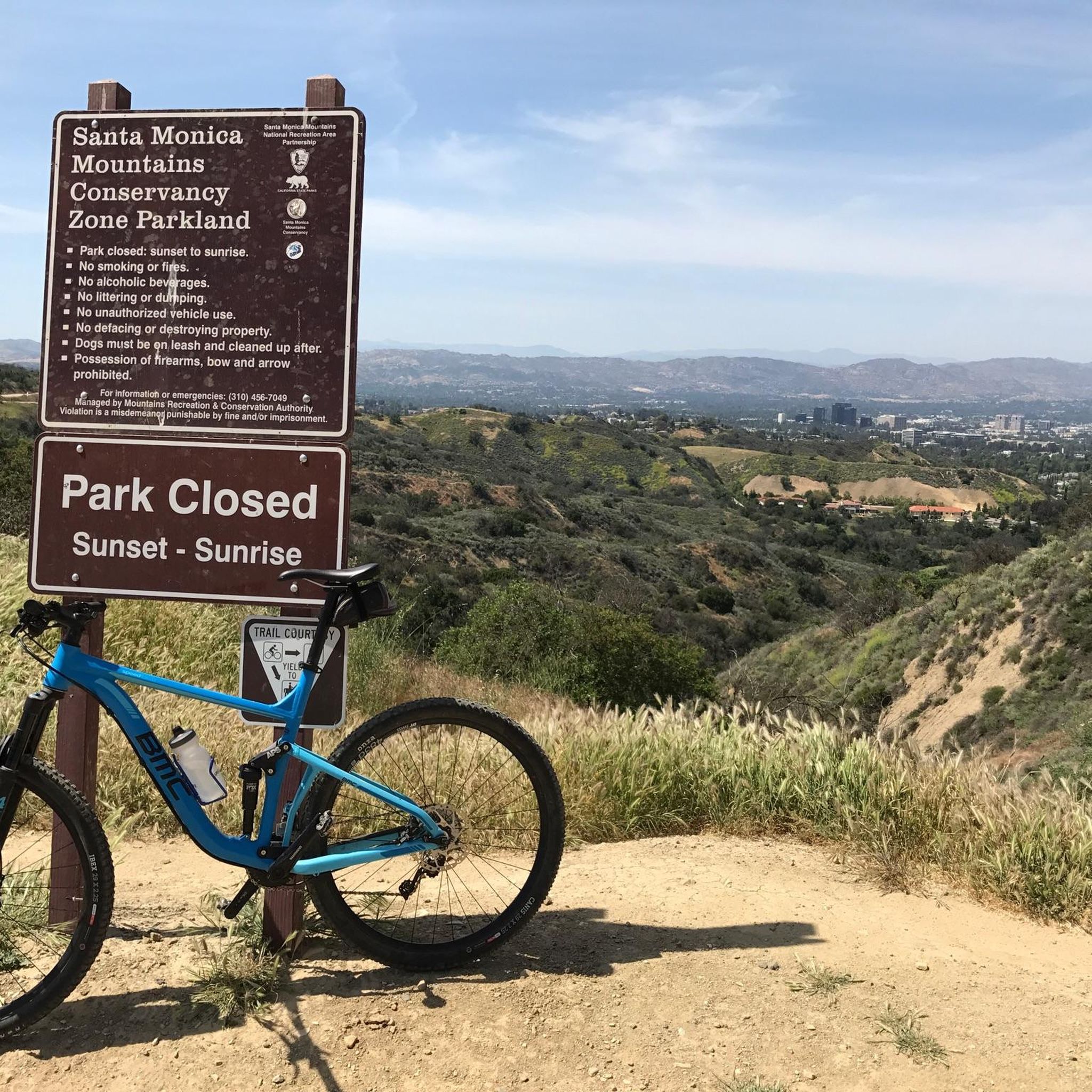
This park has an old fire road — perfect for non-technical riders — and a more challenging singletrack trail that more or less parallels the fire road. Both run north along the ridge, eventually connecting with the dirt/gravel section of Mulholland Drive.
0
0

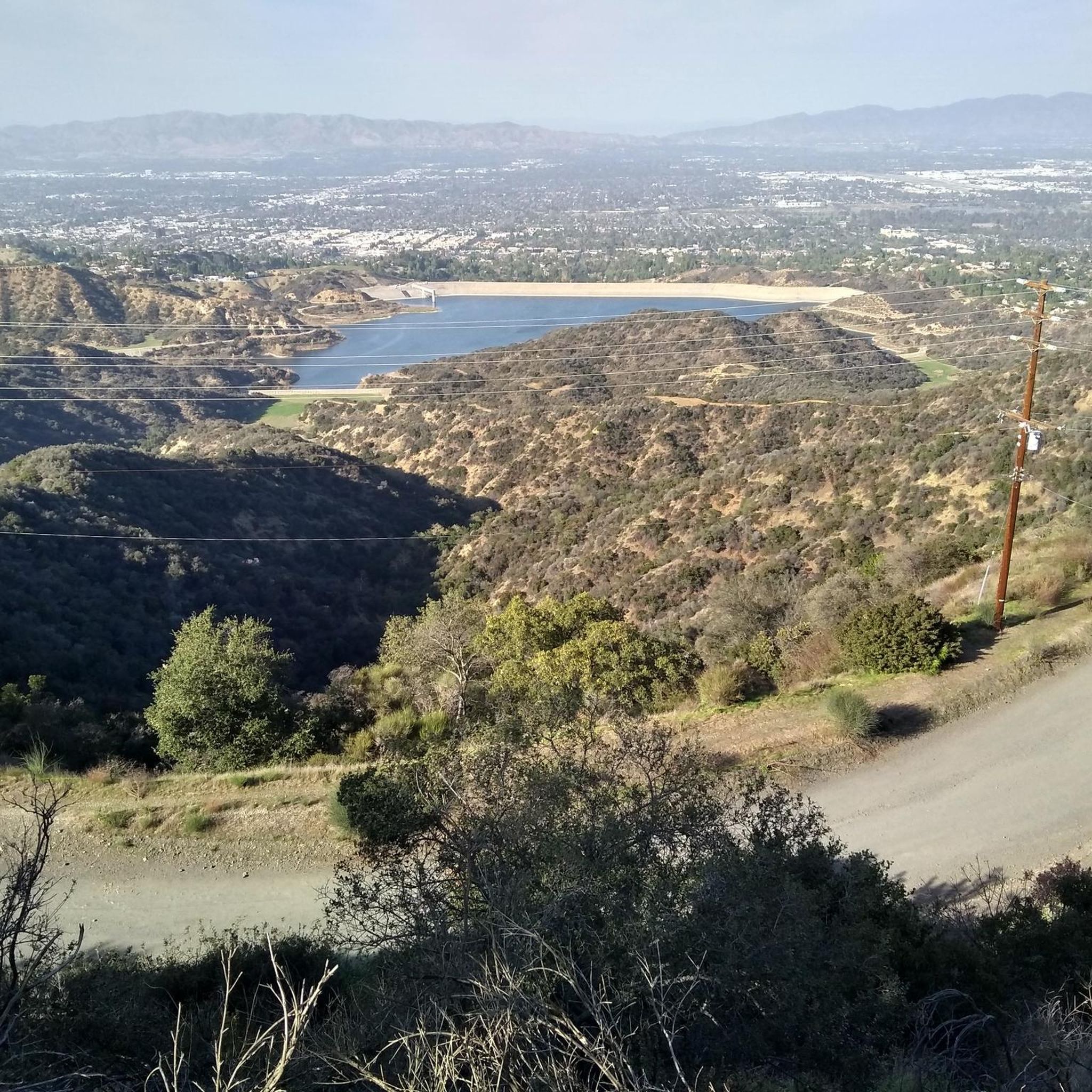
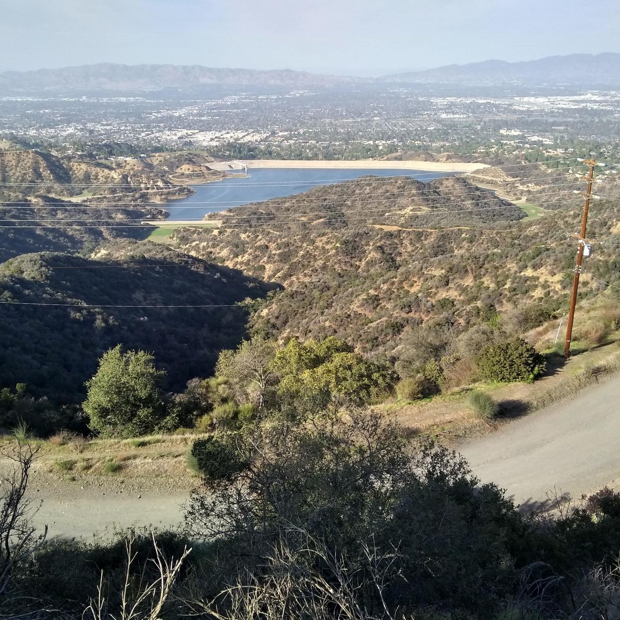
San Vicente Mountain Park, located 2.7 miles west of the 405 freeway on an unpaved section of Mulholland Drive, has awesome 360-degree views and access to extensive hiking, mountain biking, and equestrian trails. The 10.2-acre park has public picnic areas, bathrooms, and is a gateway to Westridge Canyonback Park and the 20,000-acre “Big Wild” wilderness area. A short walk along a wide dirt road leads visitors to this historic site, which once housed a Nike-Ajax missile radar station during the Cold War (1956–1968). The original radar tower now provides panoramic views of the Santa Monica Mountains, Encino Reservoir, San Fernando Valley, and Los Angeles Basin, making it one of the best spots in the region to watch a sunset.
1
0

West Mandeville Fire Road is a 3.7-mile trail located on the eastern edge of Topanga State Park. This popular, steep trail climbs from Santa Monica to Mulholland Drive and San Vicente Mountain Park, offering sweeping views of the city, mountains, and adjcent canyons. The wide fire road is ideal for biking, but is not a technical trail. It is popular with horseback riders and and hikers, so be on the look out for them. There is little shade so it can get hot, but this means that you get great views! The trail can be accessed from Mandeville Canyon Park in Santa Monica at the staging area at the end of Westridge Road, with access on the west side of the lot.
0
0

This is a great little summit, it makes for a good effort just to get here. The views from this platformed type summit with its raised observation tower is super good. You get great vistas of the Santa Monica Mountains, Encino Reservoir and the San Fernando Valley. There is a restroom and a toilet here.
0
0
Mulholland Drive is a famous road and known the world over. This segment of it is gravel and closed to cars, making it an excellent place to hike, bike or run. The road takes you high into the Hollywood Hills overlooking downtown Los Angeles and the views are great. This is a gravel section so I would suggest a good gravel bike with 40mm+ tires would be an excellent choice for this section.
0
0
This is a great little summit, it makes for a good effort just to get here. The views from this platformed type summit with its raised observation tower is super good. You get great vistas of the Santa Monica Mountains, Encino Reservoir and the San Fernando Valley.
0
0
This segment of the famous Mulholland Drive is gravel and closed to cars, making it an excellent place to hike, bike, and explore high in the Hollywood Hills.
0
0
Frequently Asked Questions
Are dogs allowed in Westridge-Canyonback Wilderness Park?
Yes, Westridge-Canyonback Wilderness Park is very dog-friendly. It is one of the few areas in Los Angeles where dogs are permitted to be off-leash, provided they are under voice control. Always be mindful of other trail users and wildlife.
How do I get to the trailheads and where can I park?
There are several access points. The main entrance is at the end of Westridge Road, where there is a small parking lot. Another popular starting point is from the San Vicente Mountain Park entrance off Mulholland Drive. Street parking is available near the trailheads, but be sure to check for any posted restrictions.
Are there any easy, family-friendly hikes in the park?
Yes, the park offers many options for easier walks. A good choice is the Hiking loop from Mandeville Canyon Park. This relatively flat 4-mile (6.4 km) trail is great for a casual outing with the family, offering wide paths and pleasant views without significant elevation gain.
What is the historic Nike missile site and how can I hike to it?
The park provides access to San Vicente Mountain Park, home to a decommissioned Nike missile control site from the Cold War. The former radar tower is now an observation deck with historical displays. You can hike there via the Old Nike Missile Tower – Westridge Burning Bush loop from Mandeville Canyon Park, which takes you directly to this unique piece of Los Angeles history.
What kind of views can I expect on the trails?
The ridgeline trails in the park offer spectacular panoramic views. Depending on your location and the clarity of the day, you can see across the Los Angeles Basin, the San Fernando Valley, and out to the Pacific Ocean and Catalina Island. Sunset hikes are particularly popular for the stunning light over the city.
Are the trails suitable for mountain biking or horseback riding?
Yes, many of the trails are multi-use. The wide Westridge Fire Road is particularly popular with mountain bikers and horseback riders. Singletrack trails may have more restrictions, so always check trail signage for permitted uses.
How many trails are there in Westridge-Canyonback Wilderness Park?
There is an extensive network of trails to explore, with over 150 different routes mapped on komoot. These range from wide fire roads to narrow singletrack paths, offering options for all skill levels. About half of the documented routes are considered easy.
What kind of plants and animals might I see?
The park is a prime example of Southern California's chaparral ecosystem, dominated by drought-tolerant shrubs and sage scrub. You'll also find oak and sycamore groves in the canyon bottoms. While larger mammals are elusive, the area supports a diverse range of birds, reptiles, and amphibians. For more detailed information, you can visit the MRCA's page on local flora and fauna.
Is there any shade or water available on the trails?
Most of the trails, especially along the ridgelines like the Westridge Fire Road, are very exposed with little to no shade. The canyon bottoms, such as in Sullivan Canyon, can offer some tree cover. There are no water fountains in the park, so it is essential to bring plenty of water for yourself and your pets, particularly on hot days.
What do other hikers say about the trails in this park?
The trails in Westridge-Canyonback Wilderness Park are highly regarded by the komoot community. Reviewers frequently praise the incredible panoramic views, the dog-friendly policies, and the unique experience of hiking to the historic Nike missile site.
Are there any circular walks available?
Yes, the park has numerous loop trails. For a moderate option that explores a shaded canyon, consider the Sullivan Canyon loop. This 8.7-mile (13.9 km) route offers a varied experience, descending into the canyon before climbing back to the exposed ridgeline.
Most popular routes in Westridge-Canyonback Wilderness Park
Most popular attractions in Westridge-Canyonback Wilderness Park

Get inspired with the komoot mobile app


Explore more
Browse the best Hikes in other regions.
