The best cycling routes in Montaña De Oro State Park
4.7
(8)
316
riders
32
rides
Touring cycling in Montaña De Oro State Park offers diverse landscapes across 8,000 acres along California's Central Coast. The park features a rugged coastline with cliffs and secluded sandy beaches, alongside inland areas characterized by coastal plains, eucalyptus groves, streams, canyons, and hills. Its varied terrain includes both paved roads and an extensive network of dirt and gravel trails, catering to different skill levels. This combination provides options from easy coastal rides to challenging ascents, often with dramatic ocean views.
Best touring cycling routes in Montaña De Oro State Park
- The most popular touring cycling route is Hazard Peak loop from Montaña de Oro State Park, an 8.2 miles (13.1 km) trail that takes 1 hour 18 minutes to complete. This loop provides expansive coastal vistas and varied terrain.
- Another top favourite among local touring cyclists is Spooner's Cove – Oats Peak Trail loop from Spooner's Cove, a moderate 6.0 miles (9.7 km) path. This route leads through coastal hills and offers views towards the Irish Hills.
- Local touring cyclists also love the Hazard Peak loop from Valencia Peak, an 8.0 miles (12.9 km) trail leading through varied terrain with significant elevation gain, often completed in about 1 hour 15 minutes.
- Touring cycling in Montaña De Oro State Park is defined by rugged coastlines, eucalyptus groves, and diverse trails, including gravel paths and singletrack. The network offers options for different ability levels, from easy coastal rides to challenging ascents.
- The routes in Montaña De Oro State Park are highly rated by the komoot community with an average score of 4.25 stars from over 7 reviews. More than 260 touring cyclists have used komoot to explore Montaña De Oro State Park's varied terrain.
Last updated: October 2, 2026
15
riders
13.1km
01:18
310m
310m
Moderate bike ride. Good fitness required. Mostly paved surfaces. Suitable for all skill levels.
14
riders
9.67km
01:03
240m
240m
Moderate bike ride. Good fitness required. Mostly paved surfaces. Suitable for all skill levels.

53
riders
14.8km
01:27
290m
290m
Moderate bike ride. Good fitness required. Mostly paved surfaces. Suitable for all skill levels.
7
riders
6.98km
00:36
80m
80m
Easy bike ride. Great for any fitness level. Mostly paved surfaces. Suitable for all skill levels.
6
riders
12.9km
01:15
320m
320m
Moderate bike ride. Good fitness required. Mostly paved surfaces. Suitable for all skill levels.
Get access to more routes and recommendations from other explorers.
Already have an account?
Our route recommendations are based on thousands of hikes, rides, and runs completed by other people on komoot.
Start today with a free account
Your next adventure awaits.
Tips from the Community

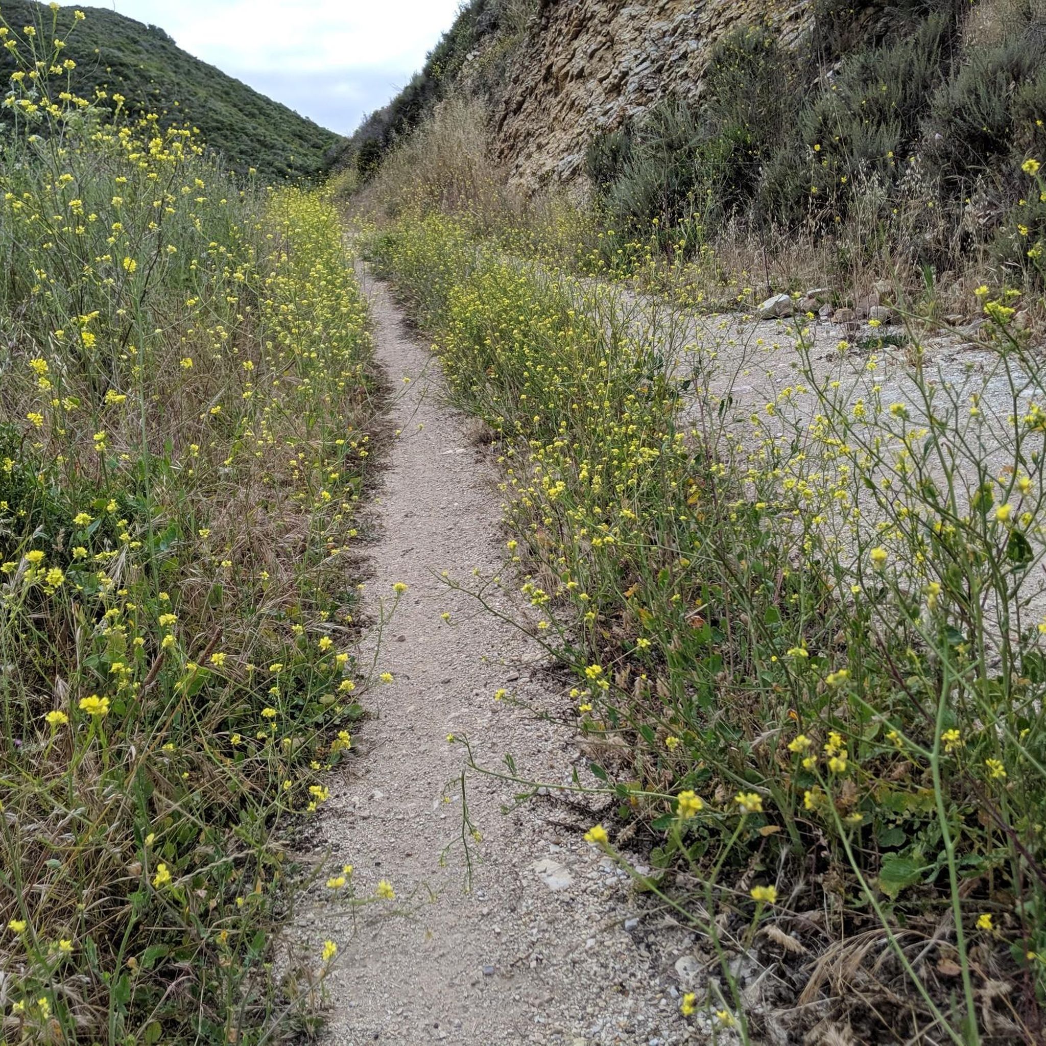
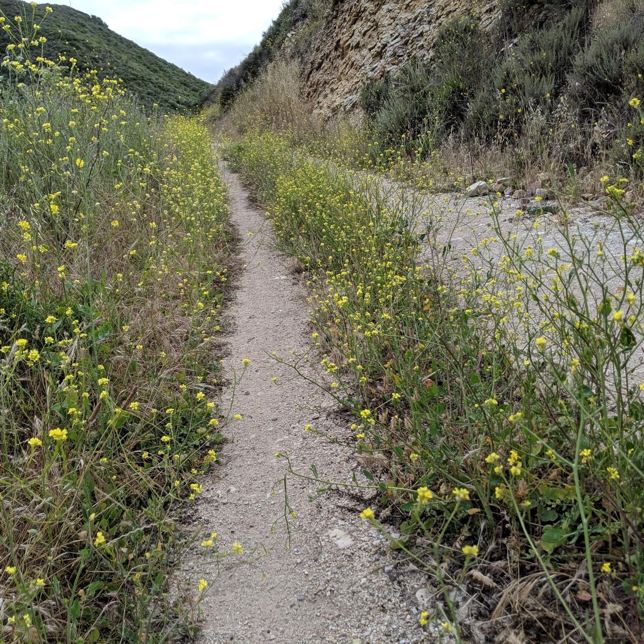
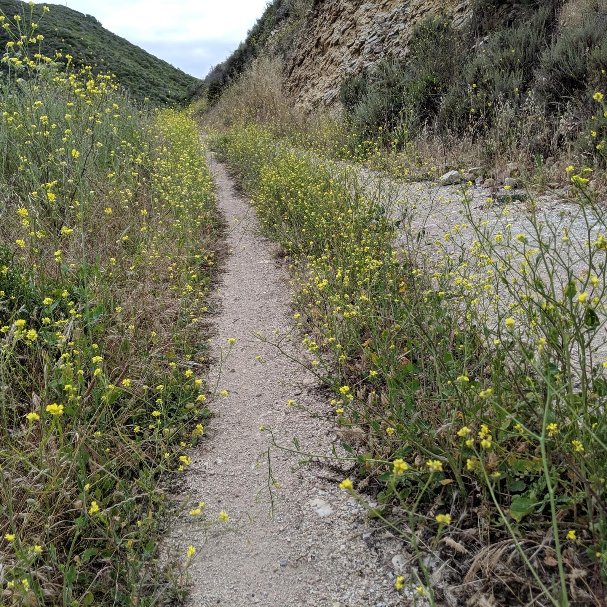
This trail presents a continuous uphill climb, starting from sea level and ascending over 1,300 feet to reach Oak Peak. Along the way, you'll be treated to breathtaking views of rolling hills and the Pacific Ocean. During the spring, the wildflowers in this area are truly outstanding.
0
0
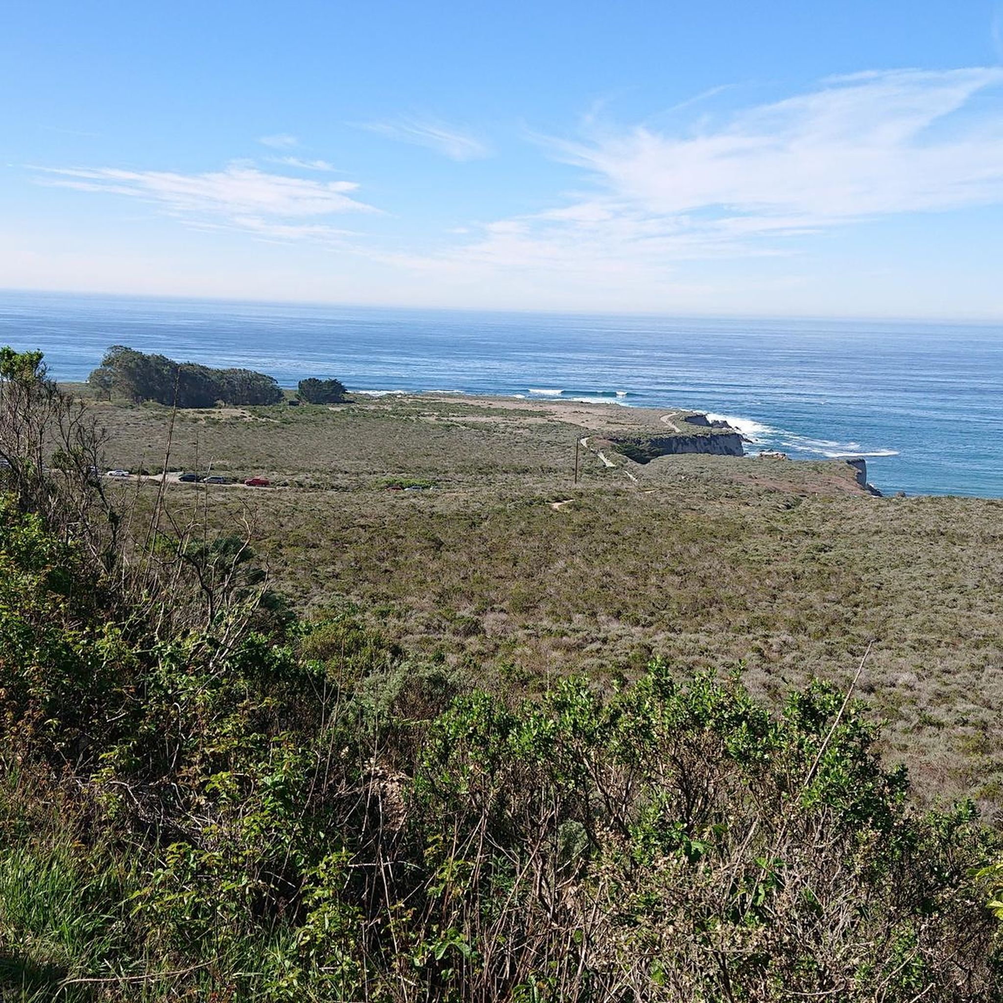
Hazard Peak stands at 1,076 feet, making it one of the highest peaks in the area. Don't be misled by the name; it was named after Alexander Hazard, the previous landowner, and not because of any hazardous conditions. The views of the ocean and dunes from here are truly spectacular.
0
0

Running along this trail you can see the power of the ocean water crashing against the cliffs: a natural spectacle!
0
0

This was in January, but there seems to be some kind of wildlife all the time. We also saw a baby rattlesnake, a 🦎, a couple of sea otters, and a lot of birds. There are always amazing views.
0
0

There is a wonderful bike path (gravel) that winds along Montana State Park. It is easily ridden on a road bike. The views are epic.
1
0
Super beautiful bay with a gorgeous beach! But don't stop there, keep going to ride along the coast in Montana de Oro!
2
0
Frequently Asked Questions
How many touring cycling routes are available in Montaña De Oro State Park?
Montaña De Oro State Park offers a wide selection of touring cycling routes, with over 30 options available. These routes cater to various skill levels, including 13 easy, 12 moderate, and 7 difficult trails.
What kind of terrain can I expect on touring cycling routes in Montaña De Oro State Park?
The park features a diverse landscape, from rugged coastlines with cliffs and sandy beaches to inland areas with eucalyptus groves, streams, canyons, and hills. While there's a main paved road, Pecho Valley Road, much of the rewarding cycling is on an extensive network of dirt and gravel trails, including some singletrack. You'll find paths ranging from relatively flat to those with significant elevation changes.
Are there touring cycling routes suitable for beginners or those looking for an easy ride?
Yes, Montaña De Oro State Park has 13 easy touring cycling routes. A great option for an easy ride with coastal views is The Bluffs – Spooner's Cove loop from Valencia Peak, which is 3.9 miles long and features minimal elevation gain.
What do other touring cyclists say about the routes in Montaña De Oro State Park?
The touring cycling routes in Montaña De Oro State Park are highly rated by the komoot community, with an average score of 4.4 stars from 8 reviews. Over 300 touring cyclists have used komoot to explore the park's varied terrain, often praising the stunning coastal views and diverse trail options.
Are there any touring cycling routes that offer stunning ocean views?
Absolutely. Many routes provide breathtaking vistas of the Pacific Ocean and the coastline. The Hazard Peak loop from Cuesta-by-the-Sea is a popular choice, offering dramatic ocean views from Hazard Peak. Another excellent option is the Hazard Peak loop from Montaña de Oro State Park, which also provides expansive coastal vistas.
Can I find routes that pass by interesting natural features or landmarks?
Yes, several routes will take you past notable features. You can explore Spooner's Cove, a well-known beach ideal for picnicking and tidepool exploration. The Spooner's Cove – Oats Peak Trail loop from Spooner's Cove leads through coastal hills with views towards the Irish Hills. Additionally, the park's Bluff Trail offers scenic coastal views and opportunities to spot wildlife.
Are there any circular touring cycling routes in the park?
Yes, Montaña De Oro State Park offers several excellent loop routes. Popular options include the Hazard Peak loop from Cuesta-by-the-Sea, the Hazard Peak loop from Montaña de Oro State Park, and the Spooner's Cove – Oats Peak Trail loop from Spooner's Cove.
Is Montaña De Oro State Park suitable for family-friendly touring cycling?
Yes, the park has easy, relatively flat paths that are suitable for families. The main paved Pecho Valley Road offers a charming ride, and trails like the Bluff Trail are generally easy and provide scenic coastal views, making them good options for a family outing.
What is the best time of year to go touring cycling in Montaña De Oro State Park?
Spring is a particularly beautiful time to visit, as the hills are blanketed with golden wildflowers, giving the park its name and creating picturesque scenery. The weather is generally pleasant year-round, but spring offers an extra visual treat.
Are there opportunities to see wildlife while cycling in the park?
Montaña De Oro State Park is home to a variety of wildlife. While cycling, you might spot black-tailed deer, bobcats, raccoons, and California quail. Along the coast, seals and sea otters are often seen, and the park is also known for birds like the black oystercatcher.
Where can I park when visiting Montaña De Oro State Park for cycling?
The park provides various parking areas. Spooner's Cove is a well-known spot that serves as a good starting point for several trails, including the Islay Creek Trail. You'll find trailheads and parking accessible throughout the park.
Are there any challenging touring cycling routes in Montaña De Oro State Park?
For those seeking a challenge, the park offers 7 difficult touring cycling routes. The Hazard Peak loop from Cuesta-by-the-Sea, for example, is a 15.4-mile route with over 2,000 feet of elevation gain, providing a significant workout and rewarding views.
Most popular routes in Montaña De Oro State Park
Most popular attractions in Montaña De Oro State Park

Get inspired with the komoot mobile app


Explore more
Browse the best Cycling routes in other regions.
