The best walks and hikes in Hillkeep Regional Park
4.9
(12)
316
hikers
17
hikes
Hiking in Hillkeep Regional Park offers an accessible outdoor experience atop Chilliwack Mountain, a 36-acre nature reserve. The park features diverse natural habitats and panoramic viewpoints overlooking the Fraser Valley, including the Cascade Mountains and Mount Cheam. Trails wind through areas with Douglas firs and other plant life, providing opportunities for wildlife observation. The terrain includes both viewpoint trails and meadow loops, catering to various hiking preferences.
Best hiking trails in Hillkeep Regional Park
- The most popular hiking route is Dyke Road — Fraser Valley, a 6.4 miles (10.2 km) trail that takes 2 hours 35 minutes to complete. This moderate route offers views of farms, fields, and sloughs along the Fraser Valley.
- Another top favourite among local hikers is Vedder River loop from Peach Creek Spawning Channels, an easy 4.0 miles (6.5 km) path. This trail follows the Vedder River, providing a refreshing experience through natural surroundings.
- Local hikers also love the McFadden Pond – Peach Creek Spawning Channels loop from Peach Creek Spawning Channels, a 2.9 miles (4.7 km) trail leading through pond and spawning channel areas, often completed in about 1 hour 10 minutes.
- Hiking in Hillkeep Regional Park is defined by panoramic viewpoints, Fraser Valley vistas, and Douglas fir forests. The network offers options for different ability levels, from easy walks to moderate routes.
- The routes in Hillkeep Regional Park are highly rated by the komoot community with an average score of 4.8 stars from over 10 reviews. More than 300 hikers have used komoot to explore Hillkeep Regional Park's varied terrain.
Last updated: August 6, 2026
3
hikers
10.2km
02:35
10m
10m
Moderate hike. Good fitness required. Easily-accessible paths. Suitable for all skill levels.
5.0
(1)
5
hikers
4.25km
01:05
10m
10m
Easy hike. Great for any fitness level. Easily-accessible paths. Suitable for all skill levels.

Sign up for free
5.0
(1)
34
hikers
6.48km
01:39
20m
20m
Easy hike. Great for any fitness level. Easily-accessible paths. Suitable for all skill levels.
4.0
(2)
11
hikers
3.75km
00:57
10m
10m
Easy hike. Great for any fitness level. Easily-accessible paths. Suitable for all skill levels.
8
hikers
Easy hike. Great for any fitness level. Easily-accessible paths. Suitable for all skill levels.
Get access to more routes and recommendations from other explorers.
Sign up for free
Already have an account?
Our route recommendations are based on thousands of hikes, rides, and runs completed by other people on komoot.
Start today with a free account
Your next adventure awaits.
Login or Signup



Tips from the Community

Browne Creek Wetlands is a small, protected marsh and riparian habitat along Browne Creek. The area is key in filtering water and is easy to explore via a network of flat gravel paths and wooden boardwalks. Visitors come here for birdwatching, strolling, running, or biking.
0
0
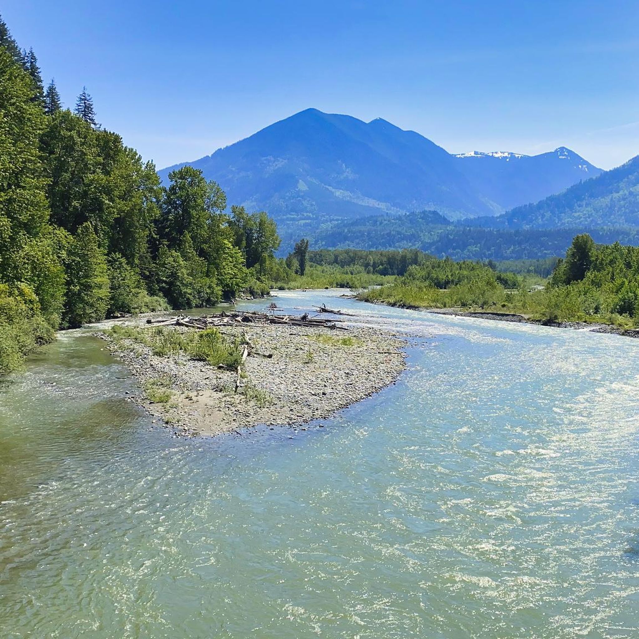
The Vedder River flows along the southern edge of Chilliwack, beginning at Cultus Lake and running northwest until it joins the Fraser River. The river is famous for salmon fishing during fall salmon runs. Besides fishing, visitors like to swim, tube, kayak, and raft.
0
0
Dyke Road is less of a formal hiking trail and more of a wide dirt road used by walkers and bikers. If you want to walk side by side with a friend, this is the perfect trail. This road traces the top of the flood-control dike, across farms, fields, and sloughs. There is almost no elevation gain and loss, very flat the whole way, and keep your eyes open for all sorts of birds along the wetlands.
0
0
Nicomen Slough is a side channel and wetland area connected to the Fraser River, spanning 14 kilometers. The slough is very important to waterfowl under the Pacific Birds Habitat Joint Venture because it is an important migration area for wintering and breeding of many kinds of birds.
0
0
This short spur trail brings hikers to the sandy shores of the Fraser River. Sandy tree-covered islands dot the river, and the Cheam Mountain Range stands mighty in the backdrop. The River shaped early British Columbia, bringing tens and thousands of prospectors in 1858.
0
0
Frequently Asked Questions
How many hiking trails are available in Hillkeep Regional Park?
Hillkeep Regional Park offers a good selection of hiking opportunities, with over 15 trails to explore. These range from easy walks to more moderate routes, ensuring options for various fitness levels.
What are the typical trail difficulties in Hillkeep Regional Park?
The trails in Hillkeep Regional Park primarily offer easy to moderate difficulty levels. For instance, routes like Vedder River loop from Peach Creek Spawning Channels are considered easy, while the longer Dyke Road — Fraser Valley is a moderate option. The park is designed to be accessible for many visitors.
Are there any circular walks in Hillkeep Regional Park?
Yes, there are several circular routes available. A popular choice is the McFadden Pond – Peach Creek Spawning Channels loop from Peach Creek Spawning Channels, which offers a pleasant walk around pond and spawning channel areas. Another option is the McFadden Pond loop from Browne Creek Wetlands.
What kind of views can I expect while hiking in Hillkeep Regional Park?
Hikers in Hillkeep Regional Park can enjoy spectacular panoramic views, especially from the viewing platform. These vistas stretch across the Fraser Valley, encompassing the majestic Cascade Mountains and Mount Cheam. During winter, when trees are bare, glimpses of the Fraser River winding through the valley are also possible.
Is Hillkeep Regional Park suitable for families with children?
Yes, Hillkeep Regional Park is very family-friendly. It features easy walks and meadow loops that are suitable for all fitness levels, including children. The accessible nature reserve provides a great opportunity for families to enjoy nature together.
Can I bring my dog to Hillkeep Regional Park?
Hillkeep Regional Park is generally dog-friendly, allowing visitors to enjoy the trails with their canine companions. It's always recommended to keep dogs on a leash and follow park regulations to ensure a pleasant experience for everyone and to protect the natural habitat.
What is the best time of year to visit Hillkeep Regional Park for hiking?
Hillkeep Regional Park is enjoyable year-round. The trails provide a refreshing experience even on rainy days. In winter, when trees are bare, you can get unique views of the Fraser River. For lush greenery and milder temperatures, spring and fall are excellent choices.
Are there opportunities for wildlife spotting in Hillkeep Regional Park?
As a nature reserve, Hillkeep Regional Park is a natural habitat rich in diverse wildlife and plants. It's an excellent spot for bird watching, and visitors might even encounter deer along the trails. The park is home to Douglas firs and other plant life, contributing to its ecological diversity.
What are the parking options for Hillkeep Regional Park?
While specific parking details for Hillkeep Regional Park trailheads are not provided, regional parks typically offer designated parking areas for visitors. It's advisable to check local park signage upon arrival for the most accurate information on parking availability and regulations.
Is public transport available to access Hillkeep Regional Park?
Information on direct public transport access to Hillkeep Regional Park is limited. Visitors typically access the park by car. For detailed public transport options in the broader Chilliwack area, it is recommended to consult local transit authority websites.
What do other hikers enjoy most about Hillkeep Regional Park?
The area is highly rated by the komoot community, with an average score of 4.8 stars from over 10 reviews. Reviewers often praise the panoramic viewpoints, the diverse natural habitats, and the accessibility of the trails, making it a beloved spot for outdoor enthusiasts.
Are there any other outdoor activities available near Hillkeep Regional Park?
Beyond hiking, the broader region around Hillkeep Regional Park, particularly the Vedder River, offers opportunities for other outdoor pursuits. These include cycling, mountain biking, road cycling, swimming, tubing, kayaking, and rafting. The Vedder River is also famous for salmon fishing during fall salmon runs.
Are there any easy trails suitable for a quick walk?
Yes, Hillkeep Regional Park offers several easy trails perfect for a quick walk. The park features meadow loops and viewpoint trails that are generally accessible. For example, the Peach Creek Spawning Channels loop from Browne Creek Wetlands is an easy option for a shorter excursion.
Most popular routes in Hillkeep Regional Park

Get inspired with the komoot mobile app


Explore more
Browse the best Hikes in other regions.
