The best running trails in Cypress Provincial Park
4.9
(23)
2,106
runners
49
runs
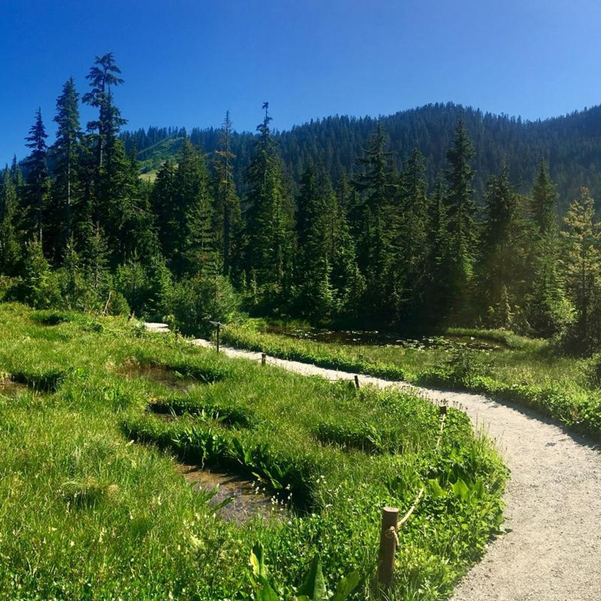
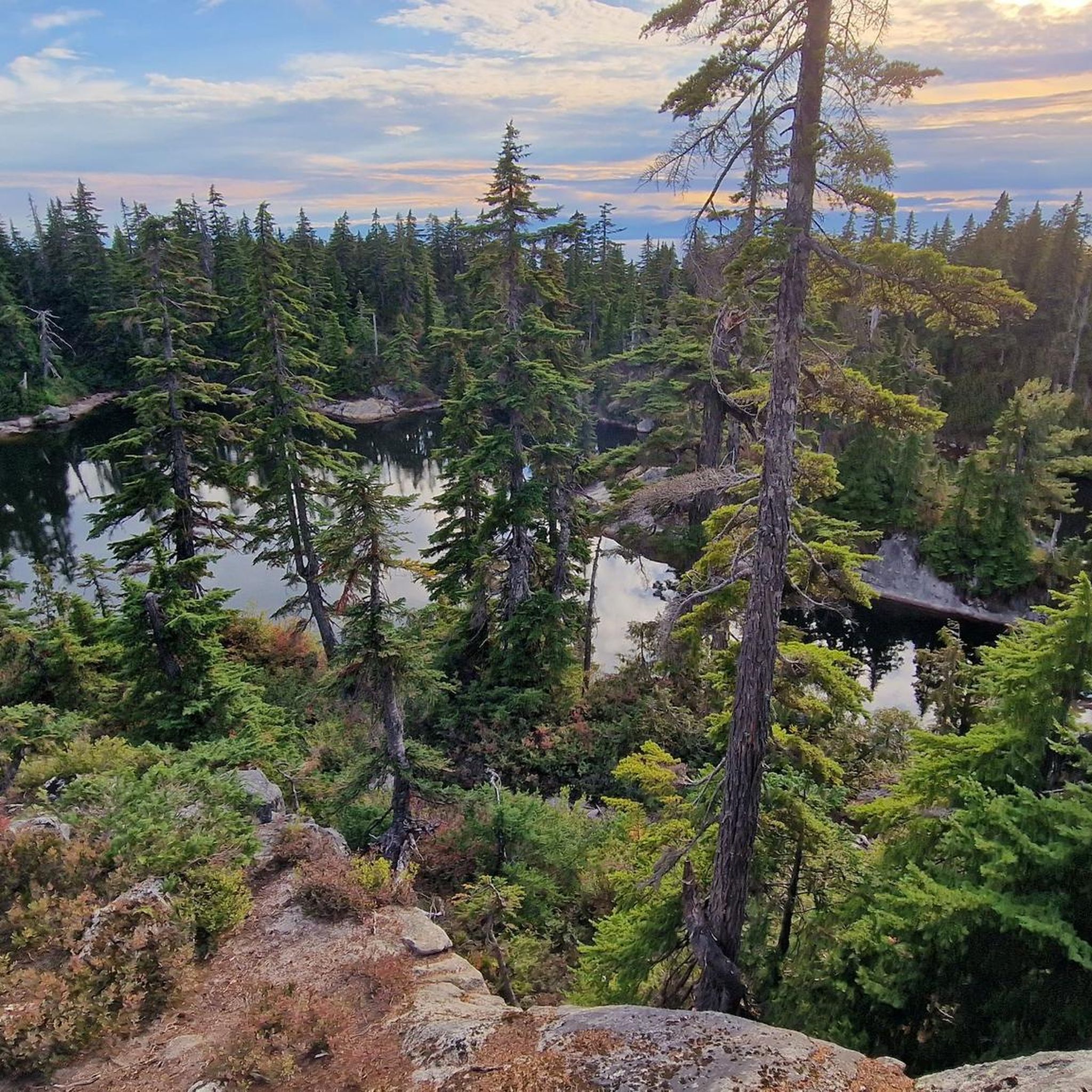
Jogging in Cypress Provincial Park offers a diverse range of running routes within the North Shore Mountains, encompassing Mount Strachan, Black Mountain, and Hollyburn Mountain. The terrain features lush forests, alpine meadows, and natural lakes such as Yew Lake and Cabin Lake. This mountainous backdrop provides varied environments for runners, from accessible paths to more challenging trails with significant elevation changes. The park's network of trails caters to different fitness levels, with options ranging from easy to difficult.
Best jogging routes in Cypress Provincial Park
- The most popular jogging route is Saint Marks Summit – Cypress Provincial Park loop from Cypress Mountain, a 6.5 miles (10.5 km) trail that takes 1 hour 41 minutes to complete. This difficult route offers panoramic views of Vancouver and Howe Sound.
- Another top favourite among local runners is Cougar Lakes – Theagill Lake loop from Cypress Mountain, a difficult 4.4 miles (7.1 km) path. This running route leads through varied forest terrain and past mountain lakes.
- Local runners also love the Cabin Lake loop from Cypress Mountain, a 2.6 miles (4.1 km) trail leading through forested areas to the freshwater Cabin Lake, often completed in about 42 minutes.
- Jogging in Cypress Provincial Park is defined by mountainous backdrops, lush forests, and alpine meadows. The extensive network offers options for different ability levels, from short loops to longer, more strenuous climbs.
- The routes in Cypress Provincial Park are highly rated by the komoot community with an average score of 4.9 stars from more than 20 reviews. More than 3000 runners have used komoot to explore Cypress Provincial Park's varied terrain.
Last updated: July 27, 2026
72
runners
8.85km
01:18
300m
300m
Hard run. Very good fitness required. Sure-footedness, sturdy shoes and alpine experience required.
13
runners
4.11km
00:42
260m
260m
Hard run. Good fitness required. Sure-footedness, sturdy shoes and alpine experience required.

Sign up for free
19
runners
12.8km
01:48
460m
460m
Hard run. Very good fitness required. Sure-footedness, sturdy shoes and alpine experience required.
12
runners
8.64km
01:09
310m
310m
Hard run. Very good fitness required. Sure-footedness, sturdy shoes and alpine experience required.
5
runners
5.16km
00:48
220m
220m
Hard run. Good fitness required. Sure-footedness, sturdy shoes and alpine experience required.
Get access to more routes and recommendations from other explorers.
Sign up for free
Already have an account?
Our route recommendations are based on thousands of hikes, rides, and runs completed by other people on komoot.
Start today with a free account
Your next adventure awaits.
Login or Signup
Popular around Cypress Provincial Park
Tips from the Community

This section of the Baden Powell Trail provides a gentle introduction to one of the North Shore's most famous routes. The trail follows a shaded corridor through coastal forest above Horseshoe Bay, crossing small creeks and passing beneath towering Douglas fir and cedar trees. While much of the Baden Powell is known for rugged terrain, this stretch is relatively approachable and serves as a scenic connector between Horseshoe Bay and the steeper trails climbing toward Eagle Ridge and Fisherman's Bluff.
0
0

The Howe Sound Crest Trail runs high above Howe Sound. It follows the ridgeline between Cypress Mountain and Porteau Cove, with plenty of steep climbs and ups and downs along the way. You’ll move through rocky alpine terrain with big, open views of the ocean, islands, and surrounding peaks almost the entire time.
0
0
The Baden-Powell Trail is a 48km hiking trail that runs from Horseshoe Bay to Deep Cove. Most of the trail is heavily forested and well-maintained. The trail is also well marked with orange triangular tags attached to trees along the trail.
0
0
This is a great vantage point to take in views of Bowen Island and Horseshoe Bay.
0
0
Whyte Lake is a small lake in the hills of West Vancouver. There is a small wooden dock and secluded beach on the north side of the lake.
0
0
Frequently Asked Questions
How many running routes are available in Cypress Provincial Park?
Cypress Provincial Park offers nearly 60 dedicated running routes. While many are rated as difficult, there are also moderate and a few easier options available, catering to various fitness levels.
Are there easy running routes suitable for beginners in Cypress Provincial Park?
Yes, while the park is known for its challenging terrain, there are routes suitable for beginners. Some trails feature mostly paved surfaces, offering a gentler run. For example, the trail to Yew Lake is noted for being flat and accessible, providing a serene experience amidst nature.
Can I find routes with scenic viewpoints in Cypress Provincial Park?
Absolutely. Many running routes in Cypress Provincial Park offer stunning vistas. For panoramic views of Vancouver, Howe Sound, and beyond, consider routes that lead to Bowen Lookout or Eagle Bluffs Viewpoint. The Saint Marks Summit – Cypress Provincial Park loop from Cypress Mountain is particularly renowned for its sweeping views.
Are there any circular running routes in the park?
Yes, many of the popular running trails in Cypress Provincial Park are circular routes. Examples include the challenging Saint Marks Summit – Cypress Provincial Park loop from Cypress Mountain, the varied Cougar Lakes – Theagill Lake loop from Cypress Mountain, and the shorter Cabin Lake loop from Cypress Mountain.
What natural features or landmarks might I see while running in Cypress Provincial Park?
The park is rich in natural beauty and interesting landmarks. You can encounter serene spots like Yew Lake and Cabin Lake, or explore areas with unique Alpine Flora. For a historical touch, you can also pass by the Olympic Rings, a remnant from the Vancouver 2010 Winter Games.
Is Cypress Provincial Park suitable for family jogging?
Yes, Cypress Provincial Park offers options for families. While some trails are very challenging, there are easier, more accessible paths like the one leading to Yew Lake, which is flat and suitable for a family outing. It's best to check the difficulty rating of specific routes to ensure they match your family's fitness level.
Are dogs allowed on the running trails in Cypress Provincial Park?
Cypress Provincial Park generally welcomes dogs, but specific rules apply to different areas and trails. It's always recommended to check the official park regulations or signage at trailheads regarding dog access, especially for sensitive ecological areas or during certain seasons. Dogs must typically be on a leash.
What is the best time of year to go running in Cypress Provincial Park?
The best time for running largely depends on your preference and the trail's elevation. Spring through fall generally offers the most accessible conditions, with lush forests and alpine meadows. Later summer months might even allow for a refreshing dip in Cabin Lake. Winter running is possible but requires appropriate gear and caution due to snow and ice.
How can I get to the running trails in Cypress Provincial Park?
Cypress Provincial Park is accessible by car, with parking available at various trailheads, particularly near Cypress Mountain. For those relying on public transport, options might be limited, so planning ahead is crucial. The park's convenient location in West Vancouver makes it a popular choice for local runners.
What do other runners say about the trails in Cypress Provincial Park?
The running routes in Cypress Provincial Park are highly rated by the komoot community, with an average score of 4.9 stars from over 20 reviews. More than 3000 runners have used komoot to explore the park's varied terrain, often praising the challenging climbs, diverse landscapes, and the rewarding panoramic views of Vancouver and Howe Sound.
Are there any less crowded running options in the park?
While popular routes like the Saint Marks Summit loop can attract many visitors, exploring some of the less-trafficked trails or visiting during off-peak hours (early mornings or weekdays) can offer a more solitary running experience. The park's extensive network means there are always options to discover quieter paths.
What kind of terrain can I expect on the running trails?
The terrain in Cypress Provincial Park is highly varied, ranging from mostly paved surfaces on some easier trails to rugged, uneven paths with steep sections, rocks, and roots on more difficult routes. You'll run through lush forests, alpine meadows, and experience significant elevation changes, especially on trails like the Whyte Lake – Baden-Powell Trail loop from Cypress Falls Park.
Are there specific trails that lead to lakes?
Yes, several trails in Cypress Provincial Park lead to beautiful lakes. The Cabin Lake loop from Cypress Mountain takes you directly to the freshwater Cabin Lake. Additionally, the accessible trail to Yew Lake offers a serene wilderness experience surrounded by the North Shore mountains.
What should I consider when planning a winter run in Cypress Provincial Park?
Winter running in Cypress Provincial Park can be beautiful but requires careful preparation. Trails may be covered in snow and ice, especially at higher elevations. It's essential to wear appropriate winter running gear, including traction devices for your shoes, and to check trail conditions and weather forecasts before heading out. Some trails might be closed or require snowshoes.
Most popular routes in Cypress Provincial Park
Most popular attractions in Cypress Provincial Park

Get inspired with the komoot mobile app


Explore more
Browse the best Running Trails & Routes in other regions.
