The best walks and hikes in Colony Farm Regional Park
4.5
(58)
1,414
hikers
83
hikes
Hiking in Colony Farm Regional Park offers a diverse and accessible trail network, characterized by flat terrain and a mix of open fields, marshland, and riverside paths. The park features trails running alongside the Coquitlam River and through former farm fields, now wildlife habitats. Distant views of the Coquitlam Mountains are visible from various points within the park. Many trails are suitable for various fitness levels, with some sections being wheelchair-accessible.
Best hiking trails in Colony Farm Regional Park
- The most popular hiking route is Traboulay PoCo Trail, a 15.7 miles (25.3 km) trail that takes 6 hours 27 minutes to complete. This difficult route connects seamlessly with the larger Port Coquitlam trail network.
- Another top favourite among local hikers is Coquitlam River Park – PoCo Trail loop from Port Coquitlam, a moderate 6.4 miles (10.3 km) path. This trail offers scenic views along the Coquitlam River and through open parkland.
- Local hikers also love the PoCo Trail loop from Port Coquitlam, a 3.2 miles (5.2 km) trail leading through riverside areas and open parkland, often completed in about 1 hour 19 minutes.
- Hiking in Colony Farm Regional Park is defined by riverside paths, open fields, and diverse marshland ecosystems. The network offers options for easy, moderate, and difficult trails, accommodating various ability levels.
- The routes in Colony Farm Regional Park are highly rated by the komoot community with an average score of 4.5 stars from over 60 reviews. More than 1000 hikers have used komoot to explore Colony Farm Regional Park's varied terrain.
Last updated: August 15, 2026
2.55km
00:39
0m
Easy hike. Great for any fitness level. Easily-accessible paths. Suitable for all skill levels.
6
hikers
25.3km
06:27
70m
70m
Hard hike. Very good fitness required. Easily-accessible paths. Suitable for all skill levels.

Sign up for free
2.22km
00:39
60m
60m
Easy hike. Great for any fitness level. Easily-accessible paths. Suitable for all skill levels.
7
hikers
5.19km
01:20
30m
30m
Easy hike. Great for any fitness level. Easily-accessible paths. Suitable for all skill levels.
6
hikers
5.18km
01:19
10m
10m
Easy hike. Great for any fitness level. Easily-accessible paths. Suitable for all skill levels.
Get access to more routes and recommendations from other explorers.
Sign up for free
Already have an account?
Our route recommendations are based on thousands of hikes, rides, and runs completed by other people on komoot.
Start today with a free account
Your next adventure awaits.
Login or Signup

Tips from the Community

Gates Park offers a mix of paved and natural trail sections along the river, with picnic areas, playgrounds, and sports fields, making it a good starting or ending point for a longer riverside walk or ride into ƛ̓éxətəm.
0
0
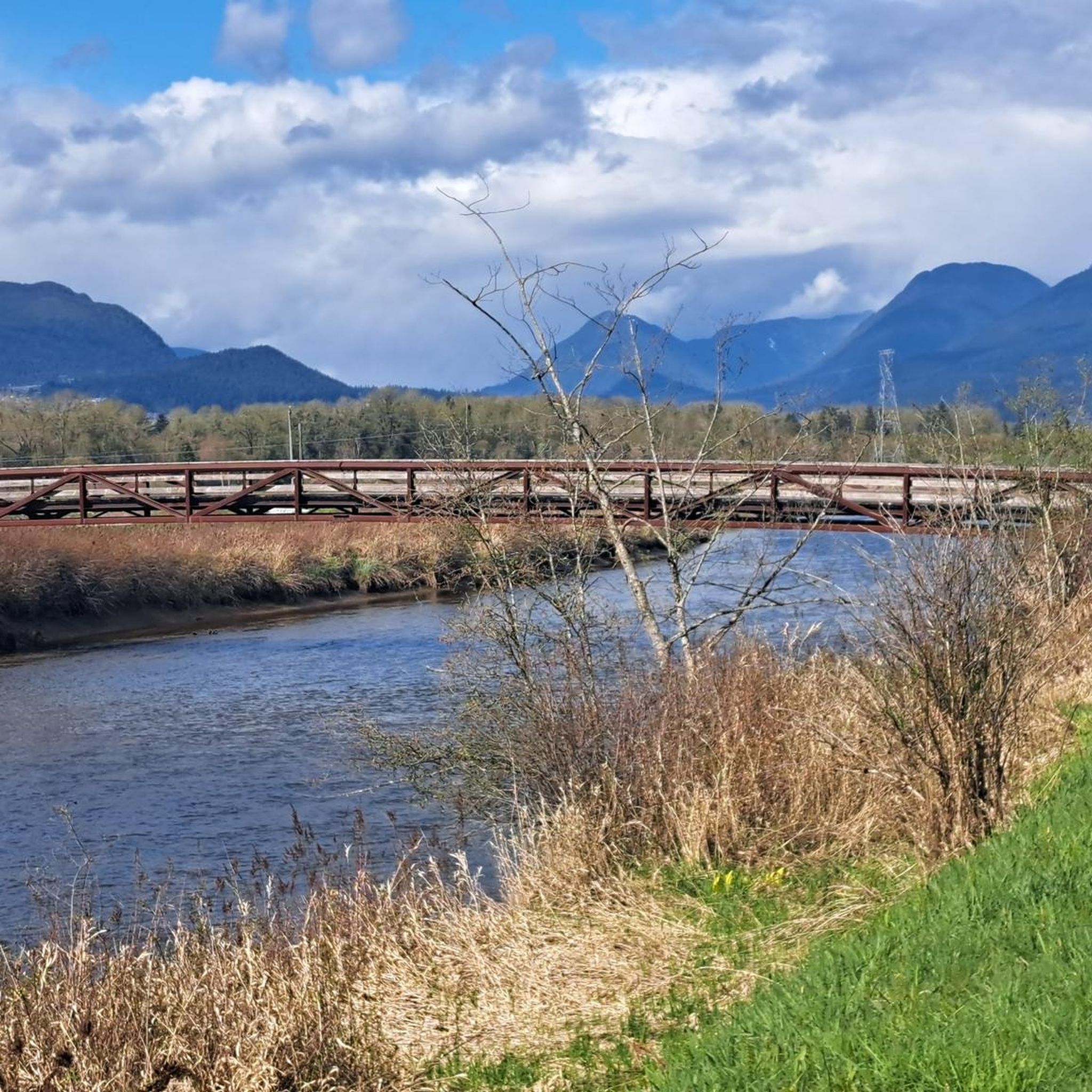
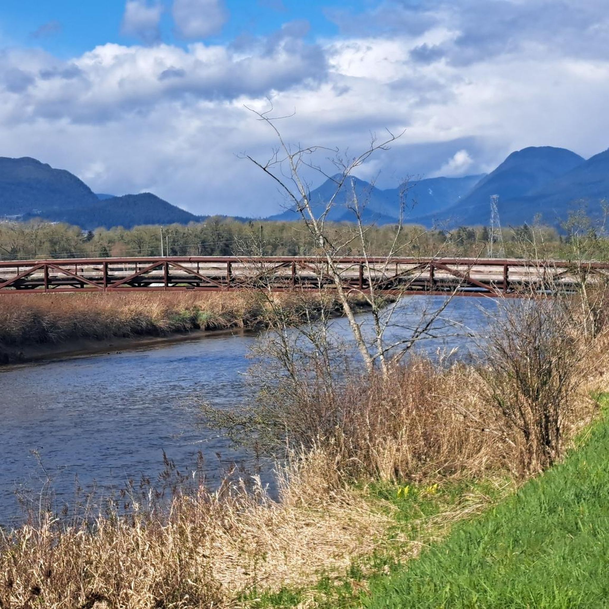
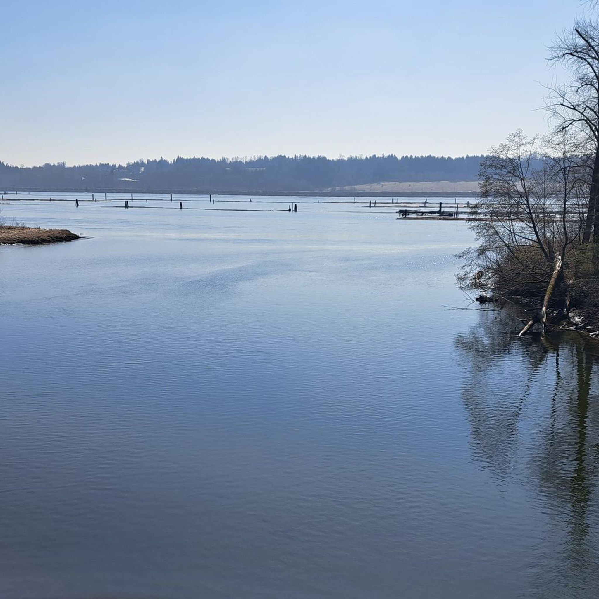
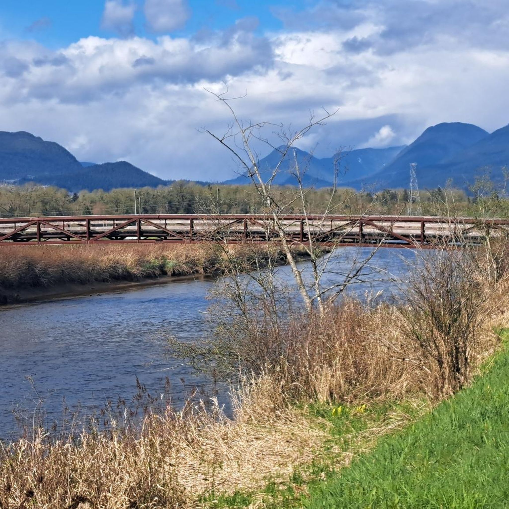
At this southern spot near Pitt River Road, the Coquitlam River opens up and slows down. The water here is wider and calmer than the fast-moving sections further upstream.
0
0
The park is very practical for visitors because it has clean public washrooms and a large, free parking lot. You can pack a lunch to enjoy at one of the many shaded picnic tables or check out the local food trucks that often park nearby.
0
0

The Upper Trail climbs about 30 meters in elevation over 0.67 kilometers as it winds through thick forest. From the top, you can easily connect to the rest of the trail network, making your return route as long or as short as you’d like.
0
0
Riverview Forest is an urban woodland that spans over 24 hectares. The forest features an extensive trail network that’s popular for walking, jogging, and mountain biking.
0
0

This 165-acre municipal park features nearly 10 km of forested trails winding through riparian woodlands. Seasonal changes bring dramatic shifts, from high water and swirling currents in winter to calmer flows perfect for wading in during summer. In autumn, the river becomes a vivid stage for returning salmon and the autumn colors illuminate the river corridor. There are trong ties to the traditional lands of the Kwikwetlem Nation, with the river's name coming from their language and meaning "red fish up the river". Coquitlam River Park offers a quiet nature escape just minutes from the city.
0
0

This beautiful river is a major tributary of the Fraser River that flows south from the Garibaldi Ranges, through Pitt Lake, before joining the Fraser River near Port Coquitlam. The lower stretches of the river are tidal, and the surrounding wetlands are home to a rich diversity of wildlife. The river also holds cultural significance for the Kwantlen First Nation, serving as a natural corridor that connects the coastal region with the interior of the province.
0
0
The Traboulay PoCo Trail is a beautiful multiuse 25.3-kilometer loop surrounding Port Coquitlam that winds through diverse landscapes including forest, marsh, riverfront, and urban areas, with fantastic views of the Pitt and Coquitlam Rivers along with abundant wildlife. The trail is mostly flat and well-maintained, with a mix of gravel and paved sections, and is an ideal location popular with walkers, runners, cyclists and families.
0
0
Frequently Asked Questions
What kind of terrain can I expect when hiking in Colony Farm Regional Park?
Colony Farm Regional Park features predominantly flat terrain, with many gravel trails. You'll find a mix of open fields, marshland, and scenic riverside paths along the Coquitlam River. While generally accessible, some sections may have slight inclines or uneven surfaces.
Are there trails suitable for families or those with limited mobility?
Yes, Colony Farm Regional Park is very family-friendly and offers many accessible options. Several gravel trails, including the Home Farm Dyke Trail, Wilson Farm Dyke Trail, Mundy Creek Trail, and Garden Trail, are considered wheelchair-accessible, making them ideal for strollers and those seeking an easier walk.
Can I bring my dog to Colony Farm Regional Park?
Yes, Colony Farm Regional Park is generally dog-friendly. Dogs are permitted on most trails, but it's always best to keep them on a leash and follow park regulations to protect the abundant wildlife and ensure a pleasant experience for all visitors.
What kind of wildlife can I expect to see in Colony Farm Regional Park?
The park is a significant wildlife habitat, especially for birdwatching, with over 200 species identified. You might also spot coyotes, river otters, muskrats, and occasionally even black bears. The Wilson Farm Wildlife Habitat Area is a particularly good spot for bird sightings.
Are there any circular hiking routes in Colony Farm Regional Park?
Yes, the park offers several circular routes. A popular option is a 4 km loop combining the Home Farm Dyke Trail, Mundy Creek Trail, and Colony Farm Road Trail. You can also explore the PoCo Trail loop from Port Coquitlam, an easy 5.1 km hike, or the Riverview Forest - Upper Trail loop, an easy 2.2 km option.
What are some notable natural features or landmarks to look out for?
Hikers can enjoy scenic views of the Coquitlam River, especially from the Millennium Bridge, which is a prominent landmark within the park. The open fields, once farmlands, now offer expansive views of the distant Coquitlam Mountains to the north. You'll also pass by charming community gardens.
How many hiking trails are available in Colony Farm Regional Park?
Colony Farm Regional Park offers a wide selection of routes, with nearly 70 hiking trails available. These range from easy strolls to more challenging, longer expeditions, catering to various fitness levels and preferences.
What do other hikers enjoy most about Colony Farm Regional Park?
The area is highly rated by the komoot community, with an average score of 4.6 stars from nearly 60 reviews. Hikers frequently praise the park's accessible, flat trails, the abundance of wildlife, and the peaceful riverside scenery, making it a popular spot for a relaxed outdoor experience.
Are there any longer routes for experienced hikers?
While many trails are easy, the park connects to longer networks. For a more challenging experience, consider the Traboulay PoCo Trail, a difficult 25.3 km route that seamlessly integrates with the larger Port Coquitlam trail system.
Is there parking available at Colony Farm Regional Park?
Yes, Colony Farm Regional Park has multiple parking areas, providing convenient access to the trail network. This allows hikers to choose their starting point and explore different sections of the park easily.
Can I reach Colony Farm Regional Park using public transport?
Colony Farm Regional Park is accessible by public transport. Several bus routes serve the area, with stops located within a reasonable walking distance of park entrances. It's advisable to check local transit schedules for the most current information.
What is a good moderate hike in the park?
For a moderate hike, consider the Coquitlam River Park – PoCo Trail loop from Port Coquitlam. This 10.3 km path offers scenic views along the Coquitlam River and through open parkland, providing a good balance of distance and natural beauty.
Most popular routes in Colony Farm Regional Park

Get inspired with the komoot mobile app


Explore more
Browse the best Hikes in other regions.
