The best running trails in Whistler Interpretive Forest
4.7
(50)
2,072
runners
65
runs
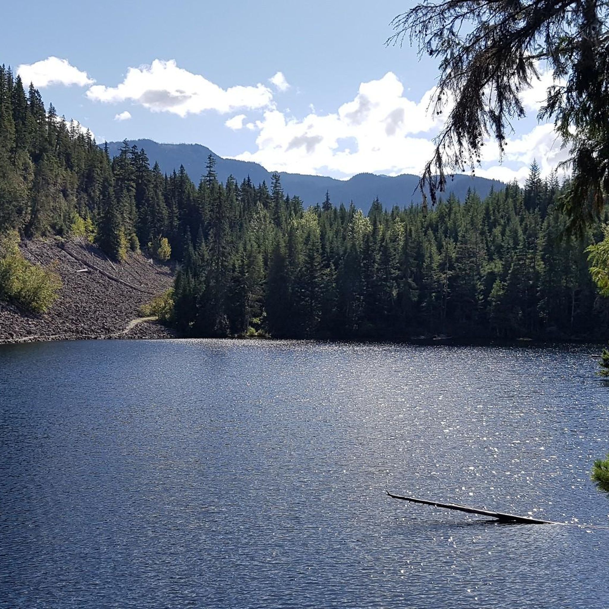
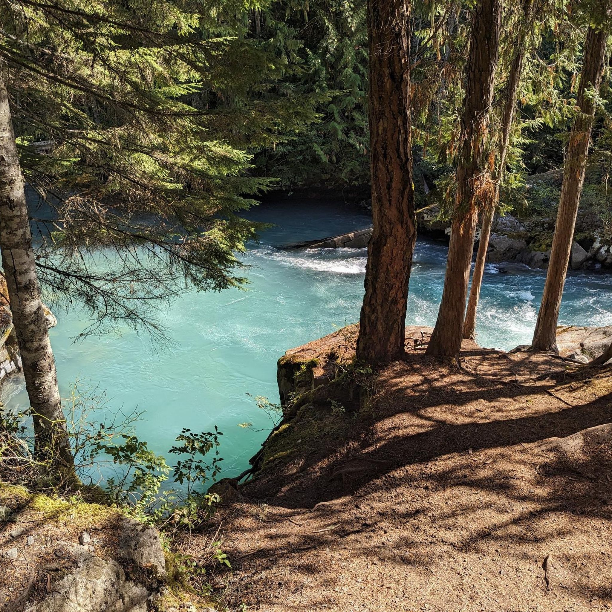
Jogging routes in Whistler Interpretive Forest traverse a landscape characterized by the turquoise Cheakamus River, diverse forest ecosystems, and unique geological features like Logger's Lake. The area, a former logging site, now features a network of well-maintained trails suitable for various fitness levels. Runners can explore paths alongside the Cheakamus River, through old-growth stands, and past points of interest such as the Whistler Train Wreck. The terrain ranges from generally flat riverside paths to routes with significant elevation changes.
Best jogging routes in Whistler Interpretive Forest
- The most popular jogging route is Nita Lake – Alpha Lake loop from Cheakamus Crossing, an 8.8 miles (14.2 km) trail that takes 1 hour 30 minutes to complete, offering views of both Nita Lake and Alpha Lake.
- Another top favourite among local runners is Helm Lake – Black Tusk Lake loop from cheakamus lake, a difficult 18.3 miles (29.4 km) path. This route features challenging climbs and scenic views of alpine lakes.
- Local runners also love the Brandywine Falls – Whistler Train Wreck loop from Cheakamus Crossing, a 14.9 miles (24.0 km) trail leading through diverse forest and past natural and artistic landmarks, often completed in about 2 hours 48 minutes.
- Jogging in Whistler Interpretive Forest is defined by the Cheakamus River, Logger's Lake, and diverse forest ecosystems. The trail network offers options for different ability levels, from easy riverside paths to more challenging routes with significant elevation.
- The routes in Whistler Interpretive Forest are highly rated by the komoot community with an average score of 4.5 stars from over 40 reviews. Nearly 2,000 runners have used komoot to explore Whistler Interpretive Forest's varied terrain.
Last updated: September 30, 2026
16
runners
14.5km
01:34
180m
180m
Moderate run. Good fitness required. Mostly paved surfaces. Suitable for all skill levels.
12
runners
29.5km
04:24
1,340m
1,340m
Hard run. Very good fitness required. Mostly paved surfaces. Suitable for all skill levels.

11
runners
28.9km
03:19
400m
400m
Hard run. Very good fitness required. Mostly paved surfaces. Suitable for all skill levels.
7
runners
21.4km
02:44
570m
570m
Hard run. Very good fitness required. Mostly paved surfaces. Suitable for all skill levels.
5
runners
3.92km
00:27
40m
40m
Easy run. Great for any fitness level. Mostly paved surfaces. Suitable for all skill levels.
Get access to more routes and recommendations from other explorers.
Already have an account?
Our route recommendations are based on thousands of hikes, rides, and runs completed by other people on komoot.
Start today with a free account
Your next adventure awaits.

Other adventures in Whistler Interpretive Forest

Tips from the Community


East June Lake is a small backcountry lake located near the Cheakamus Crossing area. The lake sits in a quiet forested setting and is part of a group of lakes connected by the Jane Lakes trail network. Surrounded by trees and low mountain terrain, it makes for a peaceful place to stop and enjoy the scenery.
0
0
The Jane Lakes Trail begins just off Black Tusk Microwave Tower Road and travels through forested terrain, leading to a series of small alpine lakes known as the Jane Lakes. The terrain is moderately challenging in places and consists of a mix of singletrack trail and old logging roads.
0
0

Memorial Rock has become an informal place of remembrance. There are often flowers, handwritten notes, and painted stones left in memory of loved ones. Please enjoy this unofficial area peacefully and respectfully, as it is important to the community.
1
0
Don MacLaurin's Crossing, more widely known as the Cheakamus River Suspension Bridge, is a pedestrian bridge spanning the turquoise waters of the Cheakamus River. The bridge sways, but it is sturdy and safe. The river is especially amazing to watch from the bridge above during spring runoff when water levels are high.
1
0
The Cheakamus River is known for its blue and turquoise water and the dramatic canyon it thunders through. The color comes from glacial melt from the nearby Coast Mountains. Hikers and bikers will pass rock cliffs and gorges carved by centuries of rushing water. The Cheakamus River is often dotted with fly fishers fishing for rainbow trout and bull trout. When the water is flowing strongly, whitewater paddlers brave the cold waters. In the fall, the surrounding trees turn amazing colors.
1
0

Alta Lake Park is the informal name for a section of land at the southwestern end of Alta Lake. The two Poet's Pause sculptures, "Lost in Sound" and "Lakeside Couple," are located here, as well as two wrecked vehicles along the forest trail.
2
0

A quiet place next to the river to remember. Our Spirits are Free like the Rivers that flow from the Mountains to the Sea. Live your Dreams.
0
0
Frequently Asked Questions
How many running routes are available in Whistler Interpretive Forest?
Whistler Interpretive Forest offers a wide selection of over 70 running routes. These trails cater to various fitness levels, ranging from easy, accessible paths to more challenging routes with significant elevation changes.
Are there easy running routes suitable for beginners in Whistler Interpretive Forest?
Yes, there are approximately 10 easy running routes available. Many trails alongside the Cheakamus River, such as the Riverside and Farside trails, offer generally flat terrain and scenic views, making them ideal for beginners or casual joggers.
What kind of natural features and landmarks can I expect to see while running in Whistler Interpretive Forest?
Runners can enjoy a variety of stunning natural features and unique landmarks. You'll encounter the striking turquoise Cheakamus River, the hidden Logger's Lake nestled in a volcanic crater, and the impressive Cheakamus River Suspension Bridge. Additionally, the intriguing Whistler Train Wreck outdoor art installation is a popular point of interest along some trails.
Are there any running routes that offer great viewpoints?
Absolutely. The forest features several spots with excellent views. You can find an Old Viewpoint of the Coast Mountains and a View of the Tantalus Range. Trails that follow the Cheakamus River also provide breathtaking vistas, especially from the Cheakamus River Suspension Bridge.
Are there any circular running routes in the area?
Yes, many of the running routes in Whistler Interpretive Forest are loops, allowing you to start and finish at the same point. A popular moderate option is the Nita Lake – Alpha Lake loop from Cheakamus Crossing, which covers 8.8 miles (14.2 km) and offers views of both Nita Lake and Alpha Lake.
What do other runners enjoy most about the trails in Whistler Interpretive Forest?
The running trails in Whistler Interpretive Forest are highly rated by the komoot community, with an average score of 4.5 stars from over 40 reviews. Runners frequently praise the diverse terrain, the stunning views of the Cheakamus River, and the unique points of interest like Logger's Lake and the Whistler Train Wreck. The well-maintained and clearly marked paths are also a common highlight.
Are there any challenging running routes for experienced trail runners?
For experienced trail runners, there are 19 difficult routes available. One such challenging option is the Helm Lake – Black Tusk Lake loop from cheakamus lake, a difficult 18.3 miles (29.4 km) path featuring significant climbs and scenic views of alpine lakes. Another demanding route is the Trash Trail – Cheakamus River View loop from Function Junction, which is 21.9 km long with over 570 meters of elevation gain.
What is the best time of year to go running in Whistler Interpretive Forest?
The forest is enjoyable year-round, but spring, summer, and fall offer the most accessible conditions. Spring brings impressive views of the Cheakamus River during runoff, while summer and fall provide pleasant temperatures and vibrant foliage. Winter running is possible, but conditions may vary with snow and ice, requiring appropriate gear.
Are there any long-distance running options in the forest?
Yes, for those looking for longer runs, the extensive trail network allows for extended exploration. The forest also serves as an access point to trails leading into the larger Garibaldi Provincial Park, offering even more extensive options for longer runs and deeper exploration.
Can I learn about the local environment while running?
Yes, the forest features diverse ecosystems, including old-growth stands and various plantations. Interpretive signs are placed throughout the trails, providing educational insights into the local flora, fauna, geology, and the region's logging history, enriching your running experience.
Is there a running route that combines natural beauty with unique artistic elements?
Certainly. The Brandywine Falls – Whistler Train Wreck loop from Cheakamus Crossing is a 14.9 miles (24.0 km) trail that leads through diverse forest and past both natural landmarks and the unique Whistler Train Wreck outdoor art installation, offering a blend of scenery and culture.
Most popular routes in Whistler Interpretive Forest
Most popular attractions in Whistler Interpretive Forest

Get inspired with the komoot mobile app


Explore more
Browse the best Running Trails & Routes in other regions.
