The best cycling routes in Tantalus Provincial Park
4.6
(10)
694
riders
32
rides
Touring cycling in Tantalus Provincial Park's vicinity is characterized by dramatic mountain vistas and varied terrain. The region features the towering granite peaks of the Tantalus Range, including Mount Tantalus, which rise above 9,600 feet (2,926 meters), alongside expansive glaciers and dense old-growth forests. Cycling routes primarily traverse valleys and include climbs that offer panoramic views of these rugged landscapes, with roads winding through forested sections and along river estuaries.
Best touring cycling routes in Tantalus Provincial Park
- The most…
Last updated: August 4, 2026
7
riders
62.8km
05:35
1,160m
1,160m
Hard bike ride. Very good fitness required. You may need to push your bike for some segments of this route.
4.5
(2)
55
riders
104km
07:51
1,660m
1,660m
Hard bike ride. Very good fitness required. You may need to push your bike for some segments of this route.

Sign up for free
14
riders
22.6km
01:54
370m
370m
Moderate bike ride. Good fitness required. Mostly paved surfaces. Suitable for all skill levels.
11
riders
84.6km
07:07
1,440m
1,440m
Hard bike ride. Very good fitness required. You may need to push your bike for some segments of this route.
5.0
(1)
15
riders
35.5km
03:05
600m
600m
Hard bike ride. Very good fitness required. Mostly paved surfaces. Suitable for all skill levels.
Get access to more routes and recommendations from other explorers.
Sign up for free
Already have an account?
Our route recommendations are based on thousands of hikes, rides, and runs completed by other people on komoot.
Start today with a free account
Your next adventure awaits.
Login or Signup

Tips from the Community

Squamish River Estuary is a vast mosaic of tidal marshes, mudflats, and channels where the Squamish River meets Howe Sound. It’s an ecologically important area spanning 673 hectares that provides habitat for salmon, harbour seals, and other wildlife, including over 200 migratory bird species, making it one of the best birdwatching destinations in British Columbia.
0
0
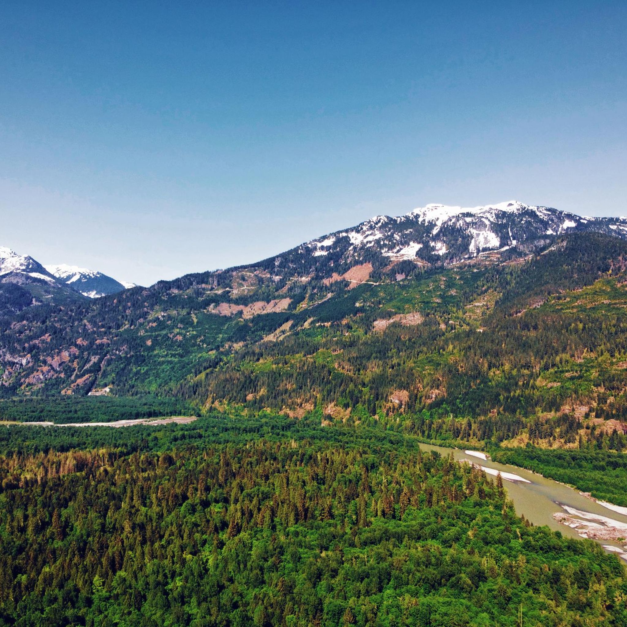
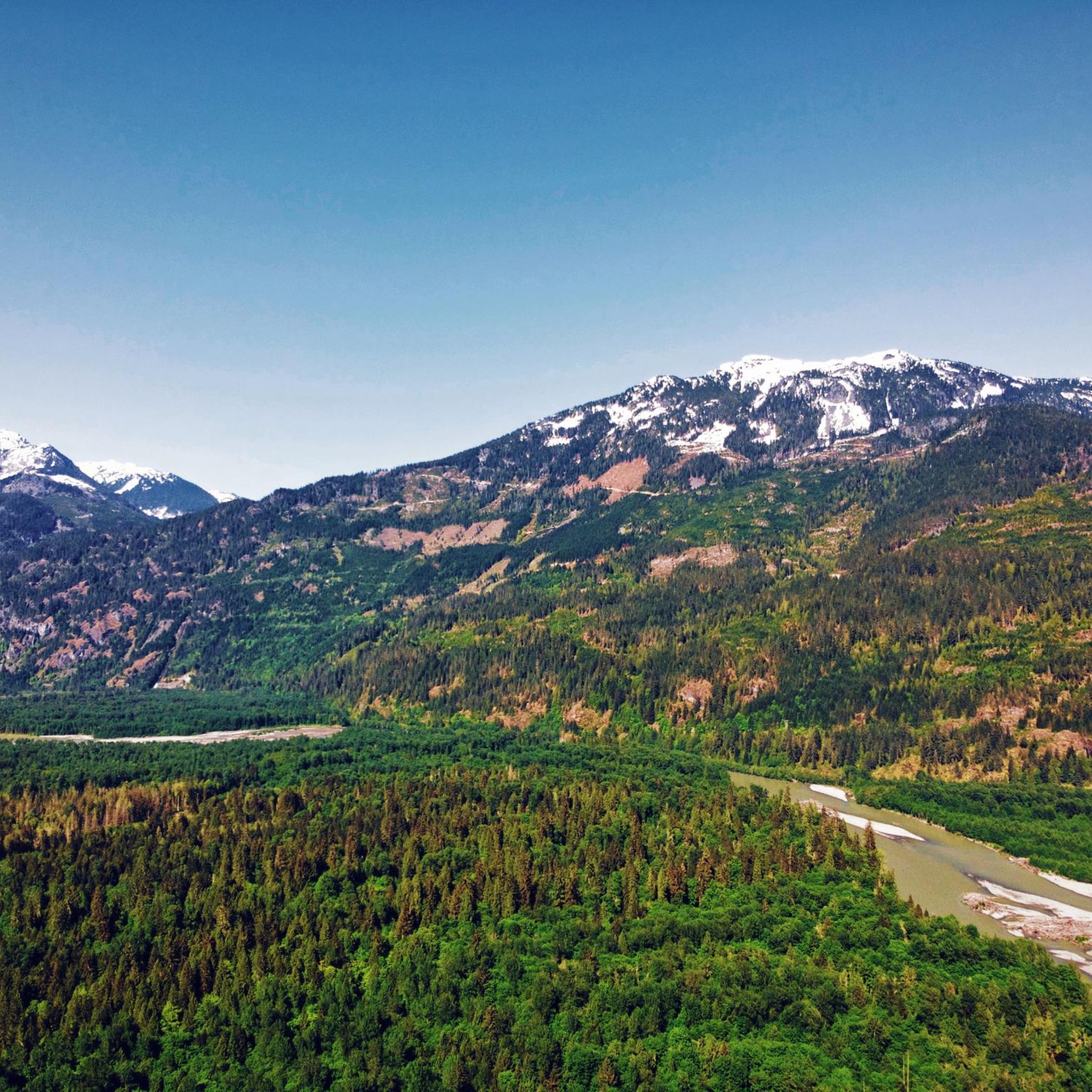
The Squamish River flows from the Coast Mountains to Howe Sound through one of British Columbia’s most scenic valleys. Along its lower reaches, the expansive river is framed by tall mountain peaks and supports a rich salmon habitat that attracts eagles, seals, and other wildlife, including bears. It’s a prime destination for fishing and whitewater rafting, and from this spot, you might see an eagle two flying overhead if you’re lucky.
0
0


You get continuous views of the gorge from along the trail, which is easy and continues at a mild incline. The north end of the trail ends at a scenic overlook to the rail bridge over Cheakamus River.
0
0

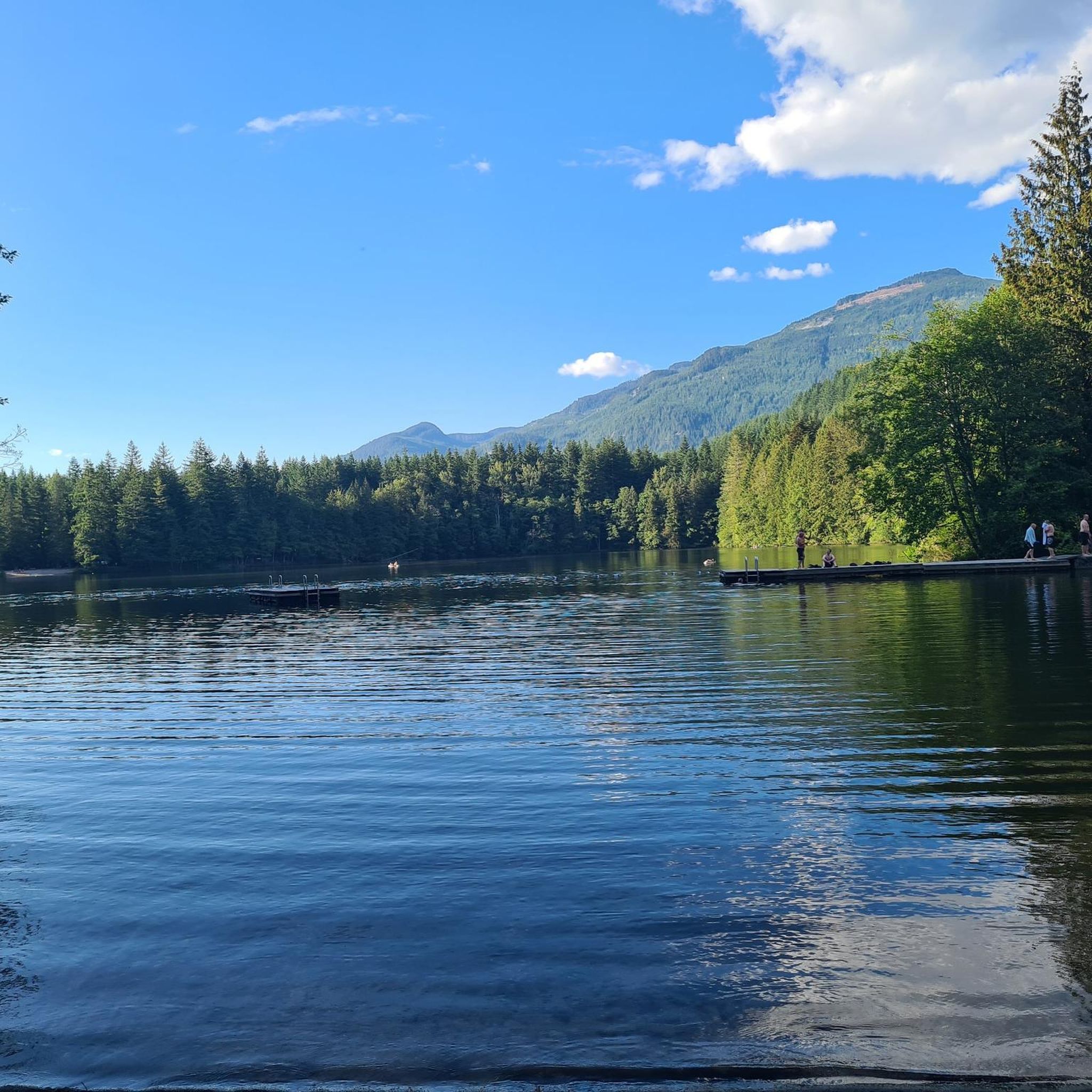
Alice Lake is the largest and most popular of the four lakes in Alice Lake Provincial Park, just north of Squamish in the Garibaldi Highlands. The lake has warm, calm waters popular for swimming, paddling, and picnicking in the summer months. Explore the lakeside and find a sandy beach, a roped-off swimming area, and plenty of space for stand-up paddleboards and kayaks.
0
0

The Sea to Sky Trail stretches 107 km from Squamish to Pemberton, leading you along coastal rainforests, rivers, and lakes. The trail is popular with hikers and cyclists; the section from here up to Starvation Lake is a wide, smooth gravel path.
0
0
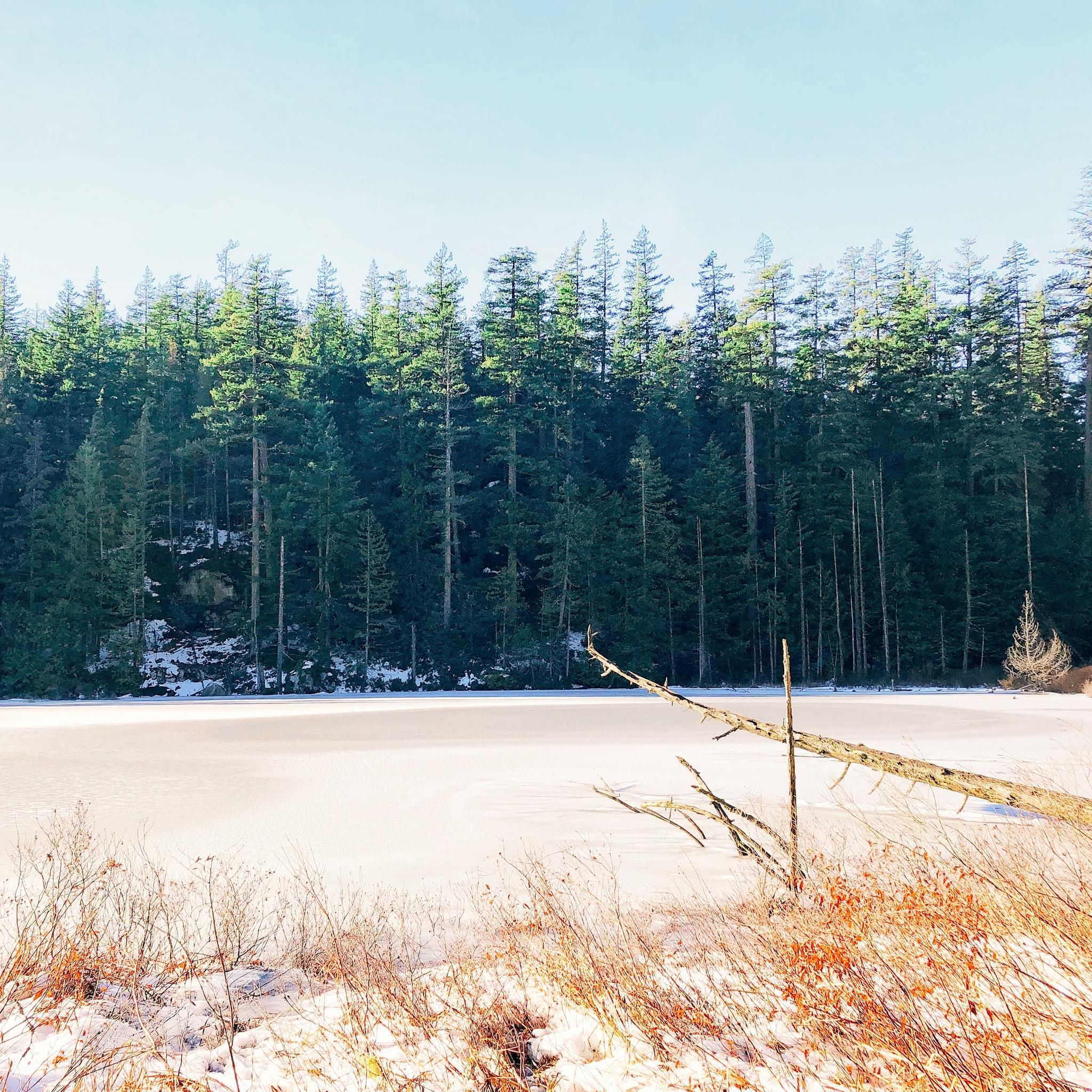
Starvation Lake is a small mountain lake nestled in a forest, offering framed views of the distant mountains. Due to its size, the lake warms quickly in the summertime, making it an excellent swimming destination. A recreation site is located on the north side of the lake, complemented by a few pocket beaches along the south shore.
0
0

The Cheakamus River flows south through a 50-meter-deep, densely forested rocky gorge. In the distance, we can see the striking rocky peak of The Black Tusk.
2
0
Frequently Asked Questions
How many touring cycling routes are available in the Tantalus Provincial Park area?
There are over 35 touring cycling routes in the vicinity of Tantalus Provincial Park. These routes offer a variety of experiences, from easy rides along estuaries to more challenging climbs with significant elevation gain, all set against the stunning backdrop of the Tantalus Range.
What kind of terrain can I expect on touring cycling routes near Tantalus Provincial Park?
The touring cycling routes near Tantalus Provincial Park feature diverse terrain. You'll find valley roads winding through dense old-growth forests, sections along river estuaries, and climbs that offer panoramic vistas of the rugged, glaciated peaks of the Tantalus Range. The landscape is characterized by impressive craggy summits and cascading mountain streams.
Are there any easy touring cycling routes suitable for beginners or families?
Yes, there are several easy touring cycling routes. For instance, the View of the Squamish Estuary – The Watershed loop from Eagle Run is an easy 11.7-mile (18.8 km) path that provides scenic views of the Squamish Estuary. Another option is the View of the Squamish Estuary – Squamish Cenotaph loop from Garibaldi Estates, which is also an easy ride.
What are some challenging touring cycling routes for experienced riders?
For experienced riders seeking a challenge, the Paradise Valley Road – Starvation Lake loop from Squamish Riverside Recreation Site is a difficult 39.0-mile (62.8 km) route. It features extensive valley views and significant climbs, with an elevation gain of over 1,150 meters.
Are there any circular touring cycling routes in the area?
Yes, many routes in the Tantalus Provincial Park vicinity are designed as loops. Examples include the View of the Squamish Estuary – The Watershed loop from Eagle Run, the The Watershed loop from Eagle Run, and the The Watershed – Brackendale Riverside View loop from The Northyards, offering varied distances and difficulties.
What is the best time of year for touring cycling near Tantalus Provincial Park?
The best time for touring cycling in this region is typically from late spring through early autumn. During these months, the weather is generally milder, and the roads are clear of snow, allowing for optimal conditions to enjoy the dramatic mountain vistas and lush valley landscapes.
What scenic views or natural features can I expect to see along the routes?
Cyclists can expect breathtaking views of the Tantalus Range, including prominent peaks like Mount Tantalus, Alpha Mountain, and Omega Mountain. Routes often traverse valleys with dense old-growth forests, pass by cascading mountain streams, and offer glimpses of the Squamish Estuary. The region is known for its 'Himalayan impressions' due to its rugged geology and glaciated peaks.
Is it possible to cycle directly within Tantalus Provincial Park?
No, direct touring cycling within Tantalus Provincial Park is not feasible. The park is a remote wilderness area with no direct road access, primarily designated for activities like hiking, climbing, and backcountry skiing. The cycling routes mentioned are in the surrounding Squamish Valley and Sea to Sky region, offering views of the park's magnificent peaks.
What do other touring cyclists enjoy most about cycling in the Tantalus Provincial Park area?
The area is highly rated by the komoot community, with an average score of 4.6 stars from more than 9 reviews. Reviewers often praise the stunning dramatic mountain vistas, the varied terrain that caters to different skill levels, and the opportunity to cycle through beautiful forested sections and along river estuaries with views of the Tantalus Range.
Are there any routes that offer views of the Squamish Estuary?
Yes, routes like the easy View of the Squamish Estuary – The Watershed loop from Eagle Run and the View of the Squamish Estuary – Squamish Cenotaph loop from Garibaldi Estates specifically highlight views of the Squamish Estuary, providing a unique coastal element to the mountain scenery.
What is the longest touring cycling route available?
The longest route listed is the Paradise Valley Road – Starvation Lake loop from Squamish Riverside Recreation Site, which spans 39.0 miles (62.8 km). This difficult route is known for its extensive valley views and challenging climbs.
Most popular routes in Tantalus Provincial Park

Get inspired with the komoot mobile app


Explore more
Browse the best Cycling routes in other regions.
