The best walks and hikes in Tantalus Provincial Park
4.5
(332)
4,940
hikers
68
hikes
Hiking in Tantalus Provincial Park offers access to a remote wilderness characterized by granite slab mountain ranges, expansive glaciers, and towering craggy summits. The terrain includes old-growth forests, sub-alpine meadows, and cascading mountain streams. This vast area protects pristine natural beauty within the Coast Mountains, providing a challenging environment for outdoor enthusiasts.
Best hiking trails in Tantalus Provincial Park
- The most popular hiking route is Lake Lovely Water Trail, a 6.4 miles (10.3 km) difficult trail that takes 6…
Last updated: July 24, 2026
20
hikers
10.3km
06:54
1,140m
1,140m
Hard hike. Very good fitness required. Sure-footedness, sturdy shoes and alpine experience required.
5.0
(1)
8
hikers
9.89km
03:45
460m
460m
Moderate hike. Good fitness required. Mostly accessible paths. Sure-footedness required.

Sign up for free
5
hikers
5.18km
01:20
10m
10m
Easy hike. Great for any fitness level. Easily-accessible paths. Suitable for all skill levels.
1.04km
00:16
0m
0m
Easy hike. Great for any fitness level. Easily-accessible paths. Suitable for all skill levels.
5.0
(2)
25
hikers
8.39km
04:03
900m
900m
Moderate hike. Good fitness required. Easily-accessible paths. Suitable for all skill levels.
Get access to more routes and recommendations from other explorers.
Sign up for free
Already have an account?
Our route recommendations are based on thousands of hikes, rides, and runs completed by other people on komoot.
Start today with a free account
Your next adventure awaits.
Login or Signup

Tips from the Community

Spit Road is a flat, gravel route leading through the Squamish Estuary to the tip of the Squamish Spit. Following the dyke, it passes tidal wetlands and slow-moving channels with beautiful views of the surrounding mountains before reaching the shoreline at the mouth of Howe Sound. It’s a popular path for hiking and cycling, with excellent opportunities to spot birds and other wildlife.
0
0
Squamish River Estuary is a vast mosaic of tidal marshes, mudflats, and channels where the Squamish River meets Howe Sound. It’s an ecologically important area spanning 673 hectares that provides habitat for salmon, harbour seals, and other wildlife, including over 200 migratory bird species, making it one of the best birdwatching destinations in British Columbia.
0
0
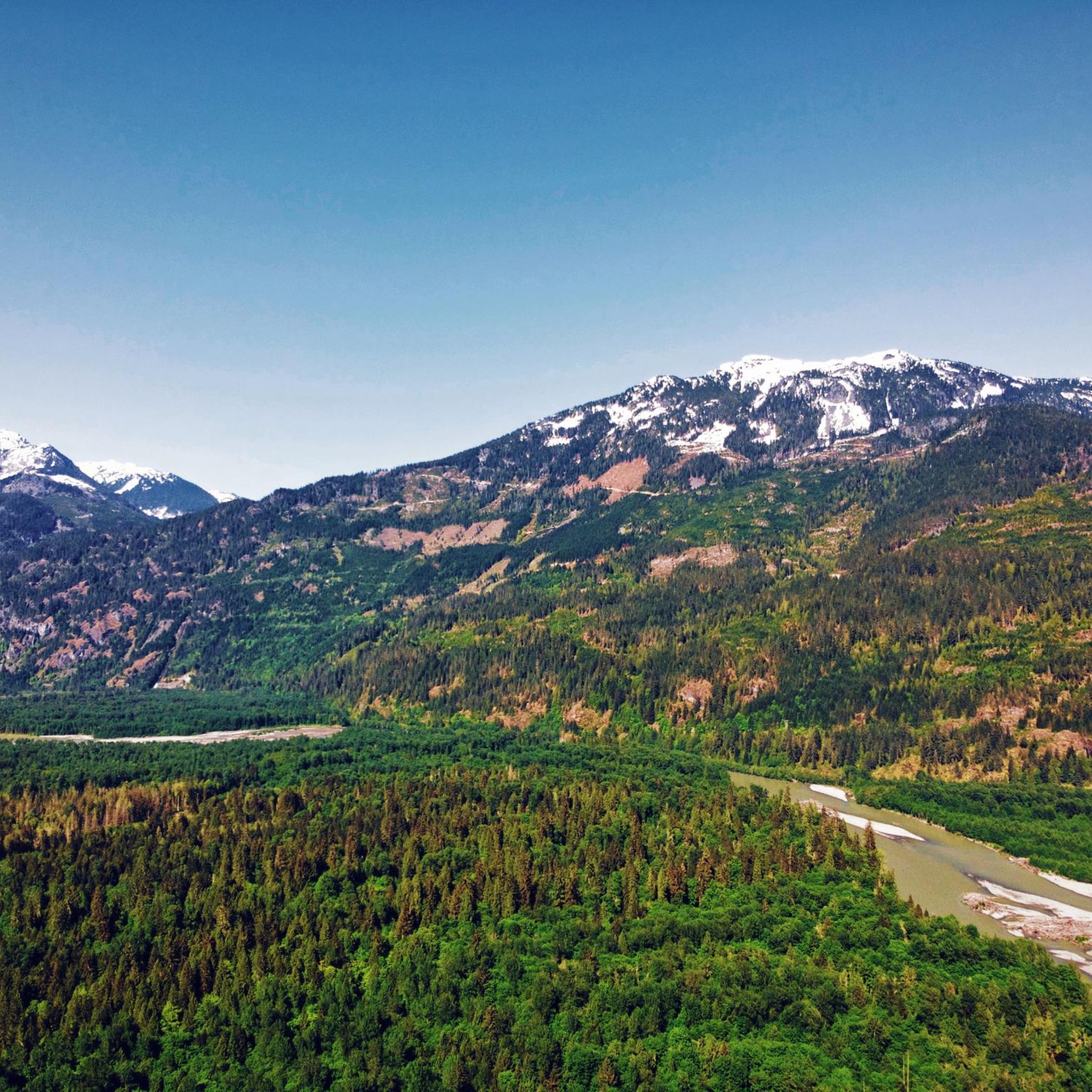
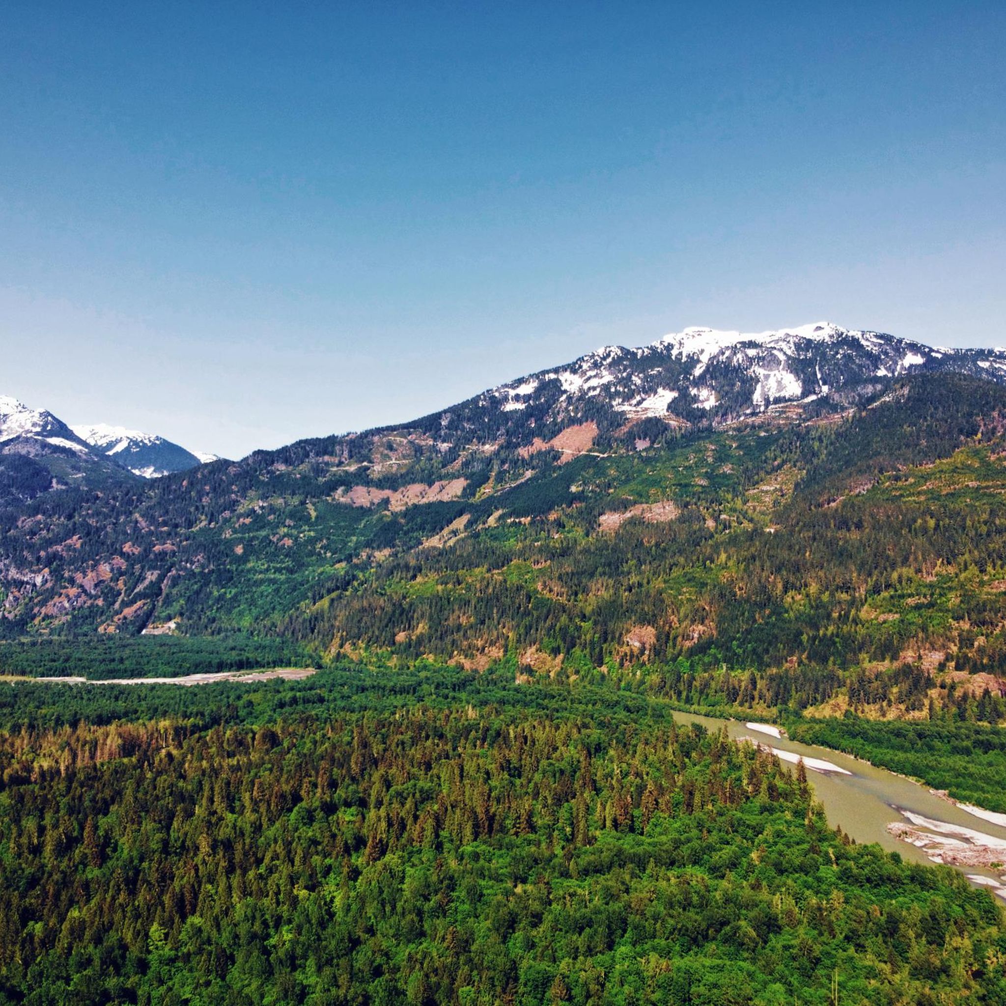
The Squamish River flows from the Coast Mountains to Howe Sound through one of British Columbia’s most scenic valleys. Along its lower reaches, the expansive river is framed by tall mountain peaks and supports a rich salmon habitat that attracts eagles, seals, and other wildlife, including bears. It’s a prime destination for fishing and whitewater rafting, and from this spot, you might see an eagle two flying overhead if you’re lucky.
0
0

There are numerous branching paths from the parking area, but all will lead you down to the beach, so you can take whichever appears the most clear of driftwood. The trail is easy and has a small parking area at the end of a gravel road.
0
0
The beach is about a half mile long and pebbly, and there are piles of driftwood every few hundred feet to climb on and explore. With no trees to obstruct the view, you get a magical 360-degree panorama of the mountains from the bank of the Squamish River.
0
0

Lake Lovely Water Trail is a very wild and very scenic hike. You can't just walk up to the trail head, but make some arrangement to cross the Squamish River. The climb is steep through old‑growth trees, and the trail may have roots sticking up, mud, possible fallen logs, or blowdowns. When the trail ends at Lovely Water, all the effort will be worthwhile as the scenery is unbelievable.
0
0
Arriving at Lake Lovely Water Trailhead is part of the hike's adventure. The start of this trail is not accessible by foot, as there is no bridge crossing the Squamish River. The most common way to cross is by jet boat, canoe, or float plane. Using your own canoe is possible, but the river has a swift current, so only experienced boaters should attempt this crossing, and there are also services like Sea to Sky Air that can get you across the river to begin your hike to Lovely Waters.
0
0
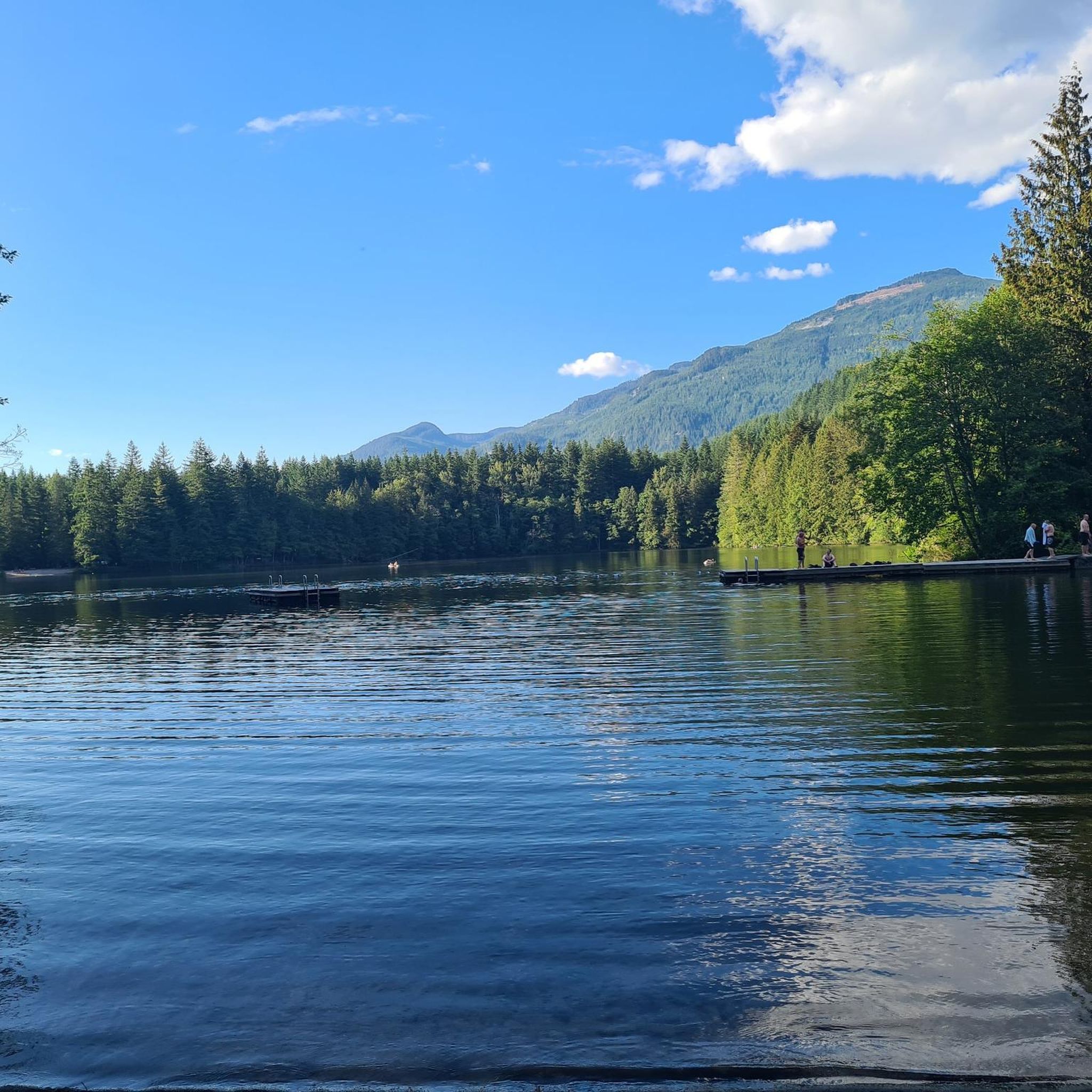
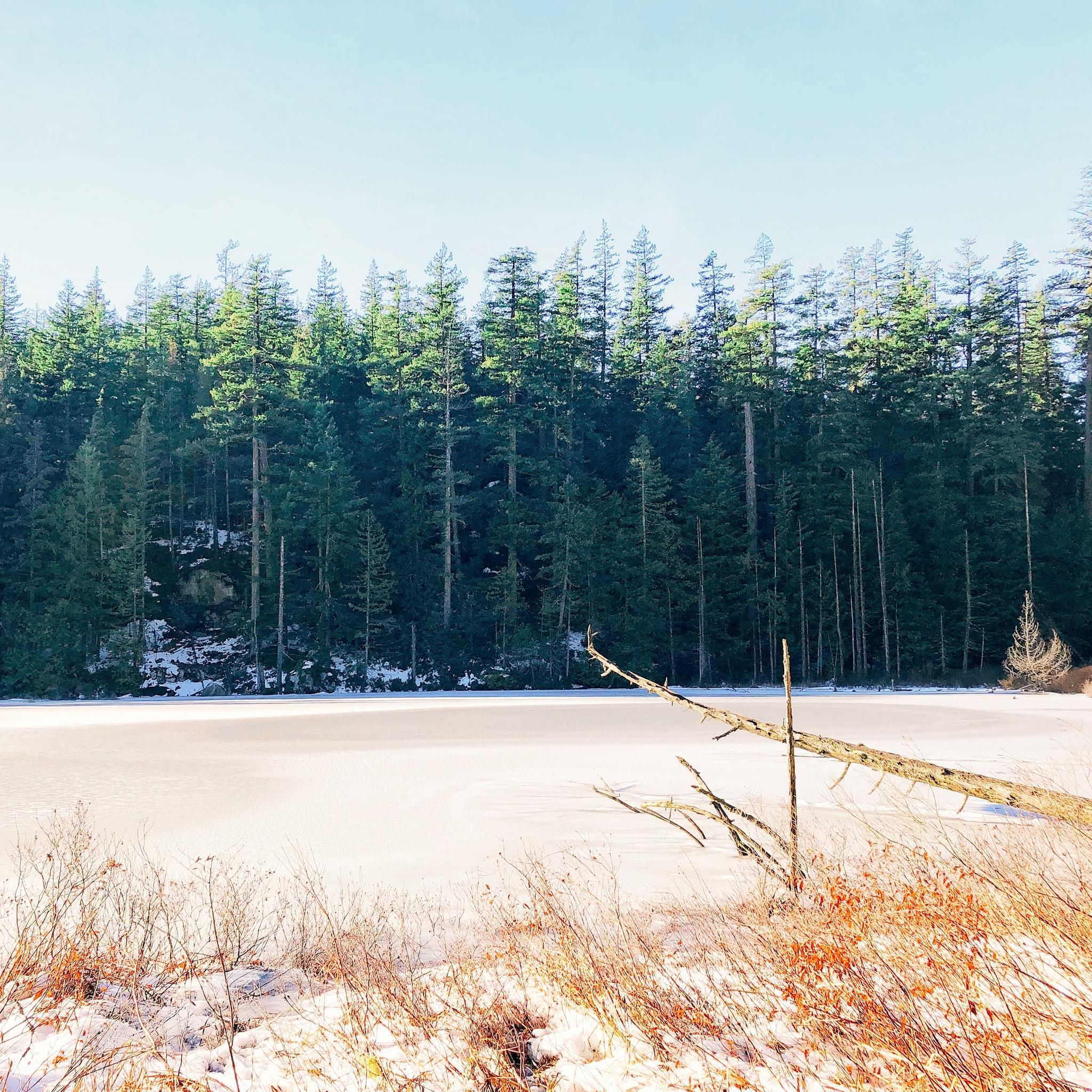
Lake Lovely Water lives up to its name, with beautiful turquoise water, nestled in the Tantalus Range high above the Squamish River Valley, across from the Stawamus Chief. The best time to hike out to Lovely Water is between July and early October. On its eastern shore, at the end of the Lake Lovely Water Trail, is a beach, campground, emergency helipad, and hut.
0
0
Frequently Asked Questions
How many hiking trails are available in Tantalus Provincial Park?
Tantalus Provincial Park offers a wide range of hiking experiences, with over 60 routes documented on komoot. These trails vary in difficulty, providing options for different skill levels within this remote wilderness.
What are the most prominent natural features or landmarks in the park?
The park is renowned for its dramatic scenery, including towering granite peaks like Mount Tantalus, Mount Dione, and Serratus Mountain, expansive glaciers, and old-growth forests. The 'crown jewel' is Lake Lovely Water, a serene sub-alpine lake with dazzling blue waters reflecting the surrounding mountains. The Tantalus Lookout, located north of Squamish, also offers impressive views of the range.
Are there any family-friendly hiking trails in Tantalus Provincial Park?
While many trails in Tantalus Provincial Park are challenging and remote, there are some options that might be more suitable for families seeking a less strenuous experience. For example, the Edith Lake loop from Eagle Run is a moderate trail that offers a pleasant outing with less elevation gain compared to the more alpine routes.
Can I bring my dog on the trails in Tantalus Provincial Park?
Tantalus Provincial Park is a remote wilderness area, and specific regulations regarding dogs can vary. Generally, dogs should be kept under control, and it's essential to practice Leave No Trace principles. Always check the latest park regulations before bringing your dog, especially in sensitive alpine environments or designated camping areas.
What is the best time of year to visit Tantalus Provincial Park for hiking?
The best time to visit for hiking is typically during the summer months, from late June to early September, when snow has melted from higher elevations and weather conditions are generally more stable. However, even in summer, hikers should be prepared for changing weather and potential limited visibility due to the park's alpine nature.
Are there any loop trails available for hiking in the park?
Yes, there are loop trails that offer varied scenery. The Crooked Falls loop from Squamish Riverside Recreation Site is a popular moderate option that leads to Crooked Falls and provides riverside views.
What kind of wildlife might I encounter while hiking in Tantalus Provincial Park?
As a remote wilderness area, Tantalus Provincial Park is home to various wildlife. Hikers might encounter black bears, grizzly bears, deer, mountain goats, and a variety of bird species. It's crucial to be bear-aware, carry bear spray, and store food in bear-proof canisters, especially in designated camping areas.
What are the permit requirements for hiking or camping in Tantalus Provincial Park?
Tantalus Provincial Park is a backcountry area, and while day-use permits are not typically required for hiking, overnight stays at facilities like the Jim Haberl Hut or Tantalus Hut require advance booking through the Alpine Club of Canada. For general backcountry camping, specific regulations and permits may apply, and it's always best to check with BC Parks for the most current information before your trip.
How do I access the Lake Lovely Water Trail, especially regarding the river crossing?
Accessing the Lake Lovely Water Trail is challenging due to a required river crossing of the Squamish River. There is no bridge, and the river's current can be swift and dangerous. Access is typically by boat shuttle or helicopter drop-off. This adds to the remote and adventurous nature of the hike.
What is the general difficulty level of hiking in Tantalus Provincial Park?
Hiking in Tantalus Provincial Park is generally considered challenging. Many trails are steep, rugged, and require good physical fitness and route-finding skills. The park's remote nature means limited facilities, appealing to those seeking an authentic wilderness experience. There are 14 difficult routes and 26 moderate routes, with a smaller number of easier options.
Where can I find parking for trailheads in Tantalus Provincial Park?
Parking availability varies depending on the trailhead. For routes like the Evans Lake Trail or the Crooked Falls loop from Squamish Riverside Recreation Site, designated parking areas are available near the starting points. However, for more remote access points, especially those requiring boat or helicopter access, parking logistics will need to be arranged with your transport provider.
What do other hikers enjoy most about Tantalus Provincial Park?
The area is highly rated by the komoot community, with an average score of 4.6 stars from over 260 reviews. Hikers frequently praise the park's stunning alpine and sub-alpine landscapes, including majestic glaciers and towering granite peaks, and the truly immersive wilderness experience offered by its challenging yet rewarding trails.
Are there any amenities or services close to Tantalus Provincial Park?
Tantalus Provincial Park is a remote wilderness area with limited facilities. The closest town with amenities and services is Squamish, located south of the park. Squamish offers accommodation, restaurants, cafes, and outdoor gear shops, serving as a base for visitors to the region.
Most popular routes in Tantalus Provincial Park

Get inspired with the komoot mobile app


Explore more
Browse the best Hikes in other regions.
