The best running trails in Zennegat - Battenbroek
4.3
(800)
48,636
runners
1,125
runs
Jogging in Zennegat - Battenbroek offers a network of running routes primarily characterized by flat terrain, riverine landscapes, and natural floodplains. The region features paths along waterways like the Dijle and Nete rivers, often passing through managed natural areas and open fields. Elevation changes are minimal, making it suitable for various fitness levels.
Best jogging routes in Zennegat - Battenbroek
- The most popular jogging route is Zennegat Lock – Zennegat Flood Area loop from Sas Battel, a 5.6 miles…
Last updated: October 7, 2026
5.0
(1)
139
runners
Hard run. Very good fitness required. Mostly paved surfaces. Suitable for all skill levels.
89
runners
Moderate run. Good fitness required. Mostly paved surfaces. Suitable for all skill levels.

5.0
(1)
167
runners
Moderate run. Good fitness required. Mostly paved surfaces. Suitable for all skill levels.
4.0
(1)
69
runners
12.9km
01:20
30m
30m
Moderate run. Good fitness required. Mostly paved surfaces. Suitable for all skill levels.
60
runners
12.6km
01:18
20m
20m
Moderate run. Good fitness required. Mostly paved surfaces. Suitable for all skill levels.
Get access to more routes and recommendations from other explorers.
Already have an account?
Our route recommendations are based on thousands of hikes, rides, and runs completed by other people on komoot.
Start today with a free account
Your next adventure awaits.

Tips from the Community

Here the water comes from different sides...
3
0
Bridges connect one side to the other side...
3
0

The viewing hut is no longer at the location.
0
0

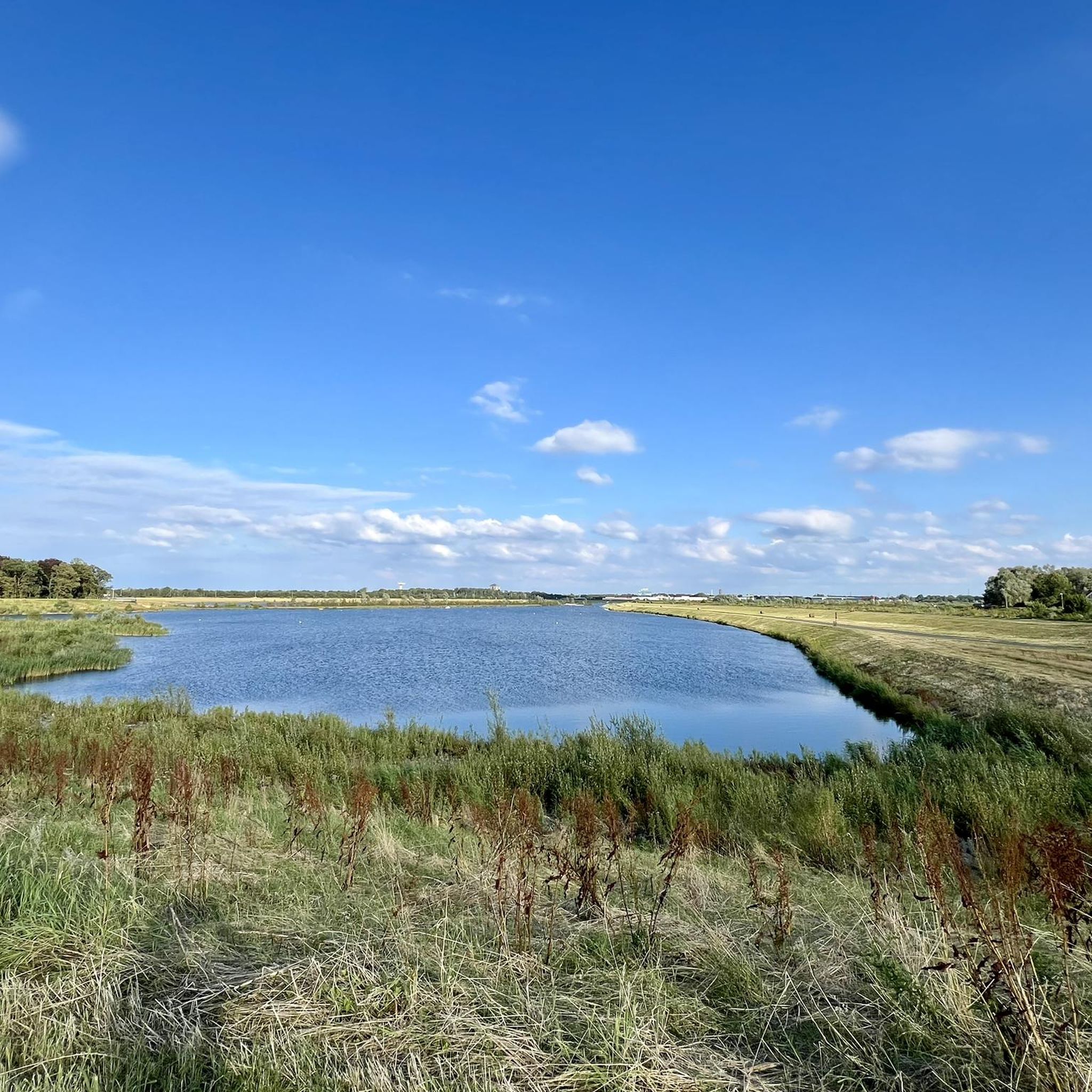
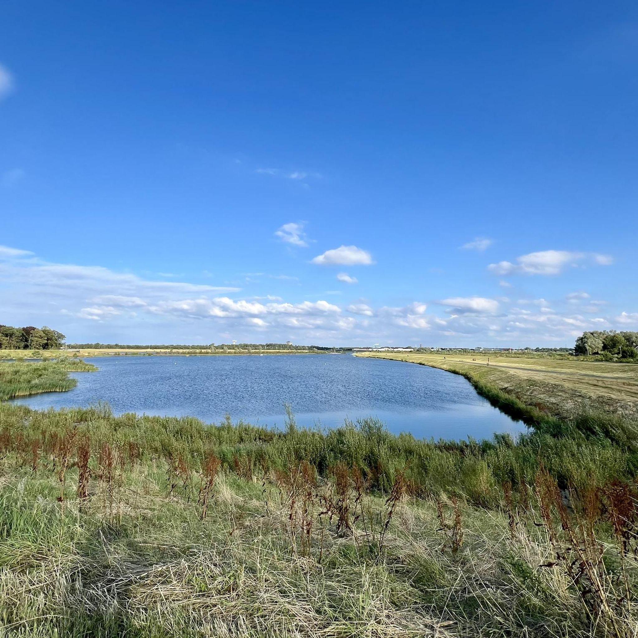
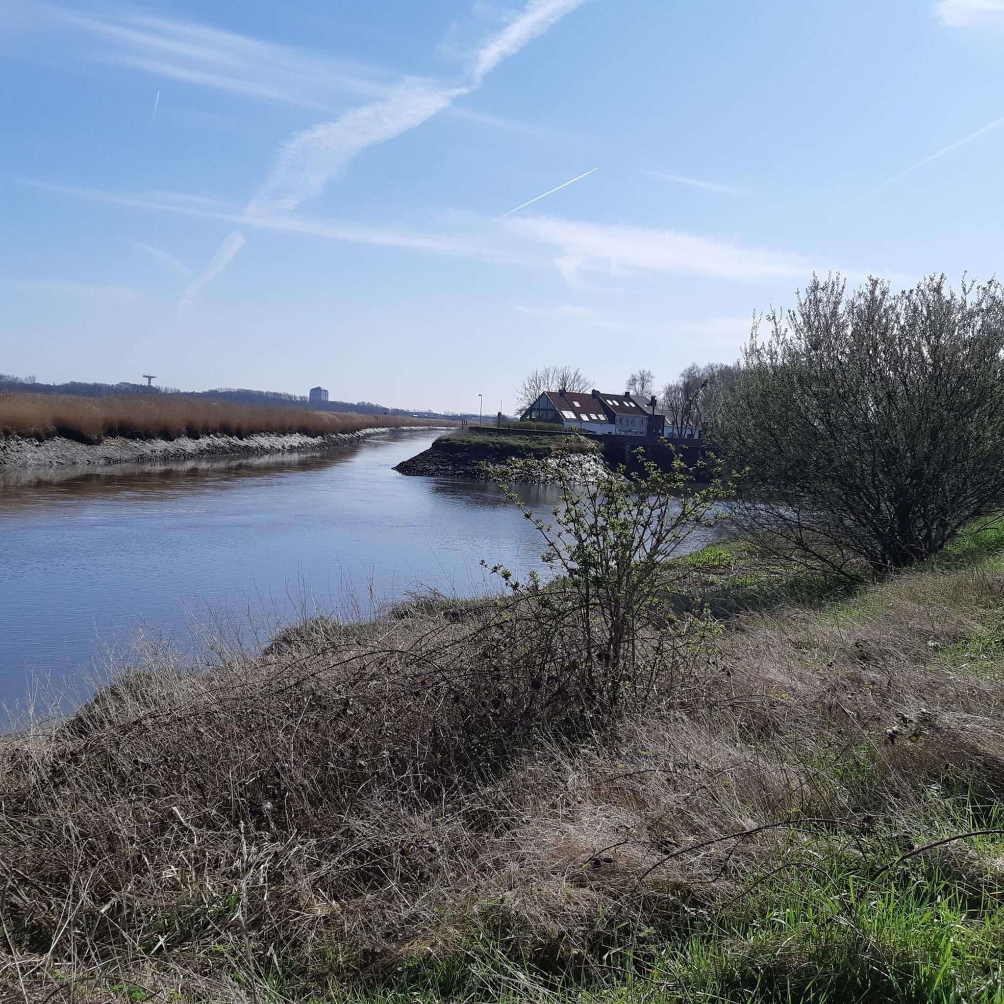
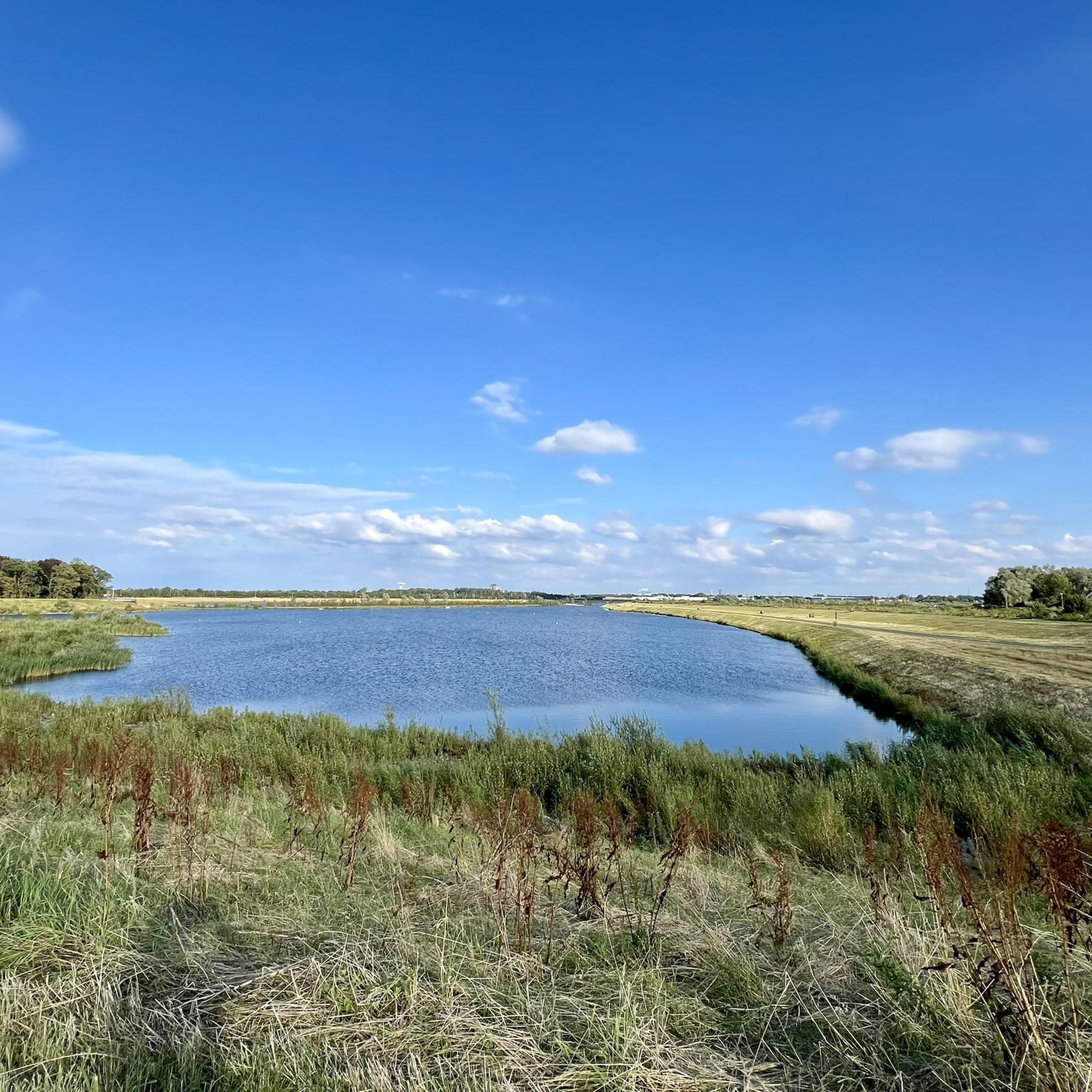
Here you have a view of the Beneden-Nete with wide reed beds just before it will form the Rupel together with the Dijle.
7
0
Here, the Dyle, Zenne, and Leuven-Dyle Canals converge to flow into the Rupel via the Nete. Cyclist and pedestrian bridges allow you to cross all these waterways safely, avoiding any detours. There's also a picnic table at the lock. Besides an idyllic hamlet, there's also a surprising nature reserve with rare mudflats and salt marshes. A beautiful area for walking.
9
0

In Vrijbroekpark, you'll find wooden structures and natural obstacles throughout the park, encouraging movement. They connect play areas like the playground and the traffic garden, ensuring a walk from the parking lot never has to be boring. Along the route, you'll encounter the renovated hotel ruins. For more information about the hotel ruins and Vrijbroekpark: www.vrijbroekpark.be.
8
0
Batteliek is a Mechelen microbrewery, microdistillery, and lemonade housed in a former church. It's a wondrous place where alchemy and industry intertwine. Let your senses be captivated by the experimental kitchen and drinks, where new flavors are developed through trial and error.
7
0
The Zennegat: intersection of water safety and nature development The Zennegat lies where the Zenne River, the Leuven-Dijle Canal, and the Dijle River meet. This flood control area guarantees safety in the surrounding area and protects valuable natural resources. Channels, mudflats, and salt marshes here provide an ideal habitat for various plants and animals.
5
0
Frequently Asked Questions
How many running routes are available in Zennegat - Battenbroek?
Zennegat - Battenbroek offers a wide selection of running routes, with over 900 trails available for exploration. These routes cater to various fitness levels, from easy jogs to more challenging runs.
What kind of terrain can I expect on the running trails in Zennegat - Battenbroek?
The running trails in Zennegat - Battenbroek are primarily characterized by flat terrain, riverine landscapes, and natural floodplains. You'll find paths along waterways like the Dijle and Nete rivers, often passing through managed natural areas and open fields. Elevation changes are minimal, making it suitable for various fitness levels.
Are there any easy running routes suitable for beginners in Zennegat - Battenbroek?
Yes, Zennegat - Battenbroek has a good selection of easy running routes. There are over 80 trails classified as easy, perfect for beginners or those looking for a relaxed jog. One such route is Oude Dijlearm loop from Galgenberg, which is 5.3 km long and takes about 30 minutes.
What do other runners say about the trails in Zennegat - Battenbroek?
The running routes in Zennegat - Battenbroek are highly regarded by the komoot community, boasting an average rating of 4.3 stars from over 590 reviews. Runners often praise the scenic riverine paths and the tranquil natural settings.
Are there any circular running routes in Zennegat - Battenbroek?
Many of the running routes in Zennegat - Battenbroek are designed as loops, offering convenient starting and ending points. For example, the Blue Bridge over the Dijle – View of the Nete River loop from Rumst is a 7.8 km circular trail that takes about 48 minutes to complete.
Can I bring my dog on the running trails in Zennegat - Battenbroek?
Many of the natural areas and river paths in Zennegat - Battenbroek are dog-friendly, but it's always best to check local signage for specific regulations, especially in nature reserves or protected floodplains. Generally, dogs are welcome on a leash.
Are there any family-friendly running routes in the region?
Given the predominantly flat terrain and well-maintained paths, many routes in Zennegat - Battenbroek are suitable for families. Shorter, easy routes like the Oude Dijlearm loop from Galgenberg are excellent choices for a family jog, offering pleasant scenery without significant challenges.
What natural attractions can I see along the running routes?
While running in Zennegat - Battenbroek, you can encounter several natural highlights. Keep an eye out for the Confluence of the Dijle and Nete = Rupel, the expansive Zennegat Flood Area, and scenic views of the Oude Nete-arm. The region is rich in riverine landscapes and floodplains.
Are there any longer, more challenging running routes for experienced runners?
Yes, for experienced runners seeking a greater challenge, Zennegat - Battenbroek offers several difficult routes. One such option is the Het Broek Visitor Center – Path Along the Stream loop from Watersportbaan Hazewinkel, a demanding 17.5 km path that follows a stream through varied natural terrain.
What is the best time of year to go running in Zennegat - Battenbroek?
The best time to go running in Zennegat - Battenbroek is generally during the spring and autumn months when the weather is mild and the natural scenery is vibrant. Summer can also be pleasant, especially in the mornings or evenings, while winter runs offer a different, often serene, experience of the riverine landscapes.
Are there places to park near the running trails?
Yes, many popular starting points for running routes in Zennegat - Battenbroek, especially near visitor centers or recreational areas, offer designated parking facilities. For specific routes, it's advisable to check the route details on komoot for parking information near the trailhead.
Can I reach the running trails using public transport?
Public transport options are available to reach various points within the Zennegat - Battenbroek region. Local bus services often connect to towns and villages near the trailheads. Checking local transport schedules for specific starting points is recommended.
Are there any cafes or refreshment stops along the routes?
While many routes traverse natural areas, you'll find cafes and taverns in the nearby villages and towns, such as Rumst or Heffen. Some routes, like the Het Brughuis Tavern – Wide Sand Path loop from Heffen, even start or pass by establishments where you can grab a drink or a snack.
Most popular routes in Zennegat - Battenbroek
Most popular attractions in Zennegat - Battenbroek

Get inspired with the komoot mobile app


Explore more
Browse the best Running Trails & Routes in other regions.
