The best running trails in Przełom Osławy Pod Duszatynem
26
runners
7
runs
Jogging in Przełom Osławy Pod Duszatynem offers routes through a nature reserve characterized by the meandering Osława River, which forms a distinctive "omega"-shaped bend. The terrain blends features of the Low Beskids and Bieszczady Mountains, providing varied elevation. Paths include former narrow-gauge railway embankments and trails through spruce, pine, beech, and fir forests.
Best jogging routes in Przełom Osławy Pod Duszatynem
- The most popular jogging route is Lower Duszatyn Pond – Dushatinskie Lakes loop from Przełom Osławy pod Duszatynem,…
Last updated: May 9, 2026
8
runners
Moderate run. Good fitness required. Mostly paved surfaces. Suitable for all skill levels.
9
runners
28.7km
03:43
820m
820m
Hard run. Very good fitness required. Mostly paved surfaces. Suitable for all skill levels.

Sign up for free
3
runners
10.3km
01:06
100m
100m
Moderate run. Good fitness required. Mostly paved surfaces. Suitable for all skill levels.
3
runners
5.21km
00:39
160m
160m
Moderate run. Good fitness required. Mostly paved surfaces. Suitable for all skill levels.
3
runners
19.7km
02:13
400m
400m
Hard run. Very good fitness required. Mostly paved surfaces. Suitable for all skill levels.
Get access to more routes and recommendations from other explorers.
Sign up for free
Already have an account?
Our route recommendations are based on thousands of hikes, rides, and runs completed by other people on komoot.
Start today with a free account
Your next adventure awaits.
Login or Signup
Popular around Przełom Osławy Pod Duszatynem
Tips from the Community

Tokarnia, a peak at 778 meters above sea level, offers stunning and expansive views of the Bukowskie Foothills and the Bieszczady Mountains. Finally, a forest-free peak. It's beautiful and peaceful here—it's hard to believe that heavy fighting took place here during World War II. It's an open clearing, so the wind can blow tourists away quite hard.
1
0
An interesting Greek Catholic cemetery right by the road is worth a look. It turns out that the Main Beskid Trail offers more than just mountains!
1
0
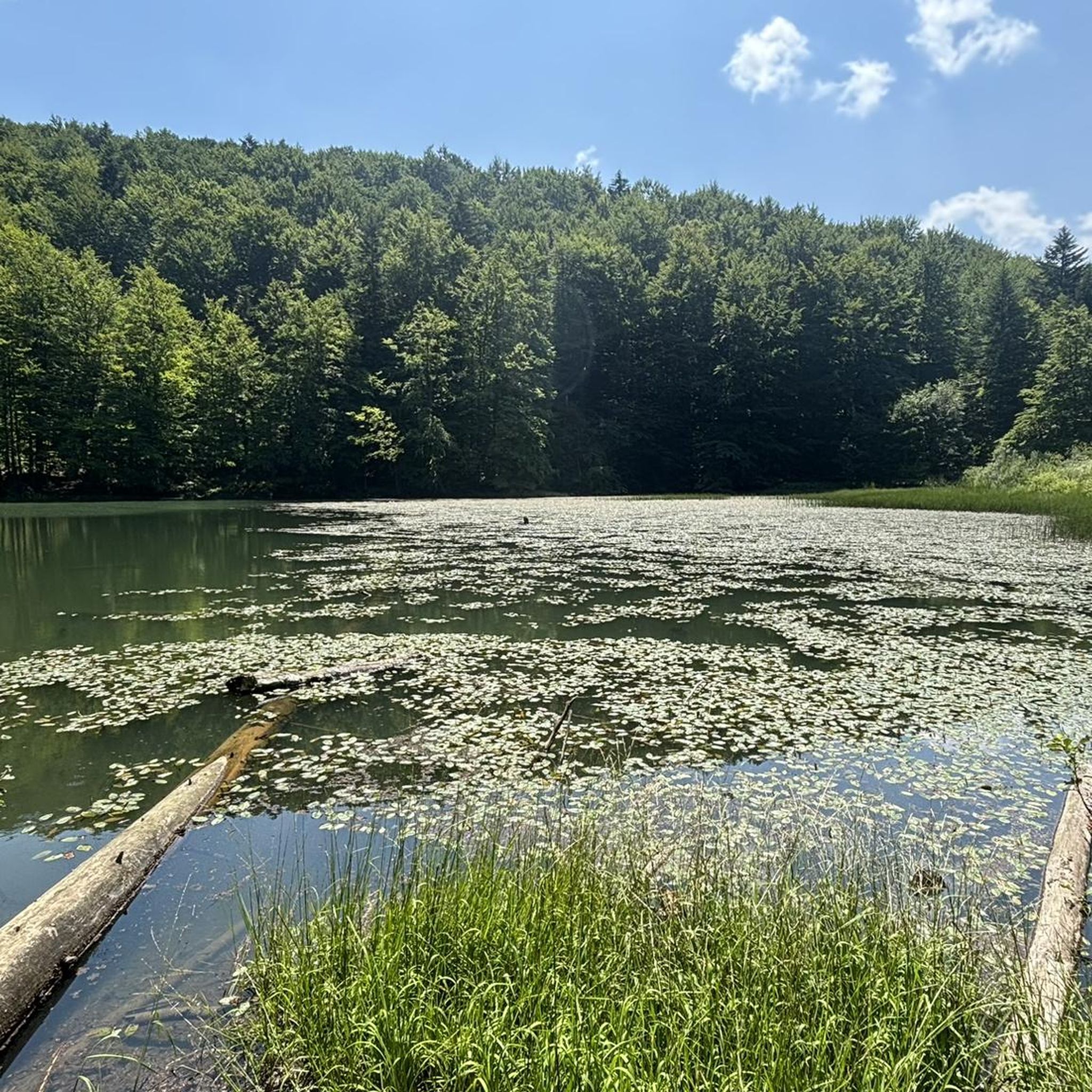
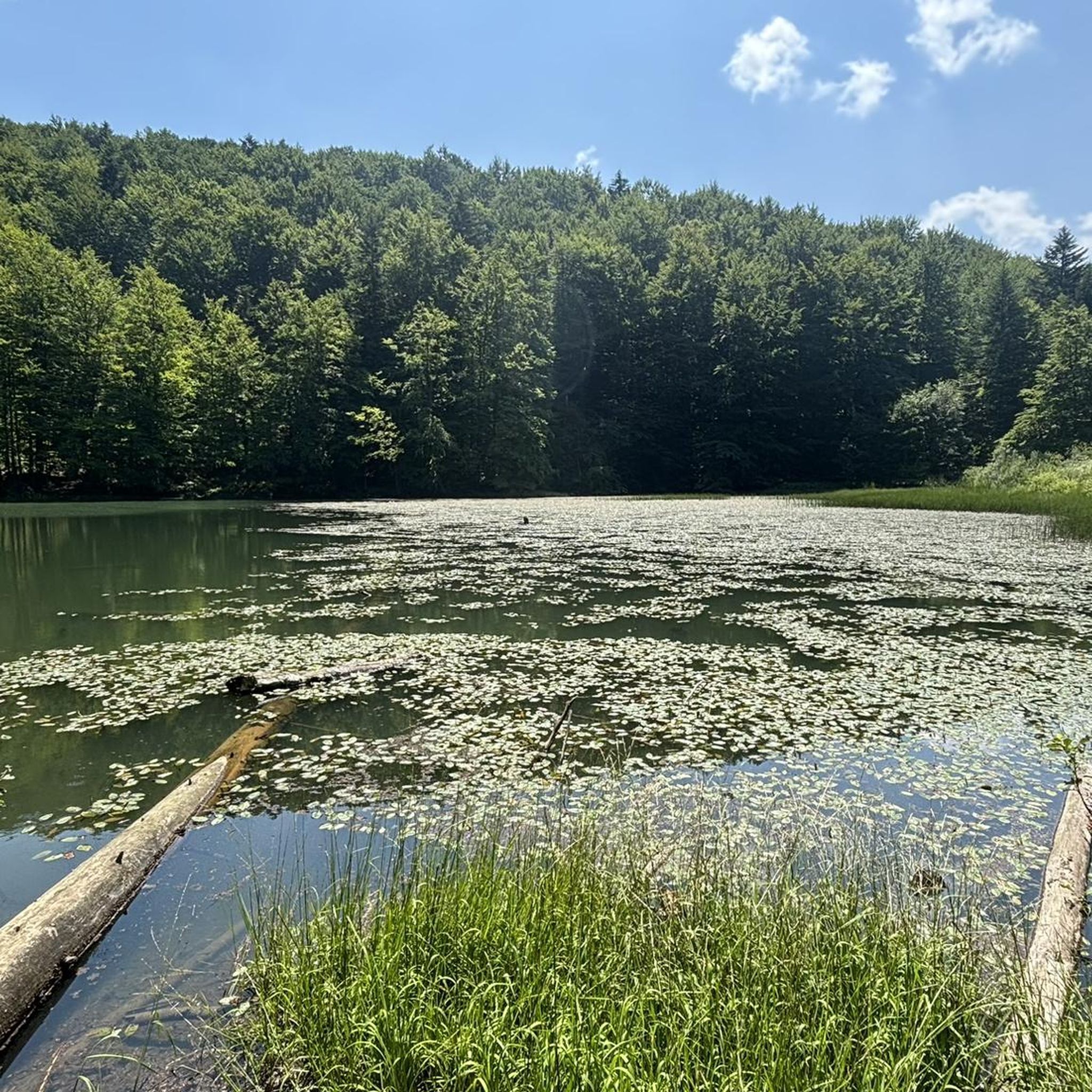
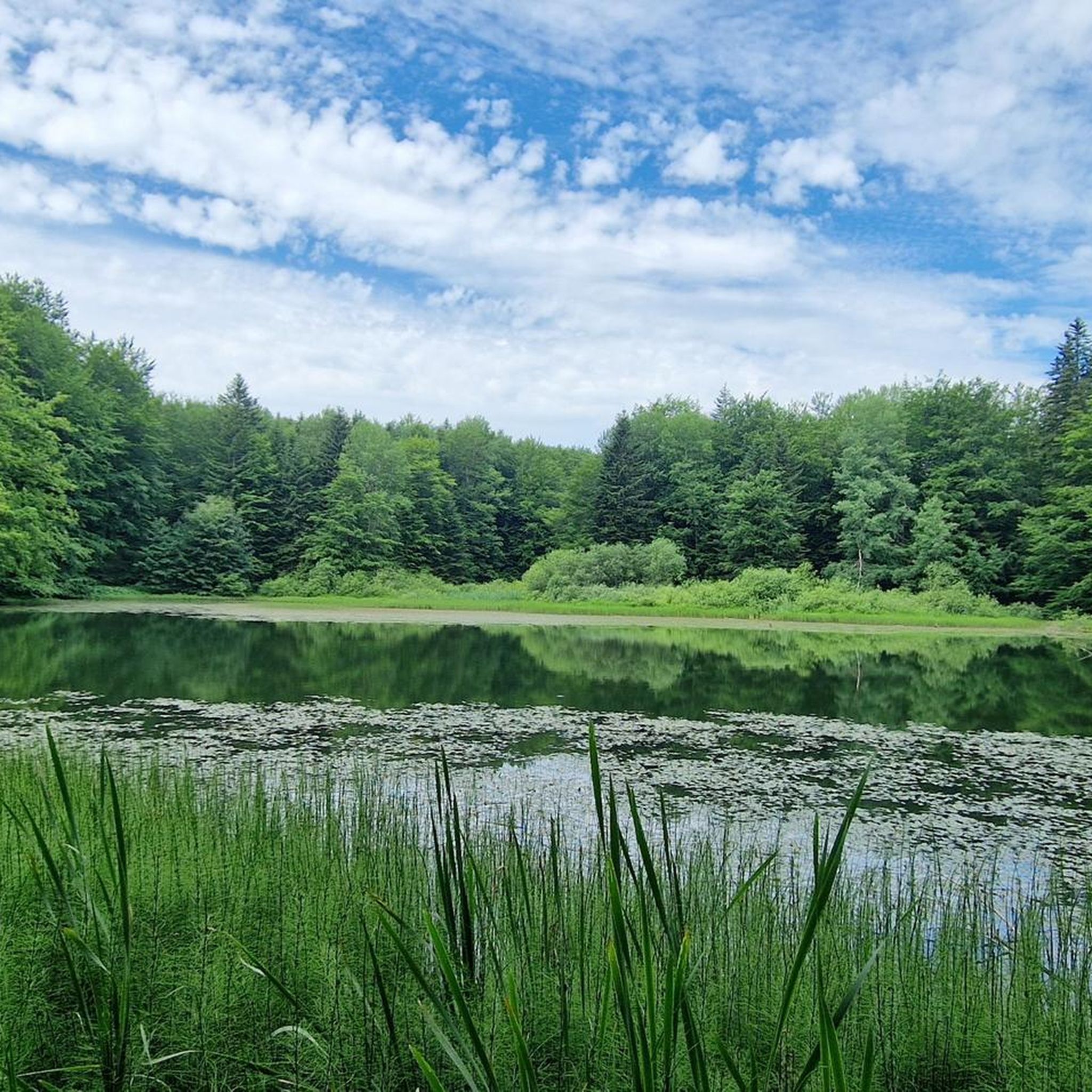
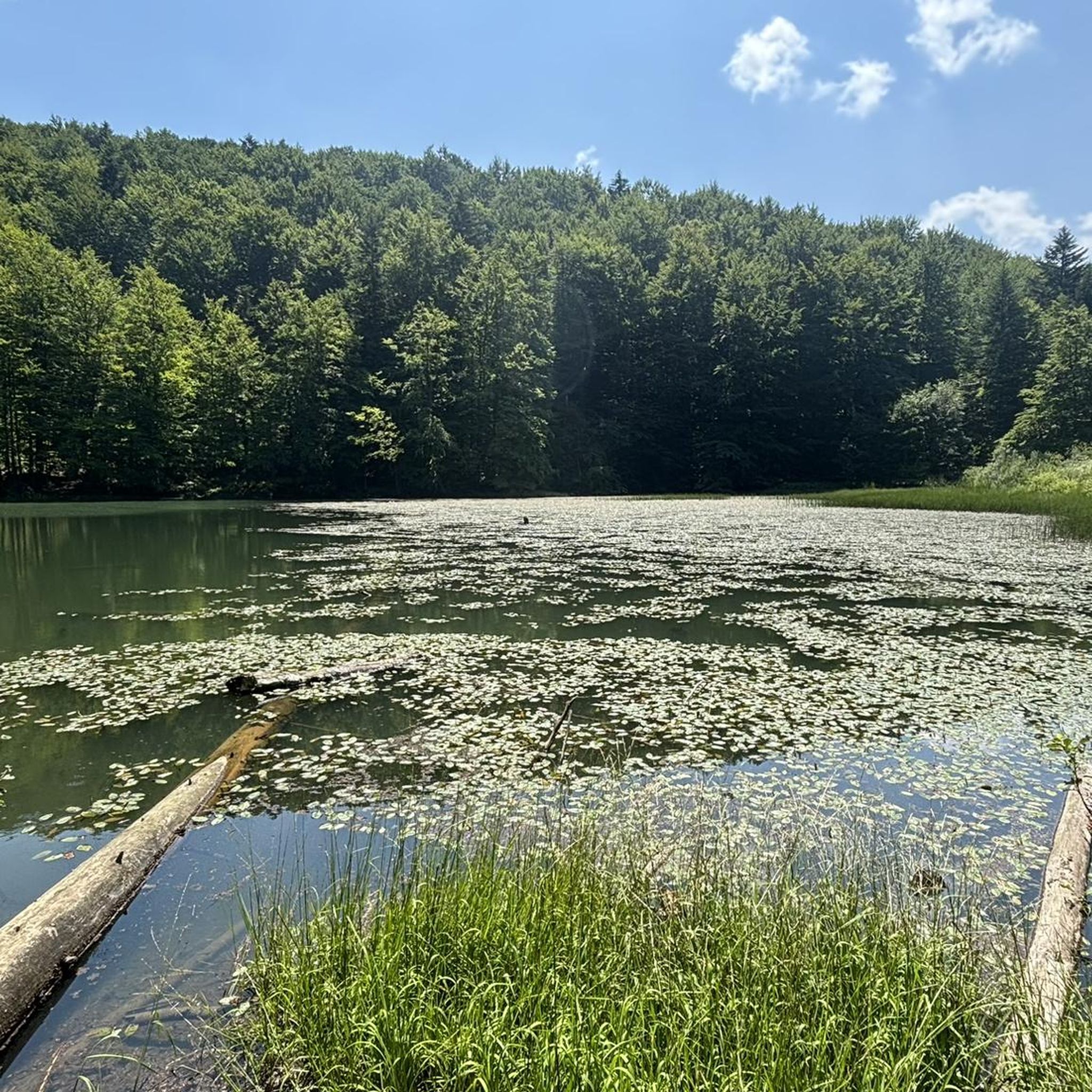
The history of these lakes is fascinating. It turns out they were formed by a landslide on the western slope of Chryszczata Mountain in 1907 after heavy rains! A natural dam formed on the Olchowata stream, and now there are the lakes. Today, it's beautiful, green, and very peaceful.
0
0

Beautiful all around panorama. Silence, emptiness, peace, nature.
0
0

Nice peak with an exposed clearing. At the top there is a telecommunication transmitter. There is also a bench.
1
0
A low peak with beautiful views. Covered with meadows. At the top, there's a bench.
1
0
The reserve includes the lakes of Dusztyn created after a landslide.
0
0
One of the lakes formed due to a landslide.
0
0
Frequently Asked Questions
What kind of terrain can I expect on the running routes in Przełom Osławy Pod Duszatynem?
The terrain in Przełom Osławy Pod Duszatynem is diverse, blending characteristics of the Low Beskids and Bieszczady Mountains. You'll find varied elevation, from relatively flat sections along former narrow-gauge railway embankments to more moderate and difficult paths through spruce, pine, beech, and fir forests. The routes often follow the meandering Osława River, offering scenic views.
Are there any easy running routes suitable for beginners in the area?
While the guide primarily features moderate and difficult routes, the presence of former narrow-gauge railway tracks offers relatively flat and accessible paths. These sections, like parts of the route Lower Duszatyn Pond – Dushatinskie Lakes loop from Przełom Osławy pod Duszatynem, can be suitable for beginners looking for less challenging terrain, though the full loops might include more varied elevation.
What natural attractions or landmarks can I see while running in Przełom Osławy Pod Duszatynem?
The reserve is rich in natural beauty. You can experience the spectacular 'omega'-shaped bend of the Osława River, known as Łokieć, and observe cascades and rocky thresholds formed by the river. Along the former narrow-gauge railway track, you might encounter one of the highest and longest railway bridges in the Bieszczady mountains and the largest cascade on the Osława River. The diverse forests and potential sightings of rare plant species also add to the experience.
Are there any circular running routes available in Przełom Osławy Pod Duszatynem?
Yes, many of the running routes in the area are designed as loops. For example, the popular Lower Duszatyn Pond – Dushatinskie Lakes loop from Przełom Osławy pod Duszatynem and the tranquil Ruiny cerkwi w Zubeńsku loop from Nowy Łupków are both circular paths, allowing you to start and finish in the same location.
Is Przełom Osławy Pod Duszatynem suitable for family running outings?
The reserve offers varied terrain, and while some routes are moderate to difficult, the former narrow-gauge railway embankment provides a relatively flat and accessible path that could be suitable for families. It's advisable to check the specific route details for elevation and distance to ensure it matches your family's fitness level. The natural beauty and diverse wildlife can make for an engaging outdoor experience for all ages.
Can I bring my dog on the running trails in Przełom Osławy Pod Duszatynem?
As a nature reserve, it's generally important to adhere to local regulations regarding pets. While the guide doesn't specify dog-friendly rules, it's common in such areas to keep dogs on a leash to protect wildlife and ensure the safety of other visitors. Always check local signage or official reserve guidelines before bringing your dog.
What is the best time of year to go running in Przełom Osławy Pod Duszatynem?
The reserve's natural beauty can be enjoyed throughout the year. Spring brings lush greenery and blooming flora, while autumn offers vibrant fall colors in the forests. Summer provides warmer weather, ideal for longer runs. Winter running is possible, but conditions may be challenging due to snow and ice, especially on higher elevations or less maintained paths. Always check local weather conditions before heading out.
How many running routes are available in Przełom Osławy Pod Duszatynem?
There are 8 distinct running routes detailed in this guide for Przełom Osławy Pod Duszatynem, ranging from moderate to difficult in intensity. These routes offer diverse experiences through the region's unique landscapes.
Where can I park when visiting Przełom Osławy Pod Duszatynem for a run?
Specific parking locations are not detailed in the route descriptions. However, as the area is a nature reserve with established trails, it is likely that designated parking areas are available near common trailheads or villages like Duszatyn, Nowy Łupków, or Rzepedź, which serve as starting points for many routes. It's recommended to check local maps or visitor information for precise parking facilities.
Are there any long-distance running options for experienced runners?
Yes, for experienced runners seeking a challenge, routes like the Vahalovsky Peak – Tokarnia loop from Komańcza Letnisko, which spans nearly 29 km with significant elevation gain, offer a demanding and rewarding experience. Another option is the Szcołb / Ščob – Głęboki Wierch loop from Łupków, a difficult 19.7 km trail through diverse forest landscapes.
What makes the running experience in Przełom Osławy Pod Duszatynem unique?
The running experience here is unique due to the distinctive natural features. The centerpiece is the meandering Osława River, forming the 'omega'-shaped bend known as Łokieć. Running alongside this river, through ancient beech and fir forests, and even on a former narrow-gauge railway track, provides a blend of historical interest and stunning natural scenery that is characteristic of the Low Beskids and Bieszczady Mountains.
Most popular routes in Przełom Osławy Pod Duszatynem

Get inspired with the komoot mobile app


Explore more
Browse the best Running Trails & Routes in other regions.
