The best mountain hikes in Frafjordheiane Landskapsvernområde
5.0
(1)
21
hikers
3
hikes
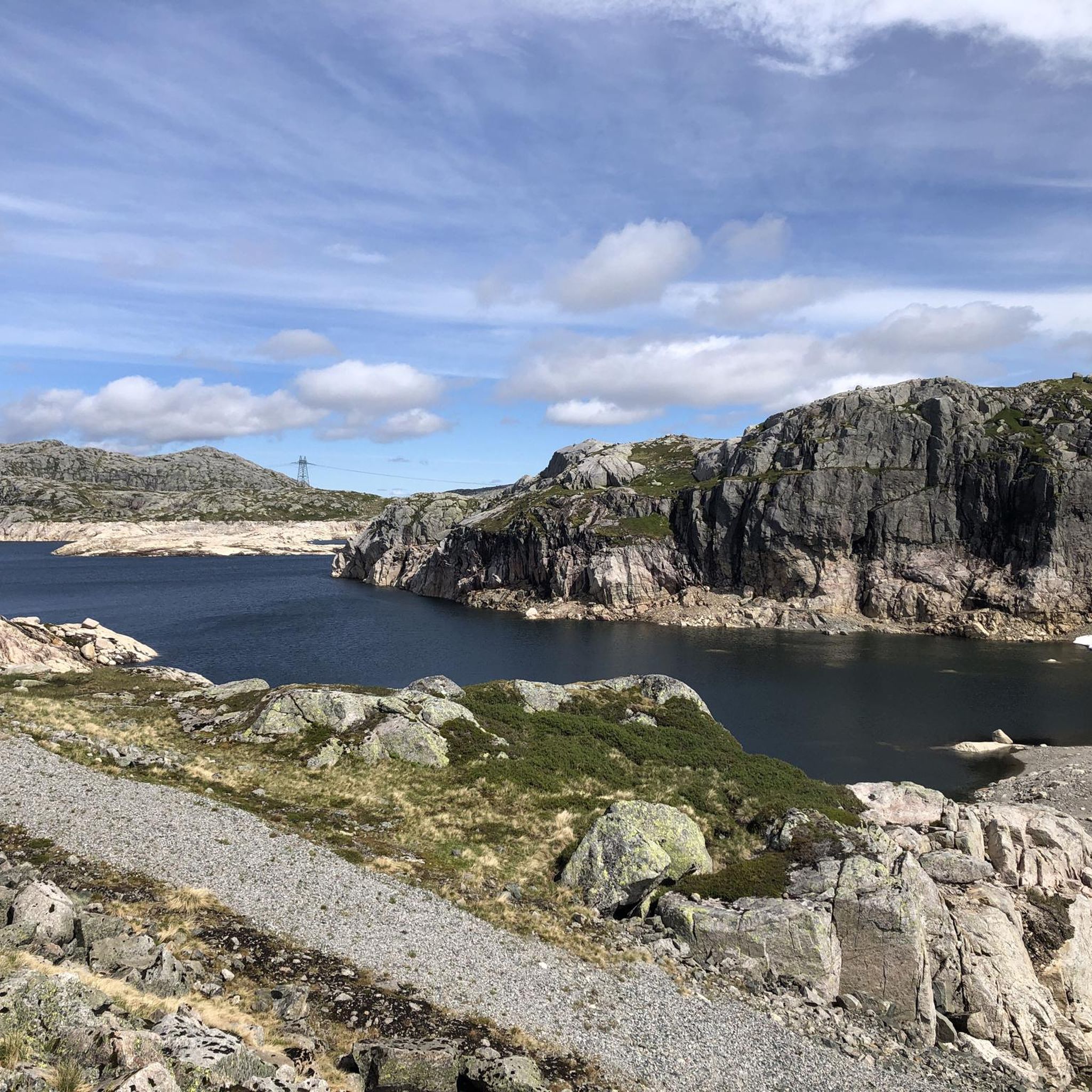
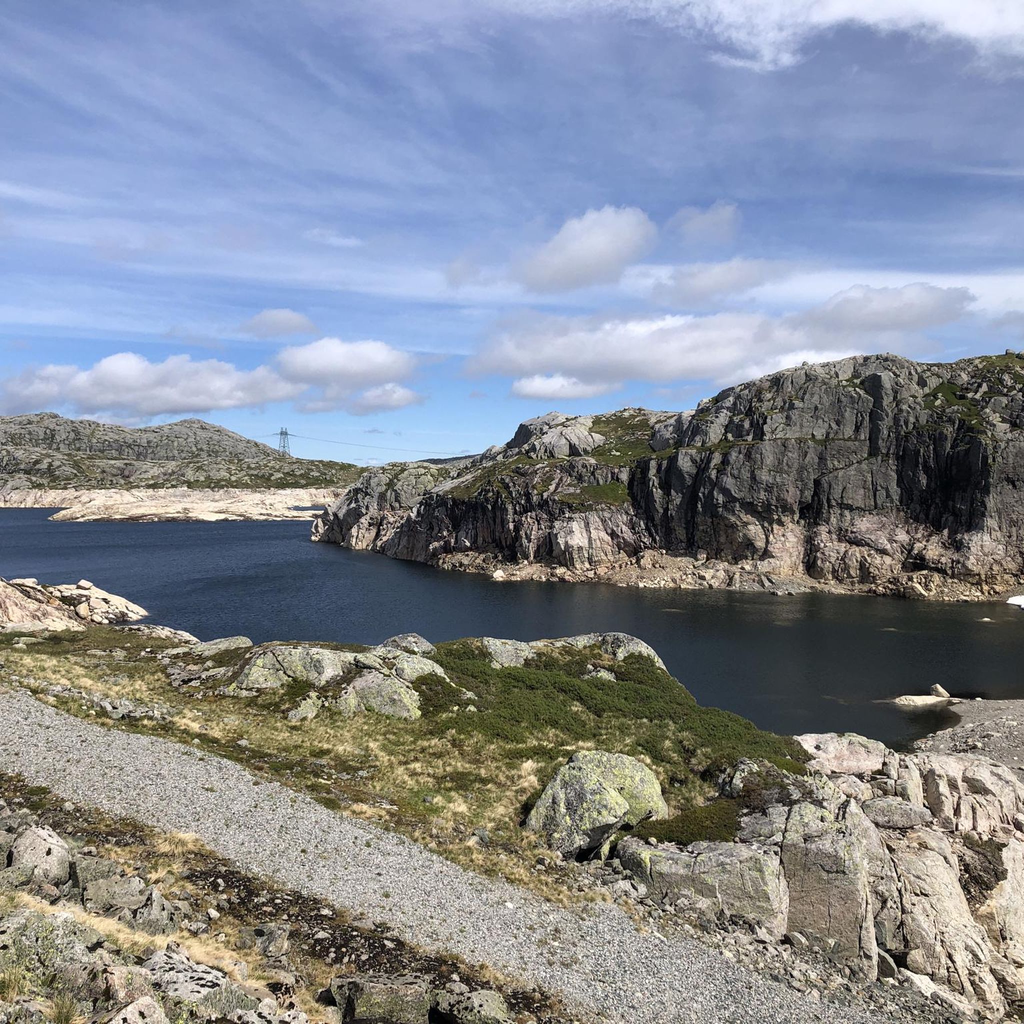
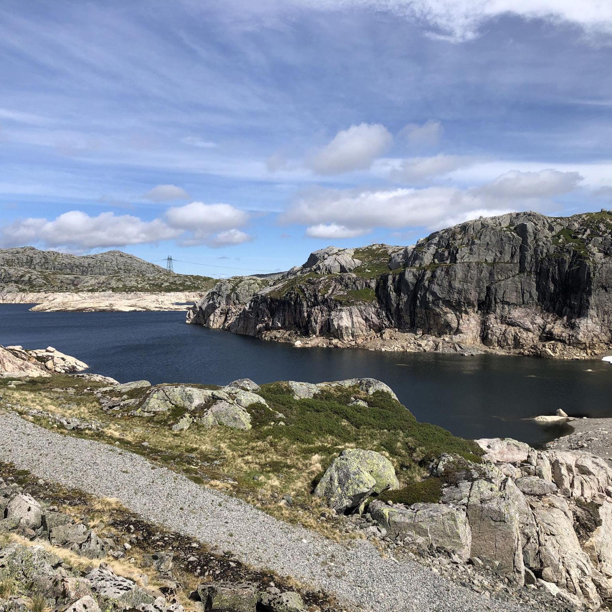
Mountaineering routes in Frafjordheiane Landskapsvernområde traverse a dramatic and varied landscape shaped by post-glacial processes. The region features a high mountain plateau divided by deep fjords and valley systems, with steep fjord and valley sides that ascend through low moors to smooth, high mountains. This topography includes terraces, moraines, scree, and large boulders, with large parts of the moors reaching up to 1100 meters above sea level. Granite gneiss rock formations are also characteristic of the area.
Best mountaineering routes…
Last updated: May 16, 2026
3
hikers
10.1km
04:34
810m
810m
Moderate mountaineering route. Good fitness required. Mostly accessible paths. Sure-footedness required.
7
hikers
5.36km
03:18
530m
530m
Hard mountaineering route. Good fitness required. Sure-footedness, sturdy shoes and alpine experience required.

Sign up for free
3
hikers
19.5km
07:29
750m
750m
Hard mountaineering route. Very good fitness required. Sure-footedness, sturdy shoes and alpine experience required.
5.0
(1)
8
hikers
4.45km
01:42
300m
300m
Easy mountaineering route. Great for any fitness level. Easily-accessible paths. Suitable for all skill levels.
Our route recommendations are based on thousands of hikes, rides, and runs completed by other people on komoot.
Start today with a free account
Your next adventure awaits.
Login or Signup
Tips from the Community

From the summit of Mule, you have one of the most beautiful views of the fjord. The view stretches far into the distance, allowing you to see the fjord in all its depth, all the way to where it meets the sea. As an added bonus, there is even a bench where you can sit and enjoy the view for as long as you like.
0
0
This small wooden bridge allows you to cross the Dirdalsana River, where the most beautiful hikes in the area begin. Take the time to stop in the middle to admire the view on both sides. On the west side, you can see the mouth of the river, still wide, surrounded by green mountains. What a beautiful sight!
0
0


Almost more impressive than Kjeragbolten.
0
0

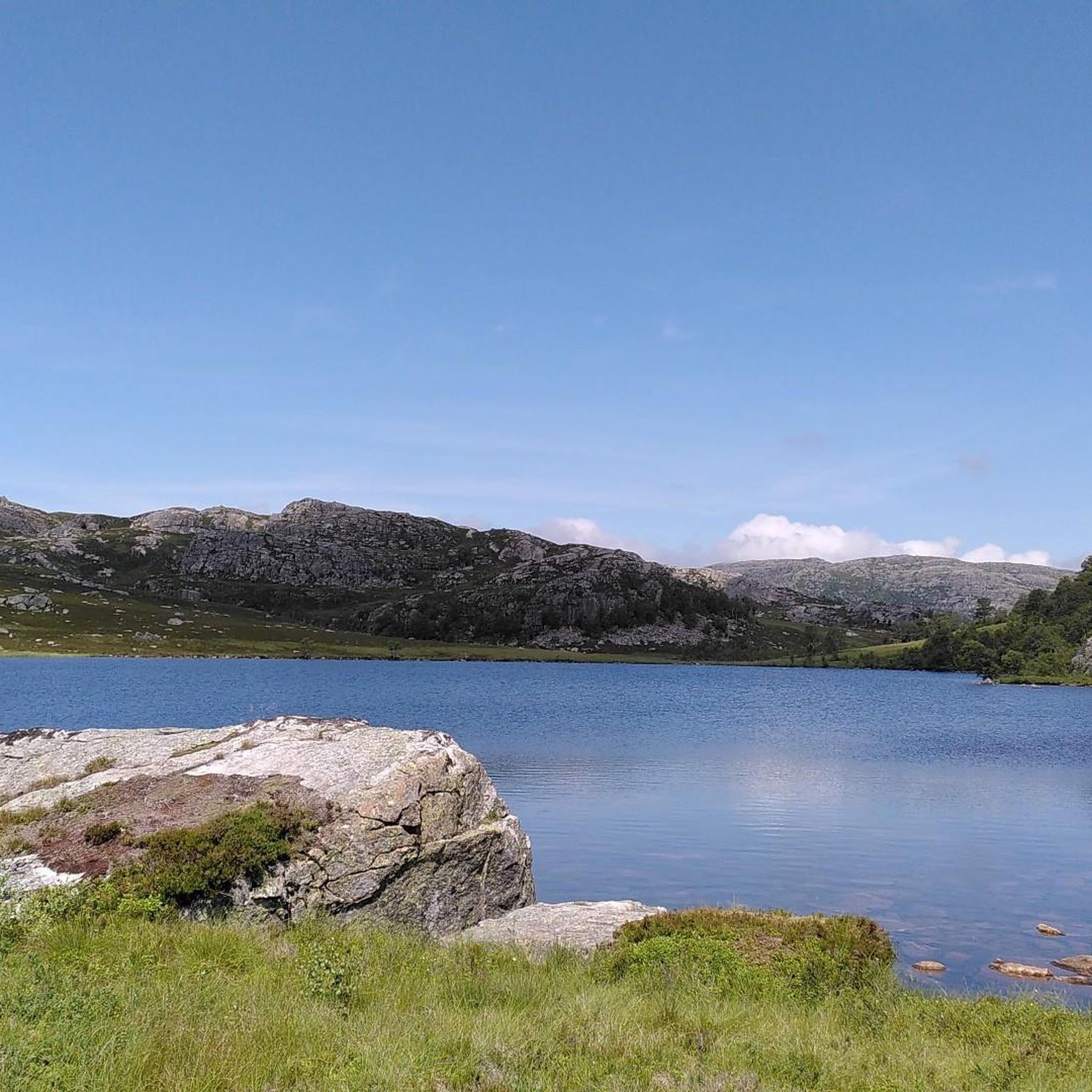
This nameless lake makes for a picture-postcard view! A great spot for a break or to pitch your tent for the night.
0
0

After a short uphill from Øygardstøl, the route to Kjerag descends to this beautiful river crossing. After this, there's more ascent before a glorious run across a superb moonscape.
0
0

beautiful view of the fjord
0
0

hardly any people here (in contrast to the Kjerak-Bolten next door).
3
0
Frequently Asked Questions
What kind of terrain can I expect on mountaineering routes in Frafjordheiane Landskapsvernområde?
The Frafjordheiane Landskapsvernområde offers a dramatic and varied landscape. You'll encounter a high mountain plateau divided by deep fjords and valley systems, with steep fjord and valley sides that gradually ascend through low moors to smooth, high mountains. The terrain is shaped by post-glacial processes, featuring terraces, moraines, scree, and large boulders, with some moors reaching up to 1100 meters above sea level. Granite gneiss rock formations are also characteristic of the area.
Are there any easy mountaineering routes suitable for beginners in Frafjordheiane Landskapsvernområde?
Yes, for those looking for a less strenuous experience, the Eikelitjørna – Sokkanuten loop from Levik is an easy mountaineering route. It covers approximately 4.7 kilometers and typically takes around 1 hour and 46 minutes to complete, offering a gentle introduction to the region's beauty.
What are some notable natural landmarks or viewpoints I can discover while mountaineering here?
Frafjordheiane Landskapsvernområde is home to several iconic natural features. You can visit the famous Kjeragbolten, a boulder wedged in a mountain crevice, or experience the impressive Månafossen Waterfall, Rogaland's highest waterfall. Many routes also offer stunning views of the fjords and the unique 'Moonscape' formations.
Are there any circular mountaineering routes available in Frafjordheiane Landskapsvernområde?
Yes, several routes in the area are designed as loops, allowing you to start and end at the same point. For example, the moderate Ternevatnet loop from Flørli kraftverk is a popular choice, offering a full circuit through the high mountain plateau. Another challenging option is the Ramnstoknuten – Mulen loop from Dirdal.
What is the best time of year for mountaineering in Frafjordheiane Landskapsvernområde?
The best time for mountaineering in Frafjordheiane Landskapsvernområde is typically during the warmer months, from late spring to early autumn (roughly June to September). During this period, snow has usually melted from higher elevations, and the weather is generally more stable, making trails more accessible and safer. Always check local weather forecasts before heading out.
What level of fitness and experience is required for mountaineering in this region?
The region offers a range of trails from moderate to difficult. Some routes, particularly those leading to iconic formations like Kjeragbolten, require good stamina, sure-footedness, sturdy shoes, and even alpine experience. It's advisable to choose routes that match your fitness level and experience, and always be prepared for changing mountain weather.
What do other mountaineers enjoy most about Frafjordheiane Landskapsvernområde?
The area is highly rated by the komoot community, with an average score of 5.0 stars. Mountaineers often praise the dramatic fjord landscapes, the challenging ascents through rugged terrain, and the opportunity to explore unique natural monuments like Kjeragbolten. The varied topography and stunning views are frequently highlighted as key attractions.
Are there any routes that feature waterfalls?
Absolutely! The region is known for its beautiful waterfalls. The famous Månafossen Waterfall is a major attraction, and you can find other scenic cascades like the Waterfall at Stølsvatnet along various trails. Some routes even offer a View of the Fjord and Waterfall simultaneously.
How many mountaineering routes are available in Frafjordheiane Landskapsvernområde?
Komoot currently features a selection of several mountaineering routes in Frafjordheiane Landskapsvernområde, ranging from moderate to difficult. These routes allow you to explore the diverse terrain and stunning natural beauty of the region.
What kind of geological features are prominent in Frafjordheiane Landskapsvernområde?
The geology of Frafjordheiane Landskapsvernområde is largely defined by its post-glacial history. You'll find extensive granite gneiss rock formations, which contribute to the rugged and dramatic appearance of the mountains. The landscape also features significant meltwater formations like terraces, moraines, scree, and large boulders, all testament to the powerful forces of past ice ages.
Are there any places to seek shelter or rest along the more challenging routes?
For those undertaking longer or more challenging routes, such as the Kjeragbolten area, there are facilities like the Kjerag Emergency Shelter available. It's always wise to research specific route details for available shelters or huts before embarking on your journey.
Most popular routes in Frafjordheiane Landskapsvernområde
Most popular attractions in Frafjordheiane Landskapsvernområde

Get inspired with the komoot mobile app


Explore more
Browse the best Mountain Hikes & Routes in other regions.
